
An earlier post followed the Kyd Brook (the name given to the Quaggy in its first few miles) from its two main sources to the confluence – submerged beneath the edge of suburbia of the western edge of Petts Wood. The Ordnance Survey map surveyed in 1894 below, shows where we left the river, close to the former Town Court.
 The post-development Kyd Brook is submerged beneath suburban streets and, while the roads are too busy to be listening for the sounds of water beneath manhole covers, the course is clear – the miniature valley of the newly combined Kyd Brook is obvious where Ryecroft Road meets Queensway.
The river remains submerged as it flows under the railway and then parallel to the former Green Lane, now Tudor Way – there are no obvious remnants of Elizabethan times here although perhaps a nod to the arts and crafts elements of some of the housing.
Kyd Brook emerges from its concrete casing just before being bridged by Petts Wood Road, its emergence is greeted by a dissipation of the traffic noise. We are in the ‘high quality estate in a rural setting’ that the 1920s developer of Petts Wood, Basil Scruby intended when he secured an option to buy 400 acres of woodland and strawberry fields in 1927. Like Cameron Corbett at Hither Green 30 years before, he recognised the importance of the railway and built the station before the homes.
The front lawns are neatly manicured in what is now expensive suburbia, but parallel to Crossway runs Kyd Brook, between the gardens – it is less constrained by expectations and providing a more natural counterpoint to the street fronts. Of course, appearances must be kept up, and there are quaint colonnaded bridges on the side roads as the river passes.

Oddly, for a while, one of the neighbouring streets was home to Charles de Gaulle who lived at 41 Birchwood Road for a few months after the fall of France in 1940. He may have admired Kyd Brook as it crossed Crossway, providing the boundary between two houses, a pleasant alternative to privet or chestnut fencing.
Kyd Brook is soon to disappear from view again – crossing Hazelmere Way it turns sharp west through the back gardens and alongside another railway line and is then buried for around 500 metres. The follower of the Brook dips under the tracks and enters a different world, although it is still Petts Wood. The arboreal buffer bought for the National Trust to prevent Basil Scruby’s developments extending further northwards. Running Past has been here before when attempting to trace some of the tributaries of the about to be Quaggy
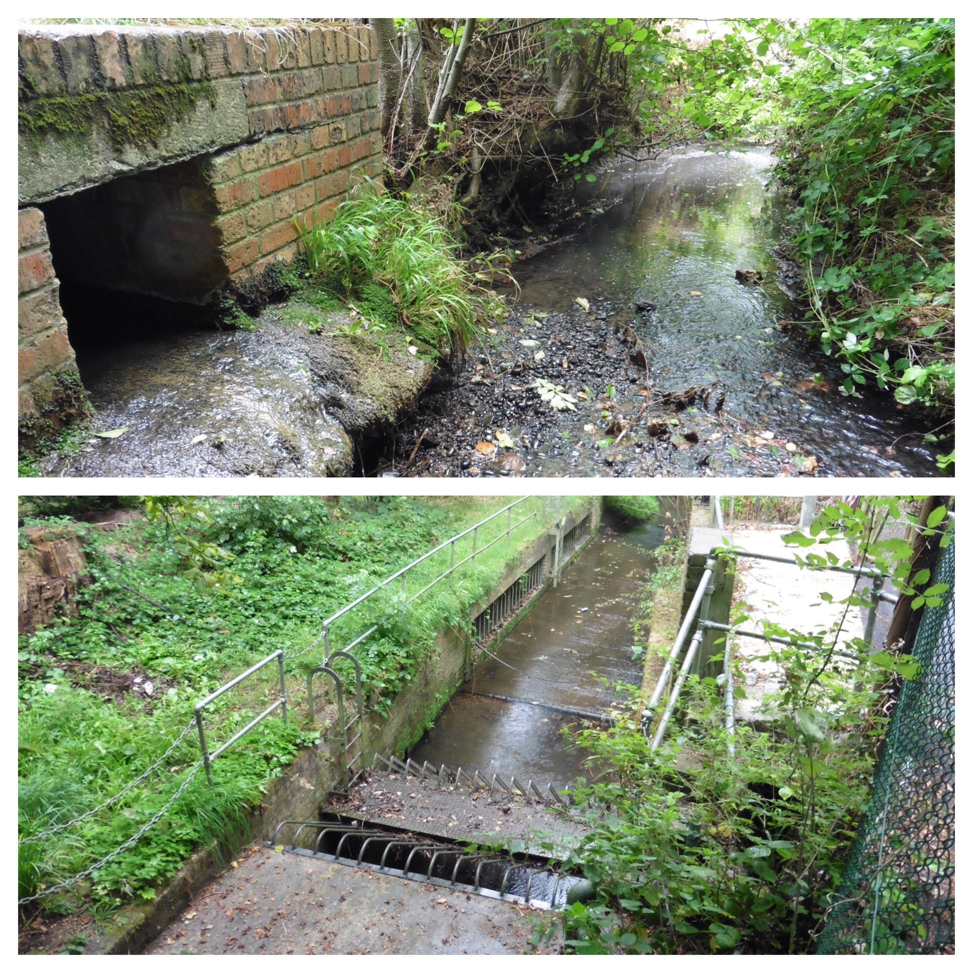
When visited almost a year ago, the Wood was a morass of mud; it was difficult to disentangle flooded paths and ditches from streams called ‘Ditch.’ At the end of September, while the two arms of the most easterly of the streams, Petts Wood Ditch, were flowing, some of the unnamed ditches were dry, even to the touch. Petts Wood Ditch used to join Kyd Brook close to the pedestrian tunnel under the railway, but an abundance of wetland plants alongside the path for a while suggests that the confluence may have been moved by Scruby’s contractors.

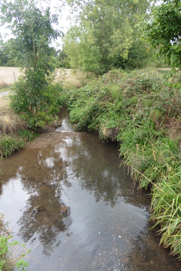
Kyd Brook emerges from an impenetrably dark tunnel under the railways and is briefly followed by a path before heading across the only really rural part of its course – the NT Tong Farm, part of the Hawkwood Estate. There are several small unnamed streams that come down the hillside from the higher parts of Chislehurst – the confluences are all unseen and all covered in an earlier post on the Estate.
There are several small visible streams emerging from the south-west following field edges before being piped under the path to emerge from pipes on the southerly bank of the still Kyd Brook. There is plenty of bird life along the river at this point – although no kites – the Anglo-Saxon meaning of Kidbrooke and presumably Kyd Brook is “the brook where the kites were seen”.
Back in the suburbia of Chislehurst, Kyd Brook is left behind and the river becomes the more familiar Quaggy, but is immediately ‘lost’ to view having been carefully ‘screened’ first. It emerges briefly in a private estate – somewhat less grand than those around its westerly source upstream.

The Quaggy is soon again unseen, but it has created an impressive valley, around 50 metres deep, presumably shaped in times when the river was more of a torrent than it now is. Railway engineers have purloined the valley at this point and the Quaggy disappears from view under Chislehurst station. The submerged parts seems greater than in the past – which skirted around the edge of the now demolished Bickley Hall. The stables were designed by Ernest Newton, the architect behind the Baring Hall pub, St Swithuns Church on Hither Green Lane and Lochaber Hall.

A rather circuitous wander around the embanked railway sees the river emerge in Bickley, while it is in the open, behind the veritable mixture of architectural styles of Lower Camden, vantage points are few are far between and with several of those the greenery is in such abundance that the Quaggy is audible but barely visible.

The Quaggy dips again under the railway’s earthworks, to emerge again alongside Sundridge Avenue, its course largely constrained by unnatural concrete banks. After crossing Elmstead Lane, the river disappears into the grounds of the former mansion of Sundridge Park – now a golf course and conference centre. We will return there another day.
