Tag Archives: Burnt Ash Farm

Victorian Cricket and a Suffragette attack in Lee

In an area bounded by Manor Lane, the railway between Hither Green and Holme Lacey Road there was once a pair of cricket grounds, Granville at the Manor Lane end and Northbrook at the western end abutting Lee Public Halls.  We’ll look at Northbrook now and Granville in a later post.

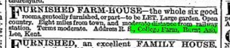
The land appears to have previously been on the southern (left) edge of Lee Manor Farm – the farm map below from the 1840s probably marks it as ‘C K 12.1.10’.  Further to the south was Burnt Ash Farm (at the current junction of Baring and St Mildred Roads).  

In the mid 1860s the railway embankments had cut through the southern end of the farm cutting off the fields and seeing several other parcels of land sold for development.  

Both farms were owned by the Baring Family, at that stage headed by Thomas Baring, Baron Northbrook from 1866 and Earl of Northbrook from 1876.  The title was named after a village close to their Stratton Park estate in Hampshire.  As was covered a while ago, some of the family money came directly from slavery, including some slave ownership.

The Northbrook Cricket club seems to have been founded in 1871 by two relatively wealthy locals of mid Victorian suburbia – William Willis and  William Marks (1).  The latter was born in 1822 and was a Silk Merchant who lived at 30 Southbrook Road (also referred to as The Cottage) in the 1881 and 1891 censuses but had probably moved there in 1871.

The other founder was William Willis QC (pictured), who was a barrister from Bedfordshire living at 4 Handen Road in 1871, 12 Northbrook Road in 1881 and 1891, he moved to the Elms at the corner of Belmont Grove and Belmont Hill during the 1890s (2) and in Belmont Park by 1911.  Willis was also a Liberal politician and MP for Colchester from 1885 until his death in 1911.

Unsurprisingly, given the name of the club, its President was Lord Northbrook (3) and the ground was imaginatively  named Lord Northbrook’s Ground (4).

It was a club with a vision of success who employed a professional in its early years – the Kent player Henry Palser (5).  He seems to have been a local man who was born in 1841, his father had been ‘Beadle of Lee Church’ in 1851.   Palser had an intermittent career as a professional around the country over the next couple of decades; out of season, he worked as a bricklayer – he was living in Court Hill Road in Hither Green in 1881.  

In the local press there wasn’t that much coverage of the club, mentions only seeming to mention fundraisers often at Lee Public Halls, next door, at least until it became a laundry. The Royal Hand Bell Ringers and Glee Singers featured in early 1880 (6).  They also covered annual dinners and the speeches at them – 1878’s noted a good season winning 16/28 matches drawing 8 and losing 4; the batting averages were topped by a Mr Cole at 41 which he won a bat for at the annual dinner (7).

From the early 1880s there began to be extensive coverage of their games, or at least the scorecards in a Victorian newspaper called ‘Cricket.’  Oddly while batting averages were published, bowling ones weren’t. The matches seemed to be friendlies, or at least no league tables were produced.   There is no intention here to do a complete season by season history of the club, it would be repetitive and probably not that interesting; instead we will look at a season every few years.

1883 was their 13th season and it was noted as being ‘successful and satisfactory.’ Matches played that season included their next door neighbours Granville, Sidcup, Burlington, Addiscombe, Old Charlton who played in Charlton Park, Lausanne, Islington Albion, Eltham (at Chapel Farm – now Coldharbour  Leisure Centre), Orpington, Hampton Wick, Pallingswick (close to Hammersmith) and Croydon.

Thirty six matches were played that summer of which 15 were won, 8 lost – of the 13 drawn games, 8 were in the favour of the men from Lee. The batting averages were headed by a W J Smith on 22.13 (8).

By 1889 the opponents were similar although matches had extended down into Kent, with matches against Gravesend and Greenhithe added.  There were 46 matches played 15 won, 12 lost, 12 drawn and 7 abandoned in the wetter summer.  The batting averages were headed by P W G Stuart  on 52.7 (9) – he was probably army Lieutenant, Pascoe Stuart who had been born in Woolwich but had moved away from the area by 1891. Heading the bowling averages was E D J Mitchell who lived just around the corner in Birch Grove, just over the road from E Nesbit of Railway Children fame.

In the late 19th century, Lee was a prosperous area on the edge of the city and those who played for the team in that era reflected that.  They included that season Thomas Blenkiron (10) a silk merchant who live on Burnt Ash Hill who had family links to Horn Park Farm – the house they lived in was called Horn Park. 

1893 started badly for the club with the pavilion being destroyed by fire in January the cause was not  clear (11). The rebuilding was incredibly rapid, with a new ‘half timbered structure with three gables’ built by Kennard Brothers of Lewisham Bridge and opened in late April ahead of the new season (12). The location was mid-way along what is now Holme Lacey Road (below).

Reporting became a lot more reduced during the 1890s, the reasons for this aren’t that clear although it may be because the nature of the Cricket newspaper may well have changed.  In the 1880s smaller clubs like Northbrook were able to pay to have their scorecards covered, this didn’t happen any more in the final decade of the century with mentions reducing to, at best, a couple of sentences.  1899 was a poor season for the club, matches includes matches against Goldsmiths’ Institute – the home away away games involved heavy defeats; a winning draw against Dulwich and a draw in the return fixture at Burbage Road, a losing draw against the London and Westminster Bank, defeats to Panther, Charlton Park and Forest Hill (13).

The number of mentions  got further and further between in the 20th century, with only a handful of reports each year.  There were a few more mentions in 1912 which seems to have been a relatively successful one for the club. There was a winning draw against Albemarle and Friern Barnet in and victories against Addiscombe and  Crofton Park in May and June respectively – A W Fish scored 50s in both games and probably his brother, HD was a centurion in June against Hertford, with Mansel-Smith a centurion against Bromley Town a few days earlier.

There was a comfortable victory against Derrick Wanderers in Manor Way in Blackheath (pictured above in 2020); the ground is still open space but is now abandoned and fenced off, owned by a development company hoping no doubt for a planning law changes that will allow them to develop the site.

In January 1914 the Northbrook Cricket Club pavilion was burned down again. While the Lewisham WSPU branch never claimed responsibility, that week’s ‘The Suffragette’ implied it was the their work the headline noting. ‘Fires and Bombs as Answer to Forcible Feeding’ and having a report on the fire below (bottom right hand corner). The national press was a little more circumspect about naming the culprit though and no one was ever charged with the arson.

It isn’t clear what happened to the club after their 15 minutes of infamy in 1914.  While it is possible that it continued for the rest of the 1914 season, it is likely that World War One brought cricket to a halt there most sport – as we saw with Catford Southend football club.   

By 1924, the landowners, presumably still the Northbrooks, had cashed in on the value of the land and sold it.  The Northbrook ‘square’ was covered by the Chiltonian Biscuit factory which had moved on from Staplehurst Road.  Today, it is the home of the Chiltonian Industrial Estate, pictured below.  The pavilion and southern edge of the outfield was covered at around the same time by the houses of Holme Lacey Road, built by W J Scudamore – pictured earlier in the post.

Notes

  1. Kentish Mercury 28 April 1893
  2. Neil Rhind (2020) Blackheath and its Environs, Volume 3 p518
  3. Kentish Mercury 11 January 1873 
  4. Sporting Life  23 September 1871 
  5. Kentish Mercury 27 May 1871 
  6. Kentish Mercury 24 January 1880 
  7. Kentish Mercury 23 November 1878 
  8. Cricket 20 September 1883 
  9. Cricket 26 September 1889 
  10. Cricket 26 September 1889 
  11. Reynolds’s Newspaper 8 January 1893
  12. Kentish Mercury 28 April 1893
  13. Cricket 1899 various dates 

Credits

  • The 1843 map of Lee Manor Farm and the picture of the Chiltonian Biscuit Factory are part of the collection of Lewisham Archives, they are used with their permission and remain their copyright;
  • The picture of William Willis is via WikiTree on a Creative Commons
  • The map showing the location of the ground is on a non-commercial licence via the National Library of Scotland
  • Census and related data comes from Find My Past

Beating the Bounds of Lee, Part 5 – Verdant Lane and Manor Lane

During the 2020 Coronavirus lockdown, Running Past has been following the boundary of Victorian Lee before it was subsumed into Lewisham at the end of the Victorian era, aided only by a Second Edition Ordnance Survey map. We have so far wandered, in stages, initially from Lee Green to Winn Road, appropriately passing Corona Road en route; the second stage took us through Grove Park, crossing the never built Ringway;  then through Marvels and Elmstead Woods and a Borough of Deptford Cemetery; and in the previous instalment through Chinbrook Meadows appropriately following Border Ditch. We pick up the 1893 Lee – Lewisham boundary on what is now Downham Way – the most southerly of the red dots on the map below.

The Downham estate was built by the London County Council (LCC) in the late 1920s and early 1930s on compulsorily purchased farm land. On this side of the estate included what was probably the last outpost of the land owned by the Baring family, Shroffold Farm, pictured later in the post.  We will probably return to the farm at some stage in the future. However, the farm was part of the Manor of Lee bought by Sir Francis Baring, later Baron Northbrook, the purchase of which was at least partially funded by both financing of slave owning operations as well as some direct ownership on enslaved people. While the Barings dispensed largesse to the locals in their latter years, their ability to do this was based, in part at least, on the enslavement of African men, women and children in Montego Bay in Jamaica at the end of the 18th century.

We’d split our circuit of Lee at the top of what was described in a 1790 map as ‘Mount Misery’, better known these days as Downham Way (the most southerly dot on the map). There was a lot of ‘misery’ in the area in that era. South Park farm, which was to become North Park – a little further down the hill in our broad direction of travel was a farm that for a while was known as Longmisery.

The reason for the split in the post at Mount Misery was that the boundary in 1893 had changed soon after the brow of the ‘Mount’ from field edge to stream at the boundary.

Before leaving this point, it is worth remembering that at the time the Ordnance Survey cartographers surveyed the area they would have had an undisturbed view almost to the north of the parish and St Margaret’s Church. Certainly this was what the local Victorian historian, FH Hart, noted in the early 1880s when following the boundary from this point.

The stream is Hither Green Ditch; a stream that Running Past followed a while ago which has several sources. The nomenclature ‘Ditch’ is used quite a lot within the Quaggy catchment, it shouldn’t be seen as belittling or derogatory it is just the way smaller streams are described – the 1893 boundary of also followed, Grove Park Ditch and Border Ditch, with Milk Street and Pett’s Wood Ditches further upstream.

This branch of Hither Green Ditch seems to have emerged somewhere around Ivorydown, south and above Downham Way. It merges with the 1893 Lee – Lewisham boundary just north of the street named after the farm, Shroffold. The merged boundary and stream followed the middle of Bedivere Road.

The section that the Lee-Lewisham boundary initially followed, is one of the sections of Hither Green Ditch that is barely perceptible on the ground, although the contours are clear on early 1:25,000 Ordnance Survey maps, if not current ones. Whether this part of the stream was actually flowing in 1893 is, at best, debatable, water tables had declined after the end of the Little Ice Age, the last really cold winter was in 1814 – with extensive flooding around the parish of Lee when there was a thaw.

The boundary and stream followed the edge of a small piece of woodland in 1893 which is now an area bordered by Pendragon, Ballamore and Reigate Roads. There is an attractive U shaped portion of the latter, where council surveyors struggled with dampness from the hidden Ditch.

The post war 1:25,000 Ordnance Survey map, notes a flow at around the point of Railway Children Walk, an homage (or a homage) to E Nesbit who lived on the other side of the railway – on of at least a trio of locations within the Parish she resided in. A small detour is worth making for a view of another Lewisham Natureman stag standing proudly above the railway.

Detour made, the boundary follows Hither Green Ditch which was marked as flowing in the 1960s 1:25,000 Ordnance Survey map, so was presumably also flowing in 1893. To the west of the Ditch, and boundary, was Shroffold Farm, the farmhouse (pictured below from the 1920s) was where the mosque is now located – diagonally opposite to where the Northover/Governor General was to be built 40 years later at the junction of Verdant Lane, Northover and and Whitefoot Lane. To the east was almost certainly land belonging to Burnt Ash Farm – both sides of the boundary owned by the Northbrooks.

While fields in 1893, this area is now part of Hither Green Cemetery. It originally opened as Lee Cemetery in 1873 but with a much smaller size at the northern end of the current one. Like the Borough of Deptford cemetery we passed through in Grove Park, it was outside the jurisdiction it served, all on the Lewisham side of Hither Green Ditch. There are two impressive chapels, the Dissenters one (for Methodists and the the Baptists of Lee High Road and what is now Baring Road), was built by William Webster of Blackheath and was damaged during the last war and is slowly decaying.

The southerly end of what is now the cemetery had changed from farm land to allotments in the early part of the 20th century. The exact timing of the expansion of the cemetery into the allotments isn’t clear, it was probably just before or just after the start of World War 2, it was showing as allotments in the 1938 surveyed Ordnance Survey map. But by the time the children who died in the awful attack on Sandhurst Road School in early 1943, were buried the area had expanded. There is a large memorial to those who perished, something covered in a blog post that marked the 75th anniversary of the bombing in 2018. The crematorium in the south east corner was opened in the 1950s.

The 1893 boundary is relatively easy to follow on the ground through the cemetery as Hither Green Ditch has left a small valley close to the Lombardy poplars that border the railway.

Just outside the cemetery in 1893 was a small hospital, Oak Cottage Hospital; it had been built in 1871 by the local Board of Works for dealing with infectious diseases like smallpox and typhoid (1).  It was overtaken by events in that the Metropolitan Board of Works (which covered all of London) decided to open a series of fever hospitals as a response to a major Scarlet Fever epidemic in 1892/93, the health system was unprepared and there was a severe shortage of beds.  One of these was the Park Fever Hospital, later referred to as Hither Green Hospital; Oak Cottage Hospital was briefly considered as a possible alternative location (2).   Oak Cottage Hospital closed soon after Park Fever opened in 1896 (3).  It eventually became housing in the 1960s or 1970s.

Beyond Oak Cottage Hospital in 1893, were again fields, probably part of Shroffold Farm. On the opposite side of Verdant Lane (then Hither Green Lane) was North Park Farm, about to be ploughed under by Cameron Corbett. The Lee Lewisham boundary continued to use Hither Green Ditch which was to remain visible until the development of the Verdant Lane estate in the 1930s. This section is pictured below, probably soon after the Corbett Estate was completed around 1910.

In addition to the Ditch, there were a pair of long gone boundary markers, one was just to the north of the junction of Verdant Lane and Sandhurst Road, perhaps at the point one of the confluence of two of the branches of the Ditch; the other where it crosses St Mildreds Road – again a possible branch of the Ditch that would have been obliterated by the railway.

St Mildreds Road hadn’t existed when the Ordnance Survey cartographers had first visited in the 1860s. While the church of St Mildreds had been built in 1872, even in 1893 only homes at the Burnt Ash Hill end had been build, including another of the homes in the area of E Nesbit in Birch Grove.

The boundary went under the railway close to what was a trio of farm workers cottages for North Park Farm, which are still there at the junction of Springbank Road and Hither Green Lane.

The boundary continued to follow Hither Green Ditch – it wasn’t just a Parish boundary at this point, but a farm boundary too – on the Lewisham side, Hither Green’s North Park Farm, which was mainly on the other side of the railway and was sold at around the time that the land was surveyed and would form the Corbett Estate. On the Lee side was Lee Manor Farm, which is pictured on a 1846 map below (right to left is south to north, rather than west to east) and Hither Green Ditch which had several small bridges is at the top.  There were several boundary stones and markers along what was broadly Milborough Crescent and Manor Lane.  There was then a sharp turn to the east along what is now Longhurst Road.

The confluence of Hither Green Ditch with the Quaggy was in a slightly different place in 1893, then it was more or less where 49 Longhurst Road is now located; it is now around 40 metres away on a sharp corner between between Manor Park and Longhurst Road, as pictured below.

We’ll leave the boundary of Lee and Lewisham here for now following what is now the Quaggy into Lewisham in the next instalment.

This series of posts would probably not have happened without Mike Horne, he was the go to person on London’s boundary markers, he had catalogued almost all of them in a series of documents. He was always helpful, enthusiastic and patient.  He died of a heart attack in March but would have loved my ‘find’ of a London County Council marker in some undergrowth on Blackheath, and would have patiently explained the details of several others he knew to me.  A sad loss, there is a lovely series of tributes to him.

Notes

  1. Godfrey Smith (1997) Hither Green, The Forgotten Hamlet p54
  2. Woolwich Gazette 02 June 1893
  3. Smith op cit p54

Picture Credits


2 – 30 Burnt Ash Road – the Story of a Shopping Parade Part 1

When we looked at Lee Manor Farm a few months ago, there was a pattern of small fields edging Burnt Ash Road – pictured below (Lee Green is in the bottom right hand corner).  The northern most of these is now occupied by Sainsbury’s, which is the latest in a series of retail establishments.  A two part blog post explores the changes, the first one takes us from the farm that Thomas Postans knew in 1843 to the end of World War 1.

The first non-rural occupants of the site was housing known as Thornhill Grove which was probably built in the late 1850s or very early 1860s. They were sat back from the main road ( as the left map below shows), with a gap for the Taunton Road that was to come.   In 1861 the occupants of the first five houses were a senior Court Clerk, a bookseller, a household of siblings between 17 and 27, perhaps parents had recently died, along with two builders, one of which was retired.  Perhaps it was one of them, either George Gates or William Bond, who had built the houses.

The houses seem to have been very short-lived in their original form, as they seem to have been altered and extended into shops between the late 1870s and early 1880s. It is clear that some of the new shops were occupied when the census enumerators called in 1881, but there was no numbering and the shops were referred to by their trades. Several shops were referred to by there previous house names in 1881.

1-14 Thornhill Grove on what was then called Burnt Ash Lane was almost entirely occupied when the 1884 Kelly’s Directory was compiled, presumably during 1883. The change to 2- 30 Burnt Ash Road came a few years later and to avoid confusion I’ll refer to the shops by this variant.


2 – 6 Burnt Ash Road

William Brown from Rotherhithe was listed at the first shop, merely referred to as ‘Fruiterer’ in 1881, with his wife Anne who hailed from Montgomeryshire, two of his adult children helped in the shop. It is not clear how many of the shop units that Brown had in 1881, but by the 1884 Kelly’s Directory he was running a business that included the strange bedfellows of selling coal, corn (and presumably oats for horses) as well as fruit. 2 and 4 seem to have been down the still remaining alley and 6, the first of the parade proper.

By 1891 the family was living over the road at 23 Burnt Ash Road, now with a servant; the accommodation attached to the shop was home to Charles Barlow and Alfred Lock – car men, drivers of horse and carts for the corn business – living at 2 and 4 respectively, with 6 empty when the census enumerators called.

William had retired by 1901, but his name was still above the door and his son Arthur (1867) was managing the business, although they had dropped the fruit selling. The name continued at the business and address until around the outbreak of World War One. It isn’t clear what happened to the family after 1901 but any business based around selling oats was going to go into decline with the rise of motorised transport. Lots of local supply outlets such as Thomas Tilling stables has all but disappeared by the end of the war.

8 Burnt Ash Road

In the 1881 census, there was a grocers shop, probably based at what was to become number 8. It was run by Albert Care who was a local lad. It didn’t seem to last long as it appeared to be vacant in 1884.

It seems to have been briefly taken on as an extension to William Brown’s empire by 1888, but by 1894 it had switched to being an extension to the smaller Martin empire based at the Post Office at number 10. The shop type that it was used for was the original trade of William Brown – a fruiterer, something that Brown had given up on by this stage.

More on Martin Martin when we turn to the Post Office, but the fruiterer was to stay in his name until around 1900. It was taken over by then by John Devenish, who appropriately came from Devon, and was to run the business into the 1920s. Like many on the parade he didn’t use the accommodation behind the shop, and like several of the others lived in large houses over the road, Devenish was at 21 in 1911 with wife, Elizabeth, a young son and a servant.

Devenish had a run in with the law in 1903 after being seen mistreating his delivery horse by kicking it Effingham Road. He was fined £1 with 7/- costs, or 14 days hard labour (1).

10 Burnt Ash Road

A Post Office was one the first retail outlets on the parade – run by Martin James Martin, who hailed from Woolwich, although he was away on census night in 1881 at what was to become number 10 was his wife, daughter, a visitor and a servant. The Martins were still living behind the shop in 1891. The role was a varied one, as well as the Post Office, it was a stationers and Registrar of Births and Deaths.

It seems that Martin Martin focussed on the later role, perhaps taking it on for the Borough of Lewisham and was listed at 2 Effingham Road in 1901 and 1911 as Registrar Of Births And Deaths, with seven children and a servant, along with his wife, Emily.

The new Sub-Postmaster was 1901 another man whose name suggested a geographical connection – Teesdale (sometimes referred to as Teasdale) Walbank – from Bingley in Yorkshire who was 61 in 1901; with him were his family which included his wife, Maria and 4 grown up daughters who assisted at the post office. He was from a family of weavers but unlike the rest of his siblings had not followed that line of work and had become a teacher in Bingley (1861), spending time and increasing the size of his family in Sedgefield (1871), Nenthead in Cumbria (1878) and near Southport (1881). It is not clear why he changed profession or moved to Lee around 1899, the first time he appeared on the electoral register).

Walbank died in May 1913 and was buried at Hither Green cemetery although his name lived on above shop until 1920s.

12 Burnt Ash Road

Samuel Brunning, a boot maker from Suffolk, seems to have lived in one the houses of Thornhill Grove before the shops were built, he and wife wife Mahala were listed in the censuses of 1871 and 1881 at a property described as Eagle Cottage. He is listed at 12 in the 1884 Kelly’s, where he was to remain until the late 1890s, although by that stage Samuel had been widowed and remarried.

Samuel had gone by the turn of the century and the new occupant was the draper, George Gooding who was expanding his business from number 16. We’ll cover him there, and it was a business that was present until around 1935.

14 Burnt Ash Road

Number 14’s history is a relatively short one as it was to become part of the Gooding ‘empire’ at 16; the first tenant in 1884 seems to have been George Lambley, a hairdresser from Gloucestershire. He’d been living in Lee since at least the 1870s, carrying out his trade in Lee High Road in 1881. The business had changed by the early 1890s and was a chemist, Frost and Harrison before being taken over by the Goodings around 1905.

16 Burnt Ash Road

There had been a milliner, Alfred Tyler, at 5 Thornhill Grove in 1881; he is not listed at any of the shops on the parade in 1884, so it may have been a business that was lost in the redevelopment for houses to shops. By 1884, 16 Burnt Ash Road was run by George Gooding who hailed from Debenham, near Stowmarket in Suffolk and was a Draper and was around 22. It was a business that seemed to thrive and George and his wife Jessie (32) George were doing well enough to be able to employ a couple of servants.

By 1894 the business had expanded into 18, the first of what were to be three expansions into adjacent properties. By 1901, they were living over the road at 21 in 1901, with the housing above/behind the shop empty or more likely being used for stock and by 1911 had moved to the still suburban Grove Park. George died in 1917 but the business continued in his name, probably run by his brother, William.  The latter had been living with the family in Grove Park in 1911, he was to marry George’s widow, Jessie, in 1924.

18 Burnt Ash Road

Like number 14, its independent history is a short one, empty in 1884, by 1888 it was a fishmongers run by John Woodward – his 1891 census record describes his trade as ‘Master Mariner, Fishmonger at Present Time’ and he was living over the road at 11. He didn’t last long, perhaps returning to his former trade as George Gooding had expanded into 18 by 1894. The accommodation behind it featured in the 1901 and 1911 censuses as it seemed be being used as a boarding houses for Drapery Assistants, with 6 listed as living there along with a housekeeper.

20 Burnt Ash

From early in this existence, 20 Burnt Ash Road was a bakers, initially called Home Made Bread; it was then taken over by the Yorkshire Bread Company who regularly advertised their produce in the local press (2). The ownership changed a couple of times  – latterly a Mr Woods who expanded into number 22.

Woods, seems to have had to sell at auction in May 1899, it was a 21 year lease, with 10 years remaining and an annual rent of £135 (3).

The purchaser was almost certainly Frederick Andrew, who hailed from St Neots, he and his wife, Georgina, had been running a smaller bakery in Brightfield Road from at least 1891. They were able to afford a servant in the 1901 census to help with the four young children. It was to become one of the longest lasting businesses on the parade, retaining Frederick’s name over the window until the late-1920s,

22 Burnt Ash Road

In its early days, the shop went through a number of businesses – in 1884, it was ‘home’ to builders, Kennard Bros., before being briefly a sales outlet for Singer Sewing Machines. By 1893, it was home to Charles Hopper who offered everything for the pianoforte enthusiast, from tuning to sales to lessons (4).

Hopper had departed by 1900, probably carrying out his business from 38 Burnt Ash Road, one of the large houses further up the street. The new occupant was a dyer/laundry although the occupant wasn’t new to the parade – Samuel Brunning, previously a boot maker at number 12 with the firm to stay there until the end of the first decade of the century.

A boot maker, William Whittle was the next occupant who stayed there until the mid-1920s, he lived just around the corner at 4 Taunton Road. He was a widower who lived with 2 children, an assistant at the shop and a live-in housekeeper. He’d moved from a shop just around the corner on Lee High Road, next to the Prince Arthur, where he’d been in 1901.

24 Burnt Ash Road

Frederick Roberts name was above the door at 24 Burnt Ash Road from around 1894, probably taking over the lease from William May Smith who had been there from early in the Parade’s life. He name was to remain until the early 1950s, expanding into 26 during the 1920s. He had taken on an additional shop at 69 Old Dover Road near Blackheath Standard by the outbreak of World War 1. Sadly, this is all that is known about him – as he never seems to have lived behind the shop nothing has been gleaned about where he came from, his family and the ownership of the shop – he could have been there for the entire 60 years his name was over the window, but it is perhaps unlikely.

26 Burnt Ash Road

There was a butchers shop in the parade in 1881, the exact location wasn’t clear but given what was to come in this shop front in this location it may have been here. The proprietor was Caroline Cook, from St George in the East in East London, who ran the business with her son. Some of her staff also lived ‘over the shop.’

Caroline Cook’s business didn’t last that long, her name was replaced with one that did had considerable longevity, another butcher John B Rolfe who was there from 1884. Unlike some of the neighbouring businesses there is no evidence that he ever lived above/behind the shop – in 1891 it was occupied by an accounts clerk, Annie Firkins, and it 1901 by four staff employed in the shop, along with the family of one of them.

Based on electoral registers, John Rolfe and his wife, Emily, were living at 12 Cambridge Drive from 1897, probably earlier. They were both from Northamptonshire and in 1901 were living at 3 Handen Road with 7 children under 10; plus three servants. The name remained until around the end of World War 1, but the shop was empty in 1920 and John died in Lewisham in 1922.

28 Burnt Ash Road

The shop front started as a carver and guilder, initially in the name of Louis Holcombe in 1884, but by 1900 the same business was being run by Wilhelm (listed in Kelly’s as William) Fellger, a German who lived around the corner at 88 Taunton Road. Carving and gilding is not a business type that really exists now – much of it seemed to relate to picture frames. He advertised this extensively in the local press (5) – noting his links to the Arts Club in Blackheath. However, he’d gone by 1905 possibly the result of local competition in a small market – there was another guilder and carver on Lee Road, Frederick Stimpson.

By 1905 the shop front was being used by watch maker Henry Ward from Cheltenham lived at 100 Taunton Road; who had moved his business from Lee High Road, close to the Duke of Edinburgh. He had gone by 1911 and was living on the last bits of the Corbett Estate to be completed, Duncrievie Road and no doubt carrying his business out somewhere else.

30 Burnt Ash Road

Throughout all of its early life 30 was a dairy; from 1888 to 1905 it was called Clay Farm Dairy in Kelly’s Directories, it is pictured in one of the early photographs of the parade.. There doesn’t seem to have been a local farm of this name, however, it may well have been a shortened version of Clay Pit Farm which was roughly on what is now Marvels Lane in Grove Park. By the time World War 1 broke out the name on the door was Edwards and Co, they were a large dairy firm based at Burnt Ash Farm.

At the outbreak of World War 1, it seemed a thriving parade, empty shops seemed a rarity, much more so than those local ones we have covered before – notably in Manor Park Parade and 310- 332 Lee High Road.  There was probably a good reason for this, in that along with the shops opposite, on Eltham Road and on Lee Road,  they would be able to supply all food shopping needs of local households.  We will return to the parade in 1919 next week, there were to be a lot of changes in the decades that followed.

The ‘story’ of the parade has been pieced together using Kelly’s Directories held by Southwark Archives – generally looking at every 5th year since the parade opened for business from 1884.

Credits

  • The 1843 map and the black and white postcards of the parade are from the collection of Lewisham Archives, they are used with their permission and remain their copyright
  • The Kelly’s Directory data was accessed via Southwark Archives
  • Census and related data comes from Find My Past (subscription required)
  • The Ordnance Survey maps come from the collection of the National Library of Scotland on a Creative Commons and are from 1863, 1895 and 1948

Notes

  1. Woolwich Gazette 17 April 1903
  2. Kentish Mercury 3 May 1889
  3. Kentish Mercury 23 May 1899
  4. Kentish Mercury 17 November 1893
  5. Kentish Mercury 27 January 1893

Wood Burning, Farming & Dairy Crest – The Story of Burnt Ash Farm

Burnt Ash Farm, stood at what is now a busy road junction – that of Baring Road and St Mildred’s Road.  The site has an interesting history – it moved from medieval settlement to being a farm, to a dairy in the 1920s, being taken over by United Dairies, before being sold to Dairy Crest in the 1990s.  It survived attempts to turn it into a Big Yellow Storage facility before being developed for social housing around 2013.

The farm wasn’t always on Baring Road, until the beginning of the 20th century it was known as Burnt Ash Lane (it still is on the Bromley side of the border) – the Barings (Northbrooks) were the local landowners who owned the Manor House and whose wealth had its roots in slavery.  It wasn’t always in that location either, it was originally located in Old Road, Lee, almost certainly situated at what is now the Lee Manor House and was known as Lee Farm; it seems to have moved around 1727 (1).  It was farmed by Thomas Butler, who is buried at St Margaret’s Lee, having died in 1733.

It was a substantial farm at this stage, its land running from around what is now Lee High Road to the current Grove Park (2).  The farm seems to have been split after Thomas Butler’s death between two of his sons with the dividing line being drawn around St Mildred’s Road (3) – Matthew who stayed at Burnt Ash Farm and James who set up a new farm, Lee Manor Farm, around the junction of Manor Lane and Manor Lane Terrace (4).   Running Past will return to Lee Manor Farm in the future.

The farm buildings at Burnt Ash were clearly marked on John Roque’s 1746 map (on a Creative Commons via Wikipedia).

It wasn’t the first settlement to have been found on the Burnt Ash site, during archaeological investigation works in 2012 on the site was found to have had a

series of pits, postholes and ditches indicating that people were living and probably working on the site in the 12th century. The majority of the finds are shards of pottery from serving and cooking vessels that were manufactured in Surrey. This indicates that trade routes may be focussed to the southwest rather than the City of London.

Whether this early settlement was abandoned soon after this, or perhaps as a result of the Black Death is unclear – an early incarnation of Hither Green, Rumbergh, disappeared at this point.  Certainly woodland covered the area from the 14th century until the early 18th century.

The name, Burnt Ash, comes from coppicing of wood for charcoal manufacture and was first mentioned in Assize Rents in 1384 and in a 1607 description of Lee Farm, with a section of Woodland called Crabland Spring. Certainly by the time Rocque surveyed the area, the woodland was gone.

Returning to Burnt Ash Farm, the farm was further subdivided in the early part of the 19th century (5), presumably after the Barings bought both the Manor House and the land portfolio that had been put together for and by Thomas Lucas.  The history of the farm during the first half of the century seems a little sketchy – but it was still a substantial operation of 367 acres in the 1839 tithe schedule, when the farmer was Richard Norman.

While the location of most of the fields is unclear, Josephine Birchenough with John King identified the locations of some of the fields – Grass Buntins was broadly where Northbrook Park now is (6), Red Robin was on the western side of Baring Road (7); Ivory Down and Buntins were roughly where the Hither Green Cemetery is now (8).  Ivory Down lives on in a road name on the Downham estate.

Norman had certainly been at the farm for at least a couple of years before the Tithe schedule was compiled, as he had been the farmer when the ‘unfortunate Mr Cocking’ was to become the first parachute death when his own design failed to work and he hurtled to his death on the farm – the sad story was covered in Running Past a couple of years ago.

Richard Norman was move on from the farm in 1844 – there was a farm sale of some of the livestock and equipment – oddly advertised as ‘Live and dead farming stock’ (9).

It isn’t clear who was farming there in the 1851 census as records are a little confused, however, by 1861 census two farmers are listed at the start of Burnt Ash Lane in the census records – the Adams and the Uptons.  Thomas Adams, born in 1806 was listed as a ‘farmer of Farmer of 72 Acres employing 3 Men’ (the acreage is probably incorrectly recorded – it may have been 272) and his family including Edward (1837) who was also working on the farm.  The three employed may have included some of the Uptons – this included John who was 69 ‘Farmer No Occupation at Place’ and his son Stephen 45 who was listed as a farmer and dairyman.  The Upton left during the 1860s – they were to move onto Durham Farm at Grove Park – where they stayed until at least 1901.

The Adams too moved on soon after the census, as by the mid-1860s Zephaniah Seal seemed to be the tenant farmer as there were several cases involving the theft of a horse, embezzlement and theft of hay in the mid-1860s when he was listed as farmer or master. Seal’s father, John, had earlier been a dairyman on the farm.  Seal had been previously living with his parents in Lee Church Street.

A William Winn (or Wynn) certainly acted as bailiff or manager for the Seals for a while, he was in the area and possibly at the Farm from around 1850 as his younger children were born around Lee – he was mentioned in one of the court cases and died at the Farm in 1863.  Whether he related to the William Winn who developed the area around Guibal and Winn Roads in unclear.   The farm and the newly built Lee station are shown on the map below published in 1870 (on Creative Commons from National Library of Scotland).

Zephaniah Seal’s brother, Charles Frederick (1827) was listed as the farmer in the 1871 census with William Warwick living in a cottage on the farm – there is no trace of Charles after that, although Zephaniah was back at Lee Church Street in the 1880s on electoral registers.

Charles Seal had moved on by 1874, at the latest – another Adams family were farming Burnt Ash Farm, Thomas who hailed from Leighton Buzzard, one of his children were born on the Farm in 1874. The farm was listed in the census as 274 acres and employing six men and two boys.

It is not clear how long the Adams Family stayed but by 1893, there were two registered cow houses at the farm – one run by Cordwell and Sons the other by W. H. Carter – the farm was still owned by the Northbrooks. By the early 20th century the farm was being run and probably owned by the Edwards family –  Public Health Reports listed them having 56 cows Burnt Ash Farm – they were being farmed as a joint operation with a few other local farms including College Farm – covered before in the blog.   Edwards and Sons were a relatively large scale dairy enterprise with 60 shops around SE London. Some of the fields still farmed at that stage are in the postcard below (eBay November 2016).

The Edwards tenure seems to have lasted until Burnt Ash Farm closed in the 1920s and their shop operation appears to have been taken over by United Dairies.  What happened the Farm is a little sketchy after that – the buildings seem to have been retained (they were still showing on a 1946 published Ordnance Survey map) and it was controlled by the Milk Marketing Board, probably still as a dairy.  However, during the 1950s, the milk depot was largely re-built (although a couple of the farm buildings were retained (10)) and was initially operated by United Dairies – at its peak they ran 54 rounds with milk floats going out on their rounds by 6:30, returning by early afternoon. It served a large area of south London with deliveries going as far as Waterloo Bridge, Sydenham, Bromley and Woolwich.  The milk float below is typical of United Dairies, although not specific to Lee (11).  United Dairies merged with Cow and Gate to become Unigate in 1959.

In a contracting sector there was some rationalisation and the depot was sold to and run by Dairy Crest from 1989 until its closure in September 2000. By that stage only 25 rounds were still in place when the milk float, like this one below (13) pulled out of Baring Road for the last time.

After the closure the site was demolished in 2001 and there were attempts by the Big Yellow Self Storage Company to build a warehouse on the site.   There was long running opposition to proposals which were finally defeated at Lewisham’s Planning Committee in 2006. In the end Big Yellow built on a site at the Land of Leather/Cliftons Roundabout a mile further along the road.

The site was eventually purchased by developers who developed the site on behalf of a housing association with work finished in late 2013.  It is one of the more attractive recent housing developments in the area, although the duck egg blue glazed balcony panels on will probably make it quite easy to date for future architectural historians.

A postscript to the post

One of the people who made the housing association scheme happen was my friend Martyn Brindley, Martyn was a lovely man with a great commitment to high quality social housing which both looked good and worked well for the residents.  Sadly, Martyn died a few weeks after I wrote this post – hopefully this scheme and several others in the area will be fitting and lasting tributes to him.

Notes

  1. Josephine Birchenough (1981) Some Farms and Fields in Lee p4
  2. ibid p 4
  3. ibid p6
  4. ibid p6
  5. ibid p10
  6. ibid p35
  7. ibid p25
  8. ibid p23
  9. West Kent Guardian 21 September 1844 – via Find My Past
  10. Birchenough, op cit, p11
  11. Both pictures of milk floats are copyright of and published with kind permission of a specialist milk floats site – Milk Float Corner
  12. ibid

Census and related data comes via Find My Past 


Dairy Farming in Lee – College Farm

Running Past has covered several of the farms of Lee that predated the gradual encroachment of the city – Lee Green Farm, Horn Park Farm, Woodman’s Farm and the slightly smaller operation of Butterfield Dairy.  College Farm is a farm that the blog has mentioned a few times before in passing and was to be the final home of the large scale Lee farmer, William Morris (sometimes called Morriss) who ran both Lee Green and Horn Park Farms for many years. College Farm was a largely dairy farm which stood on the western side of Burnt Ash Hill, located roughly where Farmcote Road now meets Burnt Ash Hill.

img_2921

Before continuing, College Farm should not be confused with a farm of the same name on Lewisham High Street which was farmed latterly by the Clarks who end up at the close by Butterfield Dairy..

The land for the farm has its roots in the early 17th century, it was bought by Henry Howard, the Earl of Northampton to help provide income for Trinity Hospital in Greenwich which was founded in 1613 (there was a post on the blog in 2015 on Trinity Hospital) (1).  The land was initially woodland, but like most of the woodland in Lee it was probably felled for farmland during the 17th century.  It was managed on behalf of Trinity Hospital by the Mercers Company (2).

The farm was referred to, although not by name, in the 1839 tithe schedule.  While the land is noted in the tithe schedule as being owned by the Mercers Company, this is probably a mistake (3).

In 1839, College Farm was being farmed at part of the large portfolio of land which William Morris leased in the area – Running Past has covered Morris in some detail in a post on Lee Green Farm.  It was listed in the 1839 Lee Tithe schedule as being of 61 acres – it was mainly set to pasture as part of Morris’ extensive dairy operation.  Some fields had some rather attractive names such as Little Climbrooks (see below – source).

College Farm 3

In his latter years Morris was to make College Farm his home, passing away there in early 1851.  His second wife, Susannah, continued to hold the farm for another 4 years – she surrendered the lease in 1855 to William Brown (4).  It appears that by 1893 Brown was the freeholder, but it may have been much earlier than this.

College Farm 4

There was an attempt to let the farm house separate to the farm, presumably by William Brown in 1862 (5).  Whether this was successful or not is unclear, but by 1871 the Bowditchs were listed in the  census as living at College Farm, Kerslake Terrace. The father of the family was away on business on census night and doesn’t appear in subsequent censuses.  Charles Edward Bowditch was living there with his mother, Anne, his cousin and a Dutch visitor.  The family seems to have been around Lee since at least the Morris’ time, as Charles was born there in 1851.

There were three other households in Kerslake Terrace in 1871 which appears to have been the name of the workers cottages on or adjacent to the farm, they were given the similar ‘Karslake’ name in 1881.

It seems that the farm was run for a while as a joint enterprise between Charles and, presumably, his brother Stephen (born 1852) but this was ended in 1879.  Stephen carried on as a dairy farmer, based at 2, The Limes, Lee in 1881.  Charles stayed on at College Farm, having married Caroline from Cambridgeshire in 1878.

Like many modern farms, College Farm tried to diversify – it offered ‘board and residence’ in The Standard a couple of times in October 1881 – interestingly Lee was still regarded as ‘very pretty country’ at that stage (6).

College Farm 5

The Bowditches remained at the farm during the latter part of the 19th century – in 1891 there was Charles, Caroline, four daughters along with Ann(e). By the 1911 census Charles seems to have retired he and had moved to Wisteria Road in Lewisham, his occupation is listed both as ‘none’ and ‘dairy farmer’ so it is probably reasonable to assume that the 60 year old Charles had retired.  He passed away in 1915.

College Farm 1

The presumably shrinking farm was taken over by the Edwards Family – Public Health Reports listed them having 36 cows in 1913 along with 56 at Burnt Ash Farm – they were being farmed together, along with a few other local farms.  It seems likely that by this stage that the College Farm was just being used for milking and storage (7) – there is a photo above of some rather dilapidated looking buildings on the farm from that era (see notes for source).  The Edwards and Sons were a relatively large scale dairy enterprise with 60 shops around SE London – the family name continued to be used for a while after it was taken over by United Dairies (8) in 1927.  The photo below is a field from the farm from around this time  (see notes for source).

College Farm 2

The numbers were the same in 1919 but reports after that don’t list the dwindling number of dairy operations – which halved between 1919 and 1924 to just six, it probably didn’t include College Farm though.

The encroachment of suburbanisation continued apace in Lee as the series of maps below from 1867, 1893 and 1914 show (all on a creative commons from the National Library of Scotland).  By the next time the cartographers visited in the 1930s to update the maps the farm was gone – 1920s and 1930s terraces and semis were to sweep away most the remaining farmland in the area – as we saw with Wates development of the neighbouring Melrose/Woodman’s Farm.  It is likely that the developer was a local builder that we have covered before, W J Scudamore and Sons, part of what was referred to as the Northbrook Estate – Farmcote Road began to be developed in 1925 (9) .

img_2917


Notes

  1. Josephine Birchenough (1981) Some Farms and Fields in Lee p13
  2. ibid p13
  3. ibid p13
  4. Like much of the family detail on William Morris – this information comes via a comment to the blog on the post on William Morris and Lee Green Farm
  5. The Times (London, England), Wednesday, Apr 16, 1862; pg. 6
  6. The Standard (London, England), Thursday, October 13, 1881; pg. 8; Issue 17858.
  7. Birchenough op cit p13
  8. Ibid p 11
  9. Joan Read (1990) Lewisham Street Names and Their Origins p22

The last two photographs are  produced courtesy of Lewisham Local History and Archives Centre.  The census and related information generally comes from Find My Past although some relating to William Morris comes from a comment by Mike on the Lee Green Farm post.

‘Death by Falling from the Clouds’ in Lee

Burnt Ash Farm, which was around what is now the junction of St Mildred’s Road and Baring Road, has a somewhat odd historical claim in that it was the scene of the first fatal parachute jump.

Robert Cocking was a watercolour artist by trade, but had spent years attempting to develop a parachute and on 24 July 1837 its maiden flight was planned from Vauxhall Pleasure Gardens, which by that stage had been re-badged the The Royal Vauxhall Gardens.

A lot was made of the launch – the public were allowed to inspect the 107 foot perimeter parachute, there were bands and an orchestra, and the parachute was to be launched from the Great Nassau balloon which was piloted by, perhaps, the best known balloonist of his generation – Charles Green.

It was planned to get the parachute to around 8,000 feet (about 2,400 metres), but the weight of the parachute with the basket below prevented this and at less than half this height Cocking was released from the balloon over Greenwich. The balloon, without the weight of Cocking’s contraption, rapidly ascended, however the parachute plummeted turning inside out and breaking apart before crash landing in Lee.

IMG_0698

John Chamberlain, a shepherd at Burnt Ash Farm was a witness to the crash and the events leading up to it with the rapidly falling parachute making a sound like ‘thunder’ and the sight of the the crash ‘quite turned him’. Others appeared on the scene quite quickly, including Richard Norman. the proprietor of Burnt Ash Farm, and the battered Cocking was taken to the previous incarnation of the (Old) Tiger’s Head, where he died soon after.  There have been suggestions that while those finding him were from Burnt Ash Farm, that he may have actually landed in a field of a neighbouring farm – Lee Green Farm (the story of the farm was covered in the blog in 2016).

IMG_0771
The original (Old) Tigers Head, built in the 1730s (1) and demolished in the early 1890s – from information board at Lee Green.

The detail of the post-mortem was published in The Lancet, which covered the horrendous extent of Cocking’s injuries in some detail. The Lancet though was damning of the enterprise, describing the parachute as a ‘suicidal machine’

The instrument of death was simply a canvas toy, constructed in ignorance, and used with the hardihood which might distinguish an unfortunate being who contemplated his own destruction by extraordinary and wonder exciting means ….

The inquest was held at the (Old) Tiger’s Head at Lee Green, the report in The Times noted that (2)

cocking times 1

These conclusions seems somewhat harsh, the paths trodden by pioneers of most means of transport were, and still are, fraught with danger. Cocking in trying and failing with an unusual design made it easier for those who came after to learn from his mistakes and was probably fully aware of the risks of failure.

It is worth noting a comment from the coroner about the innkeeper, Thomas Sears, who had charged sixpence to see the badly injured corpse of Robert Cocking’s body; the coroner found the scheme “deserving of peculiar censure and deprecation.” Some of Cocking’s clothing and pieces of the parachute also disappeared whilst in Sear’s charge (3).

Cocking was buried in the old St Margaret’s Lee Churchyard on Belmont Hill, close to the Astronomer Royal, Sir Edmund Halley – whose grave the blog visited a while ago, whilst following the Prime Meridian.

img_2271

The crash left Cocking’s family almost destitute as a ‘begging’ letter in The Times noted just after the inquest (4).

cocking times 2

Notes

  1. Kincaid, D (2001) ‘Lee Races’ Lewisham History Journal No 9
  2. The Times (London, England), Saturday, Jul 29, 1837; pg. 6; Issue 16481
  3. Kincaid op cit
  4.   The Times (London, England), Monday, Jul 31, 1837; pg. 4; Issue 16482