Tag Archives: Manor Park

One Night in the Blitz – the Air Raids on Lewisham of 8 December 1940

Last year Running Past looked at two of the most intense nights of World War Two bombing in Lee on the 27 and 29 December 1940.  We turn our attention to a night earlier in December 1940 when Lee, Hither Green and parts of the Corbett Estate were again hit  – the night of 8-9 December 1940 – most of the bombs fell in a short period around 11:00 pm on the Sunday evening.   

As was the case with the raids almost three weeks later, Lee wasn’t the real target and was a stopping off point on a major raid on London during which German bombers dropped over 380 tons of high explosive bombs and at least 115,000 incendiaries. 250 Londoners were killed on 8 December and 600 more seriously injured. Several streets in Lee, such as Brightfield Road (below), were hit in both raids.

As we have found with other posts on the Blitz, including the first night and the raids on 27 December and 29 December 1940, it is worth remembering that not every incident was reported to the Air Raid Precautions (ARP) HQ at Lewisham Town Hall, some being just reported to the Fire Brigade but others never going through official channels. This is particularly the case with incendiary bombs which residents were often able to put out themselves.

This particular night was clearly chaotic at the ARP HQ with some incidents clearly being reported and/or written up several times – as far as possible the narrative and maps have attempted to strip out the duplicates. There were around 70 incidents reported in just Lee, Hither Green and the Corbett Estate with no doubt lots not reported and large numbers elsewhere in the old Borough of Lewisham.

So, what were incendiary bombs? They were cylindrical bombs around 35cm long, and 5cm in diameter. Inside was a mechanism that ignited an incendiary compound that filled the cylinder, thermite, on impact. They were often dropped in ‘breadbaskets’ typically containing 72 incendiaries.

There appear to have been at least three ‘breadbaskets’ dropped on Lee at around 10:50 pm– one around Wantage Road, another on Burnt Ash Road, although the numbers were smaller there and a third around Brightfield Road. There were around 70 incendiaries that the ARP logged – with most, the note on the log was ‘fire put out without significant damage to property.’ The fires in Brightfield Road were of a different class to those elsewhere though– the ARP log noted that they were ‘distinguished’ – presumably a typo. Several of the houses in the postcard above were hit, whilst the photograph was taken over 30 years before, the street scene, that much will not have changed by 1940. The locations recorded from the raid in Lee are mapped below.

There were relatively few injuries – those that there were tended to be from the aftermath and/or trying to put out fires – four were injured in Burnt Ash Road, including a child who was blinded at 90 Burnt Ash Road and an ARP warden was injured in Micheldever Road.

At around the same time as incendiaries rained down on Lee several were dropped around what was then Campshill House in Hither Green Lane, Ryecroft and Campshill Roads (at the top of the map below).  A few minutes later there were a couple in the streets to the north of Brownhill Road – Ardgowan and Springbank Roads (there is a separate post on attacks on Springbank Road.) There were also incendiaries dropped in Fernbrook Road – 67 and 101 were both damaged along with another two at 127 Manor Park and Leahurst Road area (see Lee map above).  No doubt a few more fell but weren’t recorded.

At about 11:05 it seems that a ‘breadbasket’ was dropped on the eastern side of the Corbett estate with several hits on Verdant Lane and a lot falling in Minard Road (pictured below) – although they mainly landed in the street. Whilst this would have destroyed cars in 2021, this presumably wasn’t much of an issue in 1940.

While in the main, it was incendiary bombs that hit Hither Green, Lee and the Corbett Estate that night, there were a few high explosive bombs dropped too. The earliest was in Nightingale Grove at the junction with Maythorne Cottages (the eastern side of the ‘tunnel’ and current main entrance to Hither Green station.) It failed to explode, but the road was closed and, presumably, residents evacuated at around 10:00 pm. Three and a half years later, more or less the same location was hit by a V-1, causing several deaths and the destruction of a lot of homes.

Around 45 minutes later another one exploded at the junction of Mount Pleasant and Fordyce Roads causing a crater in the road and damaging the water supply.  Another unexploded high explosive bomb was reported at 59 St Mildred’s Road around 1:00 am, it was probably dropped earlier in the evening and the residents were evacuated.

The most destructive high explosive bomb was reported at 11:30 pm – at the junction of Dacre Park and Eton Grove, close to Lee Terrace.  Two houses were demolished and several others were damaged beyond repair.  Dacre Park was blocked for a while and four were reported as being injured. 

One of those injured was William John Sherriff, a 21-year-old merchant seaman from Port Talbot in South Wales; William was taken to Lewisham Hospital but died there the following day.

While of a similar size to the site from the Fernbrook Road V1 and several around Boone Street, the old Brough of Lewisham did not prefabs built on it; the site was cleared and flats built on it soon after the war, pictured below.

As noted earlier, Lewisham wasn’t the primary target of the raid – the bombers moved on towards central London where a high explosive bomb demolished the south and east sides of the Cloisters of St Stephen’s Chapel within the Houses of Parliament. The BBC buildings in Portland Place were badly damaged that night too.

Notes

  • In several locations the term ’many’ was used in the ARP log – this includes the both the eastern and western sides of Burnt Ash Road, Effingham Road (around the current Brindishe School), the eastern end of Burnt Ash. In these cases, I have assumed at least four incendiaries fell.  Some also aren’t exact – one group of four were noted as being on Micheldever between Wantage and Burnt Ash Roads.
  • The numbers are undoubtedly an underestimate – incendiary bombs that harmlessly fell in gardens or roads probably wouldn’t have been reported.

Credits

  • Most of the information for this post comes from the Lewisham ARP Log – it is a fascinating document, which is part of the collection of Lewisham Archives.
  • The postcard of Effingham Road is via eBay in February 2018
  • The maps are created via Google Maps

Beating the Bounds of Lee, Part 6 – Following the Quaggy

During the 2020 Coronavirus lockdown Running Past followed the long, thin boundary of Victorian Lee before it was subsumed into Lewisham in 1900, aided only by a 1893 Second Edition Ordnance Survey map. This has been in stages, from Lee Green to Winn Road, appropriately passing Corona Road en route; the second part took us through Grove Park, crossing the never built Ringway; we then passed through Marvels and Elmstead Woods and a Borough of Deptford Cemetery; the fourth part took us through Chinbrook Meadows appropriately following Border Ditch; and the last part followed the hidden stream Hither Green Ditch more or less parallel to Verdant Lane and Manor Lane.

We left the boundary at the confluence of Hither Green Ditch with the Quaggy to which we will return, following the red dots on the map.

The confluence has actually moved – in 1893 it was more or less where 49 Longhurst Road is now located; it is now around 40 metres away on a sharp corner between between Manor Park and Leahurst Road (pictured below).

In 1893 this was still, just, the land of Lee Manor Farm, although this would change dramatically over the next decade. As was the case when we followed the boundary along Hither Green Ditch, the Quaggy not only was the Lee – Lewisham boundary it was one between two farms. On the west was North Park Farm (the top of the map below) and on the east Lee Manor Farm – the sale of the former to Cameron Corbett who created what is known as the Corbett Estate and the latter by the Northbrooks in a more piecemeal fashion was to shape the urban landscape.

The boundary was within the flood plain, with the Quaggy meandering along the boundary of the farm, the Lee – Lewisham boundary of 1893. While this was acceptable in farmland it wasn’t in relation to the smaller suburban housing about to be developed the east of the railway. Memories of the devastating floods of 1878 will still have been prominent – the theory about dealing with such floods, which prevailed until the end of the following century, was to deepen and straighten the river, moving the water on as quickly as possible – this is clear from the photograph below. This approach also made development easier as had been seen with the development of Lampmead Road following the sale of Lee House in the 1880s.

Like the previous sections, the boundary is being followed on foot, the footwear of choice has changed though because while the rest of the route has been run, this section, apart from a 300 metre covered section in central Lewisham, is by walking along the river bed so waders became the footwear of choice.

The river and boundary continue to diverge for a little, the 1893 flow of the Quaggy and consequently the boundary meandered along what is now broadly Longhurst Road. It was never any more than 50 metres away from the river’s current, very straight, deep, engineered course. The convergence of the 19th boundary and the Quaggy more or less where the 21st century bridge from the the entrance from Longhurst Road into Manor Park is now situated – just above the start line for the annual (in non-COVID-19 years) Quaggy Duck Race.

While the Quaggy and Lee – Lewisham boundary are now coterminous and the meanders are broadly similar in 2020 to 1893, much changed in the intervening period. The Quaggy was straightened and channelised through what until the 1960s was the last bit of farming in Lee – a piggery. The open space, Manor Park, was created in the mid-1960s with meanders restored to something very close to those that existed in 1893 in 2007.

At the exit of the Park, there is a bridge, it is a long-standing crossing of the Quaggy, part of an ancient path known as Hocum Pocum Lane which ran from St Mary’s Church in Lewisham to Lee High Road. Despite the work done further upstream to deepen and straighten the course it flooded badly here in 1968.

Beyond Manor Park, the river and 1893 boundary squeezes between the Victorian housing of Weardale Road and Eastdown Park. The land for the latter land had already been developed by 1893, Eastdown Park on land that had been cultivated by the market gardens of Lewisham Nursery, run by Messrs Willmott and Chaundy, until 1860.

Beyond the river’s first meander is the garden of 45 Eastdown Park, possibly very briefly home to the Ginger Baker, his father was there just before the Cream drummer was born in 1939.  A hundred metres or so further on another there is another building with a musical history – the Rose of Lee, now Dirty South, which saw the first public performance by Kate Bush.

We have already mentioned serious flooding that occurred in the spring of 1878 in relation to straightening the Quaggy upstream.  However, while the meanders and boundary of Lewisham and Lee hadn’t changed since then, the depth of the watercourse had.  It is at least half a metre lower than in the prictue showing the partial destruction of the bridge in Eastdown Park.  So whilst it is a pleasant wander down the river there is little to see beyond boundary walls and banks for much of this stretch.

In 1893 on the opposite side of the Eastdown Park bridge was a Baptist Chapel, this was largely destroyed during World War 2 and the site is a vacant garage, last home to Penfold’s.

Both sides of the river and boundary into Lewisham were lined with housing in 1893; on the Lee (High Road) side a few remain, 152 was once home to William Sidery (pictured top) part of a multi generational Lee building firm.  Grove Cottage next to the Ambulance Station dates back to 1835 and 96 is the last remaining section of Lee Place (not to be confused with the eponymous mansion off Old Road) which was built in 1813 (lower picture) (1).

The remaining houses were largely lost to Fry’s garage and showrooms, which themsleves were replaced by a large Lidl and topped by an even larger block of flats this century.

On the opposite side of the river in Lewisham in 1893 was the well established College Park estate, briefly home to the poet James Elroy Flecker.

Behind the housing the river retains a pleasant almost rural feeling idlyll – it has probably changed very little in the 127 years since the Ordnance survey map being followed was surveyed.  

Beyond Clarendon Rise bridge, on the Lee side, was the Sultan in 1893 (pictured from early in the 20th century below), replaced in the last decade by Nandos; on the Lewisham side of the bridge is now the beautiful Hindu temple although that was a yard in 1893. Penfold’s moved into the site adjacent to both, known as Clarendon Yard around 1904.

The river disappears under what was referred to as Lee Bridge in 1893 for around 300 metres.  Alas, dear reader, this part was done at street level. 

The raised area above the river was an established shopping parade in 1896 with a tea dealer (83), a pair of boot makers (75 & 81), a wool shop (79), a confectioners with an architect and auctioneers above (77), Singer’s sewing machines (73), a stationers (71), a series of household goods shopsunder George Stroud’s ownership (65-69), a chemist (63), a florist (61) and the mainstay of that part of Lewisham high Street for generations – Chiesman’s Department Store (pictured a few years into the 20th century). 

Much has changed now, rather than Chiesmans dominating the street scene it is a massive and not particularly attractive police station. 

On the side of the police station is memorial that celebrates the contribution of Asquith Gibbes to Lewisham and, in the context of of the Black Lives Matter protests of earlier in lockdown, seems an important place to pause. Such memorials to members of London’s Black community remain a rarity, although just inside the Lee border is the Desmond Tutu Peace Garden, Tutu was a curate in Grove Park.

Asquith Gibbes was born in Grenada, and arrived in Britain in the late 1950s, working in Lewisham for 40 years fighting racial inequalities in education, policing and housing. There is a fuller biography of him as part of the brief for the memorial – two examples of his work have national significance. He chaired Millwall Anti-Racist Trust and instigated the ‘Kick it Out’ programme at Millwall Football Club in 1993, a campaign that was adopted nationally. Asquith was also part of very significant work with the Association of Chief Police Officers and the Home Office on reforming ‘stop and search’ rules.

Returning to the Lee – Lewisham boundary of 1893, the Quaggy re-emerges just beyond the shops of 1893 and the police station. The boundary though takes a sharp turn to the east (right) by St Stephen’s church, at what is/was the confluence of the Quaggy and Upper Kid Brook, following the latter towards Blackheath. We’ll cover that part of the boundary at our next visit.

Picture Credits

  • The picture of Chiesmans shop in Lewisham is via e Bay in June 2016
  • The photographs of 1968 floods, the destroyed bridge in Eastdown Park and the map of Lee Manor Farm are from the collection of Lewisham Archives and remain their copyright, but are used with their permission
  • The Ordnance Survey map of 1893 is via the National Library of Scotland on a non-commercial licence
  • The photograph of the Sultan is used with the permission of Robert Crawford, the great grandson of the Craddocks, licensees there in the 1920s, it remains his family’s copyright.

Note

1 Lewisham Leisure (1990) ‘From the Tiger to the Clocktower’

This, and the rest of the series of posts on the Lee boundary, would probably not have happened without Mike Horne, he was the go-to person on London’s boundary markers; he had catalogued almost all of them in a series of documents. He was always helpful, enthusiastic and patient. He died of a heart attack in March but would have loved my ‘find’ of a London County Council marker in some undergrowth on Blackheath during 2020’s lockdown, and would have patiently explained the details of several others he knew to me. A sad loss, there is a lovely series of tributes to him via this link.

Suffragette City – Getting the Vote

During 2018 (and just before) Running Past has looked at the activities of the Lewisham Women’s Social and Political Union (WSPU) branch and many of its activists. In this last post on the Lewisham’s militant suffragettes, which coincides with the centenary of the first General Election that women were able to vote in on 14 December 1918,  we look at the first electoral registers that they appeared in and those early elections that women were able to vote in.

The Electoral Registers

Sadly, Lewisham’s electoral registers for 1918 and 1919 seem to not have been retained – annual electoral registers were introduced in the Representation of the People Act of 1918); the earliest post-women’s suffrage records that Lewisham’s Archives possess are an addendum to the 1919 Electoral Register and the full Register of 1920. The previous Lewisham Register had been collected in 1915.  As part of the research for this post, the Electoral Registers of the addresses of all the key activists were reviewed to see who was there, and who was entitled to vote in 1920.

In virtually all of the properties where the suffragette activists had lived before the war the WSPU member and their household have moved on.  It had been thirteen years since Eugenia ‘Jeannie’ Bouvier had set up the Lewisham WSPU branch, and at least 6 years since most of the women had been actively involved in the WSPU.   The exodus was not surprising, as around three quarters of housing nationally was privately rented in 1918, and it was a sector with relatively little security of tenure, so moving home was relatively common.

7 Oakfield Road (above) had been the home of May Billinghurst – it was the address given at her various arrests and that used when May was secretary of the Greenwich WSPU branch.  Her father had died in 1912 (the top Register in the group above was for that year) and the family had moved on by the end of World War 1.  The Marsdens were living there with Henrietta’s name appearing on the 1920 Electoral Register, in part, at least due to a previous occupant’s sacrifices.

At 62 Manor Park (above), the Leighs had been replaced by the Coates.  Even had the Leigh’s still be there the Miss Leigh in charge of selling ‘Votes for Women’ (it was never clear which of the sisters it was) would not have appeared in 1920 as Cornelia would have been 29 and Gladys 27 – both younger than the 30 year old qualifying age for women voting.    The differences in the two registers is clear though with the large number of women appearing in the 1920 variant.

Perhaps the most militant of Lewisham’s suffragettes, or at least the one with the most brushes with the law, was Clara Lambert.  The Lamberts had moved on from the family home at 174 Glenfarg Road by 1916 (they weren’t there in the 1916 Kelly’s Directory) where they have moved in around 1906.  The beneficiary of suffragette activities there in 1920 was Kathleen Tidy.

The Berlin Road that Christina Campbell had lived in was no more, it had been renamed Canadian Avenue after the War.  The occupants in 1920 were the Cowells; Alice Cowell was to appear on the Electoral Register there in 1920, along with several male household members.

114 Burnt Ash Hill (below) had been home to the Llewhellin’s, they had moved on although what was, perhaps, more interesting in terms of social history was that the extent to which houses had been subdivided since 1911 into flats.  In 1911 the Llewhellins had been the only house split, this seems to have happened after Arthur’s early death in 1906.  By 1920, virtually all the houses in that part of Burnt Ash Hill had been divided into flats.

32 Mount Pleasant Road, had been home to the founder and stalwart of the Lewisham branch, Eugenia (Jeannie) Bouvier.  Jeannie was still just at Mount Pleasant Road in 1920, there were adverts offering Russian tuition there in the Workers’ Dreadnought in early 1921.  However, the only name on the Electoral Register for 32 in 1920 was George Lapman; it is quite possible that despite her years devoted to the struggle she never became a British Citizen.  In any case, she returned to Russia late in 1921, and, as we will cover later, she would never have had the opportunity to vote in a Parliamentary election anyway.

The only active Lewisham WSPU member that remained in the home she was active from was Caroline Townsend.  Caroline and her sisters, Annie and Hannah, had been living at 188 Malpass Road, but had moved to 27 Murillo Road (pictured below) ahead of the 1911 census.  They had presumably bought the house as Annie and Hannah were on the elector register for County and Local Council elections in 1915 – the 1894 Local Government Act had given the small number of women who were homeowners non-Parliamentary voting rights. But the 1920 Register saw the former Branch Secretary on the Elector Register too.

The Elections

The first election under the new rules brought in by the Representation of the Peoples Act that meant women over 30 (and all men over the age of 21, plus all soldiers of 19 or over) could vote was held on Saturday 14 December 1918. The election had been due in 1916 but had been postponed due to the war. There was subsequent legislation, which received Royal Assent in November 1918, which allowed women to stand for election – the age limit was to make little sense in that women over 21 were able to stand for Parliament but couldn’t vote until they were 30.

While many women up and down the country exercised their right to vote – a few stood for election including Christabel Pankhurst standing for the short-lived Women’s Party in Smethwick and one, Constance Markievicz, of Sinn Fein won a Dublin seat although like other members of the party she didn’t take her seat.

In Lewisham though, there were no elections, and women had to wait to exercise their vote for the first time in Parliamentary terms at least.  In both Lewisham East and Lewisham West there were Conservative Coalition Candidates who were elected unopposed Assheton Pownall and Sir Edward Feetham Coates respectively.

The reason for the unopposed election lay within the Coalition of Conservatives and part of the Liberal Party that had emerged from World War One.  Most Conservatives, some Liberals and a couple of Labour candidates were given what were referred to as ‘Coalition Coupons’ which meant that they were not opposed by other parts of the coalition.  The Conservative candidates in both the Lewisham constituencies had Coalition Coupons.

The constituencies of Lewisham East and Lewisham West were not wildly different to their current counterparts; Lewisham East consisted the following wards – Blackheath (Blackheath north of the railway), Church (centred around St Margaret, Lee), Manor (much of the present Lee Green ward), South (Grove Park and south Lee), along with parts of Lewisham Park (Hither Green), and some of Catford (the largely rural area to the south of Brownhill Road).  Lewisham West consisted of Brockley, Forest Hill, Sydenham, and the remaining parts of the wards of Catford and Lewisham Village.

The first election then that Lewisham’s women and poorer men would have been able to vote in were the London County Council (LCC) elections on 6 March 1919.  The LCC was a forerunner of the current Great London Authority, albeit over a smaller area and having very different responsibilities. The Conservatives and Liberals didn’t stand in the LCC elections using what were effectively proxy parties, Municipal Reform and Progressive Party  as surrogates.  In Lewisham West the two Municipal Reform candidates narrowly defeated those put up by the Progressives.  In Lewisham East, as in several other constituencies, Municipal Reform candidates were elected unopposed.

So, for the women of Lewisham East, there was an even longer wait, until the Borough Elections in November 1919 to be able to put their marked voting slips into a ballot box.

In Parliamentary terms, the first time that Lewisham women had a vote was in a by election in Lewisham West in September 1921, following the death of Sir Edward Coates.  This was a slightly odd affair – with the Conservative, Phillip Dawson, then known as Unionist, candidate just holding off the Anti-Waste League, backed by the Daily Mail owner in protest against what it saw as high levels of Government spending; a Liberal candidate also stood.   The National Union of Societies for Equal Citizenship, the successor of the non-militant National Union of Women’s Suffrage Societies, had held a public meeting during the campaign with all three candidates speaking.  In the end the NUSEC decided not to back any candidate.

In Lewisham East, the first Parliamentary vote in the constituency was not until the General Election of 1922,  but like buses, three came along quite quickly with further elections in 1923 and 1924. The Conservative/Unionist Sir Assheton Pownall was returned on each occasion, he was finally defeated by Labour’s Herbert Morrison in 1945.

Credits

  • The press cutting is  from The Times of Thursday, Sep 08, 1921
  • Access to the Electoral Registers was via the always helpful Lewisham Archives, the help was particularly beneficial on this occasion, as I had failed to notice the early registers in a separate cupboard.

A Walk through Hither Green’s History

Hither Green has a rich and interesting history; this post was written to ‘accompany’ a walk organised as part of the 2018 Hither Green Festival, it can be used to independently to walk the route (its a circuit of around 1.8 miles) or as virtual tour of the area.  The ‘walk’ is divided into sections which relate to the planned stopping points – each of which is full of links to other posts in the blog which will have more detailed information.

Starting Point – Before the Railway

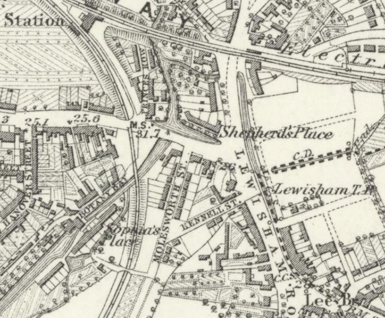
Hither Green station is the perfect place to start the walk as the railway ‘made’ the area.  At the time of the railway arrived in Hither Green in the 1860s, it didn’t stop – it was to be a junction until the mid 1890s.  When the South Eastern Railway navvies constructed the embankment and cutting through the area, Hither Green was largely rural, surrounded by farms as the map below shows – the farms including several covered by Running Past – North Park, Burnt Ash and Lee Green.

Hither Green Lane was there with several large houses but the main population centres were outside the area – the elongated Lewisham stretching all the way along what is now the High Street and Rushey Green, the three parts of Lee – Lee Green, the area around the church and Old Road, the latter with the Manor House and the farm and servants housing of Lee New Town.

While Hither Green remained a junction until the 1890s, the edges that were closer to other stations started to be developed – for example Courthill Road started to be developed from 1867, Ennersdale Road during the 1870s.  Then roads like Brightside, Mallet and Elthruda began to be developed in the late 1870s and early 1880s.  Everything changed with the opening of Hither Green Station on 1 June 1895 – the area lost its rural feel, most of the remaining large houses were sold and the Victorian and Edwardian houses and ‘villas’ built.

The Prime Meridian is crossed and marked in the pedestrian tunnel at Hither Green station, most of the walk will be in the western hemisphere..

Springbank Road & Nightingale Grove

A V-1 attack on devastated the area on the western side of the station on 29 July 1944 killing five  and destroying a significant number of homes, as the photograph (below) from the now closed ramp up to Platform 1 shows. It was one of 115 V-1 rocket attacks on Lewisham that summer – the most devastating had been the previous day when 51 had died in Lewisham High Street. Soon after the war nine prefab bungalows were put on the site; with the council bungalows probably appearing in the early 1960s.  The Beaver Housing Society homes on the corner of Nightingale Grove and Ardmere Road also replaced some of the homes destroyed – there are glazed tiles naming the landlord which is now part of L & Q Group.

© IWM Imperial War Museum on a Non Commercial Licence

Ardmere Road (covered in a 2 part post) was built in the 1870s but was considered one of the poorest in the neighbourhood by Charles Booth’s researcher Ernest Aves in 1899 – he described it as one of the ‘fuller streets, shoddy building, two families the rule.’ It was marked blue – one up from the lowest class.

The area was looked unfinished to Aves and there was even a costermonger living in a tiny tin shack with their donkey on the unfinished Brightside Road in 1899, along with a temporary tin tabernacle. This immediate area was very poor and in ‘chronic want’ compared with the comfortable middle class housing of much of the rest of the area.

Hither Green Community Garden

The Community Garden dates from 2010 – cleared and maintained by volunteers from Hither Green Community Association.

North Park Farm

The Community Garden would have been part of the farmyard for North Park Farm.  It was latterly farmed by the Sheppards, although the land was owned by the Earls of St Germans until the sale to Cameron Corbett in 1895 – there are already posts on both the farm itself and in the early days of the development.

There were two Sheppard brothers both of whom had houses – one of the farm houses remains at the junction of Hither Green Lane and  Duncrievie Roads (see above) – along with their long term farm manager William Fry, who lived in the original farm building around the Community Garden..

The shops (see below) were developed by Corbett early in the development – there was no pub as Corbett was a strict teetotaller. There was a beer house (licenced to sell beer but not wines or spirits) nearer the station in area demolished by the V-1.

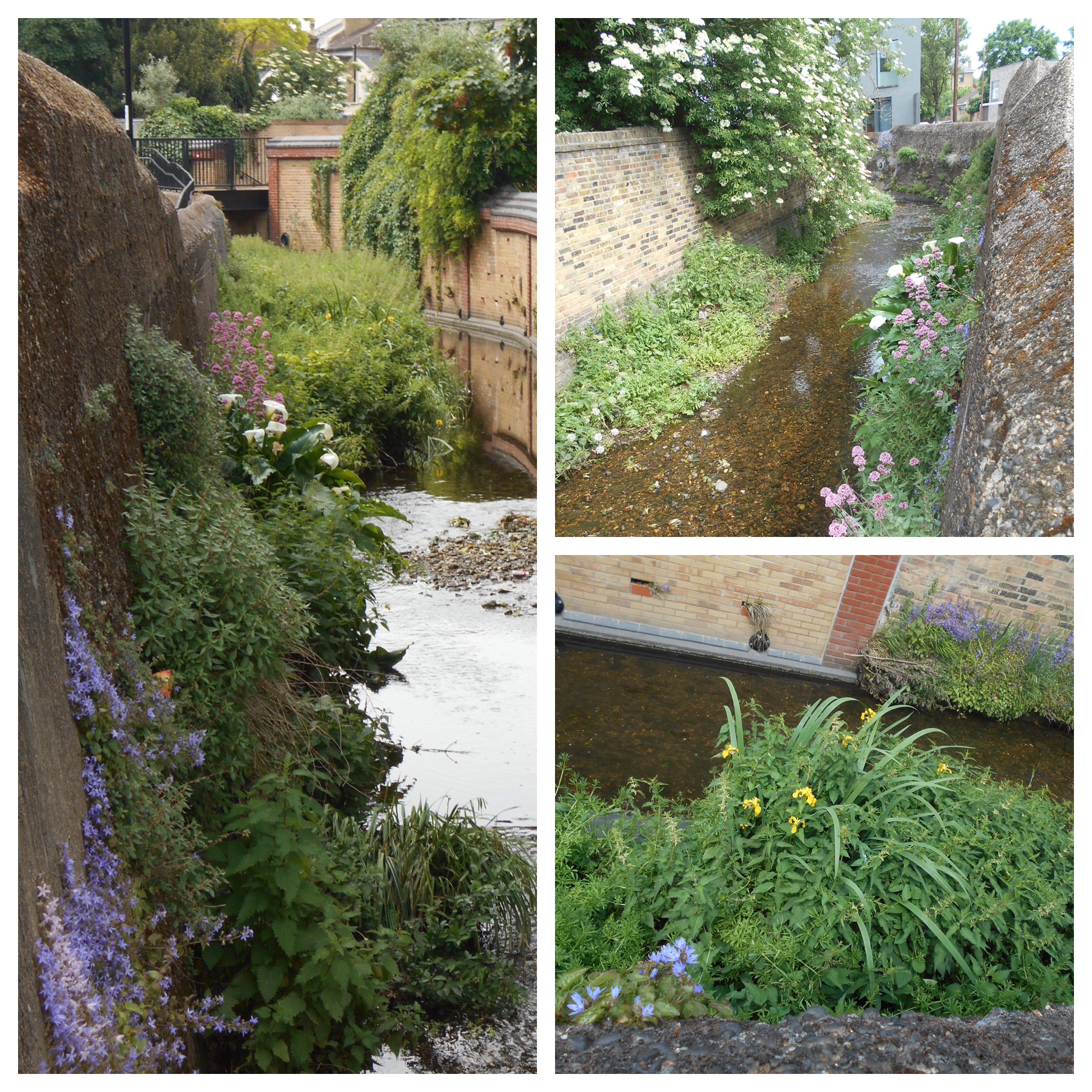
There was a small stream which I have called North Park Ditch which ran through the farm – it is visible in the Hither Green Nature Reserve and was a tributary of Hither Green Ditch, which joins the Quaggy between Manor Lane and Longhurst Road.

The Old Station

The original entrance to the station was where Saravia Court , a block of housing association flats built around 2013, is now situated – it is named after the original name for Springbank Road.  The station buildings lasted until around 1974, when the booking hall was moved to its current location at platform 4½.  The site was used by timber merchants for many years.

The only remnants of the former station are the stationmaster’s house, 69 Springbank Road and the gate pillars to the former station entrance

Park Fever Hospital

This was the site of two of Hither Green’s larger houses – Hither Green Lodge and Wilderness House, these were sold to a private developer in the early 1890s and then onto the Metropolitan Board of Works who built the hospital after much local opposition.

Despite the 1896 signs, the hospital opened in 1897, it went through variety of guises including fever, paediatrics, geriatrics in its century of use.  The site was redeveloped for housing after the hospital closed in 1997.  There is a specific post on the the hospital and the housing before and after it in Running Past in early 2018.

Opposite the hospital in Hither Green Lane was the childhood home of Miss Read – she was a popular writer of rural fiction in the mid 20th century, who covered her time there in the first volume of her memoirs.

The Green of Hither Green, the area’s small bit of common land was  at the junction of Hither Green and George Lanes and was enclosed around 1810,

Roughly the same location was the ‘home’ to Rumburgh (other spellings are available) a settlement that seems to have died out as a result of the Black Death in the mid 14th century – this was covered a while ago in the blog.

Park Cinema opened in 1913 with a capacity of 500, it is one of several lost cinemas in the area.  It closed its doors in 1959 and was vacant for  many years  – it has gone through several recent uses including a chandler – Sailsports, a soft play venue Kids’ Korner and latterly another alliteration, Carpet Corner.

Its days seem numbered as a building as after several unsuccessful attempts to demolish and turn into flats – planning permission was granted in September 2017 after an appeal against a refusal by Lewisham Council.

Beacon Road/Hither Green Lane

The Café of Good Hope  is a recent addition to the Hither Green Lane, part of the Jimmy Mizen Foundation –  Jimmy was murdered on Burnt Ash Road on 10 May 2008.  The charity works with schools all over the United Kingdom, where Margaret and Barry Mizen share Jimmy’s story and help young people make their local communities safer, so they can feel safe when walking home.

The Fox and Sons ‘ghost sign’ is next door to the Café.  Ghost signs are painted advertising signs, they are not meant to be permanent – although were to last much longer than their modern day counterparts.  The urban landscape used to be full of them but most have been lost – either to modern advertising, being painted over or the buildings themselves being demolished lost.  There are still quite a few locally – the best local ‘collection’ is around Sandhurst Market at the other end of Corbett estate.  They can be

This was very briefly an off licence, there is a photo of it but it didn’t seem to last long enough to make local directories. There is much more on the brewery behind the ghost sign in a post here.

The Pillar Box on the corner of Beacon Road may look ordinary but it was attacked by suffragettes in 1913 – it was one of many similar attacks by Lewisham’s militant WSPU branch. 


St. Swithun’s Church

The church building dates from 1904, although the now church hall was used as a church from 1884.  Both were designed by Ernest Newton who also designed the Baring Hall, the original Church of The Good Shepherd and Lochaber Hall.  Gladys Cooper, the actress was baptised here.

Perhaps the biggest surprise with St Swithun’s (pictured above) – is that it is still here.  So many of the local churches were lost in World War Two – the Methodist Church at the junction of Hither Green Lane and Wellmeadow Road, the original church of The Good Shepherd, Christ Church on Lee Park and Holy Trinity on Glenton Road.

Merbury Close

Merbury Close was developed as a sheltered scheme for the elderly in 1986.  Before that it had been a nursery – the last remnant of something that this end of Hither Green had several of  – the best known – run  Lewisham Nursery, run in its later years by Willmott and Chaundy, which finally closed in 1860.

Bullseye or Japes Cottage – (pictured above) was on the corner of Harvard Road and Hither Green Lane – it was the gardener’s cottage for one of the larger houses on Hither Green Lane  – the inappropriately named, in terms of size, Laurel Cottage.

Spotted Cow – one of the older pubs in the area, the name referring to its rural past; it closed around 2007 and was converted into flats by L&Q Housing Trust, the block at the side is the name of one of its former Chairs.

Monument Gardens

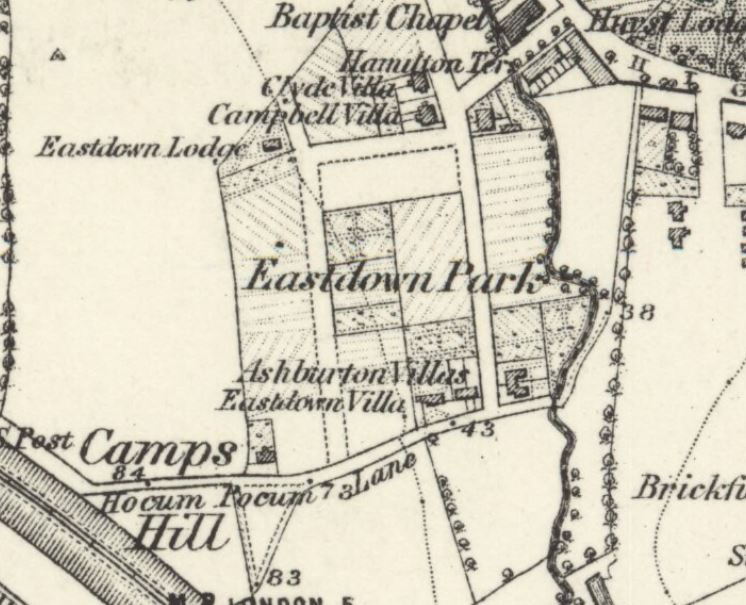
From the 1820s to 1940s this was ‘home’ to Camps Hill House, an impressive large house which was built in the 1820s for the brick maker Henry Lee – it is pictured below (source eBay October 2016) .  It was demolished post-war for what initially called the Heather Grove estate.  There is a much fuller history of both the estate and its predecessor in a blog post from 2016.

The monument on the grass is something of a mystery  – it is dated 1721, well before Campshill House was built – it is rumoured to memorial to an animal – it isn’t marked on Victorian Ordnance maps, although seems to have been there from the mid-19th century.

Nightingale Grove

This used to be called Glenview Road and was the location of one of the biggest local losses of life during World War 1 – a large bomb was dropped by a Zeppelin  in the ‘silent’ raid on the night of 19/20 October 1917.   There were 15 deaths, including 10 children, two families were decimated – the Kinsgtons and the Millgates.  The attack was covered in an early post in Running Past, as was its fictional retelling by Henry Williamson, better known for writing ‘Tarka the Otter.’

Hansbury’s (formerly the Sir David Brewster)

When this post was first written this was one of the more depressing sites (or sights) on the walk – a rapidly decaying former pub,.  While it has been converted into flats, the bar remains closed.  It was once one of half a dozen Hither Green boozers, despite Archibald Cameron Corbett preventing them on the former North Park Farm.  Hither Green now has just one pub, the Station Hotel along with the Park Fever beer and chocolate shop opposite on Staplehurst Road which offers some limited seating and the new Bob’s on Hither Green Lane.  A 2016 blog post tells the story of the pub.

There was an attempt to build a pub in the late 1870s in Ennersdale Road, however, there were two rival builders and they seemed to expect the magistrates to decide on which one to allow.  In the end neither happened (1).

Dermody Gardens

The path over the railway to here used to be called Hocum Pocum Lane (covered a while ago in Running Past), it can be followed back to St Mary’s and beyond towards Nunhead and continues down the hill over a long established bridge over the Quaggy and then north along Weardale Road to join Lee High Road by Dirty South (formerly the Rose of Lee).  It was renamed Dermody Road after an alcoholic Irish poet in the 1870s – Thomas Dermody (below) is buried at St Mary’s and there is something on his short life here.

Towards Lewisham the street layout evolved in the early 1870, the area was certainly included within the Lewisham Nursery of Wilmott and Chaundy who grew Wisteria amongst other plants, although the name of the road may predate the nursery.  The area beyond this, towards Lewisham, was developed as the College Park Estate in the 1860s.

The Holly Tree closed in 2017 and, like its neighbour over the railway, while the upper floors are used as flats the doors tot eh bar remain firmly shut.

Manor Park

This was a pig farm before being turned into a park in the 1960s, although it was once of Lewisham’s more neglected parks until a major upgrade in 2007 with Heritage and Environment Agency funding the river was opened up park and the park re-planted to encourage wildlife.   There are Running Past posts on both the Park and the Quaggy at this point.

While going through Manor Park is a pleasant detour – we will only see the backs of the houses of Leaahurst Road.  Large chunks of this end of the street, particularity on the western side were destroyed during World War 2.  The bomb sites were searched extensively during a notorious 1943 child murder investigation – the murderer was Patrick Kingston, a surviving member of the family almost wiped out in the Zeppelin attack.

Leahurst Road was also home to one of Hither Green’s once famous residents – the early Channel swimmer, Hilda ‘Laddie’ Sharp (pictured above).

Staplehurst Road

The Shops were built in the early 20th century, a little later than those in Springbank Road, the dates are marked in several places as one of the original ‘Parades’ – the sign for Station Parade is still there (above the Blue Marlin Fish Bar).  The nature of the shops has changed significantly – although mainly in the period since World War 2.  There is more on this in a blog post, including Hither Green’s Disney store.

The Station Hotel was built by the Dedman family who had previously run both the Old and New Tigers Head pubs at Lee Green and opened around 1907.  It is now Hither Green’s only pub.

The Old Biscuit Factory is a new housing development from around 2013, the site including the building now used by Sainsbury’s was originally a very short-lived cinema, the Globe – which lasted from 1913 until 1915, before being ‘home’ to Chiltonian Biscuits.

The area around Staplehurst Road suffered badly in a World War 1 air raid – two 50 kg and two 100 kg bombs were dropped by German Gotha aircraft and fell close to 187 Leahurst Road, damaging 19 shops and 63 homes, the railway line.  Two soldier lost their lives and six were injured on the evening of 19 May 1918.  Unlike the World War Two attacks, there seems little evidence there now of the bombing.  There was more significant damage and a lot more deaths in Sydenham in the same raid.

World War 2 damage is a little more obvious in Fernhurst Road, there was a small terrace built by the local firm W. J. Scudamore, which was hit by a V-1 rocket in June 1944.  Prefabs were built there immediately after the war, with the present bungalows following in the late 1950s or early 1960s.

If you want to do the walk physically rather than electronically ….

It is about 1.8 miles long and all on footpaths, it seems fine for buggies and wheelchairs apart from one very narrow, steep uneven section on Dermody Road (although it is better on the opposite side of the road).

Toilets – the only ones on the route are in Manor Park, although they are only open when the café is.

Refreshments – several places either side of the station, along with the Café of Good Hope on Hither Green Lane and the Lewisham Arts Café in Manor Park

Public transport (as of May 2018) – there is a bus map here, and rail journey can be planned from here.

Notes

  1. Kentish Mercury 04 October 1879

Picture Credits

  • The postcards and drawing of Campshill House are all from e Bay between January 2015 and January 2018
  • The painting of Japes Cottage is  ©Lewisham Local History and Archives Centre, on a non-commercial licence through Art UK
  • The Ordnance Survey map is on a Creative Commons via the National Library of Scotland
  • The photograph of the destruction of Glenview Road in the ‘silent’ Zeppelin raid is on a Creative Commons via Wikipedia
  • The photograph of the Sir David Brewster (Hansbury’s) is from the information boards at Hither Green Station.
  • The picture of Thomas Dermody comes from an information board at St Mary’s church
  • The photographs of Hilda Sharp – left photo source, right photo Times [London, England] 25 Aug. 1928: 14. The Times Digital Archive

Following the Quaggy – Manor Park to the Ravensbourne

We left the Quaggy just outside Manor Park having seen the park’s rejuvenation  from one of Lewisham’s worst bits of open space to one of its best, before that Running Past had followed the Quaggy from its sources around Locksbottom; then on through Petts Wood, the Hawkwood Estate, Chislehurst and Bickley, through the golf courses of Sundridge Park and on to Chinbrook Meadows; through the concrete and countryside of Mottingham; and then on through the playing fields and parkland of Sutcliffe Park and the Lee/Blackheath borders.
We left the river at an old crossing, although relatively new bridge that formed part of Hocum Pocum Lane; we continue along the Lane although it is now referred to as Weardale Road.  Unusually, it is visible for a short stretch as the western side of Weardale Road remains undeveloped, in spring it is a riot of colour from the plants that have colonised the banks.  The bridge is a great place for seeing the iridescent blue blur of the kingfisher – often sighted almost skimming the surface of the water, with occasional sightings of egrets and herons fishing in the shallows.
After 100 metres or so It bends sharply to the left, on the bend, in a tight triangular site, is almost certainly the finest modern building on the Quaggy – 22 Weardale Road – designed by and Anglo-Dutch architectural practice 31/44.
A little further on is the Rose of Lee pub, latterly called the Dirty South although it has gone through several names in the last 25 years.  It opened around 1900 and, perhaps, it’s greatest claim to fame was that it was the first venue that Kate Bush played.  It suffered damage and looting during the 2011 riots that spread across numerous locations in London in early August, it looked as though it was to become another lost Lewisham pub.  There were occasional signs of life and a few drinkers during 2016, but it took until 2017 to have a major revamp and re-open as the Dirty South in late October 2017.
Around here the Quaggy was once joined by Mid Kid Brook which used to flow  more or less alongside Lee High Road from close to Lee Green, its former valley is clear in places.  However, it was diverted to follow Lee Road to Lee Green, probably around the early 18th century.
The river is bridged by Eastdown Park, a bridge that was partially destroyed in a flooding in 1878 in an era when flooding seemed more common.
On the west side of f the Eastdown Park bridge (to the left of the photograph) is currently Penfolds garage – the remaining part of a company that used to have three bases locally, including taking over Lee Picture Palace as a car showroom in the 1970s. The usage of the site, which used to be home to a Baptist Chapel (below – source eBay April 2016), is about to change again – this time to flats.
The river follows a tight channel, built on both sides, occasionally over it – such as by KwikFit. The banks had been almost rural on the south-eastern side of until the College Park Estate in the late 1860s as the map below shows (on a Creative Commons from the National Library of Scotland).
By the next bridge, over Clarendon Rise, is without a doubt the most attractive riverside building on The Quaggy, a Hindu Temple, the London Sivan Kovil.  In September each year it is the venue for probably the most stunningly beautiful site in Lewisham – the Chariot Festival.
Attempts continue to be made either side of the Clarendon Road bridge to slow down flows through artificial meanders, while this allows some of the normal fluvial erosion and depositions on rivers in their natural state and thus will help a little with plant growth, it will be of little use in high flows though.
Soon after Clarendon Rise, just behind Lewis Grove, the Quaggy is covered at what used to be known as Lee Bridge.  Like much of the area upstream this too was liable to flooding – on an earlier Facebook thread on the river further upstream there were stories of what was then the Midland Bank (postcard from eBay September 2016) flooding in and notes floating around the flooded basement of the bank.
Historically, flooding was very common around Lee Bridge, this 1968 photograph, outside the Odeon (formerly Gaumont) Cinema commonly shown in relation to Lewisham flooding will probably relate to both the Quaggy and  Ravensbourne though – see comments below.
The extent of the covering of the Quaggy has varied over time, the recent development of the police station offered an opportunity to extend its visibility but it wasn’t taken and there is less of the Quaggy open now than there was a century ago as the postcard below shows (source – eBay February 2016).
The river currently re-emerges in front of St Stephen’s church, having first been joined by Upper Kid Brook. There used to be two arms to the Quaggy at this point – one by the former Roebuck pub, the second by the former Plough as the map below shows ( (Image on a Creative Commons from the National Library of Scotland). Both pubs disappeared in the early 2000s, as part of the redevelopment of Lewisham town centre.
The river broadly follows the course by the former Plough Bridge (left photo above) but at the time of writing, the confluence with the Ravensbourne is hidden in the middle of the Lewisham Gateway development which has rendered the area around the station almost unrecognisable.  Eventually, the confluence with the Ravensbourne will be in a small park, Confluence Place, but it may be a wait until the reality is anywhere near the architect’s impression.

Following the Quaggy – Lee Green to Hocum Pocum Lane

We left the Quaggy close to Lee Green with a Lewisham Natureman stag ‘grazing’ by the outflow of Mid Kid Brook, before that Running Past has followed the Quaggy from its sources around Locksbottom; then on through Petts Wood, the Hawkwood Estate, Chislehurst and Bickley, through the golf courses of Sundridge Park and on to Chinbrook Meadows; through the concrete and countryside of Mottingham; and latterly through the playing fields and parkland of Sutcliffe Park and the Lee/Blackheath borders.

The river changes here; gone now are the almost bucolic feel of the river through the playing fields and parkland in the section of the river from Sutcliffe Park to Lee Green. The Quaggy is now very much an urban river, with building up to the banks and the route downstream for the fluvial flâneur often parallel with the river only visible on bridges.

Riverside pubs have been conspicuous by their absence so far, but are a much more regular feature as we follow the last mile or so of the course.  The Old Tiger’s Head, 50 metres or so away from the river, was the base for the mid 1840s horse racing of the Lee Races. Lee Green was still rural then, complete with a green, a windmill and a farm – Lee Green Farm. The pub was very different then, being rebuilt in the 1890s, as the picture above from an information board at Lee Green shows.
The Quaggy squeezes between some 1990s flats and a plot of land that was Victorian housing and will presumably be returned to housing again; it was latterly the showroom of Penfolds Vauxhall dealers, after they moved from the former Lee Picture Palace on the corner of Bankwell Road.  The river, for a short period, is again banked and bedded in concrete – little is able to grow but that didn’t stop a few optimistic sticklebacks from attempting to eke out an existence in a hostile environment (below, top left) when I did the research for the post.

The Quaggy emerges out into the open at what used to be called Lee Green Bridge and the first proper riverside pub, the Duke of Edinburgh, still serving and with a pleasant garden at the rear.  The pub dates from around 1871 when the landlord, a Mr W Baker, took over licence of the Black Horse, which was a short-lived ‘beer house’ that may have been on the same site (1)

The river forms the rear boundary between homes in Lampmead and Brightfield Roads – the former named after a field. The course wasn’t always thus, the Quaggy originally took a course further to the north touching the southern end of what is now Lenham Road.  The differences are clear between the 1863 (top map below) and 1893 visits of the Ordnance Survey Cartographers (maps on a Creative Commons via National Library of Scotland). The effective development of Lampmead required the straightening of the river, following what was previously a path behind the houses of Robertson Street, which was to become Brightfield Road at around the same time.  The curved building (above, top right and bottom) hugs the banks of the river.
The Quaggy is bridged by the dog-leg of Brightfield Road before tumbling down into Manor House Gardens.  The Gardens are one of Lewisham’s flagship parks and were the grounds to a large house built and maintained from the proceeds of slavery until bought by the London County Council as a library and park in 1902.

Source – eBay Feb 2016

The Quaggy seems to have originally fed the small lake although is now at a much lower level.  It is bridged a couple of times within the park, both having been the venues for generations of Pooh Sticks, no doubt played before the game was named in the 1920s by A A Milne.
The river has natural earth banks topped with a dense tree canopy throughout its 400 metres or so through the park, during the summer the river is heavily shaded.  The steep banks make the river relatively inaccessible through the park.
Flowing out of Manor House Gardens, the river crosses Manor Lane, an old farm track and again forms a boundary – between the WJ Scudamore homes of Thornwood Road, a Lewisham Council sheltered scheme off Manor Lane and later more Scudamore homes on Manor Park.  This was a largely rural area until Hither Green station was build in the 1890s, there was a junction there from the 1860s, as the 1870 map below  on a Creative Commons from the National Library of Scotland) shows. This part of Lee was still used for market gardening, mainly run from Manor Farm, until the Scudamores built homes of what was marketed as the Manor Park Estate..
Over the other side of Manor Park the river turns almost 90 degrees, to flow between more gardens, between Manor Park and Longhurst Road, briefly visible by peering around a bridge on one side of Staplehurst Road – close to the shops posted about earlier in 2017.  Just before the bridge the river is joined by one of its tributaries, Hither Green Ditch (Quaggy Hither Green).
The river continues northwards, squeezing between the gardens of Manor Park (the street) and the northern end of Longhurst Road before opening out into Manor Park (the park rather than the street).  The park’s rejuvenation has been covered before in Running Past, the former small pig farm has gone from one of Lewisham’s worst bits of open space to one of its best.  The Park has become a community hub – centred around the Arts Cafe.  The river itself is used much more – including the annual Quaggy Duck Race and the Float Your Boats event in June 2017, pictured below.
The Quaggy itself while having a ‘natural’ feel at the end of the back gardens of Leahurst Road, was concrete encased and hidden from the park on  the opposite bank.   Flooding used to be common in this area – in the mid-1960s, the then MP for the area Chris Chataway described residents as living ‘in fear of this wretched stream.
At the edge of the Park, there is a bridge – while the structure is a new one, the crossing an old one – it was the final section of Hocum Pocum Lane – an ancient path from Lee High Road to St Mary’s Church, and possibly beyond.
We’ll leave the Quaggy here for its final section to its confluence with the Ravensbourne in Lewisham.
Notes
  1. Ken White (1992) ‘The Public Houses of Lee and Lewisham’ Part 6a, p134

W J Scudamore – A Family Builder of Lee

There were several builders and developers that made signifiicant impressions on the urban landscape of Lee and Hither Green – on the western side of the railway was Cameron Corbett’s development of North Park Farm in Catford and Hither Green, on the eastern side of the railway mainly on Northbrook land was John Pound. Straddling both sides and having much greater longevity in terms of years of operation were the family builders WJ Scudamore and Sons. The family retained connections in the area until at least the 1970s.  This post looks at both their lasting impact on the built environment, but also in tries to unpick some of their own story which is closely intertwined with their development of homes.

The firm appears to have been founded by William John Scudamore who was born in 1845 in Whitechapel – he married Harriet Stevenson in 1865 and together had eight children, only four of who lived beyond childhood.  The three surviving sons all became Directors of the firm – William John (1867), Cornelius (1871) and George (1873).

William (1845) was living in at 37 Henry Street in St George’s area of Borough in Southwark working as a blind maker in the 1871 census; a decade later, the family had moved to Bermondsey New Road where William (1845) was then listed as a furniture dealer.

William’s (1845) first wife Harriet died in 1896 and he married Elizabeth Drane in 1898, in Southwark. They had two further children – John William (1899) and Henry (1904) who were born in Catford and Lee respectively – as with the other sons, they were to become Directors of the family firm.

While there seems to be no reference to William (1845) in the 1891 census, it would seem likely that the building firm had already been set up – certainly, his son William (1867), who had married Annie Elizabeth Jackson the previous year, was listed as a builder living at 226 Old Kent Road – possibly for his father.

The first definite location in Lewisham that it is known that W J Scudamore developed was on the site of the former Hope Cottage on Hither Green Lane.  The plot was about 5.5 acres in size and (1) saw the development of the shops fronting Hither Green Lane and the flats above them, along with Woodlands, Benin and Blashford Streets (2).  There is a specific post on Hope Cottage and Woodlands Street.

As can be seen from a newspaper advert further down the post, 1 Benin Street (below) was used for a while as the Estate Office.  It seems that this development predated adding the ‘Sons’ to the business as there were mentions of paying bills of £20 in 1898 and £6 11s 6d in 1899 for connection of sewers.

image

By 1901, William (1845) had moved to the then suburbia of Catford and was living at 157 Brownhill Road, with his new wife.  His sons from the first marriage were all close by – William (1867) was living at 144 Laleham Road, Catford, and had a daughter, also Annie, who had been born in Southwark around 1894 and a son, also William John, born around 1897 in Catford.  His brother, Cornelius was living just around the corner at 45 Farley Road, like his brother he was listed as a builder in the census – although the family history notes that he was an ‘administrator and designer of the houses.’  The youngest brother, George, carried the same ‘trade’ in his census listing in 1901 and was a few minutes away from his brothers at 155 Hither Green Lane.

In Lee they built 53 homes on Effingham Road (presumably the westen end) ust before the turn of the century – there were requests for adoption in July 1899 (3) and being let by September 1899 – they were offered on annual rents of £28 for mid terraced homes, £29 for those with a side entrance (4).

By early 1904, probably before, the firm, now including the ‘Sons’  were at 13 Manor Lane, now 89/91 after Redruth Road became part of Manor Lane (5) They were using it as an estate office for various developments in the area;  William (1867) seems to have lived there and had another son Harold who was born there.  It is on the corner of Manor Lane and Handen Road and was a convenience store up until around 2018 when it became a nursery.  Given the similarity of some of the architectural details, it would not be surprising if the property was build by the Scudamores. The same is true of shops 103 to 109 Manor Lane which are of the same style.

image

There were advertisements in the London Press in 1906 for four bedroom homes at rents of £40 a year (6), presumably in the now well established Effingham Road.

scudamore17_1

Within a year or two they were advertising homes for sale on what they referred to as the Manor Park Estate (7).

scudamore17_2

The Manor Park Estate would seem to include roads like Thornwood, Chalcroft (below) and Kellerton Roads along with parts of Manor Lane, Manor Lane Terrace and Manor Park – the last three were all to become home to family members once the building work was completed.

image

In the same editions of the South London Press (8), they were also also letting homes in Benin Street and presumably above the neighbouring shops on Hither Green Lane.

scudamore17_3

By 1911 the brothers were all living around Lee – Cornelius had moved  to Southbrook Road, William (1867) was at 89 Manor Park and George a few doors away at 127. Their father, William (1845) was living close by at 79 Micheldever Road.

By 1915, they were operating out of 412-414 Lee High Road – they used it both as an office as well as a store and workshop for making windows.  It is where Sainsbury’s is now but was acquired by Penfolds – a couple of doors down from the Imperial Picture Palace and next door to the former Police Station, During that year they bought several pieces of land and buildings in Newstead Road although, while the Scudamore interest was noted as a builder this may have been completing transactions on work completed several years before – OS maps show Newstead Road being built around the mid-1890s.  Examples on the link are for 45, 47, 59 and 67 but there were several other similar transactions.

image

Given the similarity of houses on the neighbouring Parkcroft Road (below) and St Mildred’s Road to houses they built in Manor Park and Chalcroft Road – it is likely that they are the work of W J Scudamore & Sons too.

img_2823

Newstead Road may have been the first development in the area as the history of the family name notes that the early approach to building was to lease plots on which he built houses.

Around this point William (1845) moved into a large house at 38 Manor Lane Terrace, with gardens and tennis court – it was the former Lee Manor Farm – adjacent to homes that the firm had built and perhaps bought with the land for them.  The house was demolished, probably after Elizabeth died in the 1960s (William, 1845, had died in 1824), and is now part of Wolfram Close – probably a misspelled version of the name of last occupant of the Manor House (now library).

William (1867) and Annie moved to Baring Road (presumably built by the firm), and by 1928 had retired – they are recorded on a couple of passenger lists going to North Africa and listed as having  had no occupation.

The business seems to have been taken over by William John (1897) – the business, at least, was based at 1 Burnt Ash Hill, next to the station – convenient for sales to commuters.

In the  1920s and 1930s they were building some of the newer homes of Lee – including homes on what was then referred to as the Northbrook Estate, opposite the Northbrook Park on Baring Road (see picture below).  An advert offered the 3 bedroom homes at £725 for leasehold at £875 freehold – stressing the relative proximity of both Grove Park and Lee Stations.  It was almost certainly part of the land of College Farm, which Running Past has covered in the past.

image

William John (1897) was also extending their area of operation – particularly into Bexley, during the mid to late 1930s they developed sites at

William John (1897) married Dora and had two sons and a daughter, William John who was born around 1923, he died training as a member of the Glider Pilot Regiment in 1942. Like many of the rest of the family they lived in a Scudamore house – they were listed in the 1939 Register as living at 2 Dallinger Road (below), development of that road had started in 1914 (9). The street was named after a scientist and Methodist minister, William Dallinger, who lived locally towards the end of his life.  It is on the corner of another street the firm built – Holme Lacey Road – which is a misspelled reference to the historic home of the Scudamores – Holme Lacy in Herefordshire – the development of that street was a lot later – around 1928 (10).

img_2827

Cornelius was listed as living at 156 Halfway Street in Sidcup on a passenger list to Brisbane in 1938, presumably to visits his son, also Cornelius, who emigrated to Australia.  He was listed as a Master Builder (Retired) at the same address in the 1939 Register.  He died in 1958 in Greenwich.   William (1867) seems to have come out of retirement as he was involved with the firm in 1939, living in a large house close to Sevenoaks – one of the other occupants was his son Harold, who was listed as a Scudamore Director.  William (1867) was to live until 1955.   George had retired by 1939 and was living in Footscray Road – he died in Bromley in 1950.

Nothing is known of what happened to the firm after World War 2 although they continued in business until 1966, when they were based in Holme Lacey Road – probably where Travis Perkins are now (2017) trading from.  The firm was voluntarily wound up on 18 July 1966 and a liquidator appointed – when William John (1897) would have been around 69 and was still Chairman of the business at the time of the winding up.  William John (1897) was to live until he was 90.

The Scudamores left their mark in other ways than the homes – they had bespoke manhole covers at the rear of the homes they developed, and excellent Edith’s Streets suggested that they also had them on the roads of the estate.  Sadly, despite a ferrous foray around the streets of Hither Green and Lee looking for evidence.  Alas, dear reader, I found no evidence of the latter.  However, in the back gardens the former still exist with the Manor Lane address.

Notes

  1. Godfrey Smith (1997) Hither Green – The Forgotten Hamlet p35
  2. ibid p39
  3. Kentish Mercury 28 July 1899
  4. Kentish Mercury 29 September 1899
  5. Kentish Mercury 29 January 1904
  6. London Daily News 28 June 1906 – there were several of the same adverts around then.
  7. South London Press South London Press 29 January 1909 – the same advertisement was used for several months.
  8. ibid
  9. Joan Read (1990) Lewisham Street Names and Their Origins p17
  10. ibid p29

The elements of the family history have been gleaned from two sources – the census, shipping, marriage and related data came via Find My Past 

The most important sources have been the fascinating Scudamore Family history along with various members of the Scudamore family who have  enabled me to piece together strands that I had originally not been able to link together.

Thank you also to Nick Noel for the photograph of the drain cover.

Parklife – Manor Park

Parks of various shapes and sizes are so important to the urban runner, they allow us to get us away from the roads and run without fumes and without the disruption of rhythm and pace from crossing roads. Virtually all my day time runs involve plenty of parkland; so for a blog on running and local history, it seems like an obvious subject matter.

20140626-224444-81884316.jpg
Manor Park is not the obvious place to start though; it is a narrow strip, around 400 metres long and 50 wide flanked by The Quaggy and the large Victorian houses of the eponymous Manor Park. It isn’t even a park with a long history its usage as a public open space only going back to the mid 1960s on the site of a former pig-farm and bomb damaged house.

It is a pleasant calm, green space which is well used, although not overused, with colour coordinated planting and a path alongside the river which I use 2 or 3 times a week.

20140626-224621-81981391.jpg
It used to be so very different – it fitted much of Will Self’s antithesis of what a park should be like

In the playground the swings stand like gibbets, a few lengths of chain dangling from their rusty crossbars. The rubberised flooring – beloved of some safety-conscious bureaucrat – has long since been eroded by the scuffing of many thousands of feet, exposing the concrete and clay of the urban bedrock…

It was a park that oozed neglect, the paths were rutted and required care when running across, poor grounds maintenance had allowed Japanese knotweed to take over in places and The Quaggy was encased in a concrete channel which was a barrier rather a natural resource and seemed largely devoid of birdlife. There had been an aviary in Manor Park in a building that pre-dated the park as late as the early 1990s, but it was abandoned following a fire and the corners of its brick building, to which the path hugged, provided uncertainty for the unwary runner.

From mid-morning the main park users seemed to be the ne’er-do-wells who used to congregate in the remains of the playground. I have been threatened when running in the pre-restoration Manor Park almost as many times as every other location combined. All this, along with unpredictable opening times and haphazard decisions as to whether to open a gate at both ends of the park or just one meant that I gave up on Manor Park for years.

It was also a park that lived under the shadow of another older, bigger local park – Manor House Gardens, with which it is sometimes confused. The size of the shadow increased in 2000 when the Heritage Lottery Funded restoration of Manor House Gardens was completed.

Manor Park had to wait for its upgrade until 2007 with funding from the same source as well from the Environment Agency as part of a major scheme to reduce the flood risk posed by the Quaggy. The banks of the river have been opened up, wildflower meadows created, the ‘gibbets’ have been replaced with a larger and improved play area, and a third entrance with a new bridge over the Quaggy has been created. Birdlife has returned to the river and I have seen the iridescent blur of blue and orange of the kingfisher flashing above the surface of the Quaggy.

With CCTV and a much greater park-keeper presence, it has become a much safer environment for the runner, and everyone else for that matter.

2015 has seen park usage increase considerably with opening in the spring of  the Lewisham Arts Cafe, run by by local artists Banu and Fred Schmid, the park has become a focus for a wonderful array of arts based activities.

20140626-224724-82044690.jpg