Tag Archives: Burnt Ash Hill

Lee Sorting Office

There have been several posts on Running Past about the evolution of public buildings around Lee – the two telephone exchanges, the trio of fire stations and most recently the municipal offices off what is now Woodyates Road.  Next door to the latter, albeit constructed a little later was the Lee Sorting Office.

From around 1888, perhaps a little earlier, the Sorting Office was based on Lee High Road on the corner of what is now Lampmead Road (originally it was a dog leg of Lenham Road) – it is now home to a firm of solicitors, after being the offices of a realtively long standing business, Homesales, who were also in Market Terrace.

In the 1881 census, what was then 1 Sussex Terrace, was a grocer’s run by Nathaniel Short – he was from Greenwich and had four young children, with wife Elizabeth from Gravesend. They can have been there no more than a year as their youngest daughter was born in Lewisham, rather than Lee and the older children all were born in Bexleyheath. 

Little had changed by the 1884 Kelly’s Directory, but by1888 the address was now 226 High Road, and Short had added a Post Office to the Grocery business.  Out at the back there were some buildings used as a sorting office.

Where sorting had been done before isn’t immediately clear – there were several other local post offices, including one already covered at 10 Burnt Ash Road (now part of the Sainsbury’s site) run by Martin Martin.  There was another in the row of shops between Brandram Road and Boone Street.

There was a high turnover of grocers and Postmasters, the Shorts moved on to Enfield by around 1888 – they were in Enfield in the 1891 census, making a circuitous trip via Australia to get there.   William James Francis took over from the Shorts; Abraham Culverhouse was in charge when the census enumerators called again in 1891 and Roberts & Co were running the Post Office and grocers by 1896.  There was no mention of a post office by 1900 when A M Curtis was there and it was not listed in the 1901 census and just being a grocer in 1904 when George Iliffe was there.

With a burgeoning population, continuing to run a sorting office from some small outbuildings behind a grocery shop was not really sustainable.  Lewisham already had one – located in what is now the shopping centre and had gone out to tender in 1895 (1).  Lee’s sorting office was put out to tender three years later. It was a site next to what were originally Lee Parish Offices, on what was then Woodstock Road. It became Woodyates Road after the development of the Woodstock Estate.

The Architect was Jasper Wager; a man from Bridgnorth in Shropshire, he had been working for Her Majesty’s Office of Works since 1877, they were responsible for a lot of public building work at this stage.  The sorting office at Lee seems to have been one of the earliest projects that he was specifically responsible for.  He was probably living locally at the time it was built – in the 1901 he is listed as living next to Greenwich Park in Vanbrugh Hill.

There were several impressive Post Office buildings that Wager designed over the next decade or so including ones in Woodford Green, Esher, Enfield, and Barnet.  There was another next door to the closed Arches Leisure Centre in Greenwich, plus others in Chelsea, Islington, and Winchmore Hill.

It is a striking building; the Local Listing describes it as ‘(a) single storey red brick Queen Anne Revival building (with) near symmetrical elevation onto Woodyates Road with stone mullioned and transomed window. Stone surround to centrally placed entrance door with stylised gablet with casement windows above.’

There is some lovely detail on it – particularly the stone sign Postmen’s Office over the main door (the newer brickwork to the side was the site of the postbox).

Looking at the 1911 census, around 35 men were listed as ‘postmen’ (no women) in Lee. Some obviously may have been based at other Sorting Offices. Unsurprisingly, they were concentrated in the smaller houses of the area, but in relative terms they were well paid, as shared households were rare, other than around half a dozen in their teens.  The road with the most was Taunton Road – which was home to Edward Greenwood (131), Philip Cox (56), Arthur Fincham (47), Arthur Goodwin (69), Charles Wood and lodger William Hedge (99), plus two other lodgers William Pescott (72) and Bertie Ridgewell (64). Roads like Lenham, Lochaber and the small houses of Lee New Town also had significant numbers.

While this wasn’t the case in either the 1901 or 1911 Censuses, some staff lived on site by the time World War Two broke out – in the 1939 Register there was postman Edward Wood and Ernest Rawlings who worked as a Post Office cleaner. 

At the rear of the site there was a scout hut, it was certainly there after world War Two and possibly before.

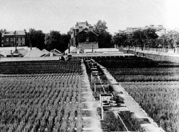
Like much of the post war development of the eastern side of Burnt Ash Road, the partial redevelopment of the site for housing in the mid-1990s related to the ending of Crown Estate leases.  It had been the same with shops on Burnt Ash and Eltham Roads that made way for the Leegate Centre and the housing that was demolished for Leybridge Court and most of the nurseries.  The Sorting Office closed in 1993 with sorting and deliveries on the Lewisham side of Lee being transferred to Endgate Street and, presumably, on the Greenwich side to Court Yard in Eltham. 

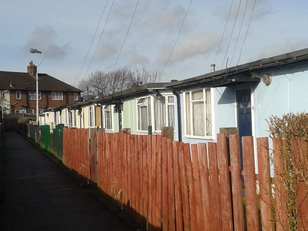
The site for both the Municipal Depot and the Sorting Office was bought by Developer Gengis Kemal.  The main depot building fronting onto Woodyates Road along with its stables in the north west corner along with the Sorting Office were all retained and converted.  There was sympathetic infill to the rest of the site.  The site is now known as Jasmin Court – it was originally to be called Jasmine after the daughter of the developer – the sign at the entrance to the former yard refers to it as this.  However, it appears to have been incorrectly had an ‘e’ removed by Lewisham so Jasmin is what it is officially known as.  It follows in the footsteps of a trio of misspelled Lee street names going back over a century – Holme Lacey Road, Aislibie Road and Wolfram Close (3).

Notes

  1. London Evening Standard 5 July 1895
  2. Kentish Mercury 12 August 1898
  3. Before someone else notes this, the irony of this is not lost on a writer with poor proof reading skills

Credits

  • Census and related information is via Find My Past (subscription required)
  • Kelly’s Directory data comes from Southwark Archives
  • The Ordnance Survey map is part of the collection of the National Library of Scotland and is used on a non-commercial licence
  • I am indebted to George Willis who lives in Jasmin Court (the 1990s development that the offices and stables are now part of) who has researched the site – although most of the research for this post was in parallel so any errors are obviously mine.  Thank you also to Darryl from the excellent 853 news blog for putting us in touch – if you don’t follow 853 you are missing out!

Wood Cottage and the Maller Nurseries of Lee

There is a postcard that appears from time to time on Lewisham Facebook reminiscence groups and for sale on eBay of a small house set back from the road with the label Burnt Ash Hill.  In the former locations, it often causes consternation as there are no obvious current or even recent landmarks.  The house was Wood Cottage and this post seeks to tell at least some of its story, and more particularly the nurseries that it was linked to.

The cottage probably dates from the 1870s and was broadly where the Roman Catholic Church of Our Lady of Lourdes now stands (pictured below) – midway between Lee Station and what is now the South Circular of St Mildred’s Road and Westhorne Avenue. 

The origin of the name is unclear, although the most likley scenario is after one of the Wood family who farmed the neighbouring Horn Park Farm who may have farmed the land for a brief period in the 1860s.

The firm running the nursery for much of its life was Maller and Sons.  It was set up by Benjamin Maller, a gardener who hailed from Surrey (Sussex in some censuses).  Born in 1823, he was living with wife Mary and daughter Mary at Belmont Lodge in 1851 – which was attached to Belmont a large house  on what is now Belmont Hill, where he was the gardener. 

In the 1861 census, Maller had moved just down the hill and was listed at 5 Granville Terrace, later it was to have the address 61 Lewisham High Street.  It is now part of the Lewisham police station site, but before that, became part of the Chiesmans empire.  Maller was listed as a ‘Nurseryman employing two boys’ in the census. Long and Lazy Lewisham which is covering the history of the High Street, notes that he had been there, trading initially with Robert Miller for around 5 years.

The partnership with Miller was short lived as was another with George Fry which ended in 1860. The next decade saw a rapid expansion, the 1871 census suggests he was employing 31 men and 6 boys. 

By 1881 they were listed in the census as being in Leyland Road – the numbering isn’t totally clear as the road was being developed and the house is just described as ‘The Nursery.’  This is pictured above (back middle), it was later numbered 72 and puts it now at the corner of Leyland Road and Alanthus Close. The nursery shown on an 1890s Ordnance Survey map. below, along with several other areas cultivated.

This would have been land leased from the Crown, part of the former Lee Green Farm (pictured below) which ceased operating in the1860s.  While the exact geography of the farm isn’t completely clear – it seems to have been a narrow farm covering land to the east of what is now Burnt Ash Road and Hill from Lee Green to around Winn Road.  Just a few hundred metres wide, it shrank rapidly as homes and shops were developed by John Pound following the arrival of the railway in Lee in 1866.  Land was also temporarily lost to clay pits and brickworks just south of Lee Station and north of The Crown.

In 1881 Maller was listed as a nursery man with 30 acres employing 4 men 8 boys.  The family included grown-up children Mary, Benjamin and Herbert – in the 1881 census at ‘the Nursery, Leyland Road’.

There had been  of significant reduction in labour since 1871 – 31 men to just 4 over 10 years.  This probably relates to the land they cultivated being rapidly lost to Victorian suburbanisation as streets like Dorville, Osberton and Leyland Roads were developed. 

Benjamin died in 1884 but the business continued as B Maller and Son afterwards, with Benjamin Boden Maller in charge – living variously at 107 and 111 Burnt Ash Road (there was access to the site from Burnt Ash Road too) and 72 Leyland Road. Benjamin Boden Maller died in 1913 although his son, also Benjamin, continued for a while.  However, in the 1939 Register he was listed as a Civil Servant living in Reigate.

So what did they grow? In 1879 an advert in the Kentish Mecury suggested the land cultivated from Wood Cottage (Burnt Ash Hill site) was for roses. The site around Leyland Road (listed as Burnt Ash Lane) was used for trees and and shrubs as well as having greenhouse plants and other plants that needed warmth – stove plants. While they cultivated Brockely Nursery they had moved from there as the Billinghursts (see below) were there by 1880 (1),

It seems that before the end of the century there was a change in focus with a lot of plants being grown for seed – they were regualrly advertising their illustrated seed catalogue to the gardeners of south east London and beyond (2).

In the early 20th century, they would also have auctions of surplus stock in September each year. The 1910 sale included 20,000 winter blooming heaths, gorse, winter aconites, ferns and palms (3).

The land that is now part of Alanthus Close seems to have remained with the Mallers until around the mid 1920s. On Burnt Ash Hill they will have added the land of the former brickworks less the frontage onto Burnt Ash Hill and a development next to The Crown centring on Corona Road.  This will have been an extension of the land cultivated from Wood Cottage.

It seems that the land was split three n the mid to late 1920s when the Mallers left.  There were different names at 107 Burnt Ash Road (May Scotland), 111 Burnt Ash Road (George Friend Billinghurst) and Norris Buttle at Wood Cottage.

May Clark Scotland was appropriately Scottish, born in Perth, she was running a florists at 111 Lewisham High Street by 1911, the name over the door was Alexander Scotland.

George Billinghurst was born around 1871 and seems to have spent his early years in Eliot Place in Blackheath, his father Friend Billinghurst was also a gardener.  There is no obvious link to the more well known Blackheath Billinghurst family, which included disabled suffragette (Rosa) May. They seem to have cultivated Brockley Nursery for a while (4), after the Mallers moved out, but family moved on to Croydon. By 1891 George was listed as a gardener, a decade later a florist and by 1911 a nurseryman living in Annerley Road.

Norris Buttle was living at 172 Ennersdale Road in 1901 and at 31 Leahurst Road in 1911 (these were probably the same house as the Ennersdale originally dog-legged around) – he was listed as a gardener then nursery gardener. 

With all three of them, details beyond 1911 proved difficult to work out.  Certainly none of them were at 72 Leyland Road – it was empty in 1939 as were 8 out of 10 the houses of that end side of the street going southwards.  It was a different picture going northwards.

Time was running out for the nurseries too, the land cultivated from Wood Cottage was lost in the 1930s as leases ran out and the Crown sold the land for development.  The land behind Wood Cottage was lost to the Woodstock Estate of Woodyates and Pitfold Roads.  Further south, the new South Circular and the developments around Horncastle and Kingshurst Roads, pictured above, further depleted the land.  The Cottage itself was lost to the new Roman Catholic Church of Our Lady of Lourdes – the church had acquired the land in 1936.

The land sandwiched between Leyland and Burnt Ash gradually was encroached upon with development at the southern end of Leyland Road although there were memories of roses being grown until the early 1960s when many Crown Estate leases ended. 

And finally, while no longer cultivated, there is a small piece of undeveloped land where the nursery was – the green space to the south of Alanthus Close. On some satellite images of the area in drought conditions show rectangles, probably the ghosts of greenhouses past – a little less clear than the prefabs around Hilly Fields.

,

Notes

  1. Kentish Mercury 16 August 1879
  2. Kentish Mercury 09 February 1894
  3. Kentish Mercury 02 September 1910
  4. Croydon Guardian and Surrey County Gazette 3 July 1880

 Credits

  • Census and related data come from Find My Past (subscription required)
  • Kelly’s Directories were accessed via a combination of Southwark and Lewisham Archives, with the reference to Lewisham High Street via the on-line collection of the University of Leicester
  • The postcard of Wood Cottage is via eBay in January 2021
  • The drawing of Lee Green Farm is from the information board at Lee Green
  • The photograph of the land between Burnt Ash Road and Leyland Road is part of the collection of Lewisham Archives, it remains their copyright and is used with their permission.
  • The Ordnance Survey map is part of the collections of the National Library of Scotland – it is used here on a non-commercial licence
  • The satellite image of Alanthus Close is via Apple Maps

Corona Road – The History of a Lee Street

The word ‘Corona’ with the suffix of ‘virus’ is currently striking fear into the population of much of the world.  In a leafier part of Lee, just off Burnt Ash Hill, there is a street with the name which pre-dates the virus by 140 years and has a much more benign meaning – ‘something suggesting a crown.’  This post looks at some of the history of the street and the neighbouring area.

The land to the east of Burnt Ash Hill in Lee had been probably been in the ownership of the Crown since 1305 as part of the estate of the Eltham Palace which was originally used for hunting.  The area has been covered several times by Running Past in relation to two of the farms on the land, Horn Park and Melrose Farms, as well is in passing in relation to pubs linked to John Pound – including The Crown.

As the city expanded with coming of the railways, they arrived in Lee 1866, the Crown began to sell off fields for housing and related activities.  One of these sales was land for a brick works on the corner of Burnt Ash Hill and what would become Winn Road – a hundred metres or so down the road from another of Lee’s farms, College Farm.  By the 1850s these were, at least partially, owned by John Pound – one of the more significant builders of the Northbrook estate (generally to the west of Burnt Ash Road and Hill) who, as mentioned, also built a quartet of pubs plus a public hall for popular entertainment.

It appears that the brick works was bought by William Winn by 1874 as he had made an application soon after to build what was to become The Crown pub (above) on land which was formerly part of the brick works; in the application he was described as a lighterman and barge owner living at 16 St Stephen’s Road in Bow (1).  Despite being married to Elizabeth, he was living there separately as a lodger, something that was still the case in 1881.   There was another William Winn who was the bailiff at Burnt Ash Farm in the 1850s and early 1860s of a similar age both from East London; however, unless William Winn had two families, it wasn’t him.

In addition to Corona Road, the roads developed by Winn were the eponymous Winn Road and Guibal Road, along with some houses on the eastern side of Burnt Ash Hill.  The early press reports for what was initially called the Burnt Ash Hill Estate are silent on the builder.  However, William Baker who was based at 43 Ronver Road in the 1881 census and employing 12 men, was mentioned in the second phase of the development of the street applying for permission to build 5 homes on the north (2) and 5 on the south side of Corona Road.  So it is quite possible that he built the entire estate.  The houses were substantial ones at the edge of Victorian suburbia – beyond and to the back was rural Kent – as the Ordnance Survey map from 1897 shows.

While the Board of works provided four gas street lights in 1881 (3), it wasn’t until 1889 that they adopted the street and planted lime trees (4); the Board had previously refused to do this, despite complaints from residents, until the builder brought it up to an acceptable standard (5).

It isn’t known how much the houses were sold for but the annual rent was 55 Guineas (£55.25) in 1882, applications could be made at 15 Corona Road which was perhaps being used as a show house for the second phase of houses (6).  This house, now numbered 61, is the only remaining one from the 1880s – it is the left of the two above..

Four years later number 5 was for rent and was described as (7) being in a

Rural situation, on high ground with bracing air.  Near station, shops and tennis ground. Kent £60

The tennis ground was in the apex of Corona Road and Guibal Road and was probably lost in the 1930s as the southern section of Woodyates Road was developed – it isn’t clear whether this was part of the same development as the northern part of the road which was covered a while ago in Running Past.

So who lived there?  A few of the houses were occupied and sold or rented out by the time the census enumerators called in 1881 – in Corona Road itself, only 9 was let or sold, it was home to the Powells – Harry was a senior Civil Servant.  Several on the wider Burnt Ash Hill Estate were the temporary homes to those working for the builders.  Archibald Harrison who was living in one of the houses on Corona Road ‘Burgoyne Cottage;’ he was described as ‘Builder and Decorator, Master’ in the census – it is possible that he may have built some of the estate, or have been a subcontractor for William Baker.

Next to The Crown, on the corner of Corona Road, at Corona Villa, was Elizabeth Winn the seemingly estranged wife of William, their two adult children including William (born 1859) and three servants.  It is worth pausing on the middle one of these, which given the issues that have brought the street name to the fore in 2020, her name seems depressingly apt – Mary Le Fever (see above).  This is almost certainly an enumerator mangling the relatively common French name for an ironworker or smith – Lefèvre.

By the time the census enumerators called again in 1891 Corona Road was an established community. Archibald Harrison, the builder and decorator was still there. The rest of the street clearly oozed wealth an included several were living on their own means, with inherited wealth or had retired with a sizeable income; there was an East India Merchant, a Shipowner and broker, an Accountant, a Civil Engineer and a Chemical Manufacturer. Virtually all had servants, most had more than one.  Elizabeth Winn was still thereon the corner of the street but marked as a widow, with her daughter Maria who was also a widow.

A decade later Archibald Harrison remained and the ‘class’ of occupant was much the same and included a grain merchant, a confectioner, a hardware merchant, a wholesale bookseller, a couple of living on their own means, a shopkeeper, a retired engineer, a solicitor and an accountant. There was also a Mantle manufacturer, George Smith, perhaps the supplier for Alexander Aitken’s shop next to the Lee Green fire station. Again virtually all had servants.

By 1911, not that much had changed, the households were still relatively small in the large houses, almost all with a servant – amongst the occupants was still George Smith, his neighbours included a retired builder, an artist (living on her own means), another living on own means, a ship broker, a company secretary, a bookseller, and a bank cashier.

The 1939 Register was compiled soon after war broke out. A lot had changed since the 1911 census, only one, quite old household had a servant and the household incomes sources and occupations had changed dramatically – jobs now included a teacher, a municipal accountant, office maintenance worker

Corona Road, more particularly the northern side of it fared badly in World War 2, the London County Council maps show much of that side destroyed or damaged beyond repair (8). By 1948 when the Ordnance Survey surveyors mapped the post war urban landscape, that side of the road was full prefab bungalows, no doubt not dissimilar to those that are still present (spring 2020) on the Excalibur Estate a mile to the west.

From the exterior of the current blocks and houses the prefabs were probably replaced in the late 1950s or early 1960s by Lewisham Council.

On the opposite side of the road while the bomb damage maps had marked the land as less badly damaged, the site seems to have been cleared by 1948.  This was presumably for the blocks of Elwyn Gardens, which look as though they may have been built soon after the war.

The housing at the western end of Corona Road is newer, perhaps from the early 1980s, following the demolition on the houses facing Burnt Ash Hill.  Like the rest of the estate, where homes have not been sold under right to buy, it is now owned and managed by a housing association L&Q.

Either side of the only house from the 1880s (pictured above), there are a few what look like 1930s houses, but almost certainly date from the 1950s given the wartime destruction.

Notes

  1. Kentish Mercury – 29 August 1874
  2. Woolwich Gazette – 02 October 1880
  3. Kentish Independent – 10 December 1881
  4. Woolwich Gazette -27 September 1889
  5. Kentish Independent -13 November 1886
  6. 22 September 1882 – Kentish Mercury
  7. 26 February 1886 – London Daily News
  8. Laurence Ward(2015) ‘The London County Council Bomb Damage Maps 1939-1945’


Credits

  • A massive thank you to Pat Chappelle who made the link of Corona Road to the correct William Winn – any subsequent errors are, of course, mine.
  • The 1881 census image is via Find My Past as are all the other census, 1939 Register and related references – subscription required
  • The Ordnance Survey maps from 1897 and 1948 are via the National Library of Scotland on a Non-Commercial Licence

Olive Llewhellin – A Lewisham Suffragette Activist

During 2018, in the centenary of (some) women getting the vote, Running Past celebrated the militant Lewisham branch of the Women’s Social and Political Union.  The name of Olive Llewhellin was mentioned in several posts, including a section within a post on activities in Lee and Hither Green.  Her significance though was a little understated, largely due to an error in court and newspaper reporting where she was incorrectly referred to as Margaret.   This post corrects this and tells Olive’s story.

Olive was one of many suffragettes who refused to register in the 1911 census; she was living at 114 Burnt Ash Hill – where the only occupants listed were her mother Sarah Jane and her sister Daisy. Olive’s activity was a mixture of militancy and organisation. She was arrested at least three times– the first time was with fellow Lewisham branch member Clara Lambert in late January 1913 after the smashing of the windows of the Hamburg American Line in Cockspur Street off Trafalgar Square. While Olive was remanded in custody, unlike Clara, she was later discharged (1).  One of her arrests may well be pictured below; it is a picture in her adopted family’s collection, they believe it to be Olive.

She was arrested in Downing Street in the spring of 1913 for smashing the window of the Chief Whip at number 12 (2).  In all the press reports, she was listed as ‘Margaret.’  Later editions of ‘The Suffragette’ corrected the mistake reporting the date that she was due to be released from Holloway in late April 1913 (3). Olive is listed in the roll of imprisoned suffragettes.

The severity of Olive’s sentence  was raised by Keir Hardie in the House of Commons in relation to the proportionality of the fine and whether there was an instruction to treat suffragettes differently to male defendants convicted of similar ‘crimes’.  Olive was still incorrectly referred to as ‘Margaret.’  He pointed out that a Mr E W Hills  who smashed windows valued at 2s 6d (12½p) at the WSPU Offices at Lincoln’s Inn House, was fined 5s (25p) or 7 days imprisonment.  Olive was fined £2, had £2 2s costs awarded against her, and had to pay for the window, also valued at 2s 6d, a total of £4 4s 6d – over 33 times the total penalty of the male defendant.

If there was any doubt as to her time in Holloway, her ‘adopted’ family still have the lovely portcullis brooch given to imprisoned suffragettes.

Olive was also arrested as part of protest by the Cymric Suffrage Union, which she was also a member of, due to her Welsh ancestry, when Lloyd George refused to see a deputation later in 1913 (4).

Olive was the driving force behind the Lewisham WSPU banner, above, (5) – she had designed a well-received poster for the office window in 1912 (6). This seems to have led to her designing the banner (7) and being in charge of the fundraising for it (8).  She is pictured bottom right below, with Caroline Townsend to her left; above her to the left is Clara Lambert and a Miss Warwick to the right (9).

Olive was Branch Treasurer from early 1913 (10) and briefly acted as Branch Secretary in mid-1913 (11). She was an occasional speaker at the public meetings held most Sunday evenings at 7:00 in Lewisham Market – such as on Sunday 21 September when she spoke with Eugenia Bouvier (12).

Olive had been born on 8 October 1888, in Lewisham, and lived at 114 Burnt Ash Hill (a house probably built by John Pound) from around 1899 – her father appeared on the electoral register there from that year. She is pictured below aged 7.

Her parents were Arthur Jones Llewhellin, the mother was Sarah Jane (nee Thomas) – both were from Pembroke Dock in south west Wales, where they married in 1873. Arthur worked for the Inland Revenue and the family moved around a lot with children being born in Dublin, the Potteries, Malvern, Greenwich and Lewisham (Olive).

In terms of the local WSPU branch, both Sarah, Olive and her elder sister Ethel were active members – they were included in the branch photograph probably taken in mid-1913 at 3 Ravensbourne Park.  Sarah is second from the left on the back row, Ethel is on the front row with her niece on her lap, and Olive is to the right of her (13).  There is detail on the rest of group in the post on the Lewisham WSPU Branch.

Sarah was widowed in 1906 and listed as living on her own means in the 1911 census; times obviously became harder for the family after Arthur died in early 1911. 114 was the first house in that part of Burnt Ash Hill to be split between two households – all the others had gone the same way be the time the 1920 Electoral Register was complied though. Sarah was mentioned several times in ‘The Suffragette’ for donations, producing food for sale and catering, including for the Annual Branch meeting in 1912 (14).

Olive and the rest of the family had moved on by the time the women were able to vote in Parliamentary elections in Lewisham.  By 1927 she was living in the Stockwell/Camberwell borders at Dover House on Cormont Road – she registered from there as a teacher and also corresponded with Chrisatbel Pankhurst, following the death of Emmeline in 1928 (see above). Dover House is a large Victorian mansion block on an estate created by a family of Protestants fleeing religious persecution in France in the 17th century centering on Myatt’s Fields.

She was living in Poole in Dorset in 1939, she later returned to London –she died in Wandsworth in 1972 – she is photographed below in her later years.

Notes

  1. The Suffragette 31 January 1913
  2. The Suffragette 04 April 1913
  3. The Suffragette 25 April 1913
  4. The Suffragette 13 October 1913
  5. The banner is part of the collection of the Museum of London, as is the photograph, the Museum allows its use for non-commercial research such as this – add exact link
  6. The Suffragette 25 October 1912
  7. The Suffragette 4 July 1913
  8. The Suffragette 20 December 1912
  9. The photograph of the Lewisham Banner is part of the collection of the Museum of London who allow its use for non-commercial research such as this
  10. The Suffragette 24 January 1913
  11. The Suffragette 1 August 1913
  12. The Suffragette 19 September 1913
  13. The branch photograph is part of the collection of the Museum of London, who allow its use for non-commercial research such as this
  14. The Suffragette 25 October 1912

I am indebted to Ruth Knapton for this post; Olive was ‘adopted’ as family by one of her friends; her photographs and some papers relating to her WSPU activity have been passed down within that adopted family to Ruth.   The photographs that are used here are done so with Ruth’s permission but remain her copyright.

Census and related data comes via Find My Past; the Electoral Register information comes through the always helpful Lewisham Archives.

Suffragette City – Getting the Vote

During 2018 (and just before) Running Past has looked at the activities of the Lewisham Women’s Social and Political Union (WSPU) branch and many of its activists. In this last post on the Lewisham’s militant suffragettes, which coincides with the centenary of the first General Election that women were able to vote in on 14 December 1918,  we look at the first electoral registers that they appeared in and those early elections that women were able to vote in.

The Electoral Registers

Sadly, Lewisham’s electoral registers for 1918 and 1919 seem to not have been retained – annual electoral registers were introduced in the Representation of the People Act of 1918); the earliest post-women’s suffrage records that Lewisham’s Archives possess are an addendum to the 1919 Electoral Register and the full Register of 1920. The previous Lewisham Register had been collected in 1915.  As part of the research for this post, the Electoral Registers of the addresses of all the key activists were reviewed to see who was there, and who was entitled to vote in 1920.

In virtually all of the properties where the suffragette activists had lived before the war the WSPU member and their household have moved on.  It had been thirteen years since Eugenia ‘Jeannie’ Bouvier had set up the Lewisham WSPU branch, and at least 6 years since most of the women had been actively involved in the WSPU.   The exodus was not surprising, as around three quarters of housing nationally was privately rented in 1918, and it was a sector with relatively little security of tenure, so moving home was relatively common.

7 Oakfield Road (above) had been the home of May Billinghurst – it was the address given at her various arrests and that used when May was secretary of the Greenwich WSPU branch.  Her father had died in 1912 (the top Register in the group above was for that year) and the family had moved on by the end of World War 1.  The Marsdens were living there with Henrietta’s name appearing on the 1920 Electoral Register, in part, at least due to a previous occupant’s sacrifices.

At 62 Manor Park (above), the Leighs had been replaced by the Coates.  Even had the Leigh’s still be there the Miss Leigh in charge of selling ‘Votes for Women’ (it was never clear which of the sisters it was) would not have appeared in 1920 as Cornelia would have been 29 and Gladys 27 – both younger than the 30 year old qualifying age for women voting.    The differences in the two registers is clear though with the large number of women appearing in the 1920 variant.

Perhaps the most militant of Lewisham’s suffragettes, or at least the one with the most brushes with the law, was Clara Lambert.  The Lamberts had moved on from the family home at 174 Glenfarg Road by 1916 (they weren’t there in the 1916 Kelly’s Directory) where they have moved in around 1906.  The beneficiary of suffragette activities there in 1920 was Kathleen Tidy.

The Berlin Road that Christina Campbell had lived in was no more, it had been renamed Canadian Avenue after the War.  The occupants in 1920 were the Cowells; Alice Cowell was to appear on the Electoral Register there in 1920, along with several male household members.

114 Burnt Ash Hill (below) had been home to the Llewhellin’s, they had moved on although what was, perhaps, more interesting in terms of social history was that the extent to which houses had been subdivided since 1911 into flats.  In 1911 the Llewhellins had been the only house split, this seems to have happened after Arthur’s early death in 1906.  By 1920, virtually all the houses in that part of Burnt Ash Hill had been divided into flats.

32 Mount Pleasant Road, had been home to the founder and stalwart of the Lewisham branch, Eugenia (Jeannie) Bouvier.  Jeannie was still just at Mount Pleasant Road in 1920, there were adverts offering Russian tuition there in the Workers’ Dreadnought in early 1921.  However, the only name on the Electoral Register for 32 in 1920 was George Lapman; it is quite possible that despite her years devoted to the struggle she never became a British Citizen.  In any case, she returned to Russia late in 1921, and, as we will cover later, she would never have had the opportunity to vote in a Parliamentary election anyway.

The only active Lewisham WSPU member that remained in the home she was active from was Caroline Townsend.  Caroline and her sisters, Annie and Hannah, had been living at 188 Malpass Road, but had moved to 27 Murillo Road (pictured below) ahead of the 1911 census.  They had presumably bought the house as Annie and Hannah were on the elector register for County and Local Council elections in 1915 – the 1894 Local Government Act had given the small number of women who were homeowners non-Parliamentary voting rights. But the 1920 Register saw the former Branch Secretary on the Elector Register too.

The Elections

The first election under the new rules brought in by the Representation of the Peoples Act that meant women over 30 (and all men over the age of 21, plus all soldiers of 19 or over) could vote was held on Saturday 14 December 1918. The election had been due in 1916 but had been postponed due to the war. There was subsequent legislation, which received Royal Assent in November 1918, which allowed women to stand for election – the age limit was to make little sense in that women over 21 were able to stand for Parliament but couldn’t vote until they were 30.

While many women up and down the country exercised their right to vote – a few stood for election including Christabel Pankhurst standing for the short-lived Women’s Party in Smethwick and one, Constance Markievicz, of Sinn Fein won a Dublin seat although like other members of the party she didn’t take her seat.

In Lewisham though, there were no elections, and women had to wait to exercise their vote for the first time in Parliamentary terms at least.  In both Lewisham East and Lewisham West there were Conservative Coalition Candidates who were elected unopposed Assheton Pownall and Sir Edward Feetham Coates respectively.

The reason for the unopposed election lay within the Coalition of Conservatives and part of the Liberal Party that had emerged from World War One.  Most Conservatives, some Liberals and a couple of Labour candidates were given what were referred to as ‘Coalition Coupons’ which meant that they were not opposed by other parts of the coalition.  The Conservative candidates in both the Lewisham constituencies had Coalition Coupons.

The constituencies of Lewisham East and Lewisham West were not wildly different to their current counterparts; Lewisham East consisted the following wards – Blackheath (Blackheath north of the railway), Church (centred around St Margaret, Lee), Manor (much of the present Lee Green ward), South (Grove Park and south Lee), along with parts of Lewisham Park (Hither Green), and some of Catford (the largely rural area to the south of Brownhill Road).  Lewisham West consisted of Brockley, Forest Hill, Sydenham, and the remaining parts of the wards of Catford and Lewisham Village.

The first election then that Lewisham’s women and poorer men would have been able to vote in were the London County Council (LCC) elections on 6 March 1919.  The LCC was a forerunner of the current Great London Authority, albeit over a smaller area and having very different responsibilities. The Conservatives and Liberals didn’t stand in the LCC elections using what were effectively proxy parties, Municipal Reform and Progressive Party  as surrogates.  In Lewisham West the two Municipal Reform candidates narrowly defeated those put up by the Progressives.  In Lewisham East, as in several other constituencies, Municipal Reform candidates were elected unopposed.

So, for the women of Lewisham East, there was an even longer wait, until the Borough Elections in November 1919 to be able to put their marked voting slips into a ballot box.

In Parliamentary terms, the first time that Lewisham women had a vote was in a by election in Lewisham West in September 1921, following the death of Sir Edward Coates.  This was a slightly odd affair – with the Conservative, Phillip Dawson, then known as Unionist, candidate just holding off the Anti-Waste League, backed by the Daily Mail owner in protest against what it saw as high levels of Government spending; a Liberal candidate also stood.   The National Union of Societies for Equal Citizenship, the successor of the non-militant National Union of Women’s Suffrage Societies, had held a public meeting during the campaign with all three candidates speaking.  In the end the NUSEC decided not to back any candidate.

In Lewisham East, the first Parliamentary vote in the constituency was not until the General Election of 1922,  but like buses, three came along quite quickly with further elections in 1923 and 1924. The Conservative/Unionist Sir Assheton Pownall was returned on each occasion, he was finally defeated by Labour’s Herbert Morrison in 1945.

Credits

  • The press cutting is  from The Times of Thursday, Sep 08, 1921
  • Access to the Electoral Registers was via the always helpful Lewisham Archives, the help was particularly beneficial on this occasion, as I had failed to notice the early registers in a separate cupboard.

Pound Land – The Homes of John Pound, Victorian Builder & Brick Maker of Lee, Blackheath & Grove Park

Running Past has covered several of the builders who made a substantial mark on the landscape of Lee and Hither Green – W J Scudamore who built large swathes of the Lee from the 1890s to the 1930s, Cameron Corbett of the eponymous estate and others such as W H Elliotts who built Woodyates and Pitfold Roads.  A little earlier than all of these was John Pound who was prolific in Burnt Ash Hill and Roads and what is now Baring Road before moving on to be a prominent developer of Grove Park.

Pound was born in Blackheath in 1827. He was the son of publicans, Thomas and Sarah, who ran the Three Tuns pub  (now O’Neill’s) in Tranquil Vale in Blackheath from 1824 (1).  In the 1851 census he was living at the pub and listed by the enumerators as a joiner, as was his younger brother Richard. His elder brother William took over the tenancy in 1853 on his father’s death (2) and seems to have stayed there until his own death in 1878.

The current building dates from after the Pounds, as it was rebuilt in the 1880s.  It was the ‘principal village pub’ during the 19th century used by ordinary working people and shopkeepers.  There was a riot there in 1877 with a battle between police and some locals – with as many as 120 involved at one point.  Oddly this didn’t prevent the licence being renewed ‘because it was an essential part of ordinary working life in the Village, with its slate clubs, dining room and livery stables.’

In 1851 John Pound seems to have made his first foray into development – being responsible for the building of shops at 13 to 21 Montpelier Vale (below).  It seems that he wasn’t the builder though, that appears to have been the established Blackheath builders, Couchman and Co (3).

Pound’s first known development as a builder was in the mid 1850s with the large villas of 89 to 95 Shooters Hill Road (4), as the same style continues eastwards he may have been responsible for up to 113 too.

John Pound’s life away from building was changing too, he married Rose Morton in 1854.  Rose too was imbued in the pub business – her parents ran the Old Tiger’s Head at Lee Green.  By the time the census enumerators visited their home in Burnt Ash Lane in 1861 they had two daughters.  More importantly in terms of the development of Lee and surrounding areas he was listed as a ‘builder employing 50 men and 10 boys.’

Some of the earliest homes and shops that John Pound built in Lee were in the south eastern quadrant of Lee Green which were developed around 1860, Orchard Terrace on Eltham Road (now the Leegate Centre) and Crown Terrace on Burnt Ash Lane (now Road) which was roughly opposite where Sainsburys is now.

In the mid to late 1860s he was developing another street in Blackheath – the initially tenanted large houses in St Johns Park, west of Strathenden Road (5); the houses on the northern side of the road remain (see below).

Probably during the 1860s, possibly earlier, Pound opened or took over a brickworks with clay pits surrounding it, around the current location of Kimbolton Close.  It was certainly there and well established in 1867 when the Ordnance Survey cartographers surveyed the area (see below on a creative commons via the National Library of Scotland).

There was a clay crushing machine on site and on the opposite side of Burnt Ash Hill, roughly where Woodstock Court is currently located (6).  The brickworks were managed by Edgar Drewett who lived next to them in the 1866 (7).  There was another brickworks owned by Pound and run by Drewett on what is now the corner of Winns Road and Burnt Ash Hill. This was to become Corona Road and neighbouring streets. Oddly,  Drewett was photographer by trade who came from Guildford, he had moved to Burnt Ash in the mid-1860s, and then on to Marvels Lane in 1871.  He had returned to his former trade and hometown by 1881.

His development continued along what is now Baring Road towards Grove Park and more or less parallel along Burnt Ash Hill during the late 1860s and early 1870s.

By 1870 the houses on the eastern side of Burnt Ash Road close to Lee Green, had been built ‘many of them were the work of Blackheath-born builder John Pound (8). He went on to build a lot of houses around Lee Station and further south along Burnt Ash Hill (9). The exact houses aren’t totally clear, the photographs are likely to include some by Pound.

Pound himself moved to one of the houses his firm had built – in the 1871 census Pound was living at Stratton Villa on Burnt Ash Road – the seems to have on the western side, close to the brickworks. Rose though wasn’t there, she had died in 1865.

Around the same time Pound probably built Summerfield Street (pictured below), certainly he had having to get council approval to lay sewers there in late 1871 (10). As has already been noted in relation to what is now Waite Davies Road (originally Butterfield Street), these were quickly to become houses in multiple occupation with many of the occupants working in Pound’s brickfields and labouring – the children of those homes were the

roughest element of children to be taught and brought into a satisfactory state of discipline.

These homes would have been atypical in terms of what Pound built, all the others were large houses aimed at the wealthy middle class of Victorian society seeking what was then suburban living.  Like Cameron Corbett a generation later, he probably realised that he needed a housed local workforce for his enterprises.  Oddly, unlike most of his firm’s housing output, away from Blackheath, which has been lost to 20th century redevelopment, these are homes that have stood the test of time.

He certainly built what was known as St Mildred’s Terrace (top below), a mixture of shops and homes extending from the southwards from the corner of Summerfield Street. As will be covered in a later post on his pubs, it is almost certain that he was responsible for building the Summerfield, assuming that is the case, the adjacent shops continue the pattern and would have been built by him too.

In the early 1870s he advertised regularly in The Times both for rented properties and bespoke houses.  Presumably he felt that he was so well known in the area that he didn’t even need to put his address (11).  The estate office, collecting the rent was at 7 Burnt Ash Hill, opposite what is now Holme Lacey Road.

His development continued apace further south after Grove Park Station opened in 1871 with Pound taking advantage of this in purchasing Grove Park Farm in 1873.  Pound also seems have moved the base for his building operations from Southbrook Road – presumably what is now Southbrook Mews to Grove Park.  He moved from there in 1878, by this stage he had finished the development of the street. Perhaps also the nearby brick field had come to the end of its life and he seems to have had a large sale before moving on – presumably to a base nearer Grove Park where most of his building work was then happening (12).

Pound was able to find a use for the brickfields after their primary purpose had ended.  The Parish paid him £30 a year for their use as a ‘mud shoot’ effectively as  dumping ground for mud, manure and the like from Lee’s roads (13). The land around Woodstock Court and Kimbolton Close may be particualry fertile as a result!

Pound too moved to Grove Park by 1881, he was living at Saville House, Bromley Road (now Baring Road) – ‘a splendid house in two acres of land’ when the census enumerators called.  He was listed as Builder and Brickmaker employing 50 men. The house is pictured below on a Creative Commons – see comment by Jonathan below for source.

John Pound was responsible for much of the late 19th century development of Grove Park, it was a ‘small selected estate of large villas for the middle class.’   While there are still a few Pound homes in Lee, little or any of his work survived the post-World War Two re-development in Grove Park, the only house from that era that seems to remain is one large, much altered villa in Somertrees Avenue.

Mentions of Pound from the early 1880 onwards seem fewer and further between, whether he had run into financial problems, ill health or there were fewer development opportunities isn’t clear. There were more mentions of selling land that he had bought to smaller developers such as in East Greenwich and Blackheath in 1881 (14) and on Furzefield and Hassendean Roads in Charlton (15) which were then known as the Dean’s Common Estate.

His elder daughter, Catherine, had married Austin Budden in 1875 he was a ‘gentleman’ according to the 1881 census and they lived in a large house in Higham in Kent – Gads Hill Place – which had been home to Charles Dickens.  Budden initially rented the house from Dicken’s son.  It seems that John Pound moved to Gads Hill Place around 1884 (16). Whether he continued to run the business from Higham or someone else ran it for him, isn’t clear but he certainly got into financial difficulties and was declared bankrupt in 1895 (17).  Pound died the following year at Gads Hill Pace.

In the next post we will stay with John Pound and look at the pubs that he built in the area. 

Notes
 
1 Neil Rhind (1983) Blackheath Village and Environs Volume 2 p364
2 ibid
3 Neil Rhind (1976) Blackheath Village and Environs Volume 1 p35
4 Rhind, 1983, op cit p396
5 ibid pp364-5
6 Godfrey Edition Ordnance Survey Maps – Lee & Hither Green 1870
7 ibid
8 ibid
9 ibid
10 Kentish Independent 16 December 1871
11 The Times (London, England), Saturday,  Jan 08, 1870; pg. 14; Issue 2664
12 Kentish Mercury 05 October 1878
13 Kentish Independent 22 January 1887
14 Kentish Mercury 05 November 1881
15 Kentish Mercury 02 January 1885
16 Kentish Mercury 12 June 1896
17 Kentish Mercury 19 April 1895
 
Census and related information comes from Find My Past.