Tag Archives: Sutcliffe Park

The 1878 Lewisham and Lee Floods

There were serious floods in Lewisham in September 1968 which Running Past covered on their 50th anniversary. Previous floodings of the Ravensbourne, Quaggy and Pool were mentioned in passing at that stage, including a reference to some very serious ones 90 years earlier in 1878. It is to these that we now turn our attention. In syndicated press reports it was reported that in Lewisham the ‘whole of the village (was) 3 or 4 feet deep in water’ (1).

The 19th century had seen several inundations of Lee and Lewisham –  Victorian historian FH Hart noted very serious floods in 1814 as the ice melted following one of the last big freezes of the Little Ice Age – the last time there was a frost fair on the Thames.  There had also been really bad ones in 1853 and another flooding following a period of heavy rain on Christmas Eve 1876 – but the 1878 ones were described as being ‘the worst in living memory’ (2). 

The spring of 1878 seems to have been a very dry warm one with surfaces left hardened.  From the early hours of Thursday 11 April 1868, 3¼ inches (83 mm) of rain fell in 12 hours while this was the highest for 64 years, it was substantially less that the rainfall that led to the 1968 floods.

Unlike the floods 90 years later in 1968, where the devastation was similar in the three catchments of the Ravensbourne, Pool and Quaggy; in 1878 it was mainly in the Quaggy and the Ravensbourne below the confluence with the Quaggy near Plough Bridge – named after the pub of the same name (pictured just before its demolition around 2007).

This is not to say the other parts of the catchment escaped – there was flooding higher up the Ravensbourne with Shortlands impassable; the local landowners at Southend, the Forster’s, home was flooded and the nearby bridge on Beckenham Lane (now Hill Road) was washed away – the bridge that replaced is pictured in the background of the postcard below. The cricket pitches by Catford stations were flooded up to sills of pavilion windows. Similarly, Bell Green was impassable on the River Pool (5).

The local press though focussed on the Quaggy and lower Ravensbourne – we’ll follow the trail of destruction and damage downstream from Lee Green. 

At Lee Green the basement of the shops at what was then called Eastbourne Terrace on Eltham Road (to the left of the photo, a couple of decades later) were completely flooded out with seemingly some flooding at ground level too. 

Further downstream where the Quaggy is bridged by Manor Lane, the road was impassable.  The area was in a period of transition from its rural past to suburbia, having been opened up by the railways through (but not stopping at) Hither Green, Lee and Blackheath.  There were still some larger houses from the exclusive village past – all situated in the higher ground around Old Road and on the hill between Lee High Road and Belmont Hill.   The lower lying fields were under water as was any housing built on the flood plain.  The same continued downstream through what is now Manor Park – the course of the Quaggy was a little different at that stage though. 

The houses that had been completed on what is now Leahurst Road (then a dog leg of Ennersdale Road) which backed onto the Quaggy were badly flooded.  As a result of the 1876 floods, the local Board of Works had built a large concrete wall, an early use of the material, to try to reduce the impact of future floods.  It was described as ‘perfectly useless’ as water bypassed it and inundated the houses in Eastdown Park.  The wall is still there – extended upwards a little after the 1878 floods.

There was a small dairy on Weardale Road, probably next door to the Rose of Lee.  Unsurprisingly it became flooded and the cowherd turned out the 30 cows who were found wandering in the water on Manor Park. The were taken to the higher ground of Lee Manor Farm.  Elsewhere in Lee, pigs were drowned.   

Beyond the Rose of Lee the relatively newly built Eastdown Park bridge ‘blown up by the force of the water.’ The bridge between Weardale Road and Eastdown Park also seems to have been destroyed.

The food waters became deeper as they went down Lee High Road, up to 1.2 metres (4’) deep in the houses of Elm Place, just before Clarendon Rise (then Road).  The Sultan on the other side Clarendon Rise was badly flooded too – the third time that this had happened in a decade as the publican, Robert Janes, explained in the press. The pub is pictured below from the next century.

Beyond the Sultan, flood waters flowed both over and under the road – at one point it was expected that the culvert  from the bottom of Belmont Hill to St Stephens church might be destroyed but in the end it was just the road surface that was wrecked – this is the high pavement that now stands in front of the police station. 

The roadway in front of St Stephens several feet underwater – with the Roebuck, Plough and other pubs such as the Albion all flooded.  Boats used to ferry people through Lewisham.  There was a real bottle neck around Plough Bridge, the ‘utter insufficiency’ of the narrow Plough Bridge to carry off ordinary storm water was regarded as one of the causes too. The whole area around Lewisham Bridge (pictured below from a few decades later) badly flooded, particularly Molesworth and Rennell Streets and unsurprisingly Esplanade Cottages in the middle of the Ravensbourne, along with the pub the Maid in Mill and rest of Mill Lane.

An iron girder bridge at Stonebridge Villas was washed down along with a wall by the railway, built to try to reduce flooding a year before was washed away – hundreds of houses on the lower lying parts of what became the Orchard estate to the east of the Ravensbourne were inundated. It was the same with the market gardens on the western side, along with large swathes of Deptford. Virtually all the area around the Ravensbourne on the map below from 15 years later was left underwater.

In addition to the high rainfall there was a clear underlying cause which was summed up well by a local man, Frederick Barff, who had grown up in Lee when it was still rural but was living in Eastdown Park in 1871 and if still there in 1878 would have been flooded out. He observed that prior to the development of Lee from the mid-1850s while there had been flooding, it initially stood in large areas of fields which absorbed the runoff without major consequences. The growth of Victorian suburbia had led to increased run off and more water ending up in rivers and stream and at a quicker pace (6).

In the immediate aftermath a temporary wooden bridge over the Quaggy between Weardale Road and Eastdown Park was approved the following day by the Metropolitan Board of Works (7).

There was a public meeting at the Plough on the Friday (next day) to ‘consider the best means of alleviating the distress amongst the poor of Lewisham, Lee, Blackheath and Catford. Crowded by the clergymen, parish officials and leading tradesmen of the district.’ In days before the state intervened in disasters like this it was left to charity to provide ‘coal and relief to those poor people in the district’ whose homes had been flooded. Over £200 was collected or promised for the Lewisham and Lee Inundation Relief Fund – with £120 going to the parishes of St Mark and St Stephen in central Lewisham that had been worst affected; £50 for Ladywell; with £50 for Lee and Blackheath.

So, what happened afterwards?  The approach that was used was one that continued towards the end of the 20th century and the 1968 floods – straightening and deepening rivers to try to move water on more rapidly.  This happened on the Quaggy behind what is now Brightfield Road – as the maps from 1863 and 1893 show. The Quaggy was also moved and straightened between Manor Park and Longhurst Roads – this happened a little later once the land was developed for housing.

Several bridges were replaced – the partially destroyed Eastdown Park bridge was rebuilt and replaced with a girder one (see below from the river), the river level is lower there now too, although whether this happened post 1878 or 1968 isn’t immediately clear (8). 

Plough Bridge was replaced in 1881 by the Metropolitan Board of Works (9) having been preceded by ‘general dredging and clearing the channels of the river’ (10).  Later a new sewer between Lee Bridge and Deptford Creek was constructed to try to take some pressure off the rivers from run off (11).

Another bridge replaced by the Board of Works was the one on Lee Road.  Previously this had been a ford and footbridge, but a large single span bridge replaced it following the floods, presumably with a lowering of the river bed (12). 

The underlying problems remained though, making flows quicker may alleviate problems in one location but without storage and a whole catchment solution, including the ability to control flows on the Thames it wasn’t much better than a sticker plaster. The fields that had acted as sponges continued to be developed and increased run off. In reality, not much had changed by the 1968 floods and it took the development of flood storage in Sutcliffe Park (pictured below) in the early 2000s to really make much difference. Without it Lewisham would regularly flood – it is pictured from late 2020.

Notes

Most of the information for this post comes from the Kentish Mercury of 27 April 1878 which covered the flooding and its aftermath in depth.  Readers can assume that contemporary information comes from there unless otherwise referenced.

  1. Dundee Courier 12 April 1878
  2. Kentish Mercury 20 April 1878
  3. ibid
  4. ibid
  5. ibid
  6. ibid
  7. Kentish Independent – 13 April 1878
  8. Woolwich Gazette 31 July 1880
  9. Woolwich Gazette 1 October 1881
  10. Kentish Mercury 16 October 1880
  11. Woolwich Gazette 17 June 1882
  12. Woolwich Gazette 31 July 1880

Credits

  • Census and related data comes via Find My Past, subscription required
  • The Ordnance Survey maps are on a non-commercial licence via the National Library of Scotland
  • Postcards of Lewisham Bridge and what was then Beckenham Lane are via eBay from 2016
  • The photograph of the Sultan is used with the permission of Robert Crawford, the great grandson of the Craddocks, licensees there in the 1920s, it remains his family’s copyright
  • The photograph of the destroyed bridge in Eastdown Park is from the collection of Lewisham Archives and remains their copyright, but is used with their permission

Following the Quaggy – Sutcliffe Park to Lee Green

In previous posts, Running Past has followed the Quaggy from its sources around Locksbottom and then on through Petts Wood, the Hawkwood Estate, Chislehurst and Bickley, through the golf courses of Sundridge Park and on to Chinbrook Meadows.  Most recently, we left he river at on the south side of Eltham Green Bridge, by an old London County Council sign, wondering about how to moor a boat there.

North of the bridge, over Eltham Road, is Sucliffe Park; until the early 20th century the area was farmland, The Quaggy meandered through the fields as the map below shows (on a Creative Commons from the National Library of Scotland).  Woolwich Borough Council acquired the land just after World War 1.  It was named after the then Borough Engineer (1).

The meanders had been removed by the time that the Ordnance Surveyors cartographers visited again in 1938 and encased in concrete – as the map below shows (on a Creative Commons from the National Library of Scotland). The river was completely enclosed at some stage during the post war period, Ken White believed it to be around 1970 (2) although several on Facebook threads thought it was much earlier than this.

The look that remained until the current Millennium was of a flat, featureless park (apart from the athletics track that is home to Cambridge Harriers, whose early history was covered a while ago.  It was reminiscent of a miniature Hackney Marshes (Photo below on a Creative Commons via Restoring Europe’s Rivers wiki)

In Facebook threads on upstream posts, there were lots of memories of playing in the Quaggy and culverts around the Park, seemingly including some of the streams that join the Quaggy – notably Well Hall Stream.

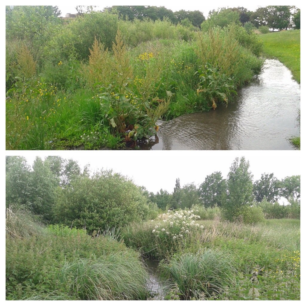
This all changed in 2002. A new meandering channel was created for the Quaggy, close to its pre-1930s course, albeit at a slightly lower level, with the park itself being remodelled to create a flood plain able to store 85,000 m³  with a series of boardwalks, viewing points and a large pond. The old channel was retained for extreme flood situations and flow can be switched to it when the storage in the park is full (above, right photograph).

The park which used to be rarely visited other than for weekend football is now a well-used focal point and reconnecting the community with the river and its natural environment – it is often held up as an excellent example of urban river management. Unlike other parts of the Quaggy’s catchment, it is beginning to be used as a place of play and discovery – children can sometimes be seen jumping across the river, there were reminiscences about doing this in Mottingham, feeding ducks on the pond along with the occasional sightings of fishing nets and buckets.

The Quaggy was originally joined by Well Hall Stream in the park, although when followed a while ago, there was little evidence of any current flow.

The river goes through some complex engineering that can shut off the flows in periods of high water, and re-emerges the other side of Kidbrooke Park Road in the playing fields of John Roan School.  Here too the river has changed, the concrete encasement had continued west of the road, I remember having to scramble down angled concrete to fish out footballs from the river during my sons’ Saturday morning football practice there. 

The Quaggy is theoretically joined by Lower Kid Brook (above) opposite a rather impressive Woolwich Borough marker (below left), or rather it isn’t any more – the flow was probably diverted into the Quaggy three hundred metres to the east in Sutcliffe Park.

Beyond John Roan playing fields, the river is sandwiched between Lyme Farm Road estate, which replaced Victorian housing, and Crofton Albion FC.  It emerges out into the public gaze again at Weigall Road where the 1903 boundary markers from Woolwich had again been busy (above right).

Over the road, to the south, there is another series of playing fields – the first is a public one, Weigall Sports Field which was once home to Ravensbourne Athletic Club’s grass running track.  It was part of a residential club and sports centre for employees of Cook, Son and Co (St Pauls) Ltd. which was a clothing wholesale company – the building faces on to Eltham Road (see above) and was completed in 1912.  Prior to then there were newspaper reports of them being based in Ladywell Fields, hence the name from a different catchment.  The building on Eltham Road was requisitioned for World War 1 billeting but returned to its former use after the War.  It continued as this until after World War Two when it was converted into flats – it is now part of Ravens Way (perhaps a shortening of the club’s name) (3).

Its next door neighbour is the Bowring Group Sports Ground (below), although its days in recreational use are probably numbered as it seems to have been acquired for  a ‘Free’ School.

The northern banks of the Quaggy also used to have playing fields, the just post war Ordnance Survey map shows cricket grounds (on a Creative Commons from National Library of Scotland.) The outlines of the fields are still there and indeed the derelict remains of one the pavilions remains.  The formerly manicured grounds have been largely abandoned and now form part of the Weigall Road flood defence and storage, although the intention has always been dual use.

It isn’t meant to be an accessible area, but fences on Weigall Road and Blackheath Park are always porous enough for the runner of a smaller stature to enter without having to resort to contortions or scaling boundaries.  It the last long section of the river where the Quaggy has a bucolic feel – it probably hasn’t changed much since the fields by the river were used as the venue for the horse racing of the Lee Races in the first half of the 19th century.

The flood defences have a second fence to prevent the fluvial flâneur but in a period of low flow they proved to be of limited deterrent.  Apparently the Weigall Road storage will hold 65,000 m³ of water.

There is/was probably a small tributary joining around here.  There is very boggy ground just south of the derelict pavilion, more standing water in wetter seasons but still pooling in a very dry Spring.  There is an occasionally running stream which forms the boundary between the fields, in recent years I have only seen water there in the very wet winter of 2013/14.

On Facebook pages relating to upstream posts, there are fond memories of playing in and on the banks of the Quaggy in these parts – there still sometime cross river swings with a ducking for those with poor grips, although none have been noticed for a year or two.

Beyond the Weigall Road flood storage area, the Quaggy briefly disappears before being bridged by Meadowcourt Road and then flowing onwards towards Osborne Terrace.  The river is then bridged by Lee Road, there was only a footbridge until as late as the 1860s, as the 1863 published 25″ Ordnance Survey shows (on a Creative Commons via National Library of Scotland). The road bridge was certainly there by the time the cartographers returned in 1893.

This was an area of flooding – Hastead reported depths of 10′ (3 metres) in the 18th century and F H Hart reporting similar depths after the rapid thaw following the bitterly cold 1813/14 winter, there was flooding over a wide area including a lot of Lee Park.  Hart reported flooding being a regular occurrence in the early 19th century with a Bromley farmer drowning in 1830.

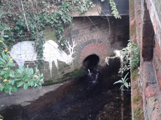
There is another Woolwich marker from 1903 by the bridge, only someone has chiselled out – the borough name, perhaps they were going to return and add Greenwich, but they never did.  Next to the bridge there is a pipe with water entering the Quaggy, with a Lewisham Natureman stag ‘grazing’ next to it, this is the diverted Mid Kid Brook.  On the opposite bank, there is a ghost sign for a ‘carver and gilder’ (more here), oddly hidden by the current cafe owners.  We’ll leave the river here for another day.

Notes

  1. Ken White (1999) The Quaggy & Its Tributaries p25
  2. ibid p25
  3. John Coulter (1997) Lewisham and Deptford in Old Photographs: A Third Selection

Well Hall Stream – A Tributary of the Quaggy, Part 2

Last week we left Well Hall Stream in slight suspense – just outside Well Hall Pleasaunce. The public park dates from the 1930s when William Barefoot, persuaded Woolwich Borough Council to buy the current Pleasaunce. The centrepiece of the park is the Tudor Barn, which despite its name dates from the early 17th century, although previous moated buildings on the site can be traced back to 1253.

Running Past has visited the Pleasaunce before, when tracing the homes of E Nesbit in Lewisham and Eltham. She lived there between 1899 and 1920 at Red House, which was demolished when the Pleasaunce was created.

The gardens were designed by the Borough Engineers, J Sutcliffe and H W Tee, the former gave his name to Sutcliffe Park, a little further downstream.

Well Hall Stream seems to enter via the moat, or originally did – possibly along with smaller streams from the North and North East – older Ordnance Survey maps seem to suggest this. There is a small trickle coming in from the right direction (in the bottom left picture below), whether it is the remnants of the Stream is unclear though.

image

There is a clear direction of flow for the Stream away from the moat – but there is no running water in it, perhaps it flows in really wet conditions, only little bits of dampness were visible.

image

The course of the stream would then have been more or less westwards, skirting the edge of playing fields before being crossed by the A2 and railway in quick succession. The original route would have then taken it through some neglected woodland sandwiched between the railway and Horsfeld Road – amidst the detritus, a ditch is visible, but dry.

image

The Stream would have crossed the South Circular and then meandered through the Eltham Green estate, there are hints of a course with a slight dip near the junction of Pinnell and Shawbrook Roads. It probably crossed Eltham Green Road near Messant Road before joining the Quaggy in Sucliffe Park. There is no current evidence of an confluence, the stream probably having been diverted a century ago.

IMG_0227

Ken White (1) suggests that there was another small tributary of the Quaggy in this area – Eltham Green Ditch. Certainly there was a stream around Eltham Green which is clear from Victorian Ordnance Survey maps. However, my reading of the OS map surveyed in the mid 1860s (see below) is that it seems more likely to have been a partial diversion, a distributary, of the Well Hall Stream as it exits Well Hall, which then joined the Quaggy close to Eltham Bridge, just before entering Sutcliffe Park.

image

As has been noted by in the Thames Facing East blog, Kidbrooke was marshy farmland covered with drainage ditches and several small streams (several already covered here before) so it is difficult to be totally sure.

Note

1 Ken White, “The Quaggy & Its Catchment Area”


Rain Stopped Play

Rain stopped play is not something that is associated with running, particularly cross country a discipline where rain and mud are generally considered a positive feature. So it was rather surprising to receive an e mail on Friday confirming that that Saturday’s fixture in the Kent Cross Country League in Danson Park had been cancelled due to a waterlogged course and concerns about damage to the park which would have impacted on other park users.

While disappointing, it is understanding and shows the problems of finding suitable venues for cross country races. So instead, I headed out this afternoon to do a tempo run around the perimeter of Sutcliffe Park. The Quaggy runs through the park had clearly flooded last weekend and its level was still higher than the path alongside it.

IMG_3653.JPG
There was still the very last vestiges of autumn colour on the edge of the athletics track, the yellows glorious in the afternoon sun.

IMG_0538.JPG
My own disappointments pale into insignificance with events in the sport that ‘Rain stopped play’ is more generally associated – cricket. That sport had a tragedy this week, with the death of the Australian Test cricketer Phil Hughes, struck on the neck by a bouncer, which just evaded the protection of his helmet. I have’t played for years or been to a game for a couple, but his death touched me greatly, particularly listening to the veteran Australian commentator Jim Maxwell announcing it.

There was a piece by Tom Fordyce on the BBC website that perhaps explains it ‘Elite sportsmen are our real-time superheroes, capable of physical wonders beyond the rest of us, seemingly unbound by many of the same biological constraints.’ They are the people we aspired to be when younger, but without their talent and commitment we remained ordinary sportspeople.

The sporting community’s tributes #putoutyourbats has produced some moving images, and recognition that bowler who innocently delivered the fatal ball, Sean Abbott, will probably suffer for the rest of his life. I was going to dust down the family bat, but the tribute left at the side of the pitch at Swansea (picture from The Mirror) by the Palace and Australia football captain Mile Jedinak seemed so much more poignant.

IMG_0539.JPG
Hughes, P 63* RIP

The Slow Road to Recovery

It’s nearly three weeks since I last posted about my running, the recovery from the lateral collateral ligament strain picked up during the London Marathon has been slow to say the least. Until this week that is, a week ago I was considering having a complete break for two or three weeks but over the last 7 days it finally seems to have cleared up with nothing felt in 5 runs including a tempo run today round a rather soggy Sutcliffe Park where The Quaggy was rather full and one of the paths had become a temporary tributary.

20140526-220355-79435850.jpg
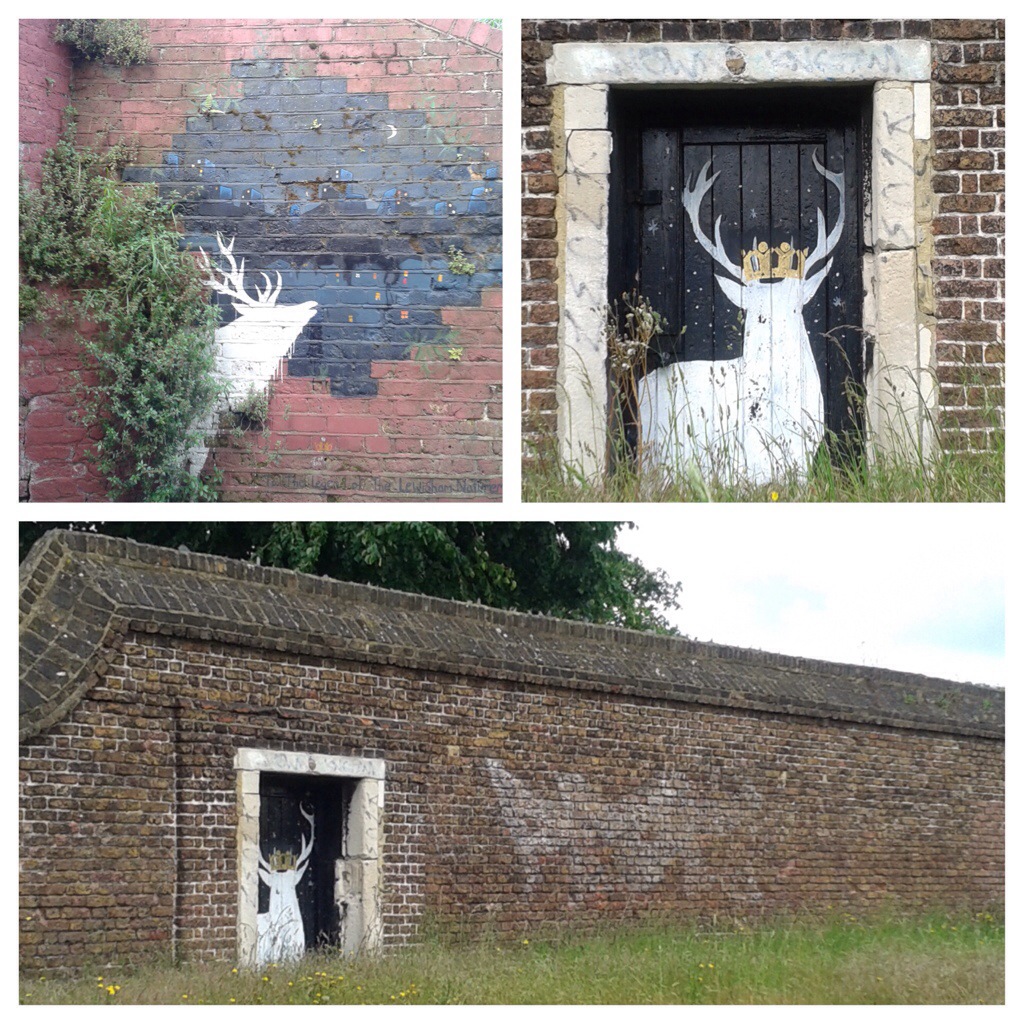
During the last couple of weeks I have ‘discovered’ some more of Lewisham Natureman’s deer – one in Cressingham Road in Lewisham

20140526-220516-79516334.jpg
The second, less than a mile away, wearing the Saxon Crown of the Borough’s badge, is on an abandoned gate in a listed wall on Blackheath, which, despite being able to walk around, has its own crown of broken glass.