The land of Burnt Ash Farm had originally been farmed from a large house which was on the site of what is now Lee Manor House.It was probably not an ideal location for the farm as its land was virtually all to the south – stretching away towards Grove Park.The move to the junction of what is now St Mildred’s and Baring Roads happened in the mid-1720s (1).The remains of the original Farm on Old Road were found underneath the library when some building work was undertaken in the early 1980s.
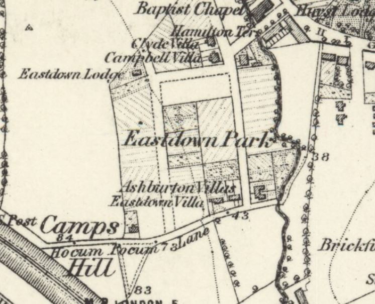
The shift in location to Burnt Ash was by Thomas Butler who came from Dagenham in, what was then, rural Essex (2). Perhaps as early as 1739, and certainly after Butler’s death in 1751 (3), Burnt Ash Farm was split between two of his sons, Matthew who remained at Burnt Ash and farmed the land south of St Mildred’s Road; and James who was to farm what was to be called Lee Manor Farm.The land was most of the area bordered by Burnt Ash Road, what is now St Mildred’s Road, the stream Hither Green Ditch until it joins the Quaggy, the river itself and Lee High Road.The initial site of the farmhouse was to the west of Pentland House (at one stage called Foclallt House) on what is now Manor Lane Terrace and included the site of Lochaber Hall (on the 1860s map above it is referred to as Manor Cottage).It was a large three-storey house with extensive outbuildings (4). The land was not owned by the Butlers and, as was covered in a post on the Manor House, was bought by William Coleman who sought to recreate the old Manor of Lee for his nephew Thomas Lucas – funded by the proceeds of slavery.Lucas inherited the farms on his uncle’s death in 1771.
On James Butler’s death in 1762 it seems likely that the Farm was again managed by his brother, Matthew, from Burnt Ash (5). After Matthew’s death in 1784 the tenancy of the two farms were taken on by Baron Dacre of Dacre House, whose estates were relatively small.(6) We will return to Dacre House at some point in the future.
Following the deaths of Lord Dacre in 1806 and Lady Dacre in 1808, there were some changes to Lee Manor Farm.Part of the land bounding Lee High Road was sold to the new owner of The Firs, Christopher Godmond, who had bought the House after the death of David Papillon. (7)
The farm house had be let separately since the 1780s; so when Lee Manor Farm was again let and managed in its own right in 1808, a new farmhouse was needed for a new tenant.The new farmhouse was built on what is now Manor Lane Terrace, between the current Northbrook and Kellerton Roads (it is shown on the map above). The bend in Manor Lane Terrace is explained by the location of the farm. The artists impression of the farm is by Lloyd Roberts (see credits below).
The new tenant was the butler of the new Lord of the Manor, Sir Francis Baring – Thomas Postans (8) – Postans was to stay there until 1816, when he moved on to manage the kitchen gardens of the Manor House to supply the officers mess at St James Palace.Mr R E Brown was the tenant of the farm for this period but Postans returned to the Farm in the mid 1830s.
There is a fascinating map of the farm from towards the end of Thomas Postans tenure drawn with an east – west axis; Lee Green is in the bottom right hand corner with Burnt Ash Road providing the bottom boundary (the other side of Burnt Ash Road was Crown Estate land) and Lee High Road to the right of the map.There is considerable overlap between the 1843 field pattern and the street pattern that emerged in the decades afterwards.
In 1845 a lease was granted to Mark Cordwell who hailed from Buckinghamshire; oddly he was listed as a seaman in the 1861 census with with his 20 year old son, Charles, born in Greenwich, noted as as the farmer.Mark died in 1864.
By 1881, Charles had married Mary (née Peasnell) who was from Buckinghamshire, like his father, and had eight children and a servant living on the farm; the farm was listed at 150 acres in the census. They may have had a bailiff or manager running the farm for them for a while in the 1870s as three children were born in Shoreham in Kent.In the 1871 census they were listed at Prestons Farm Housein Shoreham.
They were back in Lee in 1891; but by the 1901 Census, Charles was listed at 35 Medusa Road in Catford as a ‘retired farmer’ with his son and daughter in law.He may have emigrated to the USA as the last record for him is sailing to New York on the Philadelphia in 1906.
While he may have moved to America, his name lives on in the 1970s council housing that was developed to replace the southern side of Northbrook Road and land behind Kellerton Road – Cordwell Road.
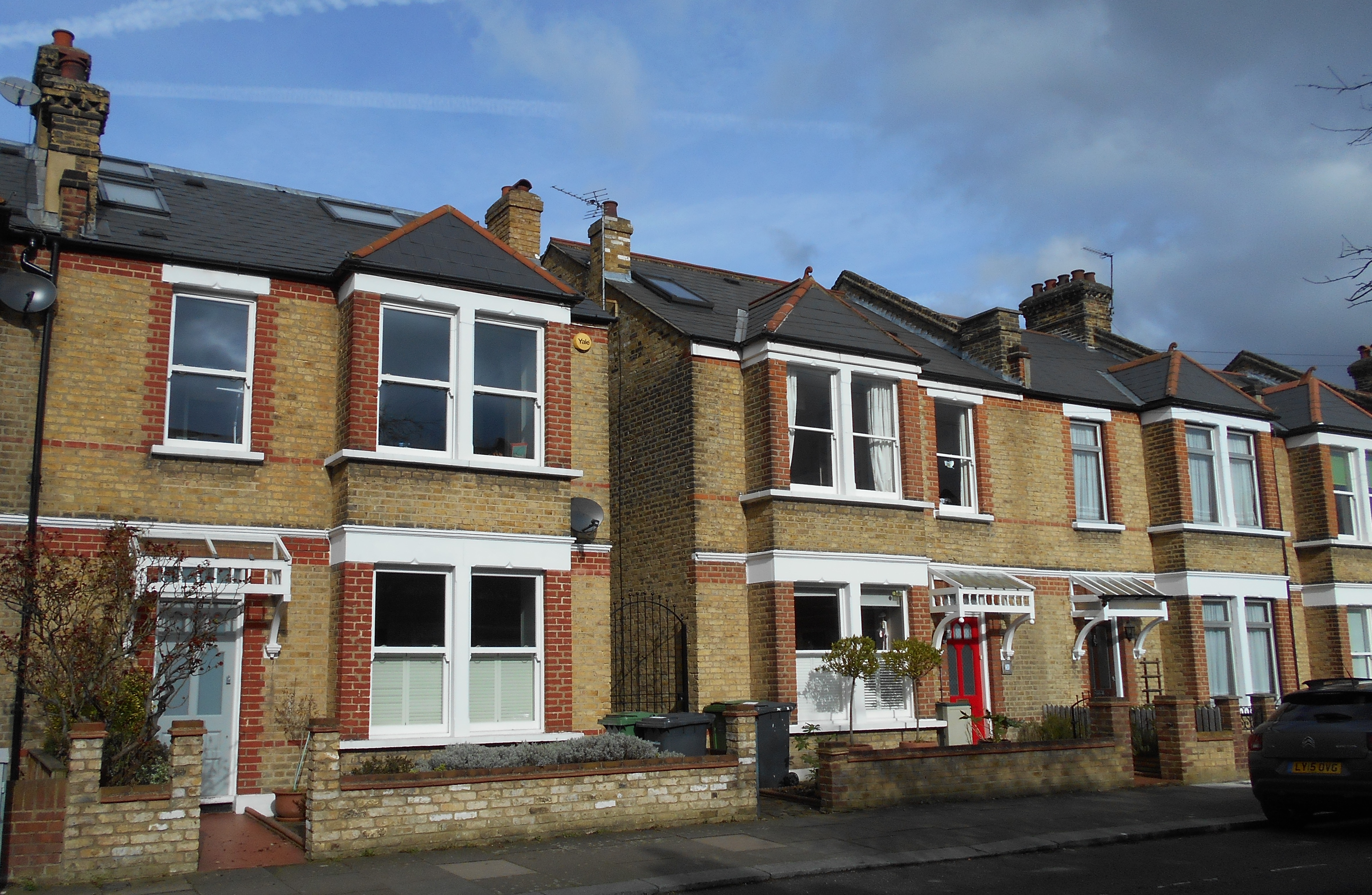
The end of the farm coincided with the gradual sale of of the Northbrook estate from the 1860s onwards.One of the main builders from the mid 1890s were the family firm W J Scudamore.Their developments included what they referred to as the Manor Park Estate (roads such as Kellerton Road, parts of Manor Lane Terrace, Redruth Road (now Manor Lane) and parts of Manor Park.It seems thatthe old Manor Farm came as part of the lot; most developers would have probably demolished the buildings and built over it.However, the Scudamores decided to retain the building as a family home – which it remained as until the 1960s – there is a little more on this in the post on W J Scudamore.
The last of the Scudamores to live in Manor Lane Terrace was Elizabeth (née Drane) who died in 1961 aged 90.After her death, the house and the land around it were acquired for council housing – although all the homes appear to have been sold under Right to Buy. The name Wolfram Close is presumably a reference to the last tenant of the Manor House – the slightly differently spelled Henry Wolffram.
Notes
Josephine Birchenough (1981) Some Farms and Fields in Lee p4
Both the drawing of the farm and the 1843 map of it are part of the collection of Lewisham Archives, they are used with their permission and remain their copyright.
The area bordering Manor House Gardens has a rich and interesting history which Running Past has written numerous posts about. This post was written to ‘accompany’ a walk organised as part of the 2019 Manor House Gardens Festival, it can be used to independently to walk the route (it’s a circuit of around a mile, which can be found here) or as virtual tour of the area. The ‘walk’ is divided into sections which relate to the planned stopping points – each of which is full of links to other posts in the blog which will have more detailed information.
Some Background
Before it was enveloped by the city Lee was a village, a village with three centres – Lee Green, the area around St Margaret’s Church and Old Road, as John Rocque’s map from 1746 shows.
Lee remained largely rural until mid-19th century until the coming of the railways – Blackheath & Lewisham stations opened in 1849, Lee in 1866 and Hither Green not until mid-1890s (it was just a junction before that).
The mid-1860s Ordnance Survey map above shows how little development there was beyond Lee Green and to the south of Old Road; farms remained until the 1920s and 1930s, such as Burnt Ash and Horn Park.
The Manor House
Old Road was once home to a series of large houses, starting from the eastern end these were Lee House, The Cedars, Lee Place, the Manor House, Pentland House and The Firs – geography played an important part, it is on a small hill which would have offered impressive views to the east and south but were high enough to protect from flooding from the Quaggy and the now diverted Mid Kid Brook, which used to flow down Lee High Road.
Lee Place
The first of the country houses was Lee Place; Its building was the result of the death of Lord of the Manor, Brian Annesley who had a moated farm probably where St Margaret’s Lee School is now situated. His later years are believed to at least partially inspired Shakespeare to write King Lear – there was happier ending than in the play though. The estate split up on his death.
Lee Place (above) probably built by/for George Thompson – had links to the slave trade but is better known as a soldier and MP during the Commonwealth brother of Maurice who lived at Lee Farm. It was the home to the Boone family (it was their family chapel) for several generations but was let out from the mid-18th century. Its last tenant was Benjamin Aislabie.
The estate was sold in 1824 as still has an impact on the current landscape as it was broken up into relatively small lots which were developed at different times. It allowed too the straightening of Lee High Road – the straightened bit was known as New Road for several decades
The Manor House
Lee Farm was previously on the site, which moved to what is now the junction of Baring and St Mildred’s Roads in 1727 and became Burnt Ash Farm. The former farm was bought initially by the slave trading brother of George Thomson, Maurice and then by William Coleman who sought to re-create the lands of the old Manor for his nephew,Thomas Lucas, both were ‘merchants’ with strong links to the slave trade.
The Grade II listed Manor House was built on the site of the farm in 1770 by Richard Jupp for Lucas. It was bought by Sir Francis Baring in early 19th century, whose family wealth also had its origins in the slave trade – used it as their near London base – the merchant on the maroon plaque is depressingly vague. The Northbrooks let in out during much of the 19th century
Pentland House was built in early 1790s and is probably the oldest residential building in Lewisham – it is a close run thing with St Mary’s Vicarage though! It has been added to considerably and rendered in the early 19th century when extended.
It was home to the rich, but not that significant Smith family, who sold to some more Smiths, who sold to some more Smiths (albeit with a prefix) – it became a Goldsmiths’ College hall in 1913 which stayed until the early 2000s. It is currently a largely backpackers hostel.
Flats & Houses Opposite
The houses and flats opposite are a bit less grand – Bankwell Road & adjoining bits of Old Road – completed in 1908, possibly by James Watt – it was the central of three plots of land bounded by Lee High Road and Old Road – as the 1890s Ordnance Survey maps below shows.
The eastern of the plots are Arts & Crafts style flats which are a bit out of kilter with rest of area. The land they were built on had been part of Lee Place – the house itself was on this part. The land was bought as an orchard and kitchen garden for Pentland House with the flats & Market Terrace on Lee High Road built in the mid-1930s.
Before moving on worth reflecting on the library, the park and indirectly the rest of the current urban landscape was paid for by the slave labour in the plantations of the Caribbean owned or traded by those that lived here and over the road.
On the way to Lochaber Hall at the first house on Manor Lane Terrace look at the wall – the remains of a sign pointing towards air raid shelters in Manor House Gardens (more on that later).
Lochaber Hall, the Firs, Holy Trinity
Lochaber Hall
If think Lochaber Hall looks like a church hall you’d be right, it was originally church hall for Holy Trinity in Glenton Road (pictured below). The church was destroyed in the Blitz and is now Callaghan Close (almost opposite the Telephone Exchange) and named after the 1970s Prime Minister who lived in Blackheath.
The Hall was designed by Ernest Newton, a locally renowned architect and President of RIBA, he also designed St Swithuns, the original Church of Good Shepherd and Baring Hall at Grove Park. Slightly surprisingly it is Grade II listed. Immediately after World War Two it was used as a hall for the Church of the Good Shepherd as that church was largely destroyed in a fire & the congregation was using the adjacent hall as the church.
The Firs Estate
The Firs was another of the large country houses of Lee, it was a large red-brick house which was a built around 1700 as the ‘town’ residence for the Papillion’s, a prominent Huguenot banking family – it stayed in the family’s ownership for a century. The last owner from the mid-1860s was John Wingfield Larkin, a member of a wealthy Kent family who had been a merchant in Egypt and British consul in Alexandria between 1838 and 1841. The family sold up on his death as the city encroached in 1893.
It was developed as Murillo, Old, Rembrandt & Lochaber Roads by the end of 19th century. It is not certain who the builder/developer was – although is a stained glass for Siderys on Murillo Road – who were prominent builders in the area.
The houses on the corner of Manor Lane Terrace and Abernethy were largely destroyed on the 1st night of the blitz. 27 Murillo Road was home to one of the more prominent Lewisham suffragettes – Caroline Townsend.
Lee Manor Farm
This was originally at the Manor House, moved to what is now the junction of St Mildred’s Road and was renamed Burnt Ash Farm in 1727; that farm was split in the early 19th century and new farm buildings constructed opposite The Firs (close to the current junction of Manor Lane Terrace and Manor Lane). It didn’t stay the farm house that long and we’ll return to it at our next stop.
Junction of Manor Lane Terrace & Kellerton Road
Manor Park Estate
We are in the land of W J Scudamore here and along with John Pound are probably the two firms of builders that most influenced the area – buying land from the Northbrooks. W J Scudamore were based on Manor Lane (corner of Handen Road) then Lee High Road (part of Sainsbury’s site) and latterly on Holme Lacey Road in Lee and active in Lee, Hither Green and later elsewhere from the 1890s until the 1930s.
The Manor Park Estate (as the roads around here were originally referred to as) was built for a mixture of rent and sale – sale prices were £265 or£275 for the bigger ones – it was 1906…!
They definitely also built
Shops on Manor Lane (eastern side)
Newstead Road
Some of St Mildred’s Road
Holme Lacey & Dalinger Roads
Several small sections of Leahurst, Longhurst and Fernbrook Roads
Probably lots of others too
Wolfram Close
On the site of the last location of the Lee Manor Farm (pictured below) – the land farmed was to the south of here. The farmhouse seems to have been sold with the land for the Manor Park Estate and became a home for the Scudamore family who remained there until 1961.
The site was redeveloped in the 1960s or early 1970s, it isn’t clear whether this was by Scudamores, as they went into liquidation in 1966. It is presumably named after the last occupant of the Manor House – Henry Wolffram from Stuttgart who ran a ‘crammer’ school for would-be army officers – the spelling of his name is incorrect though – the cul de sac as one ‘F’ the name two ‘Fs’.
The council estate behind Cordwell Road – is named after one of the last farmers of the farm.
Manor House Gardens
The park was created in the early 1770s as gardens for the Manor House until 1898 when the Northbrooks sold up to the London County Council (LCC), which as with Mountsfield Park on the Hither Green and Catford borders wanted to ensure that the newly developing suburbia had parks and libraries provided. The Gardens had been left in a poor state by last occupant (Henry Wolffram) and didn’t open to the public until 1902.
Source – eBay Feb 2016
It contains a rather impressive Ice House which was used as an air raid shelter in World War Two; there were a couple of other ones too, the outline of one of them was visible in the parched grass in the hot weather of 2018.
The Gardens have been ‘listed’ since 1987 and underwent a major refurbishment in 2000. The small lake has been part of grounds for most of its post agricultural life. The River Quaggy flows through the Gardens, it used to be at a higher level but the bed was excavated partially to reduce flooding – probably in the 1880s.
Behind the library, there are two little bits of Catford – foundation stones for the now demolished St Laurence Church and the original Town Hall.
Lenham Road/Lammead Road Corner
If we were standing here in the 1870s we would be in or next to the River Quaggy as there was a meander that originally came up to this point. It was straightened in 1880s both to allow development but possibly too as flood prevention measure – there were really bad floods in 1878.
Most of housing on Lenham, Lampmead (and Aislibie that will walk up) Roads dates from late 1880s when Lee House (more on that later) was demolished and the land sold for development. It was slightly different on the other side of the river – Robertson Street, now Brightfield Road probably dates from the late 1850s or early 1860s.
The houses at the corner are very different – early 1960s council housing as opposed to late Victorian. This was because early in the morning of 22 June 1944 a V-1 flying bomb hit the corner, killing 6. There was a lot of Blitz damage on Lenham Road as well as on Aislibie Road where there are several bits of infill council housing from the late 1950s or early 1960s.
49 Lampmead (above) was home to Phyllis Noble who was to become Phyllis Willmott and wrote a 3 part autobiography about growing up in Lee in the 1920s and 30s – this has been covered a few times – including in relation to the Sunday Constitutional and children’s play.
Almsot opposite, at the junction with Aislibie Road in 2016 a house had Blitz type damage as a result of badly executed building work.
Lee Centre
Lee House & Centre
This was originally the site of Lee House, a medieval mansion that was rebuilt in the 1820s probably partially as a result of the re-alignment of Old Road, it is pictured below. However, by the 1880s it no longer met the needs of the wealthy Victorian gent as city encroached with the railways.
Lee Centre was built on the site in the 1880s – initially it was home to a few clubs, including a chess club. But it was never developed uses that befitted its impressive architecture by World War 2 it had effectively become used for storage and nurse appointments; it was used for education from 1970s and more recently by various charities.
Next door was built as St Margaret’s Parish Rooms, long before Kingswood Halls were built; it was also home to school for many years before becoming offices and warehouses for stationery supplier and then a toy merchant. It has been a nursery for the last decade or so.
Chiesmans’ Warehouse
In a former incarnation this was home to the teetotal Lee Working Men’s Institution, it was taken over as a depot for the Lewisham Department Store, Chiesmans who rebuilt it around 1914 – it was almost completely destroyed in during the Blitz before being rebuilt on same footprint for Chiesmans in mid 1950s. After some slightly less than legitimate activities it is slowly being converted into flats.
The Cedars
Was situated on what is now the opposite corner of Aislbie Road, it was another large house – the estate was broken up and mostly sold at the same time as Lee House. The house itself remained until the 1890s before being sold for development – hence the housing at the north-western corner of Aislibie Road is different to the rest of the street. The street itself was named after, although spelled incorrectly, the slave owner and terrible cricketer Benjamin Aislabie – the last tenant of Lee Place.
Manor House Gardens (Old Road entrance)
This is next door to 36 Old Road, this was part of the estate of The Cedars. Post development the site was used for many years as stables for Thomas Tilling’s horse drawn buses and then as a workshop by the firm afterwards. It went through several uses afterwards – the sweet makers Whitehouse and Co from 1929; John Edgington and Co Marquee Manufacturers who latterly made floats for the Lord Mayors Show were there from 1949 (including some of those below) and then Penfolds used it as a crash repair workshop from the late 1980s until around 2010. Development into flats started a few years later but has been paused for a couple of years.
Picture Credits
John Rocque’s 18th century map is from the information board at Lee Green
The Ordnance Survey map from the 1860s is on a Creative Commons via the National Library of Scotland
The picture of Lee Place comes from the information board opposite St Margaret’s Church
The picture of Holy Trinity Glenton Road is via Wikipedia Commons – originally from Illustrated London News
The photograph of The Firs is from the information board on Brandram Road, opposite St Margaret’s church.
The drawing of Lee Manor Farm is part of the collection of Lewisham Archives, it remains their copyright and is used with their permission
The 1890s Ordnance Survey map is courtesy of the National Library of Scotland on a Creative Commons.
The pair of Ordnance Survey maps from 1863 (top) and 1893 are on a Creative Commons via National Library of Scotland
The sale plan of Lee House is part of the collection of Lewisham Archives, it remains their copyright and is used with their permission
The river changes here; gone now are the almost bucolic feel of the river through the playing fields and parkland in the section of the river from Sutcliffe Park to Lee Green. The Quaggy is now very much an urban river, with building up to the banks and the route downstream for the fluvial flâneur often parallel with the river only visible on bridges.
Riverside pubs have been conspicuous by their absence so far, but are a much more regular feature as we follow the last mile or so of the course. The Old Tiger’s Head, 50 metres or so away from the river, was the base for the mid 1840s horse racing of the Lee Races. Lee Green was still rural then, complete with a green, a windmill and a farm – Lee Green Farm. The pub was very different then, being rebuilt in the 1890s, as the picture above from an information board at Lee Green shows.
The Quaggy squeezes between some 1990s flats and a plot of land that was Victorian housing and will presumably be returned to housing again; it was latterly the showroom of Penfolds Vauxhall dealers, after they moved from the former Lee Picture Palace on the corner of Bankwell Road. The river, for a short period, is again banked and bedded in concrete – little is able to grow but that didn’t stop a few optimistic sticklebacks from attempting to eke out an existence in a hostile environment (below, top left) when I did the research for the post.
The Quaggy emerges out into the open at what used to be called Lee Green Bridge and the first proper riverside pub, the Duke of Edinburgh, still serving and with a pleasant garden at the rear. The pub dates from around 1871 when the landlord, a Mr W Baker, took over licence of the Black Horse, which was a short-lived ‘beer house’ that may have been on the same site (1)
The river forms the rear boundary between homes in Lampmead and Brightfield Roads – the former named after a field. The course wasn’t always thus, the Quaggy originally took a course further to the north touching the southern end of what is now Lenham Road. The differences are clear between the 1863 (top map below) and 1893 visits of the Ordnance Survey Cartographers (maps on a Creative Commons via National Library of Scotland). The effective development of Lampmead required the straightening of the river, following what was previously a path behind the houses of Robertson Street, which was to become Brightfield Road at around the same time. The curved building (above, top right and bottom) hugs the banks of the river.
The Quaggy seems to have originally fed the small lake although is now at a much lower level. It is bridged a couple of times within the park, both having been the venues for generations of Pooh Sticks, no doubt played before the game was named in the 1920s by A A Milne.
The river has natural earth banks topped with a dense tree canopy throughout its 400 metres or so through the park, during the summer the river is heavily shaded. The steep banks make the river relatively inaccessible through the park.
Flowing out of Manor House Gardens, the river crosses Manor Lane, an old farm track and again forms a boundary – between the WJ Scudamore homes of Thornwood Road, a Lewisham Council sheltered scheme off Manor Lane and later more Scudamore homes on Manor Park. This was a largely rural area until Hither Green station was build in the 1890s, there was a junction there from the 1860s, as the 1870 map below on a Creative Commons from the National Library of Scotland) shows. This part of Lee was still used for market gardening, mainly run from Manor Farm, until the Scudamores built homes of what was marketed as the Manor Park Estate..
Over the other side of Manor Park the river turns almost 90 degrees, to flow between more gardens, between Manor Park and Longhurst Road, briefly visible by peering around a bridge on one side of Staplehurst Road – close to the shops posted about earlier in 2017. Just before the bridge the river is joined by one of its tributaries, Hither Green Ditch (Quaggy Hither Green).
The river continues northwards, squeezing between the gardens of Manor Park (the street) and the northern end of Longhurst Road before opening out into Manor Park (the park rather than the street). The park’s rejuvenation has been covered before in Running Past, the former small pig farm has gone from one of Lewisham’s worst bits of open space to one of its best. The Park has become a community hub – centred around the Arts Cafe. The river itself is used much more – including the annual Quaggy Duck Race and the Float Your Boats event in June 2017, pictured below.
The Quaggy itself while having a ‘natural’ feel at the end of the back gardens of Leahurst Road, was concrete encased and hidden from the park on the opposite bank. Flooding used to be common in this area – in the mid-1960s, the then MP for the area Chris Chataway described residents as living ‘in fear of this wretched stream.‘
At the edge of the Park, there is a bridge – while the structure is a new one, the crossing an old one – it was the final section of Hocum Pocum Lane – an ancient path from Lee High Road to St Mary’s Church, and possibly beyond.
We’ll leave the Quaggy here for its final section to its confluence with the Ravensbourne in Lewisham.
Notes
Ken White (1992) ‘The Public Houses of Lee and Lewisham’ Part 6a, p134
Hidden away under trees in the corner of Manor House Gardens, close to the library, is a large block of masonry carved in a way reminiscent of Victorian graves – it is clearly a foundation stone, one of a trio of similar stones in the same area.
Unless James Brooker was very busy on 27 July 1874, it is the foundation stone of the old Lewisham Town Hall. It was initially created as the Vestry Hall for Lewisham and Penge, becoming the Town Hall after local government re-organisation in 1899.
The building was ceremonially opened a year and a day later on 28 July 1875 at a cost of about £11,000 which was shared 2/3rd to be paid by Lewisham and 1/3rd by Penge based upon their respective rateable values.
Source ebay March 2016
So who was the James Brooker? He had been born in 1803 in Newington or Walworth (depending on the census) then in Surrey. He married Ann and they had stayed around Newington; all their 9 children seem to have been born around there and in 1841 he was living in Gloucester Place.
By 1851 he had moved to Forest Hill, and listed as a ‘master builder’. He was elected to the Lewisham Board of Works from its formation in 1856, chairing it from 1857 and also representing the District on the Metropolitan Board of Works. He carried out a variety of other civic roles including Poor Law Guardian.
In the 1861 census he was listed as living in Brockley Park and a decade on he was living in St German’s Road. The foundation stone from 1874 and a few other on line references to him on-line have him back at Brockley Park.
He lived until 1877 and at his funeral he was fondly remembered in terms of his public service
The natural independence of character and integrity of character possessed by Mr. Brooker, coupled with his urbanity and impartiality as chairman, endeared him the respect and esteem of all with whom he was associated, whilst his public spirit and devotion rendered his life and services very valuable to the public generally of this district.
He was buried on the Lewisham side of Brockley and Ladywell Cemetery where the work of, perhaps, the same monumental mason as the foundation stone recalls his life in now fading detail.
The Town Hall was in rather grand Gothic Revival style and its architect was George Elkington, who was born in Bermondsey in 1824. He was described as ‘Architect to the Lewisham Board of Works’ at the time of the design.
He seems to have moved on to a similar role in his home borough, designing a similar grand vestry hall for the Bermondsey Board in 1879. It too is no more, it was demolished in 1963 following WW2 bombing. There is some video footage of this at around 45 seconds in on the YouTube video below, which was one of a trio made on the work of the council in the early 1930s. Running Past has touched on some of this in a post of Solarium Court and the Salters (the other two videos are embedded there).
The only known building of his that survives is the Leather Hide and Wool Exchange, also in Bermondsey which remained active until 1912. His other legacy is Southwark Park – he produced the initial plans for it, although in the end more modest proposals were adopted.
The builders were Higgs, Hill and Hill was who were based in Vauxhall – they had been formed by a merger the year the foundation stone was laid, so it would have been one of their first major projects. The initial ‘Higgs’ was dropped a few years later when one of the founders retired. They continued in business until 1996 when they were taken over by a Dutch construction firm.
There is video footage of the Town Hall from the 1920s when Hither Green channel swimmer, Hilda ‘Laddie’ Sharp when she was greeted by the deputy Mayor following her successful swim, covered here in Running Past. The video has not been uploaded onto YouTube so cannot be embedded in WordPress but can be watched here.
Just as local government re-organisation had seen the extension of the Town Hall at the end of the 19th century, the old Town Hall and the neighbouring St Laurence Church, were demolished in 1968 to provide a more modern Town Hall for the new, expanded London Borough of Lewisham. This was despite the involvement of Sir John Betjeman in a campaign against their demise – a picture from which is shown below.
Of the two other stones, one is rather weathered and the lettering unclear to the naked eye. The other marks an event in 1857, presumably another unveiling, by Marian Legge, wife of the Reverend Henry Legge. It doesn’t seem to relate to the Manor House, despite its prominent location at the rear, its date wouldn’t obviously link it to any of the ‘lost’ churches of the immediate area or even St Laurence Catford – all were a little earlier or later. So if anyone can through any light on this it would be much appreciated.
While the ownership of the house remained in the Baring Family until the House became a library, it wasn’t their residence for much of the final century of their ownership. They had bought Stratton Park in Hampshire in 1801 – the estate included the village of Micheldever, hence the link to the Lee street name.
The first tenant of the Barings seems to have been Frederick Perkins, whom F H Hart describes as an ‘opulent brewer’. Frederick Perkins father, John, had been Chief Clerk to the owner of the Anchor Brewery, Henry Thrale. The brewery was put up for auction in 1781 when Thrale died and bought for £135,000 by Robert Barclay, of the banking family, who seems to have seen the brewery as an investment and needed some industry knowledge. So he kept Perkins on, making him a partner. John Perkins died in a freak accident at Brighton Racecourse – being kicked in the head by a horse in 1812.
His son, Frederick Perkins, was born in 1777, he and his brother Henry were each given half of the eighth share in the brewery sometime around1805, Frederick seems not to have taken much interest in the brewery, seemingly being content to live off the income from his valuable share. He spent large amounts of money collecting books. When he moved out of the Manor House in the 1830s, the brewery was producing around 330,000 barrels a year – it was probably the biggest brewery in London.
As for the brewery, it continued on the South Bank, close to the current Globe Theatre, as Barclay Perkins, until 1955 when it merged with rival London brewer Courage. Courage rationalised their operations, demolished the buildings and sold the site in the early 1970s.
The Barings returned to the Manor House at the end of Perkins’ lease, the House being used by Sir Francis Thornhill Baring, the 1st Baron Northbrook (from 1866), who was Chancellor of the Exchequer from 1839 to 1841 – possibly whilst he was using Lee as a close-to-London base. He was the grandson of the original Sir Francis. Francis’ father would have still owned the house at that stage, it didn’t pass onto Sir Francis Thornhill Baring until 1848 when his father died.
From information board next to Boone’s Chapel
How long Sir Francis stayed at the Manor House is unclear, he may have moved back to Stratton Park when his father died. Whenever he moved out though, it is worth looking at the final two occupants as they are both interesting in their own right. The penultimate occupants were the Farnalls who seemed to have moved there at some stage in the late 1850s. Harry (Henry) had been born in Clifton in Gloucestershire he has been described as
an example of that extraordinary Victorian ideal, the gentleman civil servant defending the patrician notion of a generous, caring state in the absence of any very firm evidence that the state was routinely either of those things.
He seems to have come from a military family and had a privileged education taking him to Downing College Cambridge, via Brasenose College Oxford and Charterhouse.
His married soon after leaving Cambridge, although by the time he had moved to Lee he was in a second marriage; his new wife, Rhoda, came from Sandford, near Weston Super Mare. Before arriving in Lee, they lived in Sandal Magna, now part of Wakefield in Yorkshire, where the three children living at home in later censuses were all born.
Along with Florence Nightingale, Farnall instituted the first enquiries into the quality of nursing in workhouse infirmaries, having previously been criticised for his ‘blindness’ to this; he was also later criticised for his ‘light inspection’ of the notorious Bethanl Green Workhouse.
He had a sudden fall from grace after falling out with Gathorne Hardy, later Lord Cranbrook, who was President of the Poor Law Board, and he was ‘transferred unceremoniously to Grantham’ where he was responsible for more mundane elements of public health. The family remained in Lee though.
The family moved to Wingfield House which was attached to The Firs (covered before in the blog) between 1871 and 1881 – probably around the time of his retirement and/or the end of a lease. Harry died in 1883, the rest of the family seem to have remained at Wingfield House until it, along with The Firs, was demolished in the early 1890s to make way for the new housing on Old, Abernethy and Lochaber Roads. The family moved out of the area – by the 1901 census his widow Rhoda is listed as living in Chelsea.
By 1881 the Manor House was home to the Military ‘crammer’ School run by Henry Wolffram which was designed to prepare young men for the entrance examinations for the Army. The 1881 census lists 21 pupils along with a resident tutor, a housekeeper and a cook. Henry Wolffram was born in Stuttgart in Germany had been in Britain for a while. He had married Anne from Surrey and in the 1871 census he was running some sort of education establishment in Greenwich – it had two Swiss boarders. There is a small photo of the school in front of a now demolished extension of the House in 1884.
Wolffram’s name is remembered by a small cul-de-sac off Manor Lane Terrace, located roughtly where the final home of Manor Farm was. As with Aislibie Road, the spelling is incorrect and is given as ‘Wolfram’.
Source – EBay Feb 2016
Earl of Northbrook sold the Manor House and estate to the London County Council for £8,835 in 1898, worth a little more now given the increase in London land values. The previous tenants had left it in a poor state of repair, the LCC describing the House and Gardens as being in a ‘somewhat neglected condition’ . The House became a Library and the gardens a public Park opening in May 1902.
Source EBay Feb 2016
The House itself is listed, along with the wall forming the boundary with Pentland House to the west, the entrance gate posts and the telephone kiosk in front.
Finally, it is important to remember the history covered in the first part of the story of the Manor House – it is worth repeating the final paragraph of that post;
If you are a current Lee, Hither Green or Lewisham resident, next time you use the park, the library or just walk or travel past and admire Richard Jupp’s fantastic architecture, please at least pause to remember the ‘dark heritage’, to remember the lives of those transported 5,000 miles from New Calabar to injustice and misery in the Leeward Islands, and to remember that it was the enforced and unpaid toil of slaves that largely paid for what you are looking at. If you live somewhere else, something similar may well apply to your local ‘country house’ too.
Note
All the census and related data came via Find My Past
The Manor House in Lee is an impressive building, rightly listed, but amidst the grandeur and beauty it has financial foundations that lie very firmly in slavery – it is a prime example of what has been referred to as ‘dark heritage’.
The House was built for Thomas Lucas around 1770, he had lived in Lee for a while, renting Lee Place (on the opposite side of Old Road) from the Boones – it is a ‘country house’ that Running Past ‘visited’ a while ago.
But to understand the history of the Manor House, we need to go back a generation. It certainly wasn’t the first building on the site – John Roques map of 1746 (1) a quarter of a century before the Manor House was built shows a lot of properties around where it is now located. It was probably the location of Lee Farm, although there is some uncertainty about this. Lee Farm seems to have moved around 1745 to become Burnt Ash Farm and the vacated buildings were bought by William Coleman, Thomas Lucas’ uncle, who sought to re-create the old Manor of Lee for his nephew (2) which had been broken up after the death of Brian Annesley – covered earlier in Running Past.
Thomas Lucas was born around 1720, possibly in the West Country. He was Treasurer (1764-74) and later President (1774-84) of Guys Hospital and has been described as ‘a wealthy merchant’, much of his wealth came from joint ‘business interests’ with his uncle in St Kitts in the Leeward Islands, along with the Roundhill plantation with 150 slaves in Antigua. In his own right, Lucas probably owned land at Barbados Bay in Tobago – which almost inevitably would have had direct or indirect links to slavery.
A Thomas Lucas of this era part owned a number of ships directly involved in taking slaves to the West Indies – while there is nothing definitive linking him to Lee, there cannot have been many of that name, with sufficient wealth to own a share in a large ship, who had links to the West Country and who were involved in the slave trade at that time. One of these ships was the ‘Africa’, jointly owned by a Thomas Lucas and seven others. It left Bristol in 1774 and its captain purchased slaves at New Calabar (in what is now Nigeria) and then proceeded to St Vincent for instructions on their sale in 1775. The net proceeds were a staggering £5442, millions at today’s prices.
Manor House was designed by Richard Jupp, a well-known 18th century architect and surveyor, employed for much of his career by the East India Company. The Manor House is one of a trio of relatively well known south London properties that he designed – the others being the Sevendroog Castle and the entrance and wings to Guys Hospital (1774-77), presumably as a direct result of his work for Lucas at the Manor House.
Lucas died in 1784 and what happened next in terms of ownership and occupancy is a little confused with some contradictory evidence, although some elements of this ‘confusion’ may relate to the author’s poor understanding of 18th and early 19th century legal jargon. It seems that the former Lady Lucas let the house to the Call family, Sir John in 1792 on a 61 year lease. However, he seems to have moved out before his death in Westminster in 1801 – there is an impressive pyramidical family tomb in the old St Margaret’s churchyard.
Lucas wife, who later married John Julius Angerstein (someone else who had made money from slavery) and appears to have sold the estate in the 1790s; there is a report of a sale in August 1796 at Garraway’s Coffee-House. However, to confuse matters there is also the granting of a lease to Sir Francis Baring by the executors of Thomas Lucas in 1797. There are also frequent reports of a sale by a Sir Joseph Paice of the Manor House to Sir Francis Baring for £20,000 in 1796. This may be the same sale as that by former Elizabeth Lucas, in that the House might have been due to pass to him after her death – there is a mention of him as the reversionary legatee which might point to this. Whatever the chain of events was, the net result was that around the end of the 18th or early in 19th centuries the Manor House became the London home of the Barings – this was certainly by 1801 as John Baring, the 3rd son of Sir Thomas was born there.
Before moving onto the Barings, it is worth touching on Sir Joseph Paice. He would certainly have known Thomas Lucas as Paice was also trustee at Guys. While there were no direct links to slavery, the Paice family had ‘trading links’ with Jamaica for produce and crops inevitably produced by slave labour. Paice was also a childhood friend of Francis Baring – growing up in the same part of Devon, and was to help with the setting up of Barings Bank.
Despite their purchase of Stratton Park in Hampshire in 1801, it seems that the Barings remained at the Manor House, using it as their London base. Sir Francis died there in 1810 and Sir Thomas lived there for a few years after that, although the family was to own the House for almost another century.
The links of the Barings early wealth to slavery is relatively well known and well documented; the whole family of that era and before seem to be imbued in the trade. The graphics above come from the University College, London Legacies of Slave Ownership database – the maroon plaque from the Manor House.
Sir Francis had ‘interests’ as at least a lender at the Bogue Estate in Montego Bay in Jamaica from 1792. But he was more than that, in the detailed records of sales and related from the estate from 1792 to 1808, Sir Francis is listed in the ownership – Bogue is described as the ‘property of the heirs of Richard Atkinson Esq deceased and Messrs Baring and Clayton.’ The transactions included ‘hire of enslaved people’ in 1795 and 1796. In 1800, at around the time of the purchase of the Manor House there were 215 men, women and children enslaved on the estate.
While his son Thomas Baring is known to have eventually opposed slavery, unlike his near neighbour Benjamin Aislabie – whose murky past Running Past covered a while ago – his home and lifestyle at the Manor House and Stratton Park were under-pinned by past links to slavery.
Given this past it seemed odd that it is a family deemed worthy of a Lewisham maroon plaque without mention of what the ‘merchant’ refers to. This was finally recognised in June 2020, when, after pressure, Lewisham Council covered it up, pending a broader discussion about its future. The context of this was a series of Black Lives Matter protests across the country and in Bristol the statue of slave trader Edward Colston was pulled down and dragged into the harbour.
The next post will look at the latter years of the House in private ownership, when the Barings retained ownership but rented the House out.
If you are a current Lee, Hither Green or Lewisham resident, next time you use the park, the library or just walk or travel past and admire Richard Jupp’s fantastic architecture, please at least pause to remember the ‘dark heritage’, to remember the lives of those transported 5,000 miles from New Calabar to injustice and misery in the Leeward Islands, and to remember that it was the enforced and unpaid toil of slaves that largely paid for what you are looking at. If you live somewhere else, something similar may well apply to your local ‘country house’ too.
Notes
From information board at Lee Green
Josephine Birchenough & John King (1981)Some Farms and Fields in Lee p3


 The initial site of the farmhouse was to the west of Pentland House (at one stage called Foclallt House) on what is now Manor Lane Terrace and included the site of Lochaber Hall (on the 1860s map above it is referred to as Manor Cottage). It was a large three-storey house with extensive outbuildings (4). The land was not owned by the Butlers and, as was covered in a post on the Manor House, was bought by William Coleman who sought to recreate the old Manor of Lee for his nephew Thomas Lucas – funded by the proceeds of slavery. Lucas inherited the farms on his uncle’s death in 1771.
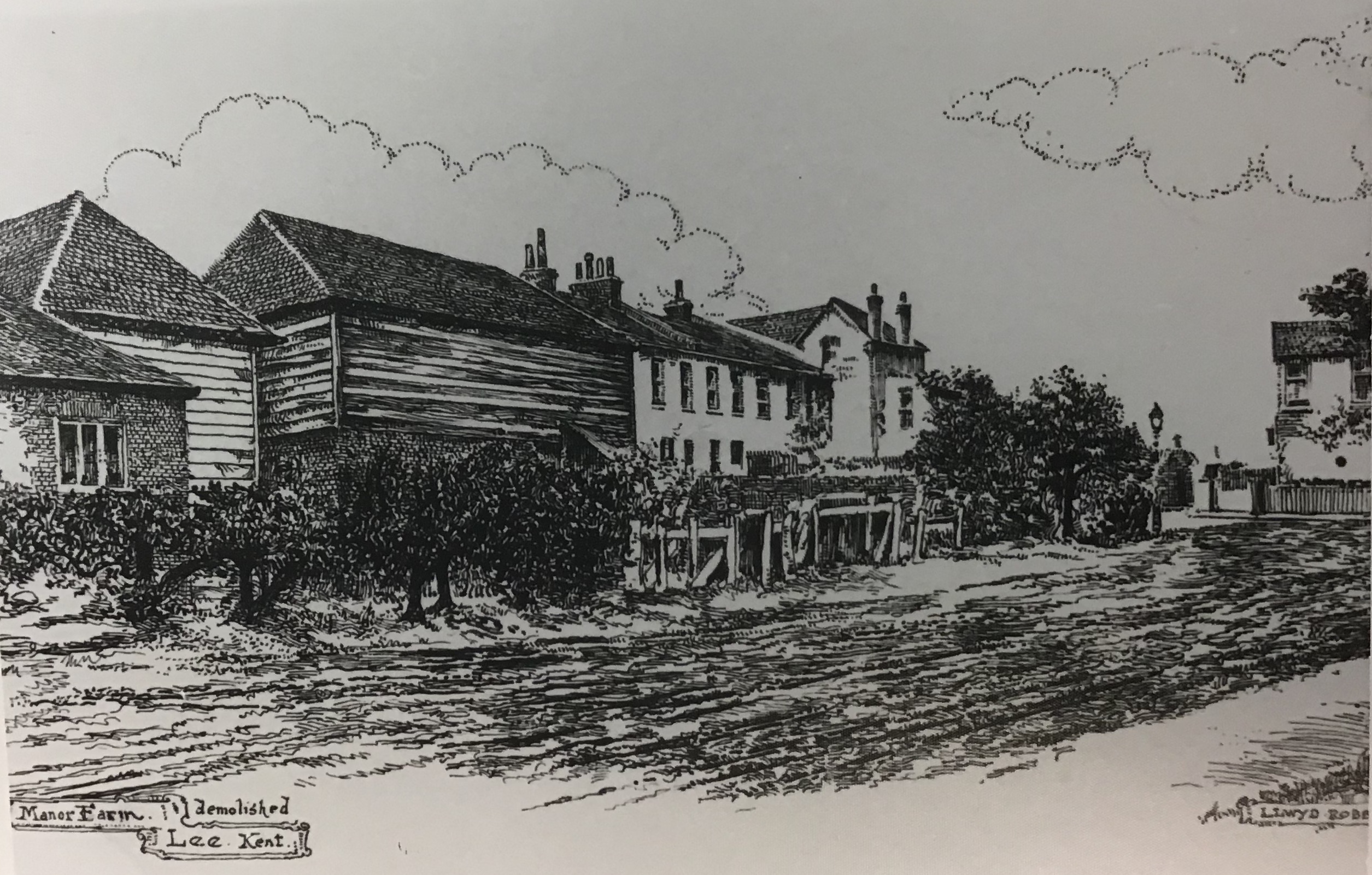


