Category Archives: Greenwich History

The Ravensbourne Athletic Club Of Ladywell and Lee

On the northern side of Eltham Road, just to the east of Lee Green, there is an elegant early 20th century building that is now part of the 1950s Borough of Woolwich (now Royal Greenwich) development of Ravens Way. The neighbouring council blocks were carefully designed to blend in with the former club, so it is easy to miss.  It started its life as a residential clubhouse for Ravensbourne Athletic Club and has an interesting story.

The early mentions of the club come from the 1870s, with the club seeming to have been formed around 1871.    But to understand the Club and its building on Eltham Road, we need to understand the origins.  It was the sports club for Cook, Son & Co. which had been formed in 1819 and was one of the largest English wholesale clothing traders and drapers of the late 19th century and early 20th century.  By the 1870s they were based in St Paul’s Church Yard in the City.  It’s head by this stage was Sir Francis Cook and by the end of the century he was one of the three richest men in the country; he had large estates in both Richmond and Sintra, just outside Lisbon in Portugal.

Cook, Son and Co. concentrated on warehousing and distribution rather than manufacturing the clothing themselves.  It sold directly to the small outfitters than still predominated the sector – this may have included the Campion family who had shops near Lee Green, on Lee High Road, Catford and Forest Hill, a ghost sign for whom is still visible in Catford (see below)  Cook, Son and Co. used the railway system for commercial traveller visits.

Ravensbourne Athletic was formed in 1871, taking its name from the location.  It is one I am sure readers will immediately recognise; their fields were described as being ‘truly rural’ and in the ‘picturesque vale of Ladywell’ (1).  It never seems to have appeared on Ordnance Survey maps, but was noted as being around 3 minutes from the station (2).  The 400 yard track at the edge of their cricket pitch was described as being at the bottom of the hill (3) so it may have been around the current locations of Chudleigh Road or perhaps Marsala Road – the latter was later home to the Edwardian professional marathon champion – Charlie Gardiner.

The 1878 sports day was referred to as their 8th Annual Meeting, it had a full range of track and field events – almost all were handicapped, which was common in the era (4) as we saw with the career of Harry Hutchens who ended up living at the other end of Ladywell Fields in Catford.  He wouldn’t have been welcome here though as he was a professional sprinter, probably the finest Victorian one.  Back to the Annual Meeting, while some races were internal affairs, some were open to local clubs such as Blackheath Harriers who were then based at the Green Man in Blackheath.  Current athletic inhabitants of Ladywell Fields, Kent AC, weren’t formed until a few years later.

 In 1883 the Annual Meeting had moved to the cinder track of Stamford Bridge (lpictured above in 1909 via Wikipedia Commons) and it was noticeable that reports seemed to be dominated by several Harriers clubs all of which are still in existence Ranlegh, Highgate and South London as well as Blackheath.  The numbers watching though were reported as being down, particularly women (5).

The reasons for the move to Stamford Bridge probably lay in the development potential of the land in Ladywell, London was expanding and as was seen with the short lived velodrome in Catford, it saw lots of suburban sports facilities disappear.  Press reports noted that the club had been ‘driven out’ of Ladywell; so it may be a short lease had come to an end (6).

The move to Stamford Bridge was a temporary one though, it seems that by 1884 they were in Lee, while the massive clubhouse was almost 30 years away, their Annual Meeting was to be held on what is now Weigall Road Playing Fields.  The ‘ground’ was described as ‘prettily situated’  and had a ‘very fair turf course.’ The Club had taken a 21 year lease out and the 1884 ‘Sports’ saw the usual fayre of Club and open races (7).

The location of their new base was field next to the Quaggy, it had been home to annual horse races 50 years before, but was to become a series of cricket and sports grounds.  It happened in a similar way around the Pool and Ravensbourne flood plains in Beckenham – as covered with the Oxo Sports Ground a while ago. Being on a flood plain, in wetter winters, fixtures will have no doubt been lost to waterlogged pitches – something that happened in the winter of 2019/20 too.

The annual sports were clearly a major social event for the company.  There were several photographs from the Illustrated Sporting and Dramatic News for 1896, including ones of the son of the owner, F W Cook, and Sir George Pragnall who was a senior Royal servant. More interesting, perhaps, are the race start photographs which show a little more of the area – particularly the children’s race which includes the rear of houses on Eltham Road (8).

A couple of years earlier the Penny Illustrated Paper covered the event, which like many of the era included bicycle races – the ‘scratch’ race is shown in the photograph below – the start line was next to Weigall Road, with the pairs of gables of the houses clearly visible behind one of the pavilions and marquees (9).

While the Annual Sports brought out those in charge of the company, the rest of the year it was a busy club with dozens of activities going on including cricket, cycling, athletics, football, tennis, billiards, swimming, shooting and a library.  Teams and individuals representing Ravensbourne, nicknamed the Ravens, won a total of 135 championships in 1910 and it retained the Houston Challenge Trophy for Athletic preeminence in the City, which it had held  since 1894 (10).

It’s not clear why the club, which had 1,200 members, decided to both build a residential clubhouse and build such a large one with around 200 rooms, after all they had managed for 40 years without one.  The sports ground at the rear had three pavilions by 1893 but a gap on Eltham Road remained which was presumably owned or leased by the Club to provide access to the playing fields.  At some point around 1912 a decision was made to develop this gap into a clubhouse.  The the building work happened over the next two years  at a cost of around £20,000 which was donated by Sir Frederick Cook (11).

The newly constructed building was offered to the War Office at the end of July 1914 for use in the war (12) that had already started although Britain did not join until a few days later.  The offer was taken up and the building used for army billeting (13).

The block appears to have remained much the same as it was when it was built, certainly the exterior all looks original. However, a temporary structure may have been added at the back either around or during World War 2 when it also seems to have been requisitioned.

Back to the sport, the 1937 edition of the ‘Sports’ saw, perhaps, its most notable participant – the ‘Mighty Atom’, Sydney Wooderson, who comfortably won the  open mile scratch race in 4:20.6 (14). It was to be a summer of success for Wooderson, who took the mile World Record at the end of August in 4:06.6 at Motspur Park in south west London (15).

In the 1950s, the clubhouse and the houses around it were acquired by the Borough of Woolwich for council housing.  The rest of the homes were designed to merge in well with the former clubhouse which was converted into flats.  A new street was created behind, parallel to Lee High Road, which retains a subtle link to the Ravensbourne Athletic – using the club nickname, ‘Ravens’ in  Ravens Way, the former clubhouse is 130-184. The playing fields were opened up to the public, accessed from Weigall Road.

As for Cook, Son & Co., it merged with a not dissimilar firm, S & J Watts & Co, who were based in Manchester, in 1960 to form Cook & Watts.  The life of the new company was a very short one though as like many in the textile and clothing sector it was taken over by Courtaulds later in 1960.

And finally, at the front of the building is a delightful, small obelisk.  It’s history seems lost but, it bears the words ‘The shadows will lie behind you if you walk towards the light’ carved into the four faces of the obelisk.  The phrase and several variants have been attributed to a wide range of sources including Walt Whitman, another person called Whitman, along with the Victorian poet Charles Swain and a Maori proverb.  However, there  is nothing obvious to link to either the Club or its corporate owners.


Notes

  1. South London Chronicle 29 August 1874
  2. Cricket 03 August 1882
  3. South London Chronicle 29 August 1874
  4. The Referee 18 August 1878
  5. Sporting Gazette 25 August 1883 
  6. The Referee 20 July 1884
  7. ibid
  8. Illustrated Sporting and Dramatic News 04 July 1896 – the pictures linked to this are from there too
  9. Penny Illustrated Paper 14 July 1894
  10. Sporting Life 24 February 1911
  11. Manchester Courier and Lancashire General Advertiser 03 August 1914
  12. ibid
  13. John Coulter (1997) Britain in Old Photographs: Lewisham & Deptford, A Third Selection p116
  14. Sunday Mirror 04 July 1937
  15. Sunday Mirror 29 August 1937


The Four Churches of St Peter, Eltham Road

When the Ordnance Survey cartographers visited the area around Eltham Road, to the east of Lee Green, for the first time in 1863, a small number of large houses had been laid out at the edge of suburbia of Victorian London.  The feel though would have been rural, little different to when horse racing had happened in the fields parallel to the main road and Quaggy up until the mid -1840s.

The change in the next four or five years was dramatic with new housing laid out along Eltham Road, almost up to what is now Sutcliffe Park.  As the local MP remarked in 1870, ‘in a short period a town has sprung up in the neighbourhood.’  (1)

As we have seen with new developments elsewhere in the area churches followed soon afterwards – Christ Church in Lee Park (1854), Holy Trinity, Glenton Road (1863), St Mildred’s in 1871, the original Church of the Good Shepherd in 1881 along with the Baptist Chapel at the corner of Eastdown Park in 1854.  This new ‘town’ between Lee Green and Eltham was no different.

From around 1867, possibly slightly before, there was a temporary ‘iron church’ that was built somewhere in the area which was called St Peter, the exact location isn’t clear – a Rev. A Tien being appointed to minister from there from a church in Bedfordshire (2). As we have seen in relation to an iron church on what is now Baring Road (see above), ‘tin tabernacles,’ as they were often referred to, provided quick solutions to the provision of a church whilst funds were raised to build a permanent place of worship.

The foundation stone for the permanent church (pictured above) was laid on 3 December 1870 by Lady Louisa Mills, who was the wife of the local MP for West Kent, Charles Mills. He obviously wasn’t that impressed with his wife laying the foundation stone; his speech ‘regretting very much the absence of a member of the Royal Family’ (3). The Conservative Mills had previously lost his seat in Northallerton, amidst a bribery scandal. Also present at both the foundation stone laying and the service in the iron church that preceded it, were the Vicar Designate, the Rev J L Macdonald, along with the Vicars of Eltham and Greenwich (4).

The church was on the corner of what it now Lyme Farm Close and Courtlands Avenue, although it was just one street then referred to simply as The Avenue.  There were a dozen or so large houses in the development plus perhaps another 150 large houses along Eltham Road, Cambridge Road (now Drive), along with Weigall, Osberton and Leyland Roads.  It was an ambitious project for a small, albeit probably relatively wealthy and pious area.  So, there was a range of fundraising activity to help pay including bazaars and concerts to help pay for the new church (5).

In the end, it all came together quite quickly with the new church consecrated in July 1871, just six months after the foundation stone was laid.  The ceremony was undertaken by the Bishop of Colombo, in the absence of the Bishop of Rochester, most of local clergy in the area being present too.   The church seemed large for the area – holding 750 and cost £4,500 to build (6).

The local paper, the Kentish Mercury, described it as ‘early French’ in style consisting of ‘nave, side aisles and an octagonal chancel…. surmounted by a very characteristic tower and spire…..Both externally and internally the edifice is of red brick, relieved with copious Bath stone dressings’ (7).

The architects were Newman and Billing, both called Arthur, who were based in Tooley Street and had an extensive practice mainly concerned with church work from around 1860.  They were also acted as surveyors to Guy’s Hospital and to St Olave’s District Board of Works in Bermondsey.   Other work included the design of the Grade II listed St Luke’s in Hackney and the Grade I listed Parish Church of St Dunstan and All Saints (The Church of the High Seas)

The builders were Dove Brothers who were a long standing Islington based builders operational between 1781 and 1993, well known for late Victorian church construction building around 130 churches between 1858 and 1900, mainly in London.

The church had parish rooms, a some distance away in St Peter’s Court at Lee Green, behind the New Tiger’s Head. The first mention in Kelly’s Directories was in 1894, but given the naming of the alley (which is still there) it probably dates from the 1880s or before. The last mention of the parish rooms was around 1911.

The church seems to have suffered as the wealthy suburban residents moved on and was closed in 1939 in a poor state of repair; several of the houses were empty on Courtlands Avenue when the 1939 Register was collected as war broke out, with others in multiple occupation – a parish probably unable to cope with the high running costs of the building. While no damage was marked on the London County Council Bomb Damage Maps (8) – given there were a couple of V-1s that fell on neighbouring fields it seem seems likely that there was some damage; certainly the church website suggests that. It seems that the remaining parishioners worshiped for a while at the elegantly situated St John’s at the top of Eltham Hill.

The church was declared redundant in 1960, and along with the rest of the housing on Courtlands Avenue was demolished, probably the same year. The much denser housing, seemingly built by Wates. All that remains now is the war memorial, which has a brief note about the church’s history.

Courtlands Avenue wasn’t the only area of large housing demolished in the early post war period – flats appeared on Ravens Way and opposite on Reed Close – maybe 99 year Crown leases were coming to an end.  There was to be much larger scale development redevelopment around Lee Green, again on Crown land.

The new, denser developments with hundreds more homes provided a nascent congregation and the church re-established itself in a wooden hall on the corner of Weigall Road in 1960, joining with the, then recently rebuilt, Church of the Good Shepherd in Handen Road.  

The plot on which the hall that the church took over seems to have been undeveloped until the late 1930s when it was listed in Kelly’s Directory as Pyke Jocelyn School of Dancing, it changed hands during the war to become Saville Hall School of Dancing before a 1960 listing as St Peter’s Church. 

The wooden structure was replaced by a smaller, attractive multi-purpose building in 1983, presumably at least partially paid for by the sale of part of the site for a sheltered housing development next door.

Notes

  1. Kentish Mercury 15 July 1871
  2. Bedfordshire Times and Independent 16 July 1867
  3. Kentish Mercury 10 December 1870
  4. ibid
  5. Kentish Mercury 10 June 1871
  6. Kentish Mercury 15 July 1871
  7. ibid
  8. Laurence Ward (2015) The London County Council Bomb Damage Maps 1939-1945 p120

Credits

  • The photographs of the original church are from the collection of Lewisham Archives, remain their copyright and are used with their permission
  • The photograph of the tin tabernacle on what is now Baring Road was from eBay in September 2016
  • The Kelly’s Directory data is from a mixture of Lewisham and Southwark Archives

The Three Fire Stations of Lee

Running Past has covered several of the current and past buildings around Lee Green, notably Lee Green Farm and the closed pubs, the Prince Arthur and the New Tigers Head as well as a little on its more ancient version, the Old Tiger’s Head, in connection with the Lee Races of the first half of the 19th century.

In the north eastern quadrant is one of the most impressive bits of municipal architecture in the area, the Grade II listed fire station. We will return to that building later; however, it seems to have been at least the third Fire Station in the area. There had been one in Weardale Road by the late 1870s (1), presumably close to the Rose of Lee based on what else had been built at that stage in the road.  Weardale Road had still been known as Hocum Pocum Lane little more than a decade before.

The next one opened by the Metropolitan Fire Brigade in 1895 was on the Lewisham side of Lee Green in the same group of buildings as the Old Tigers Head (see above). It was in an attractive group of four storey properties which have very distinctive Dutch gables. There used to be a tower in the middle of them but this appears to have been damaged in World War 2.

The site had originally been the stables for the ‘old’ Old Tiger’s Head and these seem to have been used for a while by Thomas Tilling for stabling the horses for their buses (like at 36 Old Road) – that was certainly the case in the 1888 edition of Kelly’s Directory. The courtyard entrance to the pub and stables remain with an alley with a ‘garage’ ghost sign above it.

The terrace  predates the ‘new’ Old Tiger’s Head pub by a few years – whose rebuilding was completed around 1896 (the façade is dated). The earlier building of the terrace allowed the pub to temporarily move to what became the fire station. The pub had previously had an address of 345 Lee High Road, but while it kept its number after the temporary move; by 1895 it was flanked at 343 by a hosier Alfred Trusson and at 347 to 349, a long lost type of retail outlet – a mantle warehouse, run by Alexander Aitken.

The fire station opened by 1896 once the pub had moved back to its newly rebuilt old home. In the 1900 Kelly’s Directory its neighbours were the grocers and related shop, the London and Counties Stores (see photograph above). Alexander Aitken was still selling mantles and the pub was numbered 351. By 1905 the mantle trade had moved on, 347 was empty and 349 was a chemist. After the Fire Station’s move to what would have been described at the time as ‘more commodious premises’ 345 seems to have remained empty until the late 1920s (see note below). The former fire station (and pub) is now home to Mandy Peters Solicitors.

The new fire station was designed by the Fire Brigade Branch of the London County Council Architects Department and opened in 1906 and was Grade II listed in 1973. The architectural team within the LCC had originally worked in housing and included Owen Fleming, who was better known for his work on the Boundary Estate in Shoreditch.

The listing notes for Lee Green Fire Station remark that it is ‘notable for having two elevations of architectural quality in the Arts and Crafts-style to the south, with a cross-gable, and to the east.’

The Arts and Crafts style probably reflected that it was a Fire Station built in then suburbia and while Lee Green Farm had been lost as the Crown Estate sold off parcels of land for development from the 1860s, the neighbouring Horn Park Farm was to survive until the 1930s.

The materials used at the fire station are described as

Red brick with lower courses of russet glazed brick, steeply pitched slate roof and tall brick chimneys. Rendering to twin gables and glazed brick at ground floor on side elevation. Stone canted bay to front.

There was accommodation for firefighters included within the station itself, as was common at the time of building, and in a couple of houses behind the Fire Station in Meadowcourt Road (pictured above) as well as in an early to mid 19th century detached, yellow brick house, 7 Eltham Road (see main photograph of Fire Station). Royal Greenwich locally listed 7 Eltham Road in 2019, describing it as

Good quality and rare surviving domestic building of its date with a frontage which has largely remained in its original form

I& Eltham Road may have been acquired by the Fire Brigade after the station was built and it was noted in Kelly’s Directories of 1905 and 1911 as being home to a William Issott. Any earlier detail has proved difficult to unpick due to changes in names and numbering of the houses in the late 19th century.

The new station seems to have been one of the first to have been entirely motorised with two petrol engines and a steam powered one – the fire engines pictured outside at the time of the opening in December 1906.

While many of the local fire stations of the era have closed, such as Forest Hill in Perry Vale, and Lewisham’s, towards the southern end of the High Street, which was replaced 150 metres away, Lee Green has survived both rebuilding and closure programmes over the years; long may that continue!

Notes

  1. Kentish Mercury 17 January 1880
  2. The Graphic 15 December 1906

Picture & Other Credits

The photograph of the original fire station is from the collection of the Mary Evans Picture Library in Blackheath, it is used with their permission.

The Kelly’s Directory information comes from Southwark Archives, I have copied data from every 5th year – so a few short term stays may be missed.

The Ghosts of Hillyfields & Blackheath Prefabs Past

The prolonged spells of dry weather such as those in June and July 2018 same months in 2022 dries out the top soils in many areas and made visible archaeological remains of past buildings. In 2018 it enabled the likes of the flooded village of Mardale Green to be visible again, along with various ancient settlements in Wales.  A little more recent, and a lot nearer to home, are footprints of prefabs that appeared in Hillyfields and possibly on Blackheath too.

The Blitz and the later V-1 and V-2 rocket attacks had destroyed thousands of homes in south east London. – thousands were homeless, staying with families and friends. The main plank in trying to deal with this was the Housing (Temporary Accommodation) Act 1944, which planned to deliver 300,000 prefabricated homes.The old Borough of Lewisham put up 1,610 prefabs by 1948 and a further 1,088 by 1955. While many went on quickly cleared bombsites – such as those in Fernbrook Road and Lenham Road – parks and open spaces were often used. On the Greenwich side of Blackheath, open space on Pond Road in Blackheath was used but more significantly several parks saw significant concentrations of prefabs. Notable in this was the Excalibur Estate (pictured below) which was built on part of the Forster Memorial Park – the estate partially remains although a stalling redevelopment programme is underway. The Excalibur estate (below) was covered in an early post in Running Past. There were also big concentrations around the edge of Hillyfields as well as in a couple of locations on Blackheath.P1040344.JPG

Hillyfields Bungalows

As the 1949 surveyed map that included Ladywell shows, the open ground of Hillyfields was circled with prefabs – Hillyfields Bungalows – with a double row along Adelaide and Montague Avenues, and a single broken line on Hillyfields Crescent.  A number of different types of prefabs were used – the ones here were Arcon bungalows – somewhat different in shape and design to those at Excalibur.

They were certainly there until the early autumn of 1962 as there is cine film footage of them, although there are suggestions that residents may have been moved out before the winter as there are recollections of playing in the remains of the prefabs in the harsh winter of 1962/63.

The extent of the compaction of the ground caused by the foundations means that the ground dries out more quickly than the surrounding around and so sometimes makes the footprints of the prefabs visible from the air.  The Google maps satellite images, probably taken in the dry spring or early summer of 2011. – the top one of Adelaide Avenue, the lower of Montague Avenue.

IMG_0393.PNG

IMG_0515.PNG

They may have been visible on the ground at that point but the 2018 has made them a lot clearer than in previous years as the set of photographs below shows – the top pair are of the Adelaide Avenue prefab bases, the bottom trio are of Montague Avenue and Hillyfields Crescent.

Before leaving Hillyfields, the Ordnance Survey map above indicates a series of Nissen huts close to the tennis courts.  They probably related to search lights (there were search lights there in World War 1 too).  There was nothing visible on the ground in the drought conditions – a combination of post-war trees and play equipment have disturbed the surface too much.

St German’s Place, Blackheath

Alongside St German’s Place on Blackheath there was a double row of prefabs as the photograph from Britain from Above shows the edge of in the bottom left corner,

IMG_0514.JPG

The extent is clearer from the 1949 surveyed Ordnance Survey map.

Unlike the position at Hillyfields, the post demolition outlines never seem to have been visible from the air – Blackheath has seen more more earth movement over the years than Hillyfields (apart from the former brick works around Hillyfields Crescent).  Non-natural soils have been added to the edge the grass, while the mounds look impressive in flower they will cover some of the remains of the prefab footprints.

A recent drain edges the Heath a metre further west than the mound and then beyond is a tangle of long grass. There are a couple of outlines that might be the base of a bungalow but it could easily be something else.

Hollyhedge Bungalows

In the top corner of the aerial photograph above another, larger, group of prefabs is present at the south eastern edge of the Heath, adjacent to what is now the Territorial Army Centre at Hollyhedge House – looking  beyond them is Lewisham, almost unrecognisable without the tall buildings.

The bunglaows were know as Hollyhedge Bungalows – their extent is clearer from the map below

There appeared to be nothing obvious visible on the ground when visited – a combination of lots of earth movement on the Heath in the relatively recent past and confusion of lines caused by tyres – no doubt due to the obstacles of the Race for Life Pretty Mudder race the Sunday before – the grass will recover quickly from that, once it rains.

Not every bomb site was developed immediately for prefabs – as Running Past has already covered , sites at Campshill House and Lewisham Hill were developed for new council housing almost straight after the War – the final photograph below shows both Lewisham Hill estate (2/3 way up on the right) as well as Hollyhedge Bungalows at the top.

Notes

The modern aerial images are from Google Maps – copied during 2014

The older aerial images are all from Britain from Above and on a Creative Commons

The map images are on a Creative Commons from the National Library of Scotland – the full images are via links for Hillyfields; St German’s Place and Hollyhedge bungalows

The New Tiger’s Head – A Lee Green Pub

One of the more depressing sites at the Lee Green crossroads is the slowly decaying New Tiger’s Head; it ought to be a focal point but the decline on such an impressive building was sufficient for the Victorian Society to include it on their 2017 list of 10 most endangered Victorian and Edward buildings – previous local listings have included Ladywell Baths.  Oddly, for such an impressive building, it isn’t nationally listed, and took until May 2019 to be even locally listed by Greenwich.

The New Tiger‘s Head started life as a beer shop known as the Tiger Tavern in the 1830s – it was a name that, off and on, it retained into the early 20th century. It was at the western end of a group of four cottages known as Prospect Terrace which were built at around the same time and had the same ownership. These cottages remain, housing a post office/newsagent and a hairdresser’s.  To confuse matters, it was partially on the site of its near neighbour the (Old) Tiger’s Head which had moved to its current location in the mid-18th century.

So what was a beer shop or house?  It had its roots in earlier social problems caused by excessive consumption of gin – made famous by Hogarth’s prints on the evils of Gin Lane and the relative merits of Beer Street in the 1750s – see below (1).  In the 1820s and 1830s governments were attempting to deal with widespread drunkenness through gin drinking which had partially arisen through high levels of taxation on beer.  The Beerhouse Act of 1830 abolished the tax on beer and allowed the opening on premises that could only sell beer and apart from an annual 2 guinea licence fee there was only limited control over their opening and limited regulation.  This was very different to the strict regime that existed for public houses which could sell wines and spirits too.  The beer house was the starting point in licencing terms for many Victorian public houses and there were often long campaigns to get turn the beer house licence into a full pub licence.

By 1841 the New Tiger’s Head seems to have been a successful business, it was described as being ‘intended for a licensed house, doing an extensive trade’ it was sold with the four neighbouring cottages – the lease was for 80 years with a ground rent of £17 a year (2).

In the 1840s seem to have seen the first recorded applications for a full licence for the New Tigers Head in 1847; unsurprisingly, it was opposed by Charles Morton, landlord of the Old Tigers Head opposite (3).

By 1849 the landlord was William Charles Pickup, he made the third application for a full licence – it was based on the growth of area and coming of the railway.  It was again opposed by Charles Morton, and was again refused by the bench – who noted that if Pickup ‘ever expected to gain a licence, he must conduct his house in a better manner.’ (4).

Pickup was a relatively young man, just 27 when the census enumerators called in 1851 Census. Pickup sold up in 1853 and there was a sale that year of assorted household possessions and a ‘light gig with excellent springs, patent axels, leather cushion etc.’ (5).

Each September the case for a full licence seems to have been made to the magistrates, and it was refused in 1856 (6) and the following year a petition against the request was presented to the bench ‘ numerously signed by the clergy and resident gentry of the place.’  It was again refused (7). The opposition from the clergy and the gentry shouldn’t be seen as any form of tactic support for the Mortons and their running of the Old Tiger’s Head; rather it was an opposition to drinking and pubs per se.  Much of the same group were behind the setting up of Lee Working Men’s Institution in 1854 in Boone Street.  Despite its name, it was no working men’s club and promoted the expansion of knowledge and abstinence. Running Past will return to this in the future.

James Phillips, described in the 1861 census as a refreshment house keeper, took over the licence in the late 1850s.  He used the petition tactic with his application getting support from several farmers and market gardeners of the area – perhaps including Richard Morris at Lee Green Farm, (pictured below from the information board at Lee Green) William Brown at College Farm, Thomas Adams of Burnt Ash Farm and Thomas Blenkiron at Horn Park Farm.

It was again opposed by the landlord of the Old Tigers Head, now Caroline Morton, mother-in-law of John Pound (soon to be owner of the Northbrook).  She used a different tack in the opposition to that used by her late husband, claiming the name would be too similar. Phillips suggested that it was a requirement of his lease, but he would be happy to call it ‘The Monkey’ or any other animal to get a full licence (8).  Unsurprisingly, the licence was refused, although a licence for selling wine (but not spirits) was granted later that year following new legislation (9).

Phillips, who was married to Martha and employed two live-in bar maids and a waiter in 1861, had another application rejected in 1861(10) but, after an adjournment in 1863, he finally obtained a full licence (11).

Almost as soon as Phillips had obtained the licence he sold his interest to Marchant Bowyer Warner, presumably it was worth much more than it had been as a beer house (12).

Phillips had planned to extend the frontage of the beer house in 1863, but permission had not been granted (13).  However, Warner was quick to extend – adding a billiard room in 1865 (14) along with some other alternations in 1866 (15) and a new sign, which required permission, the same year (16).

Warner was only 28 when he took over the tenancy in 1864; it wasn’t his first licence though – he’d been the publican at the Duke of Wellington in Shacklewell for just over a year before that.  Whether he had inherited wealth or the now fully licensed New Tiger’s Head was very profitable indeed, he was listed as a retired Licensed Victualler living in nearby Cambridge Drive by 1881.  He stayed in Cambridge Drive for the next three censuses and died in Lewisham in 1921.

There was a series of landlords in the 1880 and 1890s, with Edward Dicker (1881), John Stevens (1883) and Emma Porter all being licensees (17).  There were then brief interludes of Frederick Morgan (18) behind the pumps, followed by George Rose (19). Arthur Strutt Lindus took over soon after and was fined £8 12s for watering down beer in late 1894 (20). Lindus had been a licenced victualler before at the Heaton Arms in Peckham in the 1871 and 1881 censuses.

Source eBay September 2016

The pub seems to have been re-built in its present form in the late 1890s, a year or two after the Old Tiger’s Head on the opposite corner of Lee Road.  The landlord when it re-opened was probably Neville Dedman, part of a family with a strong tradition of running pubs.  Most recently, his father William had been publican at the Old Tiger’s Head before it was rebuilt in 1896.  Despite all press reports noting it as the New Tiger’s Head, it was listed as the Tiger Tavern again in the census.

For reasons that aren’t clear William, who lived a short way up Eltham Road, took over the tenancy in 1902 (21). He was eyeing up other options though and got permission to build the Station Hotel in Hither Green in 1905 (22).  Sadly, he died in 1906, the year before the Station Hotel opened and his widow, Jane, was to become the licensee. Neville was in control though by the time the census enumerators called in 1911. Neville saw out his days in an appropriate location for the pub keeping traditions of his family, at the beautiful, on the outside, at least, Licensed Victuallers Benevolent Institution Asylum Road in Peckham (See below – on a Creative Commons via Geograph) in 1939 Register.

John Reynolds from Cambridgeshire took over the tenancy in 1904, with his wife Elizabeth who hailed from Hitchin, and remained there until his death in 1914.

Albert James Bromley succeeded the Reynolds for 5 years but the long term licensee was Robert Prichard who took over in 1921 and was certainly there in the 1939 Register, then aged 71 with Agnes who he had married in 1925.  They had 5 live-in staff to help them run the business.  Robert probably remained there until his death in 1945.  It probably wasn’t his first licence as a Robert Pritchard of right age was running Red Lion, 1 Eldon Street, Shoreditch in 1901.

The pub ceased trading in 2005; it was no doubt the victim of a number of factors  – cheap supermarket drinks and some of the local factors that led to the demise of the nearby Prince Arthur – the closure of the police station and the slow haemorrhage of offices from Leegate House and Cantilever House (above the Leegate Centre).  There are suggestions too that the owners, Enterprise Inns ‘ran this place into the ground’, although the arrival of Wetherspoons’ Edmund Halley about 50 metres away with its cheaper beer and more welcoming feel at around the same time was probably more pivotal in its demise.

The building isn’t completely empty, the upper floors have been turned into 6 flats – with an annual rental income of over £70,000 – the interior has been recently had some emergency works undertaken to secure the interiors from further damage following discussions with both Lewisham and Greenwich Councils.   As Joe O’Donnell has noted (see comments below) – there was an unsuccessful application to Greenwich to turn the ground floor into flats in 2016.

At the time of writing (March 2018), the freehold is on sale with offers of £2.5 million sought. Ironically, when the plans for St Modwens redevelopment of the Leegate were first mooted there were suggestions that Wetherspoons might move to the New Tiger’s Head, although there has been nothing recent in the local media on this.

Unlike many other closed local pubs, there haven’t been pages of memories posted on Facebook – maybe there hasn’t been a trigger to do it… So, if you worked there or drank there, tell your story, who were the characters who propped up the bar, the landlord, the staff,  the atmosphere, the memorable nights, the particular celebrations that were held there, memories of the friends, the beers.  Post them below (you can use your Facebook or Twitter login – or via Facebook (if you found the post via here) – if it is you first comment ‘here’, you will have to wait for it to be ‘moderated’.  I will update the post with comments.  Anything libellous though will get deleted here & no doubt on the Facebook Group pages.

Notes

  1. On a Creative Commons via Wikipedia https://en.wikipedia.org/wiki/Beer_Street_and_Gin_Lane
  2. 12 October 1841 – Morning Advertiser – London, London, England
  3. 28 September 1847 – Kentish Mercury – London, London, England
  4. 06 October 1849 – Kentish Mercury – London, London, England
  5. 10 September 1853 – Kentish Mercury – London, London, England
  6. 27 September 1856 – Kentish Independent – London, London
  7. 25 September 1857 – Morning Advertiser – London, London
  8. 29 September 1860 – Kentish Mercury – London, London, England
  9. 10 December 1860 – Morning Advertiser – London, London, England
  10. 28 September 1861 – Kentish Mercury – London, London, England
  11. 26 September 1863 – Kentish Mercury – London, London, England
  12. 21 May 1864 – Kentish Mercury – London, London, England
  13. 21 March 1863 – Kentish Mercury – London, London, England
  14. 11 November 1865 – Kentish Independent – London, London, England
  15. 14 April 1866 – Kentish Independent – London, London, England
  16. 25 August 1866 – Kentish Independent – London, London, England
  17. 17 February 1883 – Woolwich Gazette – London, London, England
  18. 29 August 1890 – Woolwich Gazette
  19. Kentish Mercury 13 February 1891
  20. London Evening Standard 10 December 1894
  21. 29 August 1902 – Kentish Independent – London, London, England
  22. 10 March 1905 – Kentish Mercury – London, London, England

Census & related information come via Find My Past

In Search of the Greenwich Park Branch – Part 1 – Greenwich to Blackheath Hill

Running Past is a follower of things that aren’t always obvious to see – this has included often submerged streams, and a few years ago traced the route of the Greenwich Meridian back to the Observatory from the London border in New Addington.  The Greenwich Park Branch Line is a long closed and largely forgotten railway line in south east London.  However, I attempted to follow the route to see what remains of a line that mainly closed in 1917, ‘armed’ only with Victorian Ordnance Survey maps to guide me.

First the history – the railway was a relatively short lived one, built by the London, Chatham and Dover Railway from and existing junction at Nunhead to Greenwich Park. The original plan was for the branch to terminate at Woolwich Dockyard, but this idea was quickly abandoned, and there were serious problems getting funding for the section from Blackheath Hill to Greenwich – the former opened with the rest of the line in 1871 (apart from Brockley Lane station which opened in 1872) but passengers had to wait another 17 years to reach Greenwich Park, which makes some of the current delays on South Eastern seem almost acceptable.  The unmarked station can be seen at the top right hand corner of the map above. The line was never a financial success, journeys into central London were much slower than from Greenwich and changes often being needed at Nunhead.  The line closed in early 1917 due war time financial savings.  It never fully re-opened.  The section beyond the main line into London Bridge, near St Johns, was re-opened and connected to the main line in 1929, the stations never re-opened though and the section to the north and east between Lewisham and Greenwich had tracks removed and was largely abandoned until after the Second World War when it was gradually developed.

The terminus as the line’s names suggests was close to the Greenwich Park, in Stockwell Street, it opened much later than the rest of the line in 1888. The site is now home to the Ibis Hotel which opened in 1988.  The platforms are now home to a car park and the buildings edging the former station now house the Greenwich Picturehouse which is from the same era as the hotel.

The station building has been described as

‘canopied……built of yellow brick, with segmental arches above doors and windows picked out in red.  Adjoining the booking hall was a buffet, and first and second class ladies’ rooms, a two storey house was provided as a home for the Station Master.

Like much of the rest of the early part of the line, the station was in a cutting.as the levels below show.   After closure, the buildings remained, used first by the Mayfield Temperance Billiard Club and later a timber yard and saw mill.

Other than the footprint of the hotel and the car park, there is nothing to see in terms of remains of the station.  While there are several large chunks of masonry at the western edge of the car park, sadly none seem to be remnants of the station; signs suggest that they all relate to workshops for the blind which seem to have been adjacent to station buildings on Greenwich High Road, formerly London Street.  This was close to the business location of Edmund Pook who was (probably) wrongly implicated in the Eltham Murder in 1871.

While the line effectively closed in 1917, the route is relatively easy to pick out in Greenwich, the gaps between buildings with 20th and 21st century infill between Victorian properties make its course clear.  Out of the car park, the route across Burney Street is easy to spot; there is the now former Police Station on the corner of Royal Hill and the Burney Street Garden which would have been on the route.

The railway was bridged by Royal Hill at this point; the usually reliable Edith’s Streets suggests that there are some remains of the bridge, but alas dear reader, they proved impossible to find.  The next section, though, is easy to spot – there is a long site where there are periodically notices of planning applications which are then turned down by Greenwich Council.  It is currently home to the delightful Royal Hill Community Garden, pictured above.

The railway used to run almost parallel to Royal Hill and its former route continues to be clear as it crosses Circus Street – where a modern infill development, which includes the appropriately named Cutting House, partially fills the vacated space.  The theme of communal cultivation continues beyond Circus Street with the Prior Street allotments filling the void left by the railway.  There was a level crossing at this point.

As Royal Hill turns sharply back towards the High Road, a post war council block, Topham House, and its garages fill the space left by the departed steam trains.  Jervis Court is the next addition to the Greenwich streetscape – a thin block, barely as wide as the tracks that were its predecessor.  The line swung under Blissett Street, its cutting now filled and on the surface an imposing deck access block built into the hillside next to a 1970s fire station.

The railway was in a cutting here as it skirted the foot of Blackheath Hill, while it was filled in, two ‘signs’ of it remain.  A scramble across a small bit of waste ground reveals some of the cutting wall  and back at ground level, next to a basketball and football ‘cage’ that sits atop the former railway, is a bridge weight limit sign, for a bridge that is no longer visible in Lindsell Street, the gap it crossed no longer there but the restriction still applies, presumably due to difficulties of compacting the fill for the cutting. Apparently the void can be reached from the adjacent fire station and the the fire brigade use(d) the area for training, filling it with smoke.

Beyond the ghost bridge, the erstwhile track has been covered by an access road to the postwar council flats of Plumbridge Street and Dabin Close. The smoke and steam from the trains may have long gone but pollution remains as diesel lorries and cars toil up Blackheath Hill.

We will leave the railway at this point – just before the train would have reached the first stop – Blackheath Hill, returning to the line to take it on to its final destination of Nunhead next week.

Picture & Map Credits

Most of the black and white photographs come from Greenwich Photo History Wiki and are able to be used for non-commercial purposes such as Running Past, the exception to this is the photograph of the front of the station which was from eBay in September 2016.  The map is on a creative commons via the National Library of Scotland.

Following the Quaggy – Sutcliffe Park to Lee Green

In previous posts, Running Past has followed the Quaggy from its sources around Locksbottom and then on through Petts Wood, the Hawkwood Estate, Chislehurst and Bickley, through the golf courses of Sundridge Park and on to Chinbrook Meadows.  Most recently, we left he river at on the south side of Eltham Green Bridge, by an old London County Council sign, wondering about how to moor a boat there.

North of the bridge, over Eltham Road, is Sucliffe Park; until the early 20th century the area was farmland, The Quaggy meandered through the fields as the map below shows (on a Creative Commons from the National Library of Scotland).  Woolwich Borough Council acquired the land just after World War 1.  It was named after the then Borough Engineer (1).

The meanders had been removed by the time that the Ordnance Surveyors cartographers visited again in 1938 and encased in concrete – as the map below shows (on a Creative Commons from the National Library of Scotland). The river was completely enclosed at some stage during the post war period, Ken White believed it to be around 1970 (2) although several on Facebook threads thought it was much earlier than this.

The look that remained until the current Millennium was of a flat, featureless park (apart from the athletics track that is home to Cambridge Harriers, whose early history was covered a while ago.  It was reminiscent of a miniature Hackney Marshes (Photo below on a Creative Commons via Restoring Europe’s Rivers wiki)

In Facebook threads on upstream posts, there were lots of memories of playing in the Quaggy and culverts around the Park, seemingly including some of the streams that join the Quaggy – notably Well Hall Stream.

This all changed in 2002. A new meandering channel was created for the Quaggy, close to its pre-1930s course, albeit at a slightly lower level, with the park itself being remodelled to create a flood plain able to store 85,000 m³  with a series of boardwalks, viewing points and a large pond. The old channel was retained for extreme flood situations and flow can be switched to it when the storage in the park is full (above, right photograph).

The park which used to be rarely visited other than for weekend football is now a well-used focal point and reconnecting the community with the river and its natural environment – it is often held up as an excellent example of urban river management. Unlike other parts of the Quaggy’s catchment, it is beginning to be used as a place of play and discovery – children can sometimes be seen jumping across the river, there were reminiscences about doing this in Mottingham, feeding ducks on the pond along with the occasional sightings of fishing nets and buckets.

The Quaggy was originally joined by Well Hall Stream in the park, although when followed a while ago, there was little evidence of any current flow.

The river goes through some complex engineering that can shut off the flows in periods of high water, and re-emerges the other side of Kidbrooke Park Road in the playing fields of John Roan School.  Here too the river has changed, the concrete encasement had continued west of the road, I remember having to scramble down angled concrete to fish out footballs from the river during my sons’ Saturday morning football practice there. 

The Quaggy is theoretically joined by Lower Kid Brook (above) opposite a rather impressive Woolwich Borough marker (below left), or rather it isn’t any more – the flow was probably diverted into the Quaggy three hundred metres to the east in Sutcliffe Park.

Beyond John Roan playing fields, the river is sandwiched between Lyme Farm Road estate, which replaced Victorian housing, and Crofton Albion FC.  It emerges out into the public gaze again at Weigall Road where the 1903 boundary markers from Woolwich had again been busy (above right).

Over the road, to the south, there is another series of playing fields – the first is a public one, Weigall Sports Field which was once home to Ravensbourne Athletic Club’s grass running track.  It was part of a residential club and sports centre for employees of Cook, Son and Co (St Pauls) Ltd. which was a clothing wholesale company – the building faces on to Eltham Road (see above) and was completed in 1912.  Prior to then there were newspaper reports of them being based in Ladywell Fields, hence the name from a different catchment.  The building on Eltham Road was requisitioned for World War 1 billeting but returned to its former use after the War.  It continued as this until after World War Two when it was converted into flats – it is now part of Ravens Way (perhaps a shortening of the club’s name) (3).

Its next door neighbour is the Bowring Group Sports Ground (below), although its days in recreational use are probably numbered as it seems to have been acquired for  a ‘Free’ School.

The northern banks of the Quaggy also used to have playing fields, the just post war Ordnance Survey map shows cricket grounds (on a Creative Commons from National Library of Scotland.) The outlines of the fields are still there and indeed the derelict remains of one the pavilions remains.  The formerly manicured grounds have been largely abandoned and now form part of the Weigall Road flood defence and storage, although the intention has always been dual use.

It isn’t meant to be an accessible area, but fences on Weigall Road and Blackheath Park are always porous enough for the runner of a smaller stature to enter without having to resort to contortions or scaling boundaries.  It the last long section of the river where the Quaggy has a bucolic feel – it probably hasn’t changed much since the fields by the river were used as the venue for the horse racing of the Lee Races in the first half of the 19th century.

The flood defences have a second fence to prevent the fluvial flâneur but in a period of low flow they proved to be of limited deterrent.  Apparently the Weigall Road storage will hold 65,000 m³ of water.

There is/was probably a small tributary joining around here.  There is very boggy ground just south of the derelict pavilion, more standing water in wetter seasons but still pooling in a very dry Spring.  There is an occasionally running stream which forms the boundary between the fields, in recent years I have only seen water there in the very wet winter of 2013/14.

On Facebook pages relating to upstream posts, there are fond memories of playing in and on the banks of the Quaggy in these parts – there still sometime cross river swings with a ducking for those with poor grips, although none have been noticed for a year or two.

Beyond the Weigall Road flood storage area, the Quaggy briefly disappears before being bridged by Meadowcourt Road and then flowing onwards towards Osborne Terrace.  The river is then bridged by Lee Road, there was only a footbridge until as late as the 1860s, as the 1863 published 25″ Ordnance Survey shows (on a Creative Commons via National Library of Scotland). The road bridge was certainly there by the time the cartographers returned in 1893.

This was an area of flooding – Hastead reported depths of 10′ (3 metres) in the 18th century and F H Hart reporting similar depths after the rapid thaw following the bitterly cold 1813/14 winter, there was flooding over a wide area including a lot of Lee Park.  Hart reported flooding being a regular occurrence in the early 19th century with a Bromley farmer drowning in 1830.

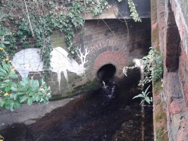
There is another Woolwich marker from 1903 by the bridge, only someone has chiselled out – the borough name, perhaps they were going to return and add Greenwich, but they never did.  Next to the bridge there is a pipe with water entering the Quaggy, with a Lewisham Natureman stag ‘grazing’ next to it, this is the diverted Mid Kid Brook.  On the opposite bank, there is a ghost sign for a ‘carver and gilder’ (more here), oddly hidden by the current cafe owners.  We’ll leave the river here for another day.

Notes

  1. Ken White (1999) The Quaggy & Its Tributaries p25
  2. ibid p25
  3. John Coulter (1997) Lewisham and Deptford in Old Photographs: A Third Selection

Following the Quaggy – Chinbrook Meadows to Eltham Bridge

In previous posts, Running Past has followed the Quaggy from its sources around Locksbottom and then on through Petts Wood, the Hawkwood Estate, Chislehurst and Bickley and through the golf courses of Sundridge Park and on to Chinbrook Meadows.

We left the Quaggy in a concrete channel coming out of Chinbrook Meadows.  A small weir lowers the level of the river bed as it exits the park, it is not to provide a more natural bed though, the notched river bed gives way to a flat one but it is still concrete – attempting to quickly move the water on, as was de-rigour in the 1960s.  The river isn’t completely barren at this point – some small plants are clinging onto an existence but struggling to put down any roots.

image

It is in a clear valley as it crosses Chinbrook Road, with climbs up to both Grove Park Station and the Grove Park and Chinbrook housing estates (both covered by the excellent Municipal Dreams blog).  But that is about as natural as it gets – while the shape of the banks and the bed change the concrete seems to remain as the Green Chain Path follows its eastern bank, it is a path that it marked on early Ordnance Survey maps (on a Creative Commons from the National Library of Scotland)


OS Claypit.png

The path emerges out onto what used to be called Claypit Lane but is now called Marvels Lane.  The road is bridged and heads towards the entrance to some playing fields – this isn’t how it has always been though.  As the Ordnance Survey map above from the 1890s shows, there used to be a small pool and a distinct meander at this point – taking  the Quaggy in front of the former agricultural workers cottages – Sydenham Cottages (below) – presumably for Claypit Farm (just off map, although no longer marked by the 1890s).

image

There was serious flooding there – notably in 1968 – which seems to have led the channelisation and straightening of the river.  The Quaggy encased in concrete is now more or less devoid of life at this point.  Its former meander is now the Sydenham Cottages nature reserve which despite its river bank location has almost no trace of wetland habitat remaining.

The straight channel is slightly disturbed opposite the nature reserve with a concrete access ramp (see above left photograph) – this has led to some fluvial deposits in the slowest moving bits of the river.  Plants have colonised the sediments, but it is a precarious existence, without deep roots, they could be lost to the next high flow.

Opposite the nature reserve, and clearly visible from it is the outflow, just above the river level, one of the tributary streams joins the Quaggy, Grove Park Ditch – which rises in Marvels Wood and has an attractive 400 metres through woodland and park edge before being forcibly submerged around the edge of the Chinbrook Estate and then the playing fields of the former Fairy Hall – which gave its name to another stream in the Quaggy catchment, Fairy Hall Flow.

The river is followed by the Green Chain Path for another hundred metres or so before the path veers off to the right towards Mottingham Lane and the last home of WG Grace.  For those following the river as a walk this is the way to head and then re-join the Quaggy near at the junction with Winns Avenue.

For most of the 20th Century the former over spill Greenwich Union Workhouse, Grove Park Hospital, dominated the area – its land went up to the banks of the Quaggy – the slight valley is clear from the postcard below (source eBay November 2016).

grove park 1914

The location both as a workhouse and in its early days as a hospital, led to its under use as it away from the urban area.  It spent time as a military barracks and hospital during World War 1 ( see post card below – eBay May 2016) but was a TB and chest hospital for most of its ‘life’, although latterly became a mental health institution – the development of care in the community and associated hospital closure programme meant that its days were numbered.  It closed in 1994 and is now a mixture of a private health club and housing.

grove PArk 1915

There used to be a second meander, in what were the grounds of Grove Park Hospital but that too was removed presumably at the same time as that of Sydenham Cottages.  The meander is easy to see on the ground, next to the former hospital is a private leisure centre through whose ground there is access to a scrubby field that gently slopes down to the river, the path to it, which traverses a broken down bit of chain link fencing, is easy to miss though.  The former meander is a jungle of brambles which proved something of an obstacle to the bare-legged urban explorer.  A little further along the path that loops around the unkempt grass, the Quaggy is reachable and seems almost back to its semi-rural state last seen on Tong Farm, several miles back upstream.  It is but a brief interlude though – the Wates developed houses on the former Melrose Farm soon appear on the western bank and the river is left to flow behind the gardens of Westdene Avenue and Jevington Way.

image

On the eastern bank is Hadlow College, which was once the site of a large Victorian house, Mottingham Hall.  For a while, the site was the Macintyre Nature Reserve – part of an organisation that provided support for people with mental health disabilities, it then became an outpost of Phoebes Garden Centre, before being taking on by Hadlow College.  Contours would suggest that there may have been at least one stream joining the Quaggy in this area.

image

The Quaggy emerges into the public gaze by the side of the entrance to the College, still with natural banks, although one is lost as it hugs the side of Mottingham Lane before flowing through a shiny new screen to prevent blockages in a section under the Lane.  The opposite side of the road is then meandered against, with the fields of Mottingham Riding School on the other side, before a confluence with one of the Quaggy’s larger tributaries, the Little Quaggy close to the Sidcup by-pass (below, right.)

image

In several Facebook threads there are memories of playing in the river in this area, catching sticklebacks and taking them home in jam jars, going through the underground sections of the river both under Mottingham Lane and the braver ones under the A20. Others used to play ‘Quaggy jumping’ in this area near the now closed Dutch House pub. ‘It was always a triumph when you reached the other side without getting wet shoes, good days.’

image

Any feelings of ‘rus in urbe’ are soon lost after crossing the A20, while edged by grass and trees on initially scrubland and then a series of sports grounds, the concrete bed and banks return in their bleakest form anywhere on the river, any remaining sticklebacks would be hard pressed to find food.  The concrete course is almost as straight as a Roman road as it bypasses playing fields including the new home of Greenwich Borough FC, whose previous permanent ground, Harrow Meadow, adjacent to the Quaggy in Sutcliffe Park was lost to developers in 2009 – and they had a nomadic existence for a few years.  On the opposite bank, until the early 1930s, would have been the Middle Park Farm – like Horn Park Farm it was originally site one of the Eltham Palace’s hunting parks.

The river then squeezes between back gardens and is bridged the South Circular – on the south side it is shielded by a wall of a height that makes visibility of the flow impossible; on the northern side while the parapet was lower the overhanging shrub on both sides of the river meant that the flow was still invisible. It emerges back into the open at Eltham Bridge.  This is an area that is still subject to flooding – over 20 houses were flooded around Christmas 2013.  Before leaving the Quaggy there for another day a stop at the Bridge is worth making; it has an old London County Council sign with a wide variety of rules relating to bridges it controlled up until 1965.  Mooring a vessel at Eltham Bridge would be quite challenging though …..

image

A View From The Point

Time series of images make for interesting viewing – it is a technique that many have used, such as the Chilean-born photographer Camilo José Vergara who recorded changes in particular buildings over 40 years and fellow blogger Bobby Seal who recorded the same view at the same time of day over a year and created a video.

On Twitter, the Barnsley Bard, Ian McMillan, creates 140 character poetic ‘images’ of his (very) ‘Early Stroll’ of around 40 minutes, that includes a visit to the paper shop – it is one of the joys of twitter .

The Point is perhaps my favourite view of London, it was the starting point for my first post on Running Past  – there is an uninterrupted vista over the city in an arc from around Battersea in the south west to glimpses of Orbit in the Olympic Park to the north east.

image

Oddly, it isn’t a well-known panorama, often I am the only one admiring; it doesn’t have the impressive Inigo Jones foreground of the view a little further around the escarpment in front of the Observatory which draws in the tourists.

copy-image1.jpg

It is a place of solitude, despite the proximity of the often pollution laden A2, frequently the only sounds are the birds in the quite dense shrubbery that flanks the viewpoint along with the more distant rumble of the DLR.

In places, the horizon is truncated by the hilly landmasses of north London – Hampstead Heath and Highgate along with their relatively near neighbour which Alexandra Palace sits atop.  All the tall London landmarks are visible – St Pauls, Telecom Tower, the ‘Cheese Grater’, the ‘Walkie-Talkie’, the ‘Shard’, the ‘Eye’, and the tops of the Canary Wharf towers – the number of stories depending on the level of pruning.

On a clear day the Wembley arch is visible in a way that the Towers never were – it sometimes glints in the sun – it is about 10 miles away as the crow flies; on a really clear day there are views beyond to what appear to be the tiny undulations of to what must be the Chilterns to the south and Harrow on the Hill to the north of it.

image

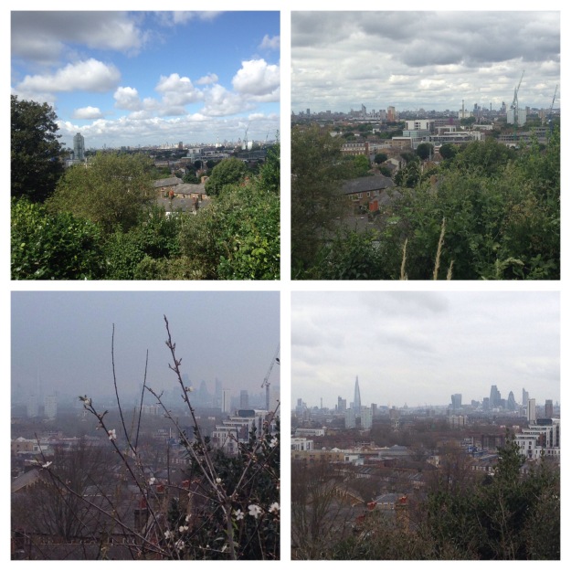
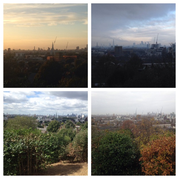
I first discovered the view from The Point on a run in the mid-1990s and have been frequently drawn back, although only started taking photographs a couple of years ago.   The camera can never pick the level of detail of an eye scanning the horizon – the clarity of the view on a frosty autumn morning or after a summer afternoon downpour are hard to replicate, particularly with a smart phone camera with no optical zoom.

Some of the changes would need a much longer time series of photographs to become apparent – most of the larger landmarks of the cities of London and Westminster have appeared in the time that I have been viewing – it is a gradual evolution of the view, almost imperceptible from visit to visit.  Over longer time periods the view has changed more – I bought a 1940s photograph of the view (taken slightly lower down the hill), while fascinating, its slightly blurry image is almost unrecognisable compared with those 70 years later, with considerable bomb damage around Deptford Creek.  Only St Pauls Deptford seems constant – its steeple particularly clear.

img_2875

The middle distance has evolved considerably – the Pepys Estate and other ‘regeneration’ schemes that have brought high specification private housing, but little genuinely affordable social housing, to the riverside and in the process have driven traditional Thames-side activities away from the waterfront.  Deptford Creek, the mouth of the Ravensbourne, around a mile away, is much altered – it is no longer visible but now seems lined with glass and steel, including the  impressive Laban Centre.  The changes are even greater to the north – when I first ‘discovered’ the view, 1 Canada Square was there but little else on the Isle of Dogs, the Barkantine Estate towers on the east of the ’Island’ were still fairly dominant, they are now dwarfed by everything around them.

There are lots of other changes too, which it is easy to forget.   Helpfully the viewpoint has a guide to the view provided by the old Greater London Council, which predated many of the now landmark buildings that dominate the skyline, less helpfully , most of the time those in charge of the grounds maintenance have allowed shrubs to block the view it described although an early January pruning has restored the view.

point3

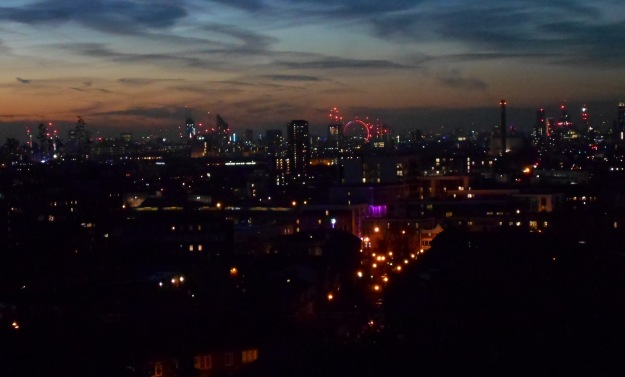
Other changes are more obvious – seasons, weather, cloud cover, pollution levels, times of day and foliage growth.  The seasons make a surprising difference – the winter sun with its much lower angle casts a very different light to its midsummer counterpart – the former is clearer, brighter and crisper but the contrast is greater. My visits are often on a Sunday morning, more recently I have frequently laced up my running shoes in the afternoon. In the summer, I sometimes eschew the Wednesday evening ‘club run’ for a run nearer home – decisions that are often based around the timing of the sunset or the weather.

I only tend to visit in daylight, it is uneven under foot and ill lit at night, although there are exceptions, and rarely when it rains, although where there is a choice I would tend to avoid running in the rain and the phone stays firmly in the pocket.

image

But perhaps that is the key point, I am one of the variables, perhaps the single biggest influence on the series of pictures – it depends on me being there to be captured – it isn’t just the wet days, I may ‘skip’ the loop to The Point if I know the visibility is poor – the clarity of the view towards the spire of Our Ladye Star of the Sea on Crooms Hill from my emergence onto the Heath– is often the bellwether of adjustments to my run.  I also decide on the angle of the photograph, the amount of zoom, while my eye is drawn more towards the horizon, the lens is drawn west-north-west towards the City, towards the glimpses of the River.

image

It Isn’t Far from Lee to Gommecourt ….

The route to the southern edges of Picardy from south-east London is a straightforward one these days; the town of Albert can be reached in around four hours via the Channel Tunnel from Lee or Hither Green.  A variant of the journey was taken by numerous young men just over a century ago

This week sees the centenary of the beginning of the Battle of the Somme on 1 July 1916 and many of those that made that short journey never returned, killed in the initial onslaughts and buried in a foreign field.  The story of the first day has been told numerous times before both factually (such as here) and fictionally, although few more eloquently or poignantly than by Sebastian Faulks who described a scene a day or two before the offensive began:

As they rounded the corner, he saw two dozen men, naked to the waist, digging a hole thirty yards square at the side of the path. For a moment he was baffled. It seemed to have no agricultural purpose; there was no more planting or ploughing to be done. Then he realized what it was. They were digging a mass grave. He thought of shouting an order to about turn or at least to avert their eyes, but they were almost on it, and some of them had already seen their burial place. The songs died on their lips and the air was reclaimed by the birds.

Sebastian Faulks (1994) Birdsong (London, Vintage), p215

The sheer enormity of the scale of human loss becomes obvious when looking at the Commonwealth War Graves Commission website – there are almost 18,000 names of deaths on first day of the battle.

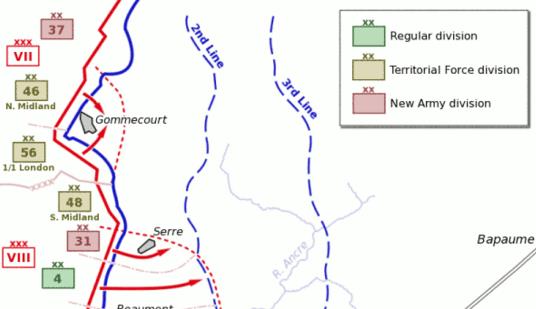
This post focuses on the role of a local regiment – the 56th Division, 1st/5th Battalion of the London Regiment (London Rifle Brigade), they were a ‘City’ Regiment but many of their soldiers were from south east London. Their role that day was essentially a diversionary one to try to divert German troops away from a more significant push further south on the Somme, the secondary aim was to help secure the northern flank around Gommecourt thus pushing the German’s back to positions that would be less easy to defend.

somme wiki

Map Source Wikimedia Commons

Initially the London Regiment met with success and took the first and second German lines, but there was much more resistance from the third line and the British suffered considerable causalities and were driven back to their original lines.  Of the 826 from the regiment at the start of the day 275 were listed as dead by the end of the day on the CWG site.  Just 89 came through the day alive and unwounded.

There were are least a dozen local men who died that day at Gommecourt with the London Rifles.  It is worth reflecting on some of those young south London lives cut short on the first catastrophic day of battle where the worth of the human life seemed to count for so little. They will have climbed out of their trenches at around 7:30, none seen again alive and with most their remains were never identified.

James Frederick Wingfield – 36 Burnt Ash Road

James was a 30 year old Rifleman of the 1st/5th Battalion of the London Regiment (London Rifle Brigade)  He was the oldest of 8 children (in the 1911 census) of son of James Peter and Elizabeth, the former was Company Secretary for a wine merchant.  The family originated in East London, where James had been born in South Hackney and by 1911 were living at 9 Effingham Road; in Civvy street, James was an Accounts Clerk.

In the intervening five years Frederick had married Ada Gertrude Glanville and had moved just around the corner to 32 Burnt Ash Road – her parent’s home – probably close to the postcard depiction below of around that time (source e bay February 2015).

Burnt Ash

There is no known grave for James Wingfield and he is remembered along with 72,194 others at The Thiepval Memorial to the Missing of the Somme to missing British and South African men, who died in the Battles of the Somme of the First World War between 1915 and 1918.  It is just a couple of miles down the road from Gommecourt.  James and another local man who died the same day, 20 year old Arthur Webber from 69 Eltham Road, are also commemorated on the War Memorial at the former St Peter’s Church site.

StPWarMem

© Copyright Stephen Craven and licensed for reuse under this Creative Commons Licence.


Cecil Ravenscroft – 94 Mount Pleasant Road

Cecil was a 19 year-old rifleman born in Chicester in East Sussex in 1896, to Byfleet Charles Ravenscroft who hailed from Worcestershire and Catherine from Swansea.  They seem to have been a family that moved around a lot this oldest brother was born in Lewisham in 1890, but in the following year’s census they were in Ifield in West Susseex (now part of Crawley).  In the 1901 census they were back in Lewisham, although only visiting someone in Brockley Park.  Cecil’s younger brother, Charles was born in Lewisham in 1895.

Cecil’s father died in 1911, before the census was conducted on 2 April.  The family was living at 49 Albacore Crescent and the 14 year old Cecil was working as a clerk, perhaps in the ‘City.’

By the time of Cecil’s death, the remaining members of the family were living at 94 Mount Pleasant Road. He was buried at Hébuterne Military Cemetery, about a kilometre south of Gommecourt.

Hébuterne Cemetery

Picture from CWGC Website which allows reproduction of images and material elsewhere

Frank Dension Chandler – 23 Vanbrugh Park

Corporal Frank Chandler was born in Camberwell in 1893, his parents were Gibbs William and Lizzie Chandler who were from Camberwell and Isle of Dogs respectively – they were living at Liford Road, Camberwell in the 1891 census.  In 1901 the family was still at Lilford Road, Frank was the fourth oldest of the six children of the family, but his mother Lizzie had died in 1898.

some chandlerBy 1911 they had moved to East Dulwich Grove, his father having married Alice from Hamstead in Kent in 1907; by 1916 the family was living at 23 Vanbrugh Park. In Civvy Street Frank (pictured – source here) worked for Lloyds broker’s Nelson Donkin & Company

Like James Wingfield, there is no grave for Frank and he is remembered at Thriepval.


Richard Hopf – 9 Davenport Road

Rifleman Richard Hopf had been born in Catford in 1888, his parents Emilie and Paul were from Germany.  Paul  seems to have died sometime between the 1886 and the 1891 census.  The family was not recorded in the 1901 census but in 1911 Richard was living was his mother and four siblings in Westdown Road in Catford – he is listed as a Counting House Clerk.

In the early stages of the war there were a lot of attacks on German nationals, something that the blog covered in relation to Deptford a couple of years ago, many were deported.  With an English born family, who presumably would have had to stay behind, Emilie remained in Catford.  Several of the family subsequently Anglicised their name to ‘Hope’, including Richard’s older brother, Paul.

Richard Hopf is listed as dead on the CWGC website and was ‘buried’ at the now peaceful looking Gommecourt 2 Cemetery.

image

Returning to the Somme, the initial push on that first terrible day foreshadowed what was to come – there was to be little success at Gommecourt – the OS Trench maps from around the end of the ‘battle’ six months later, show almost no progress from the initial lines.  Gommecourt was still under German control.


GommecourtMap

I will leave the final words about that the catastrophic losses from those initial assaults to someone who has written extensively about the Somme and particularly about Gommecourt, Alan McDonald

The men of the 56th and 46th Divisions had been sacrificed to no end. It was predictable, it was unnecessary, it was criminal.

20140731-173922-63562839.jpg