Tag Archives: Manor House Gardens

The Post Christmas Blitz on Lee Part 1 – 27 December 1940

Apologies if you’ve seen this before – the previous incarnation was partially deleted.
In the autumn of 2020, Running Past covered the attacks of the first night of the Blitz around Lee, Lewisham, Catford and Hither Green 80 years on. Over the next few months there were frequent attacks on the area – the worst night in the old Borough of Lewisham was probably the night of 8 to 9 December 1940. The Air Raid Precautions (ARP) Service Logs (an example of the log is shown below for 29 December 1940) noted for the night of 8-9 December

  • 126 high explosive bombs dropped;
  • 206 incendiary bombs – the number of both incendiary and high explosive bombs was almost certainly understated as the locations rather than numbers were often recorded;
  • 176 fires started – no doubt stretching the Fire Brigade to beyond breaking point;
  • 5 deaths; and
  • 175 injured – this was almost certainly a big understatement as at many locations injuries were ticked rather than having numbers.

However, around Lee some of the worst nights were at the end of December 1940 in two posts we’ll look at the nights 27/28 and 29/30 December where there were two nights of very heavy bombing.

There had been two quiet nights on Christmas Day and Boxing Day 1940, it was the lull before the storm with the night of 27/28 December being one of the heaviest nights of the blitz in Lewisham.

While there were attacks earlier in evening in Brockley, the first attacks on Lee was a series of incendiary bombs which hit at 19:51; one was at 33 Burnt Ash Road – a large house demolished after the war in the large scale demolitions of houses at the end of leases by the Crown Estate. There was no note of damage, but in the LCC Bomb Damage map the house ended the war with general, not structural, blast damage (1).

The other was at Reeds of Lee Green, a long standing drapers and furnishers that dominated the south east quadrant of Lee Green, straddling both Burnt Ash Road and Eltham Road – it was around 50 metres from 33 Burnt Ash Road. There was no damage marked there on the LCC Bomb Damage maps (2).

The final one of trio was at 57 Leyland Road (opposite the present day Alanthus Close) which was dealt with by officers from Lee police station.

Soon after at 20:05, another incendiary bomb was dropped close by in Burnt Ash Road between Southbrook and Micheldever Roads – there was a small fire which was quickly put out though.

There were several attacks on just after 9:00 pm on the then new homes on Upwood Road, (above) 34 and 22 were specifically mentioned but a couple of other incendiaries were reported as well. A hundred metres of so away 73 Leyland Road was hit by another incendiary. The was another dropped on Leyland Road between Dorville and Osberton Road – presumably somewhere around the current Carsten Close. With all of these the fires seem to have been put out by ARP fire wardens.

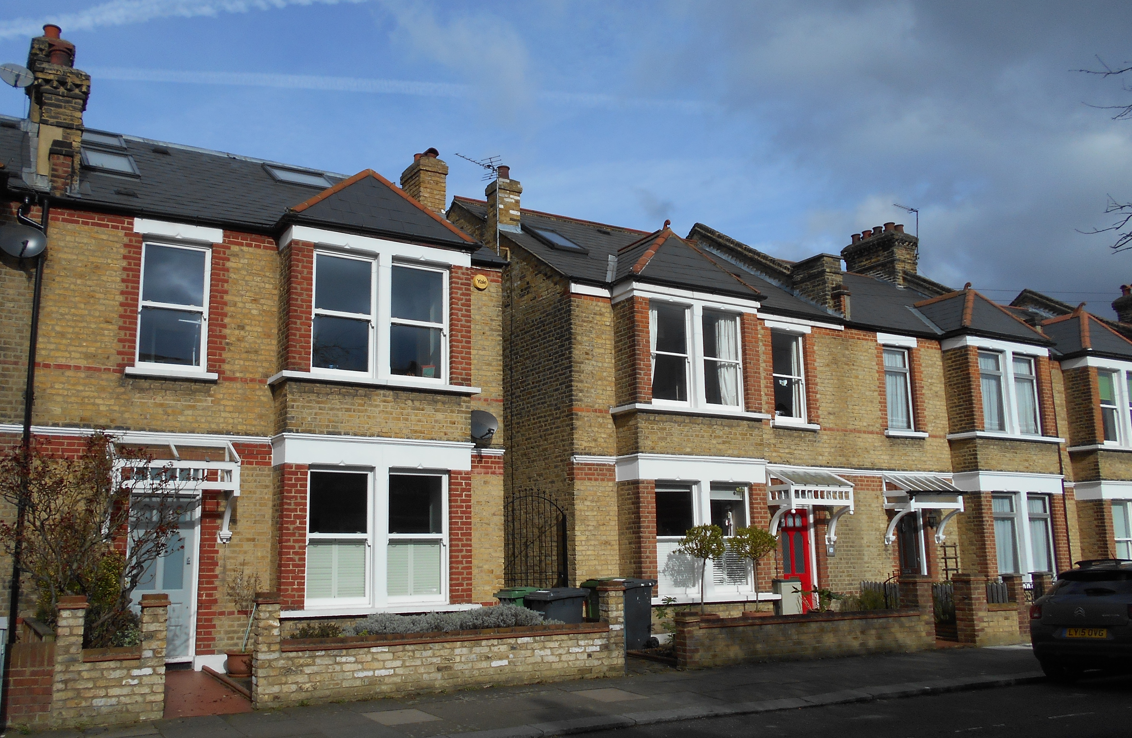
At around 9:12 pm, 41 Dorville Road and 36 Cambridge Drive were hit by incendiaries – as with the others in neighbouring streets they were put out by ARP wardens who had a busy night. The latter is a large surviving Victorian house, the former lost to the large scale redevelopment of Crown Estate land in the 1960s, but will have looked similar to the very different street scene from a few decades before.

At around 9:40 at least five bombs were dropped around Aislibie Road. One was in Manor House Gardens, which was home to three air road shelters. Fortunately the high explosive bomb hit a shrubbery between the shelters with only limited damage. Had there been a direct hit the loss of life could have been considerable as happened at Albion Way in Lewisham town centre on 11 September 1940 where 41 died.

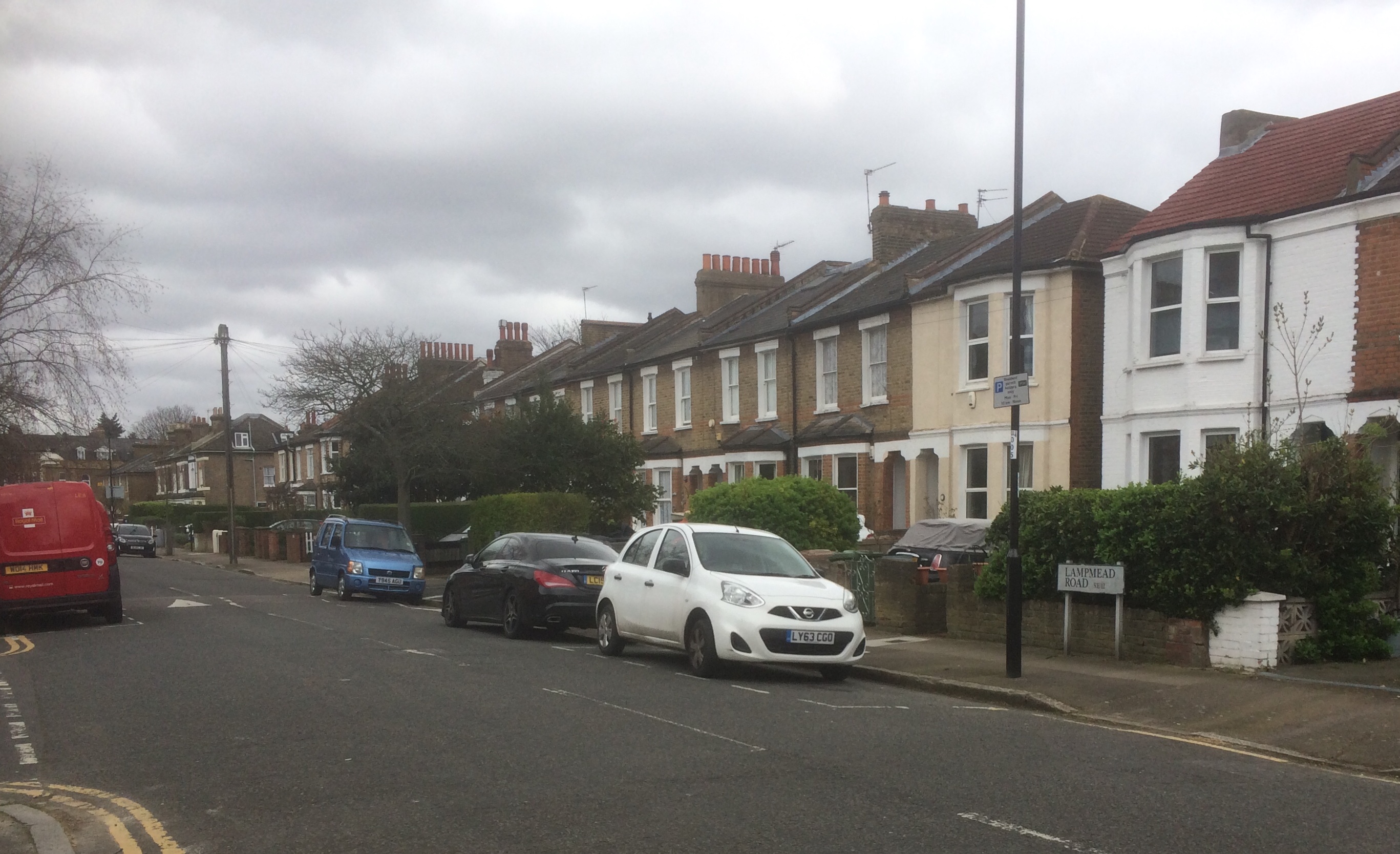
A hundred metres or so away, 14-20 Lampmead Road (between Aislibie and Lenham Roads) were hit. Presumably the impact was in the road as none of the houses was destroyed although the ARP log noted that walls on all of them were cracked. Numbers 18 and 20 have survived but 14 and 16 were destroyed by a V1 flying bomb later in the war – the circle on the map.

More serious damage was around the corner in Aislibie Road with number 50 being hit directly and largely demolished and the houses either side rendered uninhabitable. The shading on the LCC bomb damage maps is incorrect here – the Ordnance Survey map of 1949 notes ‘ruins.’

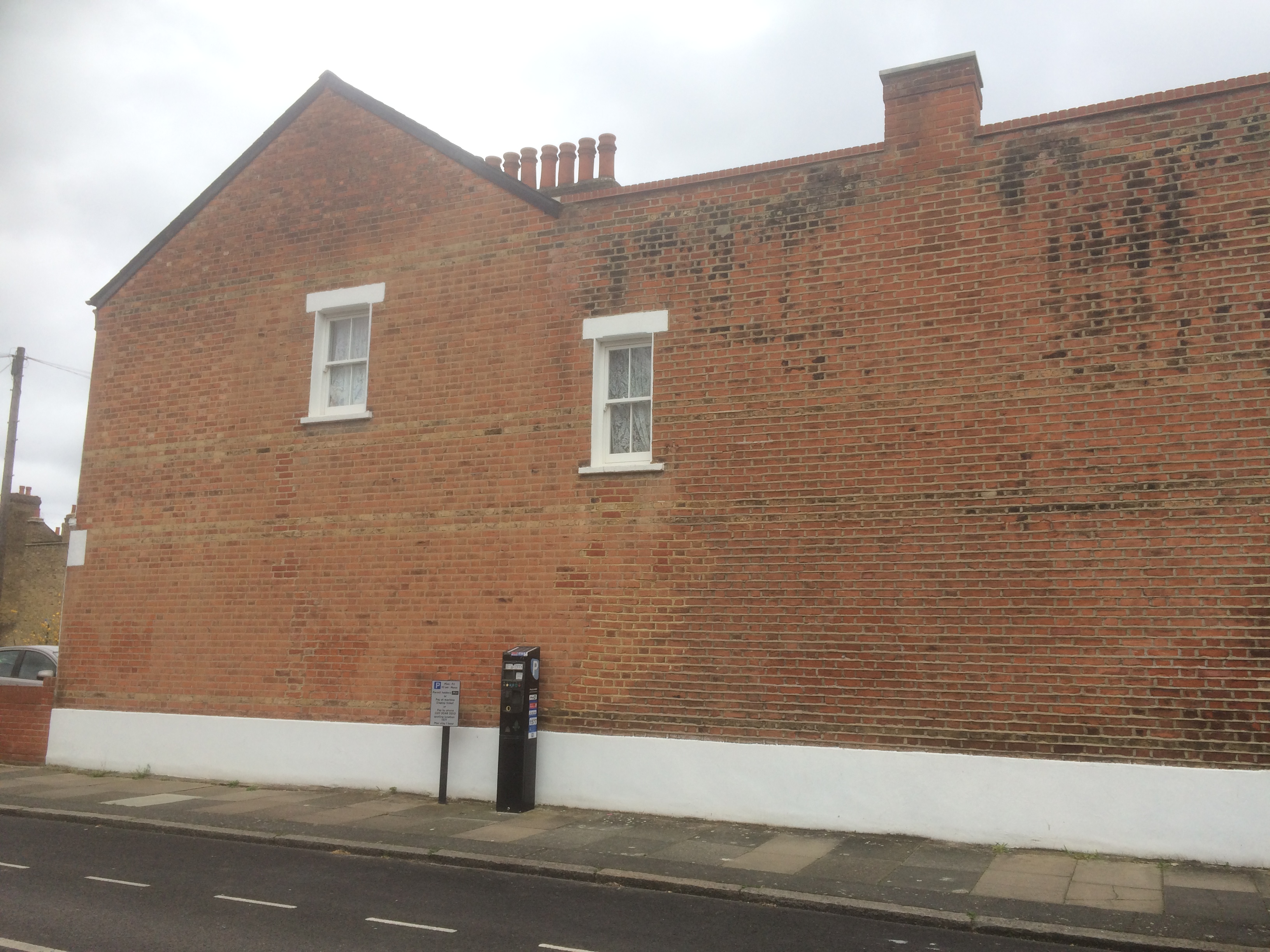
Another bomb hit a few doors up, damaging 38 Aislibie Road- it wasn’t one of the houses destroyed during the war and was marked as blast damage – minor in nature on the LCC bomb damage maps. (3). If there was any serious damage it may have been made good by the end of the war.

In the same attack there was serious damage to the odd side of the road too, 17 to 23 had their chimney stacks knocked of; but 25 to 29 were left in ruins. The site had been cleared by the time the Ordnanace Survey cartographers mapped the area in 1949, but unlike similar small sites, such as Fernbrook Road, wasn’t used for prefabs. Again there were no reports on casualties here.

At around 9:45 there were at least four high explosive bombs dropped in the area around Winn Road area between Guibal Road and Senlac Raod.  The one at 87 Guibal Road failed to explode and the houshold had to be evacuated temporarily while it was made safe. The one at 105 Guibal damaged water, gas and electricity services, with the others not seeming to do much damage other than to gardens.

At 9:55 another high explosive bomb was reported as hitting Manor Lane – 50 was described as being ‘demolished’ and 48 and 52 rendered uninhabitable. Unless these were rebuilt in in exactly the same style as the W J Scudamore originals, it may be that the report was overstated. While there has clearly been some patching of walls, original features seem to remain.

Around 10:00 pm a small explosive bomb hit the old St Margaret’s Churchyard (pictured above) leaving a small crater and several damaged tombstones. A few minutes later there were a couple of incendiary bombs dropped on Lee High Road close to the current Mercator estate – an area that was to be devastated later in the war.

Overall, that night in the old Borough of Lewisham 

  • 97 high explosive were dropped;
  • 112 incendiary bombs fell;
  • 91 fires were started;
  • 3 died;
  • 12 were injured, this is almost certainly an understatement as some just ticked the box rather than entering a number; and
  • 12 were trapped by debris having to be rescued by emergency services.

It wasn’t just Lewisham that was attacked that night, The Times for the following day noted that ‘the raid equaled in intensity, but not duration, some of the heaviest attacks on the capital….from widespread areas came the same report of enemy aircraft flying over almost continuously dropping incendiaries followed by high explosive bombs.’ (4)

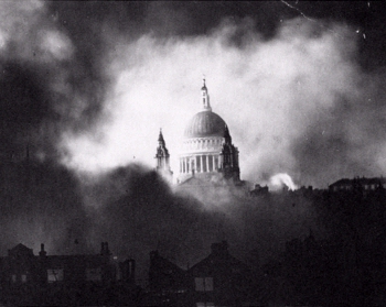
Whilst the following night seems to have seen another lull with defence guns silent (5), the Sunday evening of 29/30 saw the bombers return with in what was described in central London as the Second Great Fire of London but also saw numerous bombs dropped on Lee; we’ll return to this is the second part of the post.

Notes

  1. Laurence Ward (2015) The London County Council Bomb Damage Maps 1939-1945 p116
  2. ibid p116
  3. ibid p185
  4. The Times Saturday December 28 1940
  5. The Times Monday December 30 1940

Credits

  • Most of the information for this post comes from the Lewisham ARP Log – it is a fascinating document, which is part of the collection of Lewisham Archives. It isn’t a complete record – some incidents were reported to the Fire Brigade rather than the APR and some incendiaries were dealt with by residents or Fire Wardens without ever reaching the ARP service – this is particularly the case on busy nights such as this.
  • The map is from the London County Council Bomb Damage Maps, 1939-1945 – permission has been given by the London Metropolitan Archives, the copyright owners of the map, the to use the image here.
  • The photograph of Lee Green and the page of the ARP Log are both from the collection of Lewisham Archives, both are used with permission and remain their copyright.
  • The postcard of Dorville Road is via eBay in December 2019

The Post Christmas Blitz on Lee Part 2 – 29 December 1940

In the first part of this post we looked at the post-Christmas Luftwaffe attacks on 27 December 1940 on Lee which saw numerous bombs dropped and homes destroyed on Aislibie Road, the misspelled road, named after Benjamin Aislabie – slave owner, awful cricketer and tenant of Lee Place.

While there was a lull the following evening, it seems that the Luftwaffe were just gearing up for an even bigger raid on 29 December, the aim of which seems to have been to put the fire services under a level of pressure that they would be unable to cope with and see London burning.

The attacks were much more concentrated in a small number of streets between Lee High Road and and Manor House Gardens. Most were incendiaries, and along with a few high explosive bombs, were dropped in a few minutes around 8:15 pm.

As we found with the post on the first night of the Blitz, it is worth remembering that not every incident was reported to the Air Raid Precautions (ARP), some being just reported to the Fire Brigade but others never going through official channels. One of the pages of incidents for the night of 29/30 December 1940 is show below.

The first attacks of the night in Lee started at around 7:25 pm in Blessingham Road, when a high explosive bomb hit the back garden of number 38. Elsewhere on the street another high explosive bomb injured two people. The street was to be decimated by a series of V-1 flying bombs later in the war and was developed, initially as prefabs, and in the early 1960s, as the Mercator Estate.

Fifty minutes later, Lee was on fire, the ARP logs note several dozen incendiaries being dropped at the same time, so we’ll look at the attack on a street by street basis. Aislibie Road (pictured below) which had suffered badly two nights before, was again hit. It was different houses this evening with 5, 13, 26, 30 and 39 all being bombed with roofs and upper floors damaged by the incendiary bombs, none were destroyed though.

Parallel to Aislibie Road, and the location of a devastating V-1 flying bomb three and a half years later, is Lenham Road which saw 5, 7, 10 and 28 all hit by incendiaries. The fires were successfully dealt with by local ARP and Fire Wardens.

Incendiary bombs rained down on neighbouring Brightfield Road with 32, 34, 42, 43, 49, 63 and 83 all hit by them (some are pictured below) – the fires were put out by wardens and the inhabitants, but many of the roofs were damaged.

Elsewhere in the neighbourhood, the roof and upper floors of 24 Lampmead Road were damaged, as was 4 Hedgley Street. Taunton Road saw at least two attacks – number 60 was slightly damaged and 2 Thornhill Cottages saw its roof damamged. Thornhill Cottages was a terrace at the eastern end of Taunton Road between Burnt Ash Road and Hedgley Street seemingly on the present Sainsbury’s site.

At the opposite end of Manor House Gardens, 2, 44 and 61 Old Road plus Pentland House (pictured below) were all hit but Fire Wardens managed to deal with all four fires.

A little further along Lee High Road, number 345 was hit by another incendiary; ironically it had been a fire station up until 1906 when the one on Eltham Road opened, it is now a solicitors. The roof seems to have been damaged, and assuming that there was no damage on other occasions during the war, a central turret there was destroyed (there is a pre-damage photograph in the post on the fire station).

There was an explosive and incendiary combination dropped on Dacre Park at the same time and there were ‘several .. casualties in the road’ as a result.

Around fifteen minutes later at 8:30, a high explosive bomb hit Lee High Road between Old Road and Lochaber Road – there 5 casualties, including an ARP warden, with shrapnel damage to almshouses’ boundary wall that is still visible (along with a fading direction sign to an air raid shelter). The ARP warden was Henry Cottell of 41 Manor Lane Terrace who was to die later that evening in Lewisham Hospital – it was a house that seems to have been lost to the construction of Wolfram Close. Henry left behind two adult daughters and his wife Ann, who were there when the 1939 Register was collected.

Also at 8:30, Chiesman’s store repository at 87 Old Road was hit by a high explosive and incendiary combination – the ARP log noted that the repository was on fire. We’ll return to this incident later in the post.

One of the ARP Fire wardens for that part of Lee that night was Phyllis Noble (later Willmott), who lived at 49 Lampmead Road with her parents and grandparents. In the aftermath of the incendiaries being dropped, she and her brothers, who were also ARP Wardens, grabbed stirrup pumps, buckets and sandbags. ‘Incendiaries seemed to be everywhere, but so too were numerous fire watchers like ourselves.’ (1)

The first fire they dealt with was at the almshouses that stood at the corner Lampmead and Lee High Roads (pictured above) where a room had caught fire. They put out that and another in the neighbouring Methodist church, now the New Testament Church of God. Phyllis and her brothers spent the next few hours putting out fires in locations that didn’t even get a mention in the ARP log chasing ‘up and down stairs in the tall Victorian houses in the High Road.’ They reached Old Road and Chiesman’s Store depository by around midnight (2)

“As the red glow in the sky told us, there were still plenty of fires raging, including one in the furniture depository nearby. We went along to see if there was anything we could do there; giant tongues of red and gold flames were shooting skywards from the glowing building and clearly this was not work for us, in any case the firemen had already arrived.”

Had the Fire Brigade arrived earlier they may have been able to save 87 Old Road but it was largely destroyed.

Lee was probably only a stopping off place for the Luftwaffe as they headed towards the centre of the city. Later in the evening incendiaries rained down on central London in what was described as the Second Great Fire of London, the iconic picture of St Paul’s Cathedral amidst the smoke was from that night as 160 died and hundreds of buildings were destroyed in the capital.

Notes

  1. Phyllis Willmott (1988) Coming of Age in Wartime p50
  2. ibid

Credits

  • Most of the information for this post comes from the Lewisham ARP Log – it is a fascinating document, which is part of the collection of Lewisham Archives. It isn’t a complete record – some incidents were reported to the Fire Brigade rather than the APR and some incendiaries were dealt with by residents or Fire Wardens without ever reaching the ARP service – this is particularly the case on busy nights such as this.
  • The photograph of St Paul’s is via a Wikipedia Commons
  • The photograph of the Boone’s Almshouses and the page of the ARP Log are both from the collection of Lewisham Archives, both are used with permission and remain their copyright.

The First Night of the Blitz in Lee, Hither Green, Catford and Lewisham

The afternoon of 7 September 1940 saw wartime football matches at the Valley, where Charlton lost 4-2 to Millwall, and a few miles away Crystal Palace beat yet to be rivals Brighton 5-2 in the wartime South Regional Competition.  The almost normality was about to come to a shuddering halt with the first raids of the Blitz, when German bombers came ‘en masse’ on a Saturday afternoon, some up the Thames, some from the south – it was to be the start of eight months heavy bombing of London.

A Heinkel He 111 bomber flying over the Thames at the start of the Luftwaffe’s evening raids of 7 September 1940

One of the waves came over the Surrey hills and were recalled by a then young cyclist

It was the most amazing, impressive, riveting sight …Directly above me were literally hundreds of planes … the sky was full of them. Bombers hemmed in with fighters, like bees around their queen…

Running Past has covered many of the V-1 and V-2 attacks of the second half of the war – including ones in Lewisham High Street, Lewisham Hill, Hither Green Station (pictured below) and Blackheath Village.  On the 80th anniversary of the start of the Blitz it seems appropriate to reflect on what happened that afternoon and into the early hours of the Sunday. We’ll look at that the first night of the Blitz from the perspective of the Lee, Catford and Lewisham areas that Running Past generally focuses on.  Hither Green largely escaped that first night with one significant exception a partial collapse of the railway bridge on Ennersdale Road with 20 injured and several trapped at around 20:25 which was noted in the ARP (Air Raid Precautions) Log.

For many of the other attacks on the area, Running Past has used the ARP log for the old Borough of Lewisham.  However, in the early days of the Blitz the records seemed to be only partial, they seemed to be overwhelmed by incidents. There is better documentation for that first night in the records of the London Fire Brigade which are part of the collection of the Metropolitan Archives.  There were typed official green slips record each incident and a separate bound volume listing all the fires attended.  These were all pulled together for the 70th anniversary and a datasheet published in The Guardian, and elsewhere.  As we shall see though, even these aren’t perfect, serious incidents to homes in Limes Grove, Lewisham Road and Ennersdale Road railway bridge were not included.

The data shows the sheer scale of the attacks on the dockland communities on both sides of the Thames from late afternoon onwards, with a second wave of attacks from around 8:30 pm – seemingly the fires from the first attacks helping guide the Luftwaffe for a renewed onslaught as the natural light faded.  The attacks will have seen Londoners scurrying to their shelters – both household ones and communal ones such as those in Manor House Gardens and lots in the streets around Lewisham High Street.

The first bombs in the area – seemed to have been on Lewisham High Street furniture suppliers, Bolsom Brothers which was ‘severely damaged’ at 16:14 and the same with part of Chiesmans department store six minutes later.

There were a series of reports at 17:55, around Blackheath and Lee with damage to three houses in Brandram Road, including number 30, the original house is no longer there.  The ARP log noted another incident in a similar location around 19:09 but this could well have been the same one.  A couple of bombs failed to explode at the almshouses – given the communal shelter there (pictured below) there could have been a large loss of life had they exploded.

Around 20 minutes later 51-57 Lewisham Hill were hit – the damage noted in the Fire Brigade reports was to contents rather than the structure.  However, they were all marked as badly damaged in the LCC Bomb Damage maps – a mixture of repairable at cost, damaged beyond repair and completely destroyed, so either the Fire Brigade reports were incorrect or they were hit again either later in the Blitz or during the sporadic attacks that preceded the V-1 flying bombs – one of which caused enormous damage a little further down the Hill.  53 (the Victorian house and 55-57 are pictured below)

Bombers returned to Brandram Road at 18.31 with damage to 1, 2 and 4 although fortunately not the adjacent church – the worst damage seems to have been to a garage at number 2.

The second wave of attacks started from around 8:30 pm, and for the first few hours Lee, Catford, Hither Green and Lewisham were ignored with the much of the firepower being targeted on Lambeth, Southwark and Wandsworth areas.  By around 10:30 though dockland areas were re-targeted and half an hour later bombs started falling on Catford and Lee.

At 11:00 pm here was some limited damage to 34 Winn Road, part on an estate built by Wates just before the war; with an incendiary bomb being dropped on a nearby field in Alnwick Road. Around the same time an incendiary bomb fell in the street on Glenton Road, seemingly outside Holy Trinity Church – the extensive damage to the church was to come later in the Blitz. A bit further south ‘slight damage’ was recorded to 31-37 Abernethy Road, part of the late Victorian Firs Estate (top picture below).

The bombers returned to the skies above Abernethy Road around 11:45 pm, possibly ‘guided’ by a fire from the previous attack – the Fire Brigade report suggested that four houses of 41-47 were ‘severely damaged.’ As that numbering didn’t exist – in reality, these were almost certainly houses on Manor Lane Terrace about 30 metres away (lower picture above).  The damage to 31-37 seems much more serious than recorded and both groups of houses had been demolished by 1949. Neither site seemed to have been big enough for prefabs and the Victorian housing was replaced with council homes in the 1950s or 1960s.

In the early hours of Sunday morning the Luftwaffe turned some of their attention to Catford and the streets to the south of Brownhill Road.  The first attacks were at 0:18 and 0:20 on 141 Braidwood and 129 Killearn Roads, both suffered roof damage from an incendiary bomb – any sign of which was hidden behind a replaced roof and rendering.  At around the same time another incendiary hit a shed at Sandhurst Road School – the target of a much worse attack in early 1943 and there was some damage to 54 Laleham Road from another incendiary.

Twenty seven minutes past midnight saw an explosive bomb hit Jutland Road with seventeen houses damaged, several seriously – while some of the houses were repairable others weren’t with three houses being rebuilt (see below) – not in the style of the immediate post-war council housing so, presumably, private sector housing.

There was slight roof damage, now not obvious, from incendiary bombs to 86 Torridon and 91 Ardgowan Roads (the latter may have been hit twice as there was another report for it at 1:10 am) at the same time with some damage to fences to a couple of houses in Fordel Road. A few minutes afterwards saw the front bedroom of 127 Minard Road ‘severely damaged.’  The house was rebuilt well, with no obvious damage visible from the outside.

In between these attacks there had been an explosive bomb dropped on Sportsbank Street, which still had the stand for the former velodrome being used as warehousing, which damaged three houses, and ‘severely damaged’ three others – probably at the Laleham Road end.  The homes were rebuilt as council housing after the war (see below).

A few minutes earlier, at 138 Engleheart Road had been hit by an explosive bomb leaving two houses destroyed and two damaged beyond repair.  At 140 Ellen Moseley (37) was injured and died later in Lewisham Hospital – she was living in Hythe in Kent in 1939.  Again the homes were rebuilt post war.

Not every incident was recorded, and this was the case with the two in Lewisham where there was the biggest loss of life in the first night of the Blitz. The first of these was the bombing of 159 Lewisham Road (opposite Connington Road) where five died. Neville (20), Gwendoline (19) and Hilda Osborne (16) along with Charles Smith (23) and Christine Smith (nee Osborne – 24) who had married a few weeks before the bombing. They were all living at 213 Algernon Road in 1939 – Gwendoline  was a Photographic Clerk and Hilda an accounts assistant. Charles Smith was a Mechanical Engineering Draughtsman at the War Office as well as being in the Home Guard.

Despite the deaths and probable large amount of damage, the house (pictured above) was probably repaired during the war – it was marked on the LCC Bomb Damage Maps as orange – ‘general blast damage, not structural.’

The second unrecorded incident leading to significant loss of life was about half a mile further south; it seems that at some point during the night that 43 and 45 Limes Grove was hit. At 43 (the left of the houses below), Mayhew Edith Spedding died aged 56; she was the wife of George Spedding who was First Mate on a ship. In the 1939 Register she was listed there with George and what seem to have either been a couple of lodgers or it was a shared flat. It was a house that was split into two flats. Edith was badly injured in the bombing and later died at Lewisham Hospital.

Next door at 45, which was also two flats, lived the Bennions; both Edith Bennion (53) and her son William Arthur Bennion (18) were badly injured in the explosion, and like Mayhew next door, died later in hospital. They were survived by William Henry Bennion a mail porter and a school age daughter, also called Edith.

Lewisham had got off lightly compared with other areas, 11 deaths from the 430 who perished on that first night.  The all clear was sounded at around 5:00 am on the Sunday morning.  The respite was short though bombers arrived again over London the following night and did so every day/night for about two months and off and on for eight months.  Catford, Lee and Hither Green weren’t attacked every night but there will be more posts on the Blitz over the next few months.

The bombings changed the urban landscape, not as dramatically as they did in areas around the Thames, but most streets in the area have bits of post-war council housing amidst the Victorian terraces.  Most will tell a story of a family displaced and possibly injuries and deaths as a result.

Credits

Most of the information for this post comes from four sources:

The football results are from The Times of 9 September 1940.

Picture Credits

  • The Merchant Taylors’ Almshouses air raid shelter is from the collection of Lewisham Archives, it is used with their permission and remains their copyright;
  • The Heinkel He 111 bomber flying over the Thames is from Wikipedia and is on a Creative Commons
  • The Hither Green Station V-1 photograph part of the Imperial War Museum collection (produced here on a Creative Commons)
  • The rest are copyright of the author and are usable elsewhere, attributed, on a non-commercial basis.


VE Day in Lee and Hither Green

Friday 8 May 2020 sees the 75th anniversary of Victory in Europe, VE, Day and would have been celebrated both locally and nationally if these were normal times – it was to be one of the themes of the 2020 Hither Green Festival – maybe this will be re-visited later in the year.  We’ll look at what happened that day in 1945 with a local perspective.

After Berlin was surrounded by Allied forces and Hitler committed suicide on 30 April 1945, the end of the war was quite rapid.  A week later, on 7 May 1945 Germany accepted an unconditional surrender of German Forces in most of the areas that they still occupied in the Netherlands and northwest Germany and the surrender came into effect the following day.  A further surrender document was signed with the Russians on 8 May.

Running Past has covered many of the areas of the Home Front in recent months (for the 70th anniversary of war breaking out); the winding down of the Home Front was rapid in early May – public air raid shelters were closed down, as was the air raid warning system and plans were made for the return of evacuee children and mothers by the end of May (1).

Over a million people took to the streets on 8 May in celebration throughout Great Britain to mark the end of the European part of the war.  Many massed in central London, particularly in Trafalgar Square and up the Mall to Buckingham Palace as featured in the video footage (the sound levels are a bit variable, so beware!)

Many celebrated locally though; South Park Crescent (above and below) had been built as part of the Verdant Lane estate in the early 1930s and was the scene of a large party.  No doubt the celebrations were tempered there though by memories of 5 children from there and neighbouring streets who were amongst 38 children and 5 teachers who died at Sandhurst Road School.  There had also been a V-1 flying bomb that hit the junction of South Park and Further Green Road less than a year before at 16:48 on 12 July 1944 which injured 15 (3) –  several houses were destroyed and lots damaged – perhaps including the roofs of those pictured below).

In and around Hither Green, there were several other street parties including ones in The Woodlands and neighbouring Blashford Street.

Lee too saw several street parties, mainly in the working class streets.  Taunton Road had seen a lot of damage in the Blitz with several lives lost.  There was a posed picture probably taken close to the park entrance, the road in the background is Wantage Road.

Just around the corner in Brightfield Road (below) there was another street party in the part of the street that was built by John Pound and had originally been called Robertson Street.  As can be seen from the photograph, the party wasn’t  held there until early June 1945. 

Brightfield Road had seen some damage from the V-1 flying bomb that hit the junction of Lenham and Lampmead Roads.  In addition, there was Blitz damage to houses close to the bridge over the Quaggy, with several destroyed and several seriously damaged; along with three houses on the southern side of the bend which were damaged beyond repair (3).  The houses destroyed in Brightfield Road were never rebuilt, a new entrance to Manor House Gardens was created in their stead and those damaged beyond repair suffered a similar fate – they were to become an entrance to, what became after the war, Northbrook School and is now Holy Trinity

The street scene is now markedly different – the attractive bank buildings at the end of the street were lost after the war either to Penfold’s or Sainsbury’s expansion – more on the building another day, as there is an interesting story behind it.

While there were dozens of parties, as Lewis Blake noted, ‘for all the public display, it may be assumed that a majority of people stayed quietly at home.’ (4)

In addition to the celebration of the end of hostilities, there will have been a relief that bombing and rocket attacks were over – roads like Springbank, Taunton and Aislibie Roads had been badly affected by the Blitz, with V-1s hitting lots of local streets – including Nightingale Grove, (pictured below) Fernbrook Road, between Springbank and Wellmeadow Roads along with Leahurst Road, and as we’ve mentioned the Lenham/Lampmead junction.

A couple of days after VE Day, Lewisham was visited by the King and Queen who stopped in a packed town centre to survey the damage caused by the V-1 flying bomb from 10 months before (it’s at about 4:10 into the film, which is sadly silent).

Other than the rebuilding which was to continue for the best part of 20 years, the other element of wartime privations that was to linger on for almost another decade was rationing, which didn’t officially end for meat until 1954.

If you have personal or family local VE Day memories, please do post them either in the Facebook thread you reached this post from or in the comments below, if you haven’t commented here before, it may take a few hours for your comment to be approved.  I will hopefully add some of the comments into the main post.

In early May 2020 we don’t have the potential for street parties, but oddly, despite the lock down, we are probably contacting and seeing more of our neighbours than any of the generations since the end of World War Two. Every Thursday evening with the #ClapforCareWorkers most of our small street come out to clap and bang pots and pans; if we are typical, people often stay out in the street to chat, keeping social distancing, of course.  Neighbours are checking in with each other by phone with shopping bought for those having to stay at home.  Perhaps, for now at least, this is the World War Two type spirit we should embrace and celebrate, the parties will have to wait.

Notes

  1. Lewis Blake (1995) How We Went To War – Deptford & Lewisham 1939 -1945 p62
  2. From ARP Logs held at Lewisham Archives
  3. Laurence Ward (2015) The London County Council Bomb Damage Maps 1939-1945 p119
  4. Blake, op cit p66

Credits and Thanks

  • Thank you to Andy Wakeman and Clive Andrews for allowing the use of their family photographs of the South Park Road party – the photographs remain their families’ copyright;
  • The photgrpahs of Brightfield Road and Taunton Road are part of the collection of the Lewisham Archives, they are used with their permission and remain their copyright;
  • The photograph of the destruction on Nightingale Grove is from the collection of the Imperial War Museum – it is used here on a Non-Commercial Licence

Preparation for World War Two – Going Underground

At the time of the anniversary of evacuation Running Past, started to look at some of the preparations for war on the ‘Home Front’ with Lewisham children being evacuated to Kent then Surrey.  We return now to some of the preparations that were made to try to keep the civilian population that remained in Lewisham as safe as possible from the air attacks that were expected soon after war broke out – looking here at air raid shelters.

In theory, planning had started just after World War 1 with the setting up of the Air Raid Precautions Committee in 1924.  As regular readers of Running Past will recall, there had been devastating air raids during World War 1 on both Glenview Road in Hither Green with a Zeppelin attack (above), and with a Gotha airplane attack on Sydenham Road which also bombed the area around Staplehurst Road and Hither Green Station. However, little progress had been made because of the apparently irreconcilable conflict between the need to send the public underground for shelter from air attack but the need to keep them above ground for in the event of gas attacks.  The latter had been expected as a result of gas attacks during World War 1.

During the Munich Crisis of September 1938 the Government instructed local authorities to start building trench air raid shelters with precast concrete walls which were then covered.  They became a permanent feature in the lead up to war.

There were a series of public shelters in Lewisham High Street under the planted area that ran down most of the market (see above from a couple of decades before World War 2) – they had to cope with day time raids when the town centre would be busy (1). One of these was to be hit by a V-1 flying bomb in July 1944. There were also large public shelters opposite Lewisham Hospital and in the grounds of Robertson’s Golden Shred works on Bromley Road (2).

Running Past covered a couple of the Lee shelters that were located in Manor House Gardens – one in the Ice House, and the other seemingly under the grass almost next to it – the likely outline appeared in the drought of 2018.  A third was under the lawn in front of Manor House Library was mentioned in passing in the Lewisham ARP log (3).

A large one was also constructed in the grounds of Merchant Taylors’ almshouses (above), although it isn’t clear whether this was just for the inhabitants of the almshouses or for wider use.  There is a ‘ghost sign’ on the external wall to the almshouses on the corner of Brandram and Lee High Roads – although it has faded and it isn’t certain whether it is pointing to Manor House Gardens or the almshouses.

Some local streets also had communal shelters too – one is shown at the back of a photograph of a VE Day street party in Taunton Road in Lee.

The public shelters were not bomb-proof and many people were killed in direct hits – this included one on the Albion Way shelter in Lewisham where 41 people died on 11 September 1940.  There was another street air raid shelter in the next road – Mercia Grove.  Memories of which were included on the BBC website around the 50th anniversary of VE Day – which was described

At the bottom of the stairs there were four bays. Each bay had a wooden slatted seat at either side, along its length. …We soon made the shelter comfortable, with rugs for the floor and a paraffin stove for warmth and to boil a kettle. We slept on the floor and on the benches. After a while, bunks were installed. These served as seats during the day when it was a public shelter and at night we were issued shelter tickets and a designated bunk number. .. Soon there was a sink installed and a small portable oven, for which we paid a small rental fee. When the blitz was at its height we went down at 6.30 after the evening meal, until the all clear, or until it was time to get ready to go to work the next day. On the long summer evenings (double British summertime) we played gramophone records in the street and danced to the music, when all was quiet, no Jerry’s above.

Other locations too were used as air raid shelters, including underneath railway arches, such as those in Ladywell which, like its Lee counterparts, had a painted sign showing the way to it which still survives above it.

Below, a probably more permanent one than was possible under the arches in Ladywell is pictured from elsewhere in SE London. There were also railway arch shelters at Plough Bridge (sheltering 40, close to Lewisham Station); Morley Road (95) and Catford Hill (105) (4).


Elsewhere in London tube stations were used, but this clearly wasn’t an option in south east London. Initially cellars and basements of larger houses, churches and factories were also used but their use brought with it dangers of collapse of the building above with heavy masonry or machinery coming through from higher floors.   A few buildings built just ahead of World War Two were built with air raid shelters, such as one in East Sheen, covered in the excellent Flickering Lamps blog.

One of the stranger public shelters used by Lee and Hither Green residents involved catching a train to Chislehurst to shelter in the caves; even when London had been free of attacks for a couple of months in July 1941, 2,000 still sheltered there every night (5).

Not all air raid shelters were communal ones, it wasn’t always feasible for people to quickly get to the public ones, so individual household ones were developed – Anderson shelters (below) which were external and the internal Morrison ones.

Anderson shelters were named after Sir John Anderson, who was the Government Minister responsible for air-raid precautions prior to the outbreak of World War II.  They were made from 14 galvanised steel panels bolted together and were 1.8 m high, 2 metres long and 1.4 metres wide, and were buried 1.2 metres deep and then covered with 40 centimetres of soil.  They ‘housed’ six and were issued free to all householders who earned less than £5 a week, which was most people in areas such as Lewisham; those with a higher income were charged £7 for them.  In Lewisham around 23,000 were issued – so about 192,000 could be accommodated (6).

Running Past visited a partially fictional Anderson shelter on the Brockley/New Cross borders when looking at one of the early works of one of Lewisham’s best known authors – David Lodge’s Out of The Shelter.

While they performed well apart from dealing with direct hits, as they were buried in the ground they tended to be cold and damp, not the place to spend lots of consecutive nights – something common at the height of the German Bombing campaign.  The level of waterlogging led some Lewisham families to go back to the original advice and hide under the stairs.

My former next door neighbours  Jack (actually George) and Doris had an Anderson Shelter in their garden which was still dug into its original place by his first wife’s parents; while the soil covering of the roof was removed, they used it as a shed until they died in the late 1990s.  This was not uncommon – while local authorities collected the shelters as scrap many hung on to them, with several memories of playing in them in and around Lewisham into the 1960s.

Morrison Shelters were indoor shelters which, in theory at least, could be used as tables between air raids.  They were named after the Minister of Home Security at the time that they were first issued – Herbert Morrison, who was to become Labour MP for Lewisham South in the 1945 General Election.

Pictured below, they were effectively a cage 2 metres, by 1.2 metres and 0.75 metres high with a steel plate top and mesh sides. They had to be assembled IKEA-like by the household, with tools supplied.  Like the Anderson Shelters, they were provided free to low income households.  Around 500,000 were distributed during the Blitz with a further 100,000 ahead of V-1 attacks.  They were much more effective than the Anderson Shelters in preventing protecting households even withstanding some direct hits.

In posts in the not too distant future we will look at other World War 2 preparations on the Home Front – gas masks, warning sirens, the Women’s Voluntary Services and the Air Raid Precautions (ARP) wardens.

Notes

  1. Lewis Blake (1995) How We Went To War – Deptford & Lewisham 1939 – 1945 p41
  2. ibid p42
  3. The ARP log for Lewisham is a fragile document that lists (virtually) all the attacks, property by property, raid by raid – we will come back to this in future posts.
  4. Blake op cit p43
  5. ibid p43
  6. ibid p41


Picture credits


Old Road & Beyond – A Walk Through Some of Lee’s Past

The area bordering Manor House Gardens has a rich and interesting history which Running Past has written numerous posts about.  This post was written to ‘accompany’ a walk organised as part of the 2019 Manor House Gardens Festival, it can be used to independently to walk the route (it’s a circuit of around a mile, which can be found here) or as virtual tour of the area.  The ‘walk’ is divided into sections which relate to the planned stopping points – each of which is full of links to other posts in the blog which will have more detailed information.

Some Background

Before it was enveloped by the city Lee was a village, a village with three centres – Lee Green, the area around St Margaret’s Church and Old Road, as John Rocque’s map from 1746 shows.

Lee remained largely rural until mid-19th century until the coming of the railways – Blackheath & Lewisham stations opened in 1849, Lee in 1866 and Hither Green not until mid-1890s (it was just a junction before that).

The mid-1860s Ordnance Survey map above shows how little development there was beyond Lee Green and to the south of Old Road; farms remained until the 1920s and 1930s, such as Burnt Ash and Horn Park.

The Manor House

Old Road was once home to a series of large houses, starting from the eastern end these were Lee House, The Cedars, Lee Place, the Manor House, Pentland House and The Firs – geography played an important part, it is on a small hill which would have offered impressive views to the east and south but were high enough to protect from flooding from the Quaggy and the now diverted Mid Kid Brook, which used to flow down Lee High Road.

Lee Place

The first of the country houses was Lee Place; Its building was the result of the death of Lord of the Manor, Brian Annesley who had a moated farm probably where St Margaret’s Lee School is now situated.  His later years are believed to at least partially inspired Shakespeare to write King Lear – there was happier ending than in the play though.  The estate split up on his death.

Lee Place (above) probably built by/for George Thompson – had links to the slave trade but is better known as a soldier and MP during the Commonwealth brother of Maurice who lived at Lee Farm. It was the home to the Boone family (it was their family chapel) for several generations but was let out from the mid-18th century.  Its last tenant was Benjamin Aislabie.

The estate was sold in 1824 as still has an impact on the current landscape as it was broken up into relatively small lots which were developed at different times.  It allowed too the straightening of Lee High Road – the straightened bit was known as New Road for several decades

The Manor House

Lee Farm was previously on the site, which moved to what is now the junction of Baring and St Mildred’s Roads in 1727 and became Burnt Ash Farm. The former farm was bought initially by the slave trading brother of George Thomson, Maurice and then by William Coleman who sought to re-create the lands of the old Manor for his nephew,Thomas Lucas, both were ‘merchants’ with strong links to the slave trade.

The Grade II listed Manor House was built on the site of the farm in 1770 by Richard Jupp for Lucas.  It was bought by Sir Francis Baring in early 19th century, whose family wealth also had its origins in the slave trade – used it as their near London base – the merchant on the maroon plaque is depressingly vague. The Northbrooks let in out during much of the 19th century

They sold the house as a library and grounds to the London County Council in 1898 opening to the public in 1902.  The Northbrooks owned much of Lee and their gradual selling off of their ‘estate’ in the latter part of the 19th century which shaped the current urban landscape.

Pentland House

Pentland House was built in early 1790s and is probably the oldest residential building in Lewisham – it is a close run thing with St Mary’s Vicarage though!  It has been added to considerably and rendered in the early 19th century when extended.

It was home to the rich, but not that significant Smith family, who sold to some more Smiths, who sold to some more Smiths (albeit with a prefix) – it became a Goldsmiths’ College hall in 1913 which stayed until the early 2000s.  It is currently a largely backpackers hostel.

Flats & Houses Opposite

The houses and flats opposite are a bit less grand – Bankwell Road & adjoining bits of Old Road – completed in 1908, possibly by James Watt – it was the central of three plots of land bounded by Lee High Road and Old Road – as the 1890s Ordnance Survey maps below shows.

The eastern of the plots are Arts & Crafts style flats which are a bit out of kilter with rest of area.  The land they were built on had been part of Lee Place – the house itself was on this part.  The land was bought as an orchard and kitchen garden for Pentland House with the flats & Market Terrace on Lee High Road built in the mid-1930s.

Before moving on worth reflecting on the library, the park and indirectly the rest of the current urban landscape was paid for by the slave labour in the plantations of the Caribbean owned or traded by those that lived here and over the road.

On the way to Lochaber Hall at the first house on Manor Lane Terrace look at the wall – the remains of a sign pointing towards air raid shelters in Manor House Gardens (more on that later).

Lochaber Hall, the Firs, Holy Trinity

Lochaber Hall

If think Lochaber Hall looks like a church hall you’d be right, it was originally church hall for Holy Trinity in Glenton Road (pictured below).  The church was destroyed in the Blitz and is now Callaghan Close (almost opposite the Telephone Exchange) and named after the 1970s Prime Minister who lived in Blackheath.

The Hall was designed by Ernest Newton, a locally renowned architect and President of RIBA, he also designed St Swithuns, the original Church of Good Shepherd and Baring Hall at Grove Park. Slightly surprisingly it is Grade II listed. Immediately after World War Two it was used as a hall for the Church of the Good Shepherd as that church was largely destroyed in a fire & the congregation was using the adjacent hall as the church.

The Firs Estate

The Firs was another of the large country houses of Lee, it was a large red-brick house which was a built around 1700 as the ‘town’ residence for the Papillion’s, a prominent Huguenot banking family – it stayed in the family’s ownership for a century.  The last owner from the mid-1860s was John Wingfield Larkin, a member of a wealthy Kent family who had been a merchant in Egypt and British consul in Alexandria between 1838 and 1841.  The family sold up on his death as the city encroached in 1893.

It was developed as Murillo, Old, Rembrandt & Lochaber Roads by the end of 19th century.  It is not certain who the builder/developer was – although is a stained glass for Siderys on Murillo Road – who were prominent builders in the area.

The houses on the corner of Manor Lane Terrace and Abernethy were largely destroyed on the 1st night of the blitz.  27 Murillo Road was home to one of the more prominent Lewisham suffragettes – Caroline Townsend.

Lee Manor Farm

This was originally at the Manor House, moved to what is now the junction of St Mildred’s Road and was renamed Burnt Ash Farm in 1727; that farm was split in the early 19th century and new farm buildings constructed opposite The Firs (close to the current junction of Manor Lane Terrace and Manor Lane).  It didn’t stay the farm house that long and we’ll return to it at our next stop.

Junction of Manor Lane Terrace & Kellerton Road

Manor Park Estate

We are in the land of W J Scudamore here and along with John Pound are probably the two firms of builders that most influenced the area – buying land from the Northbrooks. W J Scudamore were based on Manor Lane (corner of Handen Road) then Lee High Road (part of Sainsbury’s site) and latterly on Holme Lacey Road in Lee and active in Lee, Hither Green and later elsewhere from the 1890s until the 1930s.

The Manor Park Estate (as the roads around here were originally referred to as) was built for a mixture of rent and sale – sale prices were £265 or£275 for the bigger ones – it was 1906…!

They definitely also built

  • Shops on Manor Lane (eastern side)
  • Newstead Road
  • Some of St Mildred’s Road
  • Holme Lacey & Dalinger Roads
  • Several small sections of Leahurst, Longhurst and Fernbrook Roads
  • Probably lots of others too

Wolfram Close

On the site of the last location of the Lee Manor Farm (pictured below) – the land farmed was to the south of here.  The farmhouse seems to have been sold with the land for the Manor Park Estate and became a home for the Scudamore family who remained there until 1961.

The site was redeveloped in the 1960s or early 1970s, it isn’t clear whether this was by Scudamores, as they went into liquidation in 1966. It is presumably named after the last occupant of the Manor House – Henry Wolffram from Stuttgart who ran a ‘crammer’ school for would-be army officers – the spelling of his name is incorrect though – the cul de sac as one ‘F’ the name two ‘Fs’.

The council estate behind Cordwell Road – is named after one of the last farmers of the farm.


Manor House Gardens

The park was created in the early 1770s as gardens for the Manor House until 1898 when the Northbrooks sold up to the London County Council (LCC), which as with Mountsfield Park on the Hither Green and Catford borders wanted to ensure that the newly developing suburbia had parks and libraries provided. The Gardens had been left in a poor state by last occupant (Henry Wolffram) and didn’t open to the public until 1902.

Source –  eBay Feb 2016

It contains a rather impressive Ice House which was used as an air raid shelter in World War Two; there were a couple of other ones too, the outline of one of them was visible in the parched grass in the hot weather of 2018.

The Gardens have been ‘listed’ since 1987 and underwent a major refurbishment in 2000.  The small lake has been part of grounds for most of its post agricultural life.  The River Quaggy flows through the Gardens, it used to be at a higher level but the bed was  excavated partially to reduce flooding – probably in the 1880s.

Behind the library, there are two little bits of Catford – foundation stones for the now demolished St Laurence Church and the original Town Hall.

Lenham Road/Lammead Road Corner

If we were standing here in the 1870s we would be in or next to the River Quaggy as there was a meander that originally came up to this point. It was straightened in 1880s both to allow development but possibly too as flood prevention measure – there were really bad floods in 1878.

Most of housing on Lenham, Lampmead (and Aislibie that will walk up) Roads dates from late 1880s when Lee House (more on that later) was demolished and the land sold for development. It was slightly different on the other side of the river – Robertson Street, now Brightfield Road probably dates from the late 1850s or early 1860s.

The houses at the corner are very different – early 1960s council housing as opposed to late Victorian.  This was because early in the morning of 22 June 1944 a V-1 flying bomb hit the corner, killing 6.  There was a lot of Blitz damage on Lenham Road as well as on Aislibie Road where there are several bits of infill council housing from the late 1950s or early 1960s.

49 Lampmead (above) was home to Phyllis Noble who was to become Phyllis Willmott and wrote a 3 part autobiography about growing up in Lee in the 1920s and 30s – this has been covered a few times – including in relation to the Sunday Constitutional and children’s play.

Almsot opposite, at the junction with Aislibie Road in 2016 a house had Blitz type damage as a result of badly executed building work.

Lee Centre

Lee House & Centre

This was originally the site of Lee House, a medieval mansion that was rebuilt in the 1820s probably partially as a result of the re-alignment of Old Road, it is pictured below. However, by the 1880s it no longer met the needs of the wealthy Victorian gent as city encroached with the railways.

Lee Centre was built on the site in the 1880s – initially it was home to a few clubs, including a chess club. But it was never developed uses that befitted its impressive architecture by World War 2 it had effectively become used for storage and nurse appointments; it was used for education from 1970s and more recently by various charities.

Next door was built as St Margaret’s Parish Rooms, long before Kingswood Halls were built; it was also home to school for many years before becoming offices and warehouses for stationery supplier and then a toy merchant.  It has been a nursery for the last decade or so.

Chiesmans’ Warehouse

In a former incarnation this was home to the teetotal Lee Working Men’s Institution, it was taken over as a depot for the Lewisham Department Store, Chiesmans who rebuilt it around 1914 – it was almost completely destroyed in during the Blitz before being rebuilt on same footprint for Chiesmans in mid 1950s.  After some slightly less than legitimate activities it is slowly being converted into flats.

The Cedars

Was situated on what is now the opposite corner of Aislbie Road, it was another large house – the estate was broken up and mostly sold at the same time as Lee House.  The house itself remained until the 1890s before being sold for development – hence the housing at the north-western corner of Aislibie Road is different to the rest of the street.  The street itself was named after, although spelled incorrectly, the slave owner and terrible cricketer Benjamin Aislabie – the last tenant of Lee Place.


Manor House Gardens (Old Road entrance)

This is next door to 36 Old Road, this was part of the estate of The Cedars.  Post development the site was used for many years as stables for Thomas Tilling’s horse drawn buses and then as a workshop by the firm afterwards.  It went through several uses afterwards – the sweet makers Whitehouse and Co from 1929; John Edgington and Co Marquee Manufacturers who latterly made floats for the Lord Mayors Show were there from 1949 (including some of those below) and then Penfolds used it as a crash repair workshop from the late 1980s until around 2010.  Development into flats started a few years later but has been paused for a couple of years.


Picture Credits

  • John Rocque’s 18th century map is from the information board at Lee Green
  • The Ordnance Survey map from the 1860s is on a Creative Commons via the National Library of Scotland
  • The picture of Lee Place comes from the information board opposite St Margaret’s Church
  • The picture of Holy Trinity Glenton Road is via Wikipedia Commons – originally from Illustrated London News
  • The photograph of The Firs is from the information board on Brandram Road, opposite St Margaret’s church.
  • The drawing of Lee Manor Farm is part of the collection of Lewisham Archives, it remains their copyright and is used with their permission
  • The 1890s Ordnance Survey map is courtesy of the National Library of Scotland on a Creative Commons.
  • The pair of Ordnance Survey maps from  1863 (top) and 1893 are on a Creative Commons via National Library of Scotland
  • The sale plan of Lee House is part of the collection of Lewisham Archives, it remains their copyright and is used with their permission
  • The picture of Benjamin Aislabie is on a Creative Commons via one of Lewisham Archives sites 

Children’s Play in Lee Between the Wars

A while ago Running Past delved into the first volume of the autobiography of Phyllis Willmott who grew up in Lampmead Road in Lee, looking at the Sunday Constitutional that she and her siblings went on with the adult male members of her extended family. We return to ‘Growing Up in a London Village,’ to explore her recollections of play around 90 years ago.

Memoirs like this from the period are rare, as Willmott herself noted ‘(Working class) families seldom write letters; they do no keep diaries or publish books;’ traditions were oral (1).

The house at 49 Lampmead Road was overcrowded by modern standards, although as noted in the posts on Ardmere Road, for working class families in the late 19th and early 20th centuries in the area, this was not uncommon. It was rented by Phyllis grandparents who had the large front bedroom as well two uncles and a cousin who shared the rear living room. Phyllis mother and father, Harriet and Alec, shared the smaller second floor bedroom – with Phyllis and her brother and sister top to tail in a single bed (2). Unsurprisingly, unless weather prevented it, play was usually outside (or at least that’s what her memories were…)

Skipping games with old clothes lines were common and could often become the entire focus of play for weeks on end to the exclusion of almost everything else, but would then be quickly abandoned (3). Hopscotch would be marked out on the pavement, which was the venue for marbles too. There would be paper chases up and down Lampmead Road and into the road itself with cars a rarity (4).

Seasonal ‘standards’ included conkers in the autumn and a season later, winter warmer. The latter involved keeping lit rags smouldering in a pierced cocoa can (5) – it isn’t clear whether the children were able to purloin any methylated spirit or other accelerant to aid the burning.

In summer holidays the children of Lampmead, Brightfield and neighbouring streets would have a ‘fair’ against the wall of the end house which faced Brightfield Road (below); the house was occupied by the irritable Mrs French. They sold sweets made by mothers, posies of flowers from gardens, swapped possessions they no longer wanted – dolls clothes, toy soldiers and the like. It lasted about a week (6).

The wall was used for other games too – one involved cigarette cards being were propped up against it, others would attempt knock the cards down by flicking their own cards at them. Any card(s) knocked down were the spoils of victory for the flicker, but all cards standing would mean the loss of the the flicked card. Spirits rose and fell with the winning and loss of cards. (7)

Ball games were played against that long flank wall to the terrace too, it had enough length to support up to 4 games at once. The reverberations no doubt drove Mrs French to despair – often shooing the children away (8).

There were a couple of dozen children of a primary school age that played out in the street (9) so perhaps Mrs French’s interventions were not surprising. Street play was safe though, unlike now, cars were a rarity in the neighbourhood apart from those on Lee High Road. Much of the rest of traffic on the streets was horse drawn or the hand pulled barrow of the type that her father used for building work. The streets ‘belonged’ to the children and other pedestrians (10).

While the back garden was very much her grandfather’s domain, the children were allowed to play there too – a favourite was racing snails found in the lilac along the wooden benches he had made. The only condition was that he made Phyllis and her siblings clear up the trails from the seats. (11)

Source EBay Feb 2016 Source eBay Feb 2016

The children seemed to have a lot of freedom to wander from an early age and a frequent destination was Manor House Gardens, which had only been open for 25 years when Phyllis made her first forays there. There was then a shop in the park, the Old Road end of the cafe which sold sweets, tea and cakes. Next to it was a covered shelter (now part of the cafe, behind what is now the outside seating) – often where they ended up when weather was poor (12). The playground at Mountsfield Park was preferred to that in Manor House Gardens (it isn’t clear what existed in Manor House Gardens at that stage – large scale maps only note the tennis courts in front of the Manor House & where the football ‘cage’ currently is.)  However, there were gangs from neighbouring areas at Mountsfield Park so it was less popular (13).

As the children got older they were allowed to venture further afield, literally to a field – next to the Little Quaggy in Mottingham – ‘camping’ by the still clear stream – fishing and paddling there and on spring trips out there, jam jars would be filled with frogspawn (14). The Sidcup by-pass had just been built, and then it was home to Express Dairy cattle, now it is riding school land with lorries thundering past.

And finally… when her Dad was in work, trips to the Imperial Picture Palace were made on Saturday mornings, it was opposite where her grandmother had grown up near Lee Green (15).

Notes

  1. Phyllis Willmott (1979) Growing Up in a London Village p6
  2. ibid p12
  3. ibid p35
  4. ibid p36
  5. ibid p36
  6. ibid p37
  7. ibid p37
  8. ibid p37
  9. ibid p31
  10. ibid p177
  11. ibid p60
  12. ibid p106
  13. ibid p109
  14. ibid p110
  15. ibid p118


Following the Quaggy – Lee Green to Hocum Pocum Lane

We left the Quaggy close to Lee Green with a Lewisham Natureman stag ‘grazing’ by the outflow of Mid Kid Brook, before that Running Past has followed the Quaggy from its sources around Locksbottom; then on through Petts Wood, the Hawkwood Estate, Chislehurst and Bickley, through the golf courses of Sundridge Park and on to Chinbrook Meadows; through the concrete and countryside of Mottingham; and latterly through the playing fields and parkland of Sutcliffe Park and the Lee/Blackheath borders.

The river changes here; gone now are the almost bucolic feel of the river through the playing fields and parkland in the section of the river from Sutcliffe Park to Lee Green. The Quaggy is now very much an urban river, with building up to the banks and the route downstream for the fluvial flâneur often parallel with the river only visible on bridges.

Riverside pubs have been conspicuous by their absence so far, but are a much more regular feature as we follow the last mile or so of the course.  The Old Tiger’s Head, 50 metres or so away from the river, was the base for the mid 1840s horse racing of the Lee Races. Lee Green was still rural then, complete with a green, a windmill and a farm – Lee Green Farm. The pub was very different then, being rebuilt in the 1890s, as the picture above from an information board at Lee Green shows.
The Quaggy squeezes between some 1990s flats and a plot of land that was Victorian housing and will presumably be returned to housing again; it was latterly the showroom of Penfolds Vauxhall dealers, after they moved from the former Lee Picture Palace on the corner of Bankwell Road.  The river, for a short period, is again banked and bedded in concrete – little is able to grow but that didn’t stop a few optimistic sticklebacks from attempting to eke out an existence in a hostile environment (below, top left) when I did the research for the post.

The Quaggy emerges out into the open at what used to be called Lee Green Bridge and the first proper riverside pub, the Duke of Edinburgh, still serving and with a pleasant garden at the rear.  The pub dates from around 1871 when the landlord, a Mr W Baker, took over licence of the Black Horse, which was a short-lived ‘beer house’ that may have been on the same site (1)

The river forms the rear boundary between homes in Lampmead and Brightfield Roads – the former named after a field. The course wasn’t always thus, the Quaggy originally took a course further to the north touching the southern end of what is now Lenham Road.  The differences are clear between the 1863 (top map below) and 1893 visits of the Ordnance Survey Cartographers (maps on a Creative Commons via National Library of Scotland). The effective development of Lampmead required the straightening of the river, following what was previously a path behind the houses of Robertson Street, which was to become Brightfield Road at around the same time.  The curved building (above, top right and bottom) hugs the banks of the river.
The Quaggy is bridged by the dog-leg of Brightfield Road before tumbling down into Manor House Gardens.  The Gardens are one of Lewisham’s flagship parks and were the grounds to a large house built and maintained from the proceeds of slavery until bought by the London County Council as a library and park in 1902.

Source – eBay Feb 2016

The Quaggy seems to have originally fed the small lake although is now at a much lower level.  It is bridged a couple of times within the park, both having been the venues for generations of Pooh Sticks, no doubt played before the game was named in the 1920s by A A Milne.
The river has natural earth banks topped with a dense tree canopy throughout its 400 metres or so through the park, during the summer the river is heavily shaded.  The steep banks make the river relatively inaccessible through the park.
Flowing out of Manor House Gardens, the river crosses Manor Lane, an old farm track and again forms a boundary – between the WJ Scudamore homes of Thornwood Road, a Lewisham Council sheltered scheme off Manor Lane and later more Scudamore homes on Manor Park.  This was a largely rural area until Hither Green station was build in the 1890s, there was a junction there from the 1860s, as the 1870 map below  on a Creative Commons from the National Library of Scotland) shows. This part of Lee was still used for market gardening, mainly run from Manor Farm, until the Scudamores built homes of what was marketed as the Manor Park Estate..
Over the other side of Manor Park the river turns almost 90 degrees, to flow between more gardens, between Manor Park and Longhurst Road, briefly visible by peering around a bridge on one side of Staplehurst Road – close to the shops posted about earlier in 2017.  Just before the bridge the river is joined by one of its tributaries, Hither Green Ditch (Quaggy Hither Green).
The river continues northwards, squeezing between the gardens of Manor Park (the street) and the northern end of Longhurst Road before opening out into Manor Park (the park rather than the street).  The park’s rejuvenation has been covered before in Running Past, the former small pig farm has gone from one of Lewisham’s worst bits of open space to one of its best.  The Park has become a community hub – centred around the Arts Cafe.  The river itself is used much more – including the annual Quaggy Duck Race and the Float Your Boats event in June 2017, pictured below.
The Quaggy itself while having a ‘natural’ feel at the end of the back gardens of Leahurst Road, was concrete encased and hidden from the park on  the opposite bank.   Flooding used to be common in this area – in the mid-1960s, the then MP for the area Chris Chataway described residents as living ‘in fear of this wretched stream.
At the edge of the Park, there is a bridge – while the structure is a new one, the crossing an old one – it was the final section of Hocum Pocum Lane – an ancient path from Lee High Road to St Mary’s Church, and possibly beyond.
We’ll leave the Quaggy here for its final section to its confluence with the Ravensbourne in Lewisham.
Notes
  1. Ken White (1992) ‘The Public Houses of Lee and Lewisham’ Part 6a, p134

James Brooker and the Old Lewisham Town Hall

Hidden away under trees in the corner of Manor House Gardens, close to the library, is a large block of masonry carved in a way reminiscent of Victorian graves – it is clearly a foundation stone, one of a trio of similar stones in the same area.

image

Unless James Brooker was very busy on 27 July 1874, it is the foundation stone of the old Lewisham Town Hall. It was initially created as the Vestry Hall for Lewisham and Penge, becoming the Town Hall after local government re-organisation in 1899.

The building was ceremonially opened a year and a day later on 28 July 1875 at a cost  of about £11,000 which was shared 2/3rd to be paid by Lewisham and 1/3rd by Penge based upon their respective rateable values.

Source ebay March 2016

Source ebay March 2016

So who was the James Brooker?  He had been born in 1803 in Newington or Walworth (depending on the census) then in Surrey.  He married Ann and they  had stayed around Newington; all their 9 children seem to have been born around there and in 1841 he was living in Gloucester Place.

By 1851 he had moved to Forest Hill, and listed as a ‘master builder’.  He was elected to the Lewisham Board of Works from its formation in 1856, chairing it from 1857 and also representing the District on the Metropolitan Board of Works.  He carried out a variety of other civic roles including Poor Law Guardian.

In the 1861 census he was listed as living in Brockley Park and a decade on he was living in St German’s Road. The foundation stone from 1874 and a few other on line references to him on-line have him back at Brockley Park.

He lived until 1877 and at his funeral he was fondly remembered in terms of his public service

The natural independence of character and integrity of character possessed by Mr. Brooker, coupled with his urbanity and impartiality as chairman, endeared him the respect and esteem of all with whom he was associated, whilst his public spirit and devotion rendered his life and services very valuable to the public generally of this district.

He was buried on the Lewisham side of Brockley and Ladywell Cemetery where the work of, perhaps, the same monumental mason as the foundation stone recalls his life in now fading detail.

image

The Town Hall was in rather grand Gothic Revival style and its architect was George Elkington, who was born in Bermondsey in 1824.  He was described as ‘Architect to the Lewisham Board of Works’ at the time of the design.

image

Photo source Creative Commons – source here

He seems to have moved on to a similar role in his home borough, designing a similar grand vestry hall for the Bermondsey Board in 1879.  It too is no more, it was demolished in 1963 following WW2 bombing.  There is some video footage of this at around 45 seconds in on the YouTube video below, which was one of a trio made on the work of the council in the early 1930s.  Running Past has touched on some of this in a post of Solarium Court and the Salters (the other two videos are embedded there).

The only known building of his that survives is the Leather Hide and Wool Exchange, also in Bermondsey which remained active until 1912.   His other legacy is Southwark Park – he produced the initial plans for it, although in the end more modest proposals were adopted.

He later seems to have had his own south London practice, with his son, also George who continued it after his father’s death in 1897..

The builders were Higgs, Hill and Hill was  who were based in Vauxhall – they had been formed by a merger the year the foundation stone was laid, so it would have been one of their first major projects.  The initial ‘Higgs’ was dropped a few years later when one of the founders retired.  They continued in business until 1996 when they were taken over by a Dutch construction firm.

There is video footage of the Town Hall from the 1920s when Hither Green channel swimmer, Hilda ‘Laddie’ Sharp  when she was greeted by the deputy Mayor following her successful swim, covered here in Running Past. The video has not been uploaded onto YouTube so cannot be embedded in WordPress but can be watched here.

Just as local government re-organisation had seen the extension of the Town Hall at the end of the 19th century, the old Town Hall and the neighbouring St Laurence Church, were demolished in 1968 to provide a more modern Town Hall for the new, expanded London Borough of Lewisham.  This was despite the involvement of Sir John Betjeman in a campaign against their demise – a picture from which is shown below.

Betjeman

Source Creative Commons via Wikipedia, here

Of the two other stones, one is rather weathered and the lettering unclear to the naked eye. The other marks an event in 1857, presumably another unveiling, by Marian Legge, wife of the Reverend Henry Legge.  It doesn’t seem to relate to the Manor House, despite its prominent location at the rear, its date wouldn’t obviously link it to any of the ‘lost’ churches of the immediate area or even St Laurence Catford  – all were a little earlier or later.  So if anyone can through any light on this it would be much appreciated.

Legge was Vicar of Lewisham between 1831 and 1879, he was no humble rural parson – the fifteenth child of George Legge, 3rd Earl of Dartmouth, one of the major Lewisham landowners of the era. George Legge was patrons of the ‘living’ so it was a ‘job for the boys’, well one of his anyway.


Lee Manor House – The Years Before the Library

Last week’s post looked at the early days of the Manor House, particularly its links to the slave trade.

While the ownership of the house remained in the Baring Family until the House became a library, it wasn’t their residence for much of the final century of their ownership. They had bought Stratton Park in Hampshire in 1801 – the estate included the village of Micheldever, hence the link to the Lee street name.

image

The first tenant of the Barings seems to have been Frederick Perkins, whom F H Hart describes as an ‘opulent brewer’. Frederick Perkins father, John, had been Chief Clerk to the owner of the Anchor Brewery, Henry Thrale. The brewery was put up for auction in 1781 when Thrale died and bought for £135,000 by Robert Barclay, of the banking family, who seems to have seen the brewery as an investment and needed some industry knowledge. So he kept Perkins on, making him a partner. John Perkins died in a freak accident at Brighton Racecourse – being kicked in the head by a horse in 1812.

His son, Frederick Perkins, was born in 1777, he and his brother Henry were each given half of the eighth share in the brewery sometime around1805, Frederick seems not to have taken much interest in the brewery, seemingly being content to live off the income from his valuable share. He spent large amounts of money collecting books. When he moved out of the Manor House in the 1830s, the brewery was producing around 330,000 barrels a year – it was probably the biggest brewery in London.

As for the brewery, it continued on the South Bank, close to the current Globe Theatre, as Barclay Perkins, until 1955 when it merged with rival London brewer Courage.  Courage rationalised their operations, demolished the buildings and sold the site in the early 1970s.

The Barings returned to the Manor House at the end of Perkins’ lease, the House being used by Sir Francis Thornhill Baring, the 1st Baron Northbrook (from 1866), who was Chancellor of the Exchequer from 1839 to 1841 – possibly whilst he was using Lee as a close-to-London base. He was the grandson of the original Sir Francis. Francis’ father would have still owned the house at that stage, it didn’t pass onto Sir Francis Thornhill Baring until 1848 when his father died.

image
From information board next to Boone’s Chapel

How long Sir Francis stayed at the Manor House is unclear, he may have moved back to Stratton Park when his father died. Whenever he moved out though, it is worth looking at the final two occupants as they are both interesting in their own right. The penultimate occupants were the Farnalls who seemed to have moved there at some stage in the late 1850s. Harry (Henry) had been born in Clifton in Gloucestershire he has been described as

an example of that extraordinary Victorian ideal, the gentleman civil servant defending the patrician notion of a generous, caring state in the absence of any very firm evidence that the state was routinely either of those things.

He seems to have come from a military family and had a privileged education taking him to Downing College Cambridge, via Brasenose College Oxford and Charterhouse.

His married soon after leaving Cambridge, although by the time he had moved to Lee he was in a second marriage; his new wife, Rhoda, came from Sandford, near Weston Super Mare. Before arriving in Lee, they lived in Sandal Magna, now part of Wakefield in Yorkshire, where the three children living at home in later censuses were all born.

Farnall was a Local Government Board inspector, there are several reports written by him or mentioning him, including poor law in South Wales (presumably before he moved to Yorkshire) and health reports on the North West, where he was a Poor Law Insepctor – this included being sent by Parliament to report on the Lancashire Cotton Famine.  The family’s arrival in Lee presumably coincided with him becoming the Metropolitan Inspector for the Poor Law Board.

Along with Florence Nightingale, Farnall instituted the first enquiries into the quality of nursing in workhouse infirmaries, having previously been criticised for his ‘blindness’ to this;  he was also later criticised for his ‘light inspection’ of the notorious Bethanl Green Workhouse.

He had a sudden fall from grace after falling out with Gathorne Hardy, later Lord Cranbrook, who was President of the Poor Law Board, and he was ‘transferred unceremoniously to Grantham’ where he was responsible for more mundane elements of public health. The family remained in Lee though.

Harry Farnell was also heavily involved in the 3rd Company of the Kent Volunteer Rifles; they were set up in 1859 and were to become part of the Territorial Army in the 20th century. He was made Captain in November 1859 and was promoted to Lieutenant Colonel in 1863. He received a sliver bugle from ladies of Blackheath and Lee to recognise his work in 1860 in front of the Manor House.

The family moved to Wingfield House which was attached to The Firs (covered before in the blog) between 1871 and 1881 – probably around the time of his retirement and/or the end of a lease. Harry died in 1883, the rest of the family seem to have remained at Wingfield House until it, along with The Firs, was demolished in the early 1890s to make way for the new housing on Old, Abernethy and Lochaber Roads. The family moved out of the area – by the 1901 census his widow Rhoda is listed as living in Chelsea.

By 1881 the Manor House was home to the Military ‘crammer’ School run by Henry Wolffram which was designed to prepare young men for the entrance examinations for the Army. The 1881 census lists 21 pupils along with a resident tutor, a housekeeper and a cook. Henry Wolffram was born in Stuttgart in Germany had been in Britain for a while. He had married Anne from Surrey and in the 1871 census he was running some sort of education establishment in Greenwich – it had two Swiss boarders. There is a small photo of the school in front of a now demolished extension of the House in 1884.

Wolffram’s name is remembered by a small cul-de-sac off Manor Lane Terrace, located roughtly where the final home of Manor Farm was. As with Aislibie Road, the spelling is incorrect and is given as ‘Wolfram’.

Source - EBay Feb 2016
Source – EBay Feb 2016

Earl of Northbrook sold the Manor House and estate to the London County Council for £8,835 in 1898, worth a little more now given the increase in London land values. The previous tenants had left it in a poor state of repair, the LCC describing the House and Gardens as being in a ‘somewhat neglected condition’ . The House became a Library and the gardens a public Park opening in May 1902.

Source EBay Feb 2016

The House itself is listed, along with the wall forming the boundary with Pentland House to the west, the entrance gate posts and the telephone kiosk in front.

image

Finally, it is important to remember the history covered in the first part of the story of the Manor House – it is worth repeating the final paragraph of that post;

If you are a current Lee, Hither Green or Lewisham resident, next time you use the park, the library or just walk or travel past and admire Richard Jupp’s fantastic architecture, please at least pause to remember the ‘dark heritage’, to remember the lives of those transported 5,000 miles from New Calabar to injustice and misery in the Leeward Islands, and to remember that it was the enforced and unpaid toil of slaves that largely paid for what you are looking at. If you live somewhere else, something similar may well apply to your local ‘country house’ too.

Note

All the census and related data came via Find My Past