Tag Archives: James Watt Catford builder

Old Road & Beyond – A Walk Through Some of Lee’s Past

The area bordering Manor House Gardens has a rich and interesting history which Running Past has written numerous posts about.  This post was written to ‘accompany’ a walk organised as part of the 2019 Manor House Gardens Festival, it can be used to independently to walk the route (it’s a circuit of around a mile, which can be found here) or as virtual tour of the area.  The ‘walk’ is divided into sections which relate to the planned stopping points – each of which is full of links to other posts in the blog which will have more detailed information.

Some Background

Before it was enveloped by the city Lee was a village, a village with three centres – Lee Green, the area around St Margaret’s Church and Old Road, as John Rocque’s map from 1746 shows.

Lee remained largely rural until mid-19th century until the coming of the railways – Blackheath & Lewisham stations opened in 1849, Lee in 1866 and Hither Green not until mid-1890s (it was just a junction before that).

The mid-1860s Ordnance Survey map above shows how little development there was beyond Lee Green and to the south of Old Road; farms remained until the 1920s and 1930s, such as Burnt Ash and Horn Park.

The Manor House

Old Road was once home to a series of large houses, starting from the eastern end these were Lee House, The Cedars, Lee Place, the Manor House, Pentland House and The Firs – geography played an important part, it is on a small hill which would have offered impressive views to the east and south but were high enough to protect from flooding from the Quaggy and the now diverted Mid Kid Brook, which used to flow down Lee High Road.

Lee Place

The first of the country houses was Lee Place; Its building was the result of the death of Lord of the Manor, Brian Annesley who had a moated farm probably where St Margaret’s Lee School is now situated.  His later years are believed to at least partially inspired Shakespeare to write King Lear – there was happier ending than in the play though.  The estate split up on his death.

Lee Place (above) probably built by/for George Thompson – had links to the slave trade but is better known as a soldier and MP during the Commonwealth brother of Maurice who lived at Lee Farm. It was the home to the Boone family (it was their family chapel) for several generations but was let out from the mid-18th century.  Its last tenant was Benjamin Aislabie.

The estate was sold in 1824 as still has an impact on the current landscape as it was broken up into relatively small lots which were developed at different times.  It allowed too the straightening of Lee High Road – the straightened bit was known as New Road for several decades

The Manor House

Lee Farm was previously on the site, which moved to what is now the junction of Baring and St Mildred’s Roads in 1727 and became Burnt Ash Farm. The former farm was bought initially by the slave trading brother of George Thomson, Maurice and then by William Coleman who sought to re-create the lands of the old Manor for his nephew,Thomas Lucas, both were ‘merchants’ with strong links to the slave trade.

The Grade II listed Manor House was built on the site of the farm in 1770 by Richard Jupp for Lucas.  It was bought by Sir Francis Baring in early 19th century, whose family wealth also had its origins in the slave trade – used it as their near London base – the merchant on the maroon plaque is depressingly vague. The Northbrooks let in out during much of the 19th century

They sold the house as a library and grounds to the London County Council in 1898 opening to the public in 1902.  The Northbrooks owned much of Lee and their gradual selling off of their ‘estate’ in the latter part of the 19th century which shaped the current urban landscape.

Pentland House

Pentland House was built in early 1790s and is probably the oldest residential building in Lewisham – it is a close run thing with St Mary’s Vicarage though!  It has been added to considerably and rendered in the early 19th century when extended.

It was home to the rich, but not that significant Smith family, who sold to some more Smiths, who sold to some more Smiths (albeit with a prefix) – it became a Goldsmiths’ College hall in 1913 which stayed until the early 2000s.  It is currently a largely backpackers hostel.

Flats & Houses Opposite

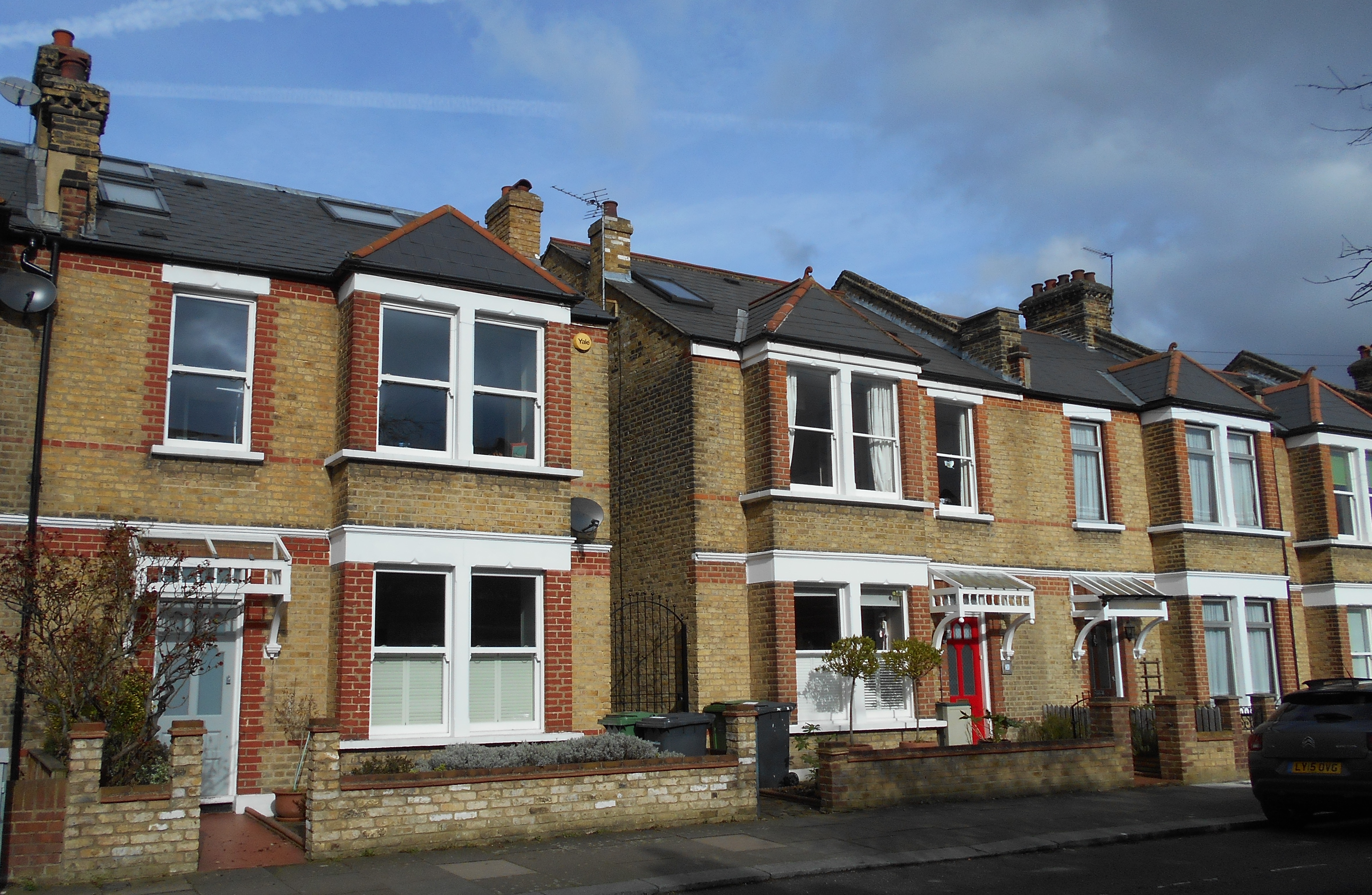
The houses and flats opposite are a bit less grand – Bankwell Road & adjoining bits of Old Road – completed in 1908, possibly by James Watt – it was the central of three plots of land bounded by Lee High Road and Old Road – as the 1890s Ordnance Survey maps below shows.

The eastern of the plots are Arts & Crafts style flats which are a bit out of kilter with rest of area.  The land they were built on had been part of Lee Place – the house itself was on this part.  The land was bought as an orchard and kitchen garden for Pentland House with the flats & Market Terrace on Lee High Road built in the mid-1930s.

Before moving on worth reflecting on the library, the park and indirectly the rest of the current urban landscape was paid for by the slave labour in the plantations of the Caribbean owned or traded by those that lived here and over the road.

On the way to Lochaber Hall at the first house on Manor Lane Terrace look at the wall – the remains of a sign pointing towards air raid shelters in Manor House Gardens (more on that later).

Lochaber Hall, the Firs, Holy Trinity

Lochaber Hall

If think Lochaber Hall looks like a church hall you’d be right, it was originally church hall for Holy Trinity in Glenton Road (pictured below).  The church was destroyed in the Blitz and is now Callaghan Close (almost opposite the Telephone Exchange) and named after the 1970s Prime Minister who lived in Blackheath.

The Hall was designed by Ernest Newton, a locally renowned architect and President of RIBA, he also designed St Swithuns, the original Church of Good Shepherd and Baring Hall at Grove Park. Slightly surprisingly it is Grade II listed. Immediately after World War Two it was used as a hall for the Church of the Good Shepherd as that church was largely destroyed in a fire & the congregation was using the adjacent hall as the church.

The Firs Estate

The Firs was another of the large country houses of Lee, it was a large red-brick house which was a built around 1700 as the ‘town’ residence for the Papillion’s, a prominent Huguenot banking family – it stayed in the family’s ownership for a century.  The last owner from the mid-1860s was John Wingfield Larkin, a member of a wealthy Kent family who had been a merchant in Egypt and British consul in Alexandria between 1838 and 1841.  The family sold up on his death as the city encroached in 1893.

It was developed as Murillo, Old, Rembrandt & Lochaber Roads by the end of 19th century.  It is not certain who the builder/developer was – although is a stained glass for Siderys on Murillo Road – who were prominent builders in the area.

The houses on the corner of Manor Lane Terrace and Abernethy were largely destroyed on the 1st night of the blitz.  27 Murillo Road was home to one of the more prominent Lewisham suffragettes – Caroline Townsend.

Lee Manor Farm

This was originally at the Manor House, moved to what is now the junction of St Mildred’s Road and was renamed Burnt Ash Farm in 1727; that farm was split in the early 19th century and new farm buildings constructed opposite The Firs (close to the current junction of Manor Lane Terrace and Manor Lane).  It didn’t stay the farm house that long and we’ll return to it at our next stop.

Junction of Manor Lane Terrace & Kellerton Road

Manor Park Estate

We are in the land of W J Scudamore here and along with John Pound are probably the two firms of builders that most influenced the area – buying land from the Northbrooks. W J Scudamore were based on Manor Lane (corner of Handen Road) then Lee High Road (part of Sainsbury’s site) and latterly on Holme Lacey Road in Lee and active in Lee, Hither Green and later elsewhere from the 1890s until the 1930s.

The Manor Park Estate (as the roads around here were originally referred to as) was built for a mixture of rent and sale – sale prices were £265 or£275 for the bigger ones – it was 1906…!

They definitely also built

  • Shops on Manor Lane (eastern side)
  • Newstead Road
  • Some of St Mildred’s Road
  • Holme Lacey & Dalinger Roads
  • Several small sections of Leahurst, Longhurst and Fernbrook Roads
  • Probably lots of others too

Wolfram Close

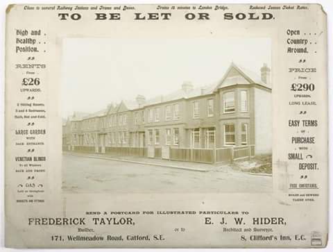
On the site of the last location of the Lee Manor Farm (pictured below) – the land farmed was to the south of here.  The farmhouse seems to have been sold with the land for the Manor Park Estate and became a home for the Scudamore family who remained there until 1961.

The site was redeveloped in the 1960s or early 1970s, it isn’t clear whether this was by Scudamores, as they went into liquidation in 1966. It is presumably named after the last occupant of the Manor House – Henry Wolffram from Stuttgart who ran a ‘crammer’ school for would-be army officers – the spelling of his name is incorrect though – the cul de sac as one ‘F’ the name two ‘Fs’.

The council estate behind Cordwell Road – is named after one of the last farmers of the farm.


Manor House Gardens

The park was created in the early 1770s as gardens for the Manor House until 1898 when the Northbrooks sold up to the London County Council (LCC), which as with Mountsfield Park on the Hither Green and Catford borders wanted to ensure that the newly developing suburbia had parks and libraries provided. The Gardens had been left in a poor state by last occupant (Henry Wolffram) and didn’t open to the public until 1902.

Source –  eBay Feb 2016

It contains a rather impressive Ice House which was used as an air raid shelter in World War Two; there were a couple of other ones too, the outline of one of them was visible in the parched grass in the hot weather of 2018.

The Gardens have been ‘listed’ since 1987 and underwent a major refurbishment in 2000.  The small lake has been part of grounds for most of its post agricultural life.  The River Quaggy flows through the Gardens, it used to be at a higher level but the bed was  excavated partially to reduce flooding – probably in the 1880s.

Behind the library, there are two little bits of Catford – foundation stones for the now demolished St Laurence Church and the original Town Hall.

Lenham Road/Lammead Road Corner

If we were standing here in the 1870s we would be in or next to the River Quaggy as there was a meander that originally came up to this point. It was straightened in 1880s both to allow development but possibly too as flood prevention measure – there were really bad floods in 1878.

Most of housing on Lenham, Lampmead (and Aislibie that will walk up) Roads dates from late 1880s when Lee House (more on that later) was demolished and the land sold for development. It was slightly different on the other side of the river – Robertson Street, now Brightfield Road probably dates from the late 1850s or early 1860s.

The houses at the corner are very different – early 1960s council housing as opposed to late Victorian.  This was because early in the morning of 22 June 1944 a V-1 flying bomb hit the corner, killing 6.  There was a lot of Blitz damage on Lenham Road as well as on Aislibie Road where there are several bits of infill council housing from the late 1950s or early 1960s.

49 Lampmead (above) was home to Phyllis Noble who was to become Phyllis Willmott and wrote a 3 part autobiography about growing up in Lee in the 1920s and 30s – this has been covered a few times – including in relation to the Sunday Constitutional and children’s play.

Almsot opposite, at the junction with Aislibie Road in 2016 a house had Blitz type damage as a result of badly executed building work.

Lee Centre

Lee House & Centre

This was originally the site of Lee House, a medieval mansion that was rebuilt in the 1820s probably partially as a result of the re-alignment of Old Road, it is pictured below. However, by the 1880s it no longer met the needs of the wealthy Victorian gent as city encroached with the railways.

Lee Centre was built on the site in the 1880s – initially it was home to a few clubs, including a chess club. But it was never developed uses that befitted its impressive architecture by World War 2 it had effectively become used for storage and nurse appointments; it was used for education from 1970s and more recently by various charities.

Next door was built as St Margaret’s Parish Rooms, long before Kingswood Halls were built; it was also home to school for many years before becoming offices and warehouses for stationery supplier and then a toy merchant.  It has been a nursery for the last decade or so.

Chiesmans’ Warehouse

In a former incarnation this was home to the teetotal Lee Working Men’s Institution, it was taken over as a depot for the Lewisham Department Store, Chiesmans who rebuilt it around 1914 – it was almost completely destroyed in during the Blitz before being rebuilt on same footprint for Chiesmans in mid 1950s.  After some slightly less than legitimate activities it is slowly being converted into flats.

The Cedars

Was situated on what is now the opposite corner of Aislbie Road, it was another large house – the estate was broken up and mostly sold at the same time as Lee House.  The house itself remained until the 1890s before being sold for development – hence the housing at the north-western corner of Aislibie Road is different to the rest of the street.  The street itself was named after, although spelled incorrectly, the slave owner and terrible cricketer Benjamin Aislabie – the last tenant of Lee Place.


Manor House Gardens (Old Road entrance)

This is next door to 36 Old Road, this was part of the estate of The Cedars.  Post development the site was used for many years as stables for Thomas Tilling’s horse drawn buses and then as a workshop by the firm afterwards.  It went through several uses afterwards – the sweet makers Whitehouse and Co from 1929; John Edgington and Co Marquee Manufacturers who latterly made floats for the Lord Mayors Show were there from 1949 (including some of those below) and then Penfolds used it as a crash repair workshop from the late 1980s until around 2010.  Development into flats started a few years later but has been paused for a couple of years.


Picture Credits

  • John Rocque’s 18th century map is from the information board at Lee Green
  • The Ordnance Survey map from the 1860s is on a Creative Commons via the National Library of Scotland
  • The picture of Lee Place comes from the information board opposite St Margaret’s Church
  • The picture of Holy Trinity Glenton Road is via Wikipedia Commons – originally from Illustrated London News
  • The photograph of The Firs is from the information board on Brandram Road, opposite St Margaret’s church.
  • The drawing of Lee Manor Farm is part of the collection of Lewisham Archives, it remains their copyright and is used with their permission
  • The 1890s Ordnance Survey map is courtesy of the National Library of Scotland on a Creative Commons.
  • The pair of Ordnance Survey maps from  1863 (top) and 1893 are on a Creative Commons via National Library of Scotland
  • The sale plan of Lee House is part of the collection of Lewisham Archives, it remains their copyright and is used with their permission
  • The picture of Benjamin Aislabie is on a Creative Commons via one of Lewisham Archives sites 

James Watt – The Builder of 5,000 Catford Homes

The development of the Corbett Estate on the borders of Hither Green and Catford has been covered several times by Running Past; firstly, looking at North Park Farm – whose sale was to allow the development of the estate, early in the development a walk with one of Charles Booth’s researchers in 1899  and a small section of the estate that was built by Frederick Taylor.  Corbett subcontracted most of the building work and probably the most important of the builders that he used was an already well-established Catford contractor – James Watt.  Watt has been mentioned briefly in relation to the short lived Lee Picture Palace which he ran and probably built.  However, he is worth a post in his own right.

Watt was Aberdonian by birth, born in 1857 his family moved to Stromness in the Orkneys by the 1861 census – his father was a farmer of a relatively small holding, just 25 acres.  Nothing is known of his early years, although by 1876 he was working in Hackney. He was certainly in Lewisham by 1887 as he married Emily from Brighton and in 1889 as his son James Henry was born then.  He initially worked as a foreman for another firm before setting up his own firm.

By the time the census enumerators called in the spring of 1891 he was living in Wildfell Road in Catford.  Also there was his brother, George who was listed as a joiner.  George was to stay around Lewisham, in 1911, for example, working as a builder’s foreman, perhaps working for James.

The house he was living in was one that the firm built, almost certainly the house on the corner of Scrooby Street (above right), where his firm also built houses.  The houses on Wildfell Road, from the outside at least, are arguably one of the most attractive terraces in Catford (see photo below) with some lovely detail (above left).  At the time of writing (July 2017) one of the small two bedroom houses was on sale for a fraction under £400,000.

Watt’s firm also built homes on Brookdale Road, along with Aitken and Barmeston Roads , further south,  off Bromley Road. He also built some of the houses on Canadian Avenue (formerly Berlin Avenue) – including ‘Kenilworth’ in 1901.  It isn’t always easy to tell exactly which houses he built – unlike the similar sized firm in Lee, W J Scudamore, there weren’t obvious patterns in the design.

By 1901 James Watt was at 4 Bromley Road (above), possibly a home built by the firm, although this isn’t certain. While he was a non-conformist, the house was next to St Laurence’s Vicarage – it was to be opposite his estate office and yard, probably the former Sangley Hall – see map below, on a Creative Commons from the National Library of Scotland)

4 Bromley Road was also convenient for the development of the Sangley Farm estate for the Forsters.  No doubt at some stage Running Past will cover the farm, whose buildings were on the corner of what is now Bargery Road.  It included streets like Penerley and Culverley Roads and was very much housing for the Edwardian middle classes and was developed on a piecemeal basis between 1902 and the 1920s.  It isn’t clear which homes he built on the estate but it undoubtedly some of those photographed below in the previously mentioned streets.

As noted before, Watt built around a third of Corbett Estate too.  The only definite location for the firms work as in Fordel Road, where 38 lbs of lead piping was stolen from an unfinished house (1).   However, it is quite possible that Watt’s firm built roads like Minard and Braidwood Roads pictured below (source for both eBay July 2016).

The firm had interests in land over a large swathe of south east London, it isn’t clear as to what they built and what they may have acquired to privately rent, but it certainly included buying 217 Westcombe Hill, Blackheath, acquired in 1918; Land and buildings, Morden Grange; 107 Lewisham Road in 1923 along with several houses in Ravensbourne Road in Catford.

Watt continued to build homes in the area in the 1920s – including homes along Bromley Road, while 115 (below, built in 1922) is definitely one of the firm’s, many others in the area are similar too – so, no doubt were built by Watt.  Like another local builders that Running Past has covered, W J Scudamore, Watt expanded his area of operation in the interwar period buying sites in Orpington in 1928 and Croydon in 1930.

Not only was Watt a builder, but he was a pioneer of popular entertainment in the area. The first time that Running Past ‘came across’ Watt was when he built and initially ran Lee Picture Palace on the corner of Lee High Road and Bankwell Road.  It was one of many cinemas he owned. He opened his first cinema in 1909 – the Electric in Catford (now retirement flats on Sangley Road and marked on the map above), but went onto own around 25 cinemas and ice rinks over the years – mainly in south London, but extending as far as Tottenham, Paddington, Belvedere and Wandsworth. These included the cinema almost opposite his home – initially called Central Hall Picture House (like most in his chain) but later the Plaza, ABC and Cannon (it is now a church) – pictured below on a Creative Commons via Cinema Treasures.  As the map above shows, Catford was also home to one of his skating rinks, next door to the cinema.

James Watt died in 1932, a very wealthy man – his estate was worth in excess of £618,000 (2). His wife, Emily, died later same year.  It has been suggested that the firm had built 5-6,000 homes in and around Catford by the time he died.

The business seems to have been taken over by his older son, James Henry – who took over the family home at 4 Bromley Road, he was living there in 1939, listed as a Director and company Secretary of Building Trades Companies.  However, it seems that times were hard as he was sharing with another family.

It is not clear what happened to James Henry, the 1939 Register is the last definitive mention on-line of him.  It is clear that the younger brother, Horace (born in 1899) who had spent time in the nascent Flying Corps during and after World War 1, and was later a director of a Catford Haulage company, seems to have taken control after World War Two.  He bought a house in early 1948 in 7, Charsley Road, but later that year was to sell a large part of the business, then known as James Watt (Estates) Ltd. (3)

The firm continued until 1957 when it was wound up, it was still based at Central Parade on Bromley Road. Horace was still alive at that point, he was retired and living in West London and was listed on a passenger ship heading for South Africa the following year.

Notes

  1. Kentish Mercury 23 December 1898
  2. The Scotsman 22 July 1932
  3. The Times (London, England), Monday, Mar 29, 1948; pg. 2; Issue 51031

Census and 1939 Register data is via Find My Past

Frederick Taylor – A Corbett Estate Builder

Running Past has ‘visited’ the Corbett Estate a couple of times before – firstly, looking at North Park Farm – whose sale was to allow the development of the estate, and early in the development a walk with one of Charles Booth’s researchers in 1899.  This post relates to a period a few years later in the development and was ‘triggered’ by an advert for the sale of newly built houses on the Corbett Estate that periodically appears on social media.

So where is the row of houses?  Well it certainly isn’t the 171 Wellmeadow Road of the advert (see two photos down) – they are larger semi-detached houses than those pictured above.  The shape of the roof at the right is unusual, and, from a couple of runs up or down almost every street on the estate (with a tiny bit of help from Streetview), it seems to appear on just a small number of roads – there are certainly a few houses at the southern end Ardfillan Road but the bay is wider there with two front-facing windows and the pointed roofs further down the advert are absent; at the northern end of the same road, the houses are again much wider, with two front-facing windows in the bay; a stretch of the terrace towards the northern end of Balloch Road is much closer, the property sizes seem right, but, again, the pointed roofs are missing.  However, the road in between, Birkhall Road, has the perfect match on its eastern side with the right mix on the neighbouring houses along with the rendering on the flank wall.  While there is no house to the right in the advertisement – this was probably just a later phase of the development.

The advert never seems to appear with a date; however, it would certainly be sometime after 1901 as 171 Wellmeadow was not occupied at that point according to the census, however, it probably wasn’t long after, as building work on the street started in 1904 (1) .

There had been considerable  price rises on the estate since we last ‘visited’ the Corbett Estate in 1899 with Charles Booth’s researcher, Ernest Aves, at that point the three bedroom houses were around £252, perhaps 5 or 6 years later, the advert prices them at £290.  Rents of £26 a year were only a £1 more than in 1899 though.  The houses advertised were more expensive than the similar houses being developed in Lee by the builders WJ Scudamore which were being sold for £265 around the same era.  The differences are minuscule compared with current prices – one of the houses in the photograph sold for just under £500,000 in 2015.

So which of the other streets on the estate did Frederick Taylor’s firm build?  The only certainty is the terrace in the photograph, however, it is very noticeable that the streets around Birkhall Road – the two mentioned above plus Ardoch Road, where the unusual gables are also present, have much less homogeneity than other streets on the Corbett Estate so maybe this ‘block’ was the area constructed by Frederick Taylor.

Frederick Taylor was certainly not the only builder to work on the Corbett Estate – as was noted in an earlier post, much of the work was sub-contracted by Corbett, whom Booth described as ‘speculator in chief‘; Running Past has covered one of the other sub-contractors, James Watt, who built a lot of homes elsewhere in Catford in his own right, along with running a chain of cinemas.  Another was John Lawrence, of whom little is known other than his name cropped up in a legal dispute between Cameron Corbett and the Borough Council relating to unpaid building control fees (2).

So who was Frederick Taylor?  He was certainly living at 171 Wellmeadow Road (above) when the census enumerators traipsed through the nearly completed Corbett estate in 1911 – the family had been living in Lambeth where he was listed as a builder a decade earlier.  He was then 49 and from Camberwell; he was married to Charlotte from Chelsea, with three children the youngest of whom was born in Lewisham in 1907.  There was an 11 year gap back to the middle child who had been born in Dulwich. Sadly Frederick was not to live much longer, he passed away in 1914; the family seems to have moved to Eltham Road in Lee just before his death.

The 1914 Kelly’s Directory lists a builder, Frederick Taylor, at 152 Muirkirk Road (below), this may have been the same man, as Kelly’s Directories always seemed a year or two behind reality, or it could of course have been his son, also Frederick, carrying on the business.  There was no mention though in the next available directory in 1917 though.

As for the architect, Ernest Hider, he had been born in Lee in 1871, and stayed in the area until his 20s – he was a Surveyors Clerk in 1891.  By the time the houses in Birkhall Road were being built he had moved away, the 1911 census had him listed in Clacton and seems to have been an active mason.  By the time the 1939 Register was drawn up he was in the Surrey commuter belt, where he died in 1960.

Notes

  1. Godfrey Smith (1997) ‘Hither Green: the Forgotten Hamlet : Including the Corbett Estate’ p42
  2. The Times (London, England), Monday, May 06, 1901; pg. 14; Issue 36447.

Census and 1939 Register data is via Find My Past

Kelly’s Post Office Directory data from University of Leicester 

If I have unintentionally breached your copyright on the ‘featured’ image (like several others) please do let me know and I will happily properly credit the image,

A Victorian Walk Around the Corbett Estate

A month or two ago it was noted in another post on Running Past, that there had ‘probably never been a single sale of land around Hither Green and Lee that has been more significant than the sale of North Park Farm by the Earl of St Germans in 1895 as it allowed for the development of was initially known as the St Germans estate, now generally known as the Corbett estate.’ This post picks up the story a few years after the sale after development was well under way, but far from being completed.

We return on 15 November 1899 in the company of one of Charles Booth’s investigators, Ernest Aves (there is a biography of Aves here)and PC Lloyds from Ladywell Police Station, who lived locally in Harvard Road.  The walk gives a fascinating insight into the early days of the estate.120px-charles_booth_by_george_frederic_watts  Charles Booth (picture Creative Commons), the centenary of whose death is on November 23, 2016, conducted an ‘Inquiry into Life and Labour in London’ between 1886 and 1903 – for much of the city he produced wonderfully detailed maps coloured on the basis of income and the social class of its inhabitants.  His assessment was based on walks carried out either himself or through a team of social investigators, often with clergymen or the police, listening, observing what he saw and talking to people he met on the road.  Sadly, no map seems to be available for most of the walk but below is an extract which includes the most southerly part of Hither Green that seems to have been mapped – available from London School of Economics as a Creative Commons.

image

booth

Albert Lloyds was about 35 and has been in the police for 11 years all of which has been in Lewisham, Booth feels that he is unlikely to get promotion due to his lack of education, he had five children in 1899.  By the 1901 census Albert Lloyds, from Newchurch in Kent, was still living at 35 Harvard Road, with his wife Ellen and 7 children in a two bedroom house.

Corbett was described as ‘speculator in chief’ but was subletting much of the work, the contractors included James Watt, whom Running Past has already covered.  The estate is described as being mainly for the ‘lower middle class’ and two styles predominated – ‘a small single fronted house letting at about £25 and a somewhat larger double-fronted house letting at £36 to £38.‘  The larger houses in Brownhill Road attracted a rent of £60.  These were presumably monthly rentals.  But there were lower, weekly, rents around ‘working class’ Sandhurst Road.

Aves seemed almost surprised that ‘many of the houses throughout the estate are said to be owned by their occupiers‘. Sale prices, on a leasehold basis a year earlier in 1898 had been £379 to £470 for the largest six bedroom homes; £298 – £353 for four bedroom homes and £215 to £252 for the 3/4 bedroom homes.  The smallest 3 bedroom homes on the estate were not offered for sales until 1903 (1).  The biggest of these are now fetching over £1 million, as was noted in a recent post in Clare’s Diary.

Duncrievie Road
His starting point was where we had left the estate a few years earlier in a post about the farm that came before the estate – North Park.  The original farm, occupied for years by William Fry, had gone, but houses occupied by the Sheppards were still there.  Eliot Lodge (below), at the corner of Hither Green Lane, was still occupied by Samuel Sheppard and the other, the former house of Edward Sheppard, was occupied by the Chief Agent for the estate, Robert Pettigrew who was from Edinburgh – it was referred to as North Park House in the 1901 census.  Both were given the second highest rating by Aves/Booth – red – ‘Middle class.  Well to do.’  Oddly Pettigrew wasn’t always in this trade, he’d been a storekeeper in 1881, but may have come across Corbett whilst the latter was developing in Ilford – he returned to Essex after he retired.

image
Springbank Road
While some of the shops had been built, but certainly not all and only two or three let – this was perhaps not surprising, while the road was laid out, the houses were yet to be built.  The bustling parade of a decade later (see below – source eBay September 2016) was yet to come.

springbank

The only houses were the other remnants of North Park farm, the ‘pink’ (Fairly comfortable.  Good ordinary earnings) former farm cottages at the corner of Hither Green Lane.
image

Wellmeadow and Broadfield Roads
The northern parts of the road, closer to the station, had already been built as had the ‘large Weslyan Chapel building’ (covered a while ago in Running Past) but south of Brownhill Road it was still under construction.

HG Church

Source – eBay February 2016

The pattern was the same with Broadfield Road (wrongly mentioned at Brookfield). Aves referred to the streets as a ‘pink barred’, this is a slight variant on some of his earlier definitions – in correspondence, this seems to mean ‘high class labour – fairly comfortable good ordinary earnings’

Brownhill Road
This was oddly described as ‘the swell road of the estate’ – many of the larger houses had already been built and were ‘red’ with a few of the pink barred blocks of houses constructed.

Ardgowan, Torridon, Arngask and Fordel Roads
Ardgowan Road, north of Brownhill Road, had been completed by the time Lloyds showed the estate to Aves, but to the south, construction was still ongoing; the opposite seemed to be the case with Torridon Road. Arngask and Fordel Roads were both completed, but Aves merely seemed to pass by noting the same pink barred colouring of the other two streets.

torridon-1910-l-wiki

Torridon Road from a decade or so later via Lewisham Archives on a Creative Commons

Glenfarg and Sandhurst Roads
These were described as ‘the two working class streets’  they were largely built, unlike much of the rest of the burgeoning estate, to rent on a weekly basis and these were the slightly lower graded pink (without barred element).

Aves with his interest in poverty lingered here longer, seemingly mainly on Sandhurst  Road –

‘most occupied by a decent class, but many on the down-grade.  Two families (per house) frequent, and even in passing many signs of deterioration observable.’

Many living in these streets were employed on the estate and would be expected to leave when the work was finished.  Given the estates position in then suburbia, Corbett presumably felt that to get the workers, he needed to build houses for them first – there seemed to be no philanthropy here, just business necessities.  Certainly, Smith noted that these houses were much later coming onto the market (2).

Maybe influenced by his companion, Aves noted that

The street (Sandhurst) is not getting a good name, and disorder and drunkenness are not uncommon, in spite of the absence of licensed houses in the intermediate neighbourhood.

Booth still felt the road to be mainly pink, but, apart from the shops of Sandhurst Market, that it would be turning ‘purple’ (‘Mixed. Some comfortable others poor.’)

It took another eleven years for the the building work to be completed with homes on Verdant Lane and Duncrievie Road being finished in 1910 (3).  The difference between 1894 and 1914 is enormous as the maps below show (both maps on a Creative Commons from the National Library of Scotland).

image
At some stage in the not too distant future we will pick up the story of the estate just before World War 2, to see whether the predictions of Aves and Booth proved to be correct.

Notes

  1. Godfrey Smith (1997) ‘Hither Green: the Forgotten Hamlet : Including the Corbett Estate’ p40
  2. ibid p40
  3. ibid p42

Census and related data comes from Find My Past.

The Firs – A Country House of Lee

From the early 17th century Lee became ‘home’ to a small number of large houses for the extremely wealthy.  Several still remain – two on Old Road, the Manor House (now library) and Pentland House – used for student and other housing, along with The Cedars on Belmont Hill.  Several were lost to Lewisham’s development – notably, Lee Place – which was covered on the blog last year, and what latterly was referred to as Dacre House.

The Firs was a large early Georgian house, on the corner of Old Road and Manor Lane Terrace, like Lee Place, it is long gone but its presence is still visible in the post-demolition street patterns in the area, particularly the on the western side of Old Road in Roads such as Abernethy and Lochaber.

image

The Firs was a large red-brick house was a  built around 1700 as the ‘town’ residence for the Papillion’s, a prominent Huguenot banking family who had prior to that lived in Norton Folgate in Spitalfields as well as having a country house in Acrise, near Folkestone.  Three generations of Papillion’s lived at The Firs over the next century – the first two owners Phillip, who died in 1736 aged 80, and David who lived until 1762 were MPs for Dover.  The final owner, another David, passed away in 1809, when The Firs was sold.

The house had a series of owners after the Papillion’s sold the house in 1809.  Notable amongst these was, General Edward Paget who had been second in command to the Duke of Wellington for a while in the Peninsula War, before becoming Governor of Ceylon and then Governor of the Royal Military College at Sandhurst.

The Firs was later home to the Sladens, who were described as ‘hospitable at home, also charitable to the poor of Lee’ – their family tomb is in the old churchyard at St Margaret’s Lee and is listed – Joseph lived at The Firs until 1855, when the house was sold.

image

The last owner was John Wingfield Larking (1801- 1891), who probably moved in after the Sladens – he was certainly on the electoral register by 1862.  Wingfield Larking was a member of a wealthy Kent family who had been a merchant in Egypt and British consul in Alexandria between 1838 and 1841.

One of the more interesting features of the latter years of The Firs happened in 1884 when Wingfield Larking appointed a young Thomas Sanders, who had been working as a gardener at the Palace of Versailles, to look after the grounds.  Sanders created a winter garden and a series of large conservatories at The Firs.  The winter gardens became well known and a trio of pictures were painted by Arthur William Head.

image

For Sanders, The Firs was a stepping stone and he moved on to edit Amateur Gardener in 1887.  Sanders settled in Ladywell and became a Councillor for Lewisham Park in 1912 – his story in interesting enough to do a post in its own right at some stage.   His gardens only lasted a few years longer – Wingfield Larking died in 1891.

image

The area changed rapidly after Wingfield Larking died; The Firs was sold and by 1894, OS maps show  the first homes on Lochaber Road and Lee High Road had already been completed on the former estate, and the housing on the western side of Old Road, Abernethy, Murillo and Rembrandt Roads would soon follow.

image

So who were the builders? The Scottish Lochaber and Abernethy Road names could have links with Cameron Corbett, who named all of his roads in both his Eltham and Hither Green/Catford borders estates after Scottish towns and areas. Similarly, it could have been one of his builders James Watt who was of Aberdonian and Orcadian descent.

A more likely answer though is the local building firm, the Siderys – there is a glazed panel above the door of 51 Murillo Road, on the corner of Rembrandt Road noting the base the fourth generation within the building trade.

The earliest was William Sidery, who was born in 1771 and died in 1825; the second generation of builders was also William Sidery, who had been born in Lee in 1803 and by the 1851 census was a master bricklayer employing 8 men; his son, predictably, also William (born in 1836) was apprenticed to his father. By 1861, William was listed as a builder at Grove Place on Lee High Road (just below Eastdown Park). He remained there until his death in 1876 – which seems to be noted on the side of the building (sadly partially hidden by a modern drainpipe).

William (1836) was listed in 1881 in Grove Place with 8 children with Elizabeth, including three sons William (1862) and John Sutton (1863) listed as carpenters and Charles (1864), a painter. In the 1891 census William was listed as a bricklayer living in st Mary’s Villas on Pascoe Road; he was to die the following year before The Firs estate was sold. The adult sons had all moved out by that point. Elizabeth, the widow of William (1836) moved into 72 Murillo Road where she remained until her death in 1908.

It isn’t clear where John was living in 1891, but by 1901 was living at 51 Murillo Road and listed as a house decorator with Mary who he had married in 1886 and two children. John died in with Mary passing away in early 1939. Their son Sydney is listed in the 1939 Register as living next door at 53, although this isn’t that clear on the register itself and could easily be at 51.

While it is possible that the Siderys built the estate, for a firm of this size a development of a couple of hundred homes may have been beyond their range, although much will depend on the extent to which work was subcontracted. They may just have worked on the estate.

Picture Credits

The three pictures by Arthur William Head (a view of the house, the Fernery and the Winter Garden) are owned by LB Lewisham and are accessible via the Local History and Archives Centre, but have been made available through the BBC’s Your Paintings site; images and data associated with the works may be reproduced for non-commercial research and private study purposes.  Non Commercial research includes blogs such as this.

The black and white picture is photographed from the information board on Brandram Road, opposite St Margaret’s church.

Census and related data comes via Find My Past

Lee Picture Palace – A Short-lived Lee High Road Cinema

Lee Picture Palace was a short-lived cinema on the corner of Bankwell and Lee High Roads.  It only showed films for seven years, but the building lived on for nearly 90 years in various guises. This post tells the story of the cinema, its builder and what happened after the safety curtain came down for the last time.

The Lee Picture Palace opened on 26th April 1910 on the corner of Bankwell Road, which had been built a few years earlier. It ought to have been successful as at that stage there was no local competition – the Imperial Picture Palace at Lee Green and The Globe at Hither Green wouldn’t open until 1913. In Lewisham, there was just the Electric Palace, which was replaced by the Prince of Wales in 1922 (1).  Its owner, operator and presumably builder was James Watt, initially he didn’t have a Cinematograph licence to operate and was fined, getting the licence a month later. Watt was a major builder of homes in the Catford area too – there is another post on him which focuses on this, as well as on his family’s history.


It had a capacity of 552 and there were both stalls and a small circle.

There is some confusion as to the architect, the London Film Project, implies it was Norfolk & Prior who were also locally responsible for the Park Cinema on Hither Green Lane (Carpet Corner as of February 2018 but with plans to turn into flats) the Electric Picture Palace on Sangley Road and what finally became the ABC in Catford.

2015/02/img_0702.jpg
Source – London Film Review

However, Cinema Treasures, suggests that it was the renowned cinema and theatre architect E. A. (Edward Albert) Stone who designed it. Stone was responsible for a large number of major projects including the Astoria in Charing Cross Road, which after it finished as a cinema became my favourite medium-sized music venue, but was sadly demolished as part of the Cross Rail development; what is now called the O2 Academy Brixton; what became the Rainbow Theatre in Finsbury Park and the Prince Edward Theatre in the West End.

It seems more likely that both were involved though, Ken George suggests that Norfolk and Prior were a local firm of estate agents (2) and the same combination was certainly used at what became the ABC in Catford.

It seems that in June 1910, once the licensing issues were resolved, that patrons had the added attraction of bagpipe music welcoming them to the theatre (3) – reflecting the owner’s Scottish heritage . There was footage of the renowned local professional marathon runner Charlie Gardiner – covered in Running Past in 2015 – in a race in the West Midlands later that summer (4).  Sadly,this footage seems to have been lost.

Little is known about the other films shown at the cinema – although pre-opening publicity suggested “Motoring Pictures”– a silent incarnation of Top Gear perhaps? Although, this might be a typesetting error and be the more mundane “moving pictures”.

In 1911 it may have shown British films like A Touch of Nature and A Burglar for One Night, and it would have almost certainly shown some British Pathé News reels such as for the coronation of George V.

While only educated guesses are possible about the films that played to the audiences at the cinema, there would not have been any Sunday showings – Watt was a devout Baptist would not let his cinemas open on a Sunday.

It is known that various sound systems were tried at the cinema including Vivaphone which attempted to synchronise sound and picture.

By 1913 it was described as giving a ‘continuous performanace, with well-arranged programmes changed bi-weekly.  Full houses are the rule.’ (5)

As well as being a fairly large scale builder, James Watt was a pioneer of popular entertainment in the area – Lee Picture Palace was one of many cinemas he owned. He opened his first cinema in 1909 – the Electric in Catford (now retirement flats on Sangley Road), but went onto own around 25 cinemas and ice rinks over the years – mainly in south London, but extending as far as Tottenham, Belvedere and Wandsworth.

It was re-named Central Hall Picture Palace on 10th January 1916, a brand used by James Watt across several cinemas. It was requisitioned by the Ministry of Munitions on 5th May 1917 and was converted into a munitions factory.  While it was still listed as Central Hall Picture Palace in Kelly’s Directories until after the war, it seems never to have re-opened as a cinema.

The former cinema was to become home to the Phoenix Garage, run by Messrs Nightingale. Bower & Booth in 1923 but by 1930 the ground floor seems to have been being used by Credit Drapers, James Brothers  and the printers Dickson and Scudamore (who were part of the family of the local builders W J Scudamore, George was the son of Cornelius who was the firm’s architect) with the Lee Social Club upstairs – however, the numbering is a little confusing the Kelly’s Directories of the era.  The Ordnance Survey map from 1950 shows several buildings on the site.

By the mid-1930s Wittals had moved in and they were to stay there in a number of different guises for around 50 years.  They were variously described as a ‘garage’ and a ‘commercial vehicle showroom.’   There is a rapidly fading Wittals ‘ghost sign’ for this on the opposite side of Bankwell Road which was covered in an earlier post.

Wittals were still there in the 1982 Kelly’s Directory but by the following year it had become home to the rather grand sounding ‘Land Carriage Company’ who sold caravans; the mobile holiday homes were only there for a couple of years.  The former cinema seems to have been empty for a couple of years until Penfold’s moved their Vauxhall sales operation from the current Sainsbury’s site around 1987.  The photograph below (on a creative commons Ken Roe) was taken soon after Penfold’s re-located back to Lee Green, almost opposite their original site.

2015/02/img_0703.jpgThe building was demolished in 2008, and a medical centre with flats above was built on the site – the Zinc Building.


In its latter years at least there was a snooker club above the showroom, amongst its regulars, before it closed down in the early 2000s, was Ian Woodley, who was the first winner of a £1m game show prize on British TV on Chris Evans’ TFI Friday.

Notes

  1. Ken George (1986) Two Sixpennies Please – Lewisham’s Early Cinemas p6
  2. ibid p9
  3. ibid p10
  4. ibid
  5. The Bioscope 01 May 1913

Kelly’s Directory information is via the always helpful Lewisham Archives

The Ordnance Survey map extract is on a Creative Commons via the National Library of Scotland