Category Archives: Bromley History

Beating the Bounds of Lee, Part 4 – Chinbrook and Downham

During the 2020 Coronavirus lockdown Running Past has been following the boundary of Victorian Lee before it was subsumed into Lewisham, aided only by a Second Edition Ordnance Survey map surveyed in 1893 and a fair amount of local knowledge. Posts have taken us in stages from Lee Green to Winn Road, appropriately passing Corona Road en route; the second took us through Grove Park, crossing the never built Ringway and the previous one through Marvels and Elmstead Woods leaving the boundary on the edge of Chinbrook Meadows allotments – and it is on to the Meadows that we now proceed.

This section is marked by the red dots on the adjacent map.

At around the point of a kissing gate, at the top of a steep hill down into Chinbrook Meadows the 1893 and 2020 variants of the boundary of Lee diverge.

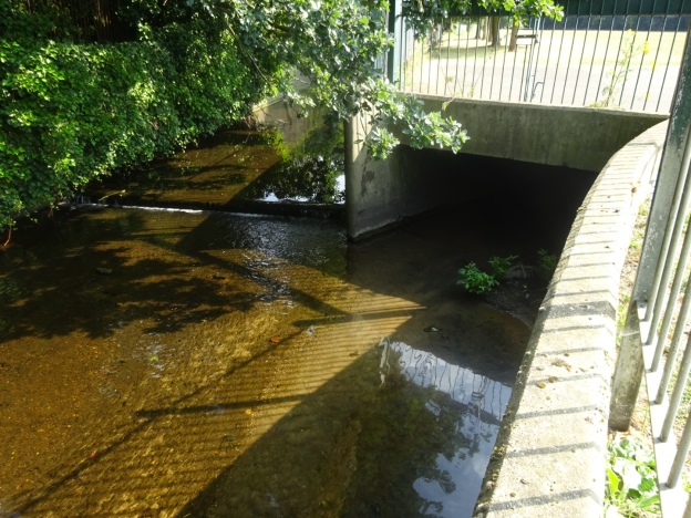
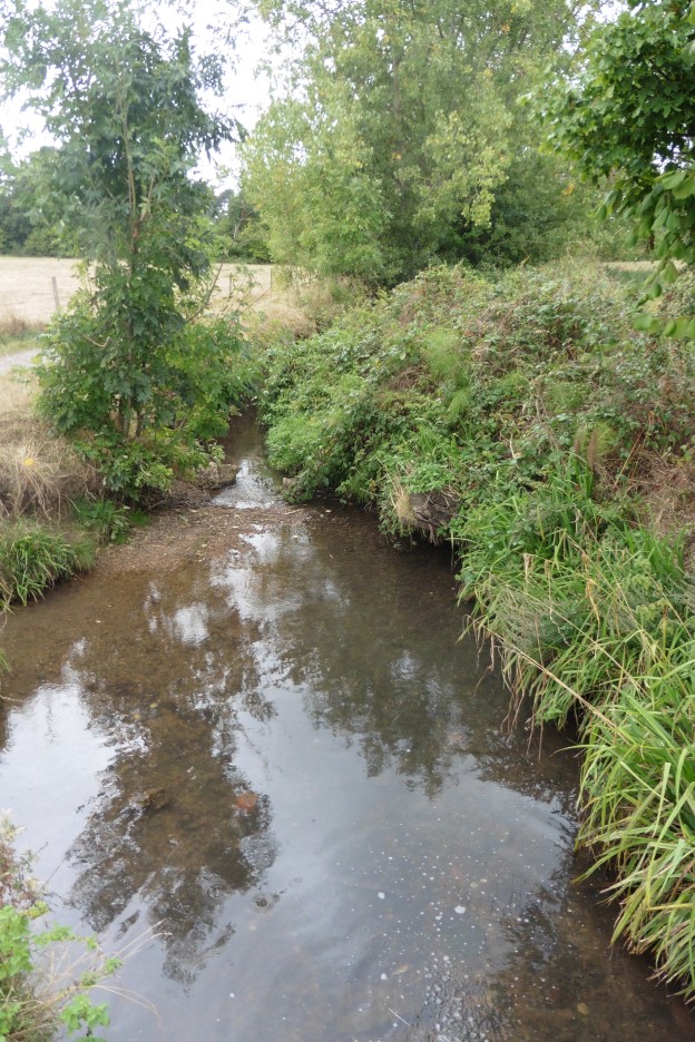
The current variant of the boundary heads down into the lovely Chinbrook Meadows; it wasn’t always like this when the farmland became a park, the Quaggy was hidden. A blog post from a few years ago, covers its rejuvenation in 2002. The now Bromley and Lewisham border largely hugs the bottom of the railway embankment coming in from Elmstead Woods.

The 1863 version of the boundary crosses the railway in what is a deep cutting at this point, and emerged in what was then a small field and is now part of the smaller southwestern field of Chinbrook Meadows following the fences to the rear of the gardens of Portland Road until the Quaggy is again reached (further upstream than when covered in earlier in the circuit of Lee).

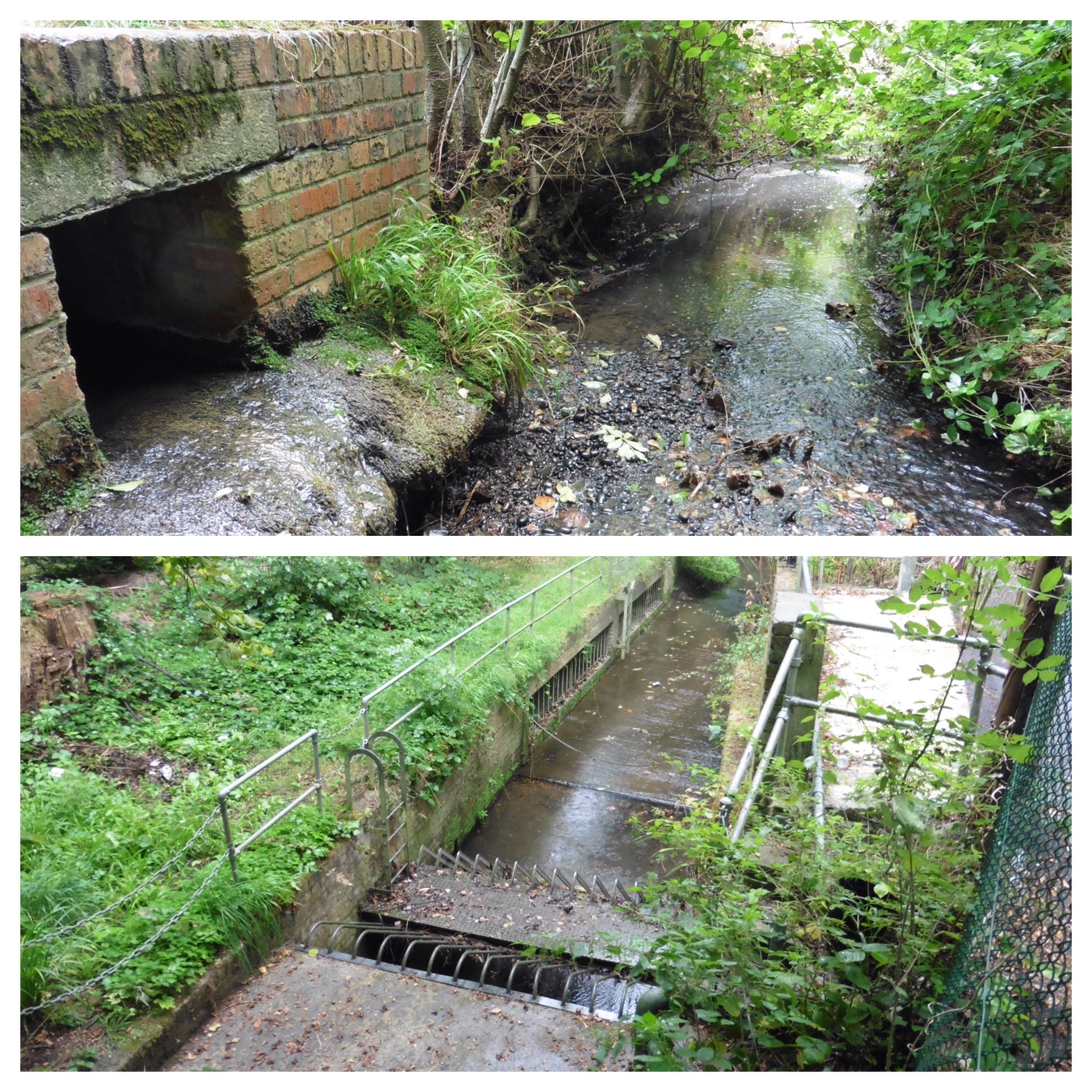
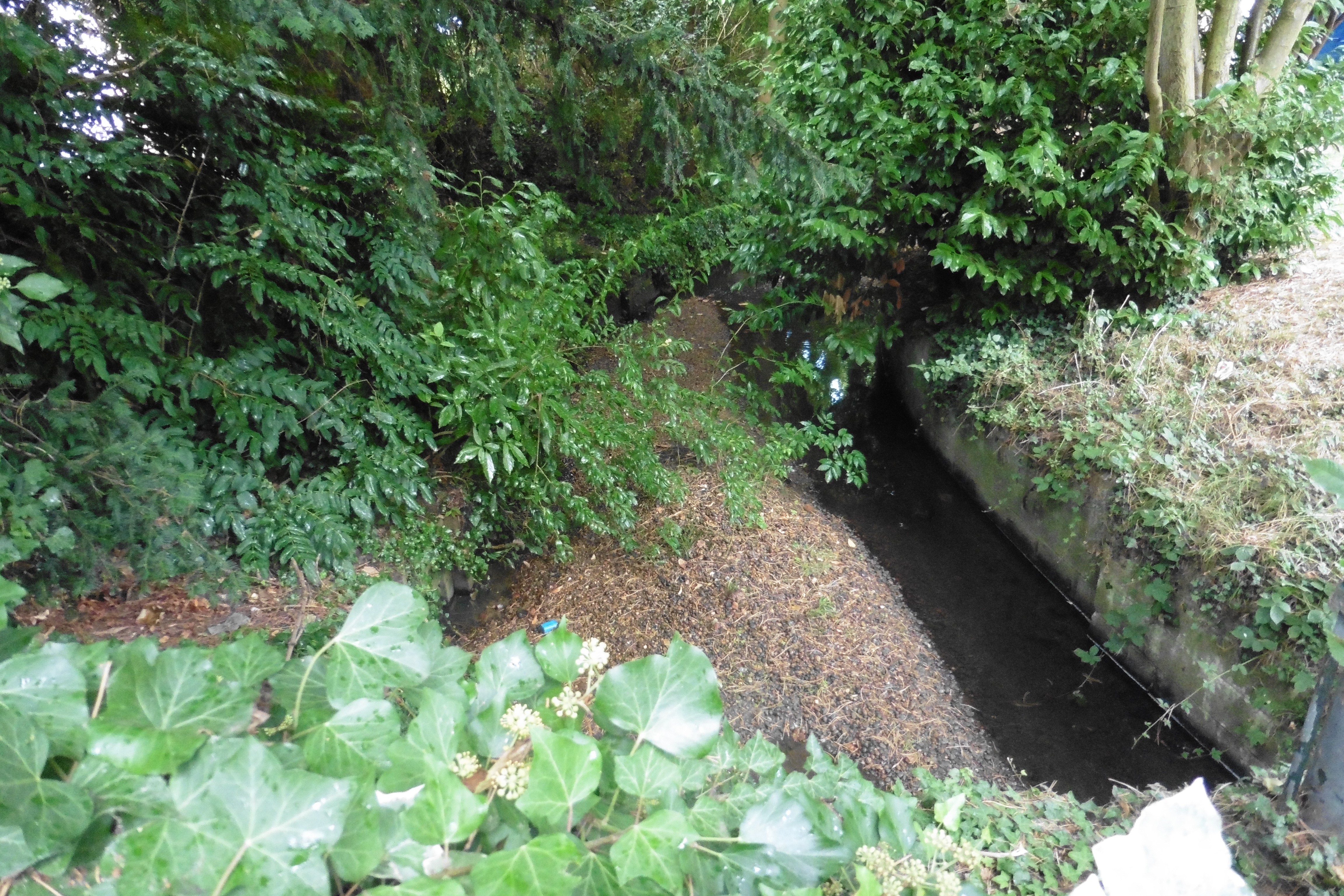
The 1893 boundary followed the Quaggy for around 100 metres until a confluence with the Border Ditch underneath the railway embankment. The ‘border’ in Border Ditch appropriately refers to the boundary we are currently following. When we followed Border Ditch as part of the tracking of the Quaggy and its constituent tributaries, the Ditch in Chinbrook Meadows was in a poor state but there were plans for a sustainable urban drainage system to be incorporated into its flow. Alas, this seems not to have materialised and the watercourse looked decidedly uninviting during lockdown – the photographs of its latter stages are from the initial visit in 2016.

Border Ditch has an even shorter flow than the Quaggy within Chinbrook Meadows – it emerges from culverting in a way that is more reminiscent of a drain than a stream.  As had been the case in the summer of 2016, there was little sign of movement in the ominous looking muddy water. 

The Ditch continues upstream and seems to have marked the border until the 1991 proposals came into force, although as was noted in the post on Border Ditch there were several minor re-alignments of the Ditch and the boundary over the years

Over the other side of the physical boundaries of the railway, which required a significant detour, Border Ditch only appeared as a field boundary on the 1893 Ordnance Survey map. It is now not only the border between Bromley and Lewisham but between the private sector semis of the former and the social housing of the latter. Traces of water were difficult to find in lockdown in the normally still flowing division between the two.

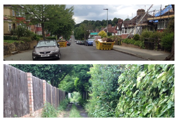
Streams, even quite small ones create valleys and out on the main Burnt Ash Lane the dip is noticeable and there lies both the current and 1893 variants of the boundary. The photograph above probably dates from just after the map was drawn, is of what was then a bridge and is looking towards Bromley.

Burnt Ash Lane was a name that once continued from here to the junction with St Mildred’s Road, but the it was renamed in ‘honour’ of the Lords of the Manor – the Baring Family. At the time they bought the Manor of Lee at least part of the Barings money was coming from an enslaved estate in Montego Bay in Jamaica. John Pound built much of Victorian Grove Park, on Northbrook/Baring land, naming the pub after them – the lovely Baring Hall.

We’ve strayed 400 metres away from the boundary putting the street name into some context, so back to the border, Border Ditch. The 1893 Lee (now Lewisham) – Bromley border continued westwards across fields to a three-way split in 1893 with Lewisham providing the third part of the trio. During the 19th century there had stood, according to F H Hart, ‘a tall round-top oak tree, a land mark from Lee Church’ at the junction of Lee Terrace and Brandram Road. It seems that this may have been lost by 1893, as this point was marked with a boundary post. In 2020, it is part of one of the dozens of largely access roads to garages in the area made largely redundant by the increase in car size, this one behind Welbeck Avenue.

The redundant access road is the course of Border Ditch which continues another 50 metres or so to a source in what is now some school playing fields. A small pond was marked in 1893. Oddly for such an elevated situation, close to the watershed between the Quaggy and Ravensbourne catchments, this was a small World War 1 airfield, Grove Park Landing Ground.

On the other side of the redundant track to redundant garages is the edge of one of the larger London County Council (LCC) estates, Downham, which was built in the late 1920s and early 1930s. The name doesn’t have any local links, rather it was that of a Chairman of the LCC just after World War 1.

The Lee – Lewisham boundary of 1893 was through fields, the boundary following what were then the hedges of field edges not marked in any way by posts, markers or marks on trees. Despite the transformation of the area between the World Wars, the street pattern still at least partially follows the field patterns. The former Lee – Lewisham boundary was follows the middle of what is now Geraint Road; like many boundaries that follow roads, it’s marked by white paint. The 1893 boundary then bisects Ivorydown, the name of a former field in this area, to reach Downham Way.

We will leave the boundary there for now because on the other side the nature of what is followed changes from field edge to hidden stream.

Credits and Thanks

  • The Ordnance Survey Map is via the National Library of Scotland on a non-commercial licence.
  • The black and white photograph of Burnt Ash Lane was originally used in the post on Border Ditch on the basis of a creative commons from this site, although the photograph library with it seems to have been deleted.

The series of posts on the Lee boundary that this post is part of, would probably not have happened without Mike Horne, he was the go-to person on London’s boundary markers; he had catalogued almost all of them in a series of documents. He was always helpful, enthusiastic and patient. He died of a heart attack in March but would have loved my ‘find’ of a London County Council marker in some undergrowth on Blackheath during 2020’s lockdown, and would have patiently explained the details of several others he knew to me. A sad loss, there is a lovely series of tributes to him via this link.

Beating the Bounds of Lee, Part 3 – through Grove Park

During the COVID-19 lockdown Running Past has been following the boundary of Victorian Lee a few years before it was subsumed into Lewisham, aided only by a Second Edition Ordnance Survey map and a smattering of knowledge of the area. The previous two posts have taken us in stages, from Lee Green to Winn Road, appropriately passing Corona Road en route; the second took us On through Grove Park, crossing the never built Ringway, We’d left the boundary on Grove Park Road, on top of a culverted Grove Park Ditch, with a marker that had been weathered beyond any potential to decipher.  

For the pedants of periphery, the boundary marker is no longer on the boundary, in adjusting it to the rear fences of Marvels Lane it has led to the now Bromley – Lewisham boundary dog legging down the middle of Grove Park Road, the small sign of the former and the larger one of the latter announce the changes.  

The route followed in this section was entirely rural in 1893 as the Ordnance Survey map below shows with the Morse code dot dash line – although the most southerly end of Victorian Lee, the largely John Pound developed ‘new town’ of Grove Park is visible to the north east.

One the opposite side of Grove Park Road is the attractive Chinbrook Estate, built by the Greater London  Council (GLC) in the early 1960s; it is a development that has been covered by the 21st century’s foremost chronicler of council housing, Municipal Dreams, who noted 

“What was exceptional ….is the overall architectural and design quality of the Estate…..Chinbrook is a reminder of the best that might be achieved with proper investment and careful planning.”

Like the much larger Downham estate, which we will encounter further along the Lee boundary, it is an estate that straddles a boundary, Mottingham to the east, Lee to the west in 1893, at least.  The 21st century boundary is slightly different and is a currently  a Lewisham to Bromley one, The divisions aren’t immediately obvious, but as with Upwood Road further back, while there are no boundary stones, the  21st century markers are clear.  Along with the Borough colour coded bins, the Borough street signage indicates the location – white on blue for Lewisham, white on green for Bromley (plus some faded black on white signage, perhaps from the GLC era).

Back in 1893 there was a boundary marker close to where Grove Park Ditch now enters its long culvert on the edge of the estate; if it is still there, it is lost in the dense undergrowth.  Whilst the border probably ought to have followed Grove Park Ditch it doesn’t and seems to have followed field and probably ownership boundaries.  So the border follows what is now a fence between the attractive Lower Marvels Wood and the rear gardens of Grace Close.  The name coming from ‘W G’ who lived both in Mottingham and Sydenham. The estate provides links to other Lewisham sporting greats, Henry Cooper Way and Lions (Millwall’s nickname) Close. 

Over Dunkery Road, the 2020 boundary has been slightly amended compared with its late Victorian counterpart to cope with the slight dog leg of Duddington Close. There has also been a slight adjustment to for the 1930s council housing of Bilsby Grove.

The late Victorian boundary of Lee was at the border between the woodland of Marvels Wood and farmland.  The woodland remains but behind the council housing of Charminster Road the former fields have become Grove Park Cemetery.  It was an out of town burial solution by the Borough of Deptford whose main burial ground, Brockley Cemetery, was almost full by the early 1930s.  Running Past has covered Brockley Cemetery several times in the past, notably in relation to the murder of Jane Clouson who was buried there in the 1870s and has a large memorial.

Grove Park Cemetery was designed by their Borough Surveyor H Morley Lawson and ‘juxtaposed formal and informal elements and the cemetery buildings showed the influence of Moderne and Art Deco style.’  It was used from 1935.

From Bromley side of the boundary, the cemetery is largely hidden, albeit rather attractively by a hundred metre long mural by the seemingly now defunct Onit Design. At the top of the hill, within a metre of the boundary there is some even more impressive artwork, a chainsaw carving by Will Lee, which seems somewhat apt when following the Lee boundary.  There is some more of his work about 100 metres into the woods.

A couple of metres further on there is a very weathered boundary marker which in the Victorian Ordnance Survey map was a three way marker for Lee, Mottingham and Bromley; now the bigger London Boroughs of Bromley and Lewisham.  A metre or two along the path is another, hard to spot boundary marker, just inside the heavy duty palisade fencing ‘protecting’ the cemetery from the Green Chain Walk in what is now Elmstead Woods. It is unusual in the that it marks the direction of the boundary, located as it is on an angle.  The direction is incorrect as it appears that the marker was moved at the time of construction of the cemetery and unintentionally rotated by 90°.

The 1893 boundary darted easterly across the fields  towards Grove Park, the current variant, dating from 1991, is a little more circuitous and reflects the ownership of the cemetery and skirts its border.

There was, and probably still is, another marker at the eastern edge of the cemetery. However, in the very dense undergrowth it proved impossible to find amidst the brambles and nettles (poor companions for a short-clad runner).  All was not lost though, there was a marker of sorts – a Lewisham bollard, marking the  boundary of car park and Green Chain Walk.

Over the car park the Victorian boundary followed the northern edge of what are now allotments – we’ll leave the boundary there for a while before we go through Chinbrook and on to the edge of the Downham Estate.  

Credits and Thanks

The Ordnance Survey map is via the National Library of Scotland on a non-commercial licence.

The series of posts on the Lee boundary that this post is part of, would probably not have happened without Mike Horne, he was the go-to person on London’s boundary markers; he had catalogued almost all of them in a series of documents. He was always helpful, enthusiastic and patient. He died of a heart attack in March but would have loved my ‘find’ of a London County Council marker in some undergrowth on Blackheath during 2020’s lockdown, and would have patiently explained the details of several others he knew to me. A sad loss, there is a lovely series of tributes to him via this link.

South Norwood Stream – A River Pool Tributory

Running Past has traced the routes of several of the small tributaries of the River Pool that emanated from the higher ground of the Great North Wood from Sydenham to South Norwood Hill – Adams’ Rill, Wells Park Stream, Pissarro’s Stream, Porcupine Stream, Penge Stream and the River Willmore.  A little further down the hill are a pair of streams that run through the wild urban oasis of South Norwood Country Park and have a confluence within it.  The Park is not to be confused with South Norwood Lake and Grounds, which we passed through with the River Willmore.  Collectively the streams appear to have been named, albeit not obviously on maps, South Norwood Stream – which seems appropriate based on its location.  Unlike all the other streams followed to date in the catchment it is visible for much of its route.

As there are two main flows, which need to be distinguished and as a there is already ‘South’ in the name these can’t be based on compass points – North South Norwood Stream would be far too confusing!  The northern flow is along the edge of the Beckenham Cemetery, two of the more famous names of buried there are Thomas Crapper (of flush fame) and W. G. Grace, who Running Past covered on the centenary of his death in 2015.  Whilst tempted to use the former, particularly as the South Norwood Country Park was once Croydon’s Sewage works (more on that later), it is a flow that deserves a better epithet – so it will be referred to as Grace’s Brook.

The southern branch is close to Elmer’s End so this seems rather appropriate to call it Elmer’s Brook.  However, the two competing narratives for the derivations of the name  are fairly grizzly, in both the ‘End’ relates to a brutal death – either for a ‘famous highwayman’ being hanged or more likely it came from  the Anglo Saxon word for criminal, Elmerus, and related to local people being executed on the Green.  Although with the latter, nothing was found on-line to back this up other than other references to Elmers End and delving further into the name it seems as likely that it is a variant of a German name Hildimar – meaning famous fighter.   Those of you wanting a more benign option and who have had small children in the recent past, may well be aware of an Elmer whose demise has yet to be reported, an elephant with a brightly coloured coat – although that appears to have been commemorated (although not in name) by the Glass Mill Leisure Centre further downstream in Lewisham.

Grace’s Brook

The sources, and there are two of them, are close to that for one of the branches of the Willmore which was at Goat Bridge.   Fluvial flows are indicated on maps with upward pointing notches in contour lines caused by the stream eroding the ground as it flows.  For the northerly source, the highest of these is around John Street, although the land rises above that and there was a small pond on the Victorian Ordnance Survey map (see top left hand corner below – on a non-commercial licence from National Library of Scotland) which was around 50 metres along Manor Road from Portland Road which may have been the source.

There is a fine Victorian building now on the site with a car park on the at the rear, but no 21st century sign of water.

The subsequent route takes the Brook along Harrington Road, there were still no obvious subterranean sounds of flowing water emanating from beneath manhole covers.  The Brook emerges out into the open near the eponymous Croydon Tramlink stop on the edge of South Norwood Country Park.  Sounds of water were heard sooner than any physical sign in the impenetrable bramble and nettle strewn undergrowth.

The Environment Agency Flood Risk maps (where surface water is selected) show the route quite clearly.

The southerly of the sources has contour lines which peter out at Merton Road close to the large railway cutting, which broadly followed the route laid out by its predecessor the Croydon Canal, again, nothing was obvious on the ground.  It may well be that this is or was the source.  While difficult to be certain the route probably follows Crowther and Holland Roads – there is a pronounced valley at this point on Portland Road.

A little way up the northern side of the valley was the home of William Walker at 119 Portland Road; Walker was a diver who used his underwater skills to help shore up and underpin serious subsidence at Winchester Cathedral during 1906, without which the Cathedral may well have collapsed.  Born in 1869, he trained with the Royal Navy at Portsmouth Dockyard, and amongst other projects he had worked included the Blackwell Tunnel.  He died during the ‘flu epidemic of 1918 and was buried just downstream in at Beckenham.  There is an impressive plaque on the front of the house.

The valley continued along Belfast Road, albeit with no obvious watery sounds from beneath the ironwork in the road.  Ground levels and contours suggest that the Brook would probably flowed just to the north of the brickworks which were where the Croydon Arena is currently situated; they will have utilised the heavy clays  of the area.  It was an area where there were several brickworks – evidence of which remains in Brickworks Meadow in Woodside and Heavers Meadow in South Norwood.  Unlike several of the other works in the area, the marked (on Ordnance Survey map above) Portland Road Brickworks appears not to have been mentioned in on-line.  The same is the case for the South Norwood Potteries – although there is a small cul de sac, Pottery Close, which is near the confluence with the northern branch.

The newly merged Grace’s Brook skirts the northern edge of South Norwood Country Park initially with natural banks but soon in an old concrete channel, there is little in the way of obvious life although a few plants seem to be inhabiting cracks in the concrete banks.  The path alongside was barely visible and painful to follow in places due to nettles and the benign cow parsley. Despite the volume of urtica dioica and a marked absence of rumex leaves to salve the resultant rash, the Park was a delight – an area of wilderness criss-crossed by paths and with a small lake at the Elmers End Road side.

It wasn’t always thus, for a century from 1862, the land was used as a sewage farm with lagoons filtering out the sediment – it wasn’t that successful given the clay subsoil – some of the concrete channels used apparently still remain though, although were never seen due to the height of the foliage .  The area was used for training for armed forces during World War 2 and also abandoned and largely left to go wild until the creation of the Country Park. Elsewhere in the park there was dumping of rubble from the Blitz in Croydon which now provides a fine vantage point for the rest of the Park.


Elmer’s Brook

Unlike Grace’s Brook, the source is a little indeterminate – contours seem to imply a source on the edge of Long Lane Wood (although this was never found); it then follows a footpath on the opposite side of Long Lane – historically there were flows alongside but there is nothing now either side of the border with a driving range.   While modern Ordnance Survey maps offer an intermittent blue line alongside the west of the Tram Link tracks it was several hundred metres before anything definitive was found.

A secondary source appears to be to the south west of the Croydon Arena, although contour lines and on ground investigation proved inconclusive as to where this might have been.  As with Grace’s Brook while sounds of water were heard at various points the depth and density of the undergrowth proved a barrier to finding the flow.

While there is nothing now obvious on the ground, at this point it would have fed two concentric rectangular moats surrounding a 13th century house, the house was probably abandoned due to flooding  by the mid-15th century.   The site was excavated in the 1970s before the Country Park was created, with significant and interesting finds of timbers, pipes and pottery along with the moats.  It was marked on the 19th century Ordnance Survey map – see above.

Another man-made water feature was created when the Country Park was created – a small lake.  Elmer’s Brook skirts around the edge of it before a confluence (which may be a recent man-made one) with Grace’s Brook. The volume of water from Elmer’s Brook appears less at this point than further up-stream, it is suspected that much of the flow is now going into the lake although no obvious evidence of this was found.

What is now South Norwood Stream darts under Elmers End Road flowing through Dorset Road allotments opening out onto the flank of Maberley Road playing fields (a different Maberley Road to the one covered in the post on the River Willmore).  The banks here are naturalised (see photographs at the top of the post) and while in parkland, the streamside path is choked with plants.  It then passes through passing through a Bromley Recycling facility before doglegging along the edge of Churchfields Recreation Ground, again with concrete banks and continues under the railway between Elmers End and Clock House.

For the fluvial flâneur there is a mile long retracing of steps through parks and along footpaths through Elmer’s End before seeing South Norwood Stream again as it crossed Clock House Road, the stream having dawdled just 75 metres in its now concrete channel.  It is bridged by the road and in the gardens between Clock House and Forster Roads a confluence with Chaffinch Brook is made unseen due to a large buddleia bush blocking the view.

Porcupine Stream – A River Pool Tributary

There are a number of streams (or former streams) that we have already covered that rise in the high ground that stretches from the borders of Croydon to the borders of New Cross – in the past covered by woodland known as the Great North Wood. Running Past has covered (and named) several of these including Penge Stream, Adams’ Rill, Wells Park Stream and the River Willmore.

We now turn our attention to another group of streams whose sources are very close to another covered – Pissarro’s Stream.  It doesn’t seem to have a name that has survived, but for the purposes of identification has been called Porcupine Stream here – the reasons for this became clear in John Rocque’s map of the 1740s (above), we’ll return to the farm later.  The map suggests around four sources – some of which are above Charleville Circus and others currently within Crystal Palace Park.  It is this latter group that we turn our attention to first.

More than perhaps any small section of south east London, the moving of the Crystal Palace to the top of Anerley Hill in 1854 saw massive changes to the levels of land, obliterating former contour lines and altering flows of streams.  Streams were ‘stolen’ to help provide the water for the large array of fountains and cascades within the Park, although with the help of Brunel, two enormous water towers recycle water from the large reservoirs in the middle of the Park which provided the bulk of the water.

Despite the changes to the landscape, a small valley is visible high up in the northern corner of the Park and point to a former stream that would have fed what is now the small lake in front of the decaying Concert Bowl, sometimes referred to as the ‘rusty laptop’. There is  a small flow behind the Concert Bowl which follows the course the stream would have followed to fill the one of the many reservoirs that were created in the Park, which is now referred to as the Fishermen’s Lake.  Whether it now contains water diverted from the original stream’s course is unclear.

Before moving on, the Concert Bowl used to be a significant venue for the summer outdoor festivals – it was a stage that once saw the likes of Pink Floyd,  Steve Harley & Cockney Rebel and The Cure perform. As the 1863 surveyed Ordinances Survey map shows, in the years after the opening of the Park that corner was home to quieter activities – an archery range and the English Landscape Garden.

Any flow beyond the Fisherman’s Lake would have been into the now lost North Basin (see Ordnance Survey map above).  There used to be an implication in a now deleted on-line Environment Agency document that any excess water was diverted to the eastern end of the Park seemingly to join the stream coming down from above Charleville Circus and Ordnance Survey map contours suggest that this was probably the original route anyway. 

We have ‘visited’ Charleville Circus before, as the source of Pissarro’s Stream is just to the east of it.  To the north-west of the Circus, in the apex of Westwood Hill and Crystal Palace Park Road – currently home to an imposing 1930s mansion block, Torrington Court, are the other sources of Porcupine Stream. While Rocque’s map suggested three or four sources, the upward pointing contour lines of fluvial erosion only highlight one of these.  The route above Charleville Circus is through private gardens, but a fluvially eroded depression is just about visible from the main road.   Very briefly, possibly coincidentally, the route across the Circus was coterminous with a boundary which helpfully still has a pair of Lewisham Parish boundary markers in the south east and south west quadrants.

The boundary veers off the the north just south of Charleville Circus, briefly following Pissarro’s Stream.  Porcupine Stream, though, ‘ploughs’ a small furrow – visible clearly on Border Crescent,  and on Ordnance Survey maps, flowing parallel to Crystal Palace Park Road.

While contours suggest a deepening of the small valley down the hill, the on ground reality is slightly different with the dip only just perceptible on Sydenham Avenue and on Lawrie Park Road at the rear of another elegant 1930s block, Park Court designed by by Frederik Gibberd,.  The route followed, as the Environment Agency surface water flood risk map shows (above), is broadly along the appropriately named Springfield Road.

Considerably below the surface, the stream broadly follows the route on another line marked on maps – that of one of several railway tunnels through Sydenham Hill – this one carrying the railway between Sydenham Hill and Penge East stations.

Just below Springfield Road, the stream would have met the Croydon Canal, later to be, London and Croydon Railway– it isn’t clear whether the stream was used to feed the canal or not, some were, some weren’t.  On the other side of the railway contours would indicate a flow just off Station Road in Bredhurst Close – however, it, and it is a large ‘IF’, the stream is still flowing culverted it may have been moved a few metres to the south as there is always the sound of rushing water below a manhole cover close to the junction of Crampton and Station Roads (it could, of course, be just a very active sewer…).   before a confluence with the branch coming from the Park close to the elegant Penge East station.

The rushing water has never been regularly heard from other manhole covers in the area and contour lines imply a route under the current railway close to Penge East in the direction of Parish Lane.

What is now Parish Lane was once home to Porcupine Farm – it was active from the mid-18th century in Rocque’s map (see above), probably earlier, until 1851; it is listed in a directory with William Wrenn being the farmer, published that year.  It is possible that the farm had been first leased by Wrenn’s father in 1800 – there is evidence of a lease in Penge to another William Wrenn in 1800.

It has also been suggested that it may have also been a pub.  However, the farm wasn’t mentioned in the 1851 census and while William Wrenn was probably still farming it, he was listed as farming 100 acres with 4 labourers but living on the main Beckenham Road.  The farm buildings were still there, but weren’t mentioned by name in the 1863 surveyed Ordnance Survey map.  Without the farm it was referred to as Porcupine Meadow and was sold by the Duke of Westminster to the Metropolitan Association for Improving the Dwellings of the Industrious Classes.  The idea behind the scheme was to build workers cottages close to stations.

164 small semi-detached houses were built on Porcupine Meadow between 1866 and 1870; the financing of the scheme was based on

…working men are prepared to pay down a deposit of £10 and enter into the necessary arrangements for securing the absolute ownership of a cottage and garden at the end of 12 or 13 years by paying a weekly sum which would cover all expenses and yield a liberal rate of interest for the investment in the meantime.

Back to the stream – in would have flowed down Parish Lane, to a confluence with Penge Stream somewhere around the Green Lane junction with Parish Lane before joining the Willmore ahead of its confluence with the Pool.

Picture & Map Credits

  • The Ordnance Survey map is on a Creative Commons via the National Library of Scotland 
  • John Rocque’s map was a screen shot from years ago, I can no longer find the original source to properly credit it
  • the postcard of the Crystal Palace was via eBay in April 2019
  • the photograph of Penge East station is from Wikipedia on a Creative Commons

1851 census data comes via Find My Past

The River Willmore – a Penge Stream

Running Past has covered several of the streams that eventually amalgamate to form the River Pool in Beckenham’s Cator Park – all had their sources in the Great North Wood which sits on one of South London’s most prominent pieces of high ground – stretching from South Norwood Hill, through the present Crystal Palace, Sydenham Hill and Forest Hill – to date these have included several without surviving names, those that I have called Pissarro’s Stream, Wells Park Stream and Adams’ Rill.

This lack of names is more than made up for by a quartet of options for this waterway – known variously as Boundary Stream, Boundary Ditch, the River Willmore and Shire Ditch.  Regular readers of Running Past will know I am partial to using ‘Ditch’ – it is common in the Quaggy catchment. However, it seems out of place here and given the significance of this watercourse, I think that it deserves ‘river’ status.

Rivers and streams often form the boundaries between parishes, wards districts and counties – as was covered in a post on the Quaggy catchment on Border Ditch which is part of the boundary between Lewisham and Bromley.

The boundary that the Willmore is used for refers to is a ‘lost’ one between Surrey and Kent (to the east), and later the frontier between Municipal Borough of Beckenham and Penge Urban District Council (UDC).  As a boundary it was there when John Roque mapped Surrey in 1762 (above) marking the edge of the surveyed land.

Penge has had a strange history in terms of boundaries – for hundreds of years it had been an isolated part of the parish of Battersea, itself part of the Hundred of Brixton.  In the second half of the 19th century the Metropolis Act brought it together with Lewisham and it was run by the Board of Guardians – this was a cross boundary arrangement with Lewisham being in Kent and Penge in Surrey. After the London local government re-organisation that came into force in 1965, Penge UDC was merged with its next door neighbour, Beckenham, over the Willmore (along with the Municipal Borough of Bromley, Orpington Urban District and the Chislehurst bit of Chislehurst and Sidcup Urban District.)  to form the London Borough of Bromley.

The main sources of the Willmore are in the high ground above South Norwood Lake.  The steep hillside coming down from the ridge that continues on from Sydenham Hill and Anerley Hill, on top of which once sat the Crystal Palace saw numerous springs where the geology changes and the gravel meets the London Clay beneath. The hillside below them is gently serrated with small valleys gouged out by fluvial activity as water tumbled down towards lower levels. These valleys are clear both on the ground, despite the volume of housing that clings to the hillside, as well as on Ordnance Survey maps where there are upward pointing notches in the contour lines.

Some of the flows are no longer visible either because they are no longer flowing due to changes in the water table or because they have been culverted.  The 1863 surveyed map above shows some evidence of the flows.

The reality on the ground now is a little harder to work out due to the extent to which, first the Croydon Canal , which opened in 1809, and its successor along much of the course 30 years later, the London and Croydon Railway, played havoc with the natural lines of the landscape, changing contour lines and flows.

Environment Agency 100 year flood risk map,  whilst relating to surface water is helpful in tracking former streams as storm flows will often follow the courses of former or hidden streams due to the small valleys that have been created.

There are two main groups of these the northerly streams ones which coalesce around Maberley Road and the Auckland Rise group which would have combined in what is now South Norwood Lake and Grounds, along with a southerly one originating around Goat House.

Maberley Branch

The exact sources of the streams forming this branch are not that obvious, development has made exploration of the upper slopes of the hill difficult.  In any case, changes in the water table have probably meant that they are no longer flowing,.  However, the multiple switchbacks caused by streams eroding the hillside are clear on Auckland Road, one around Fox Hill, the other in Stambourne Way (below).

Originally gravity would have probably suggested that the course was a downhill one – there are hints of this on the Environment Agency map.  However, the downward flow would have been blocked by the route of the Croydon Canal.  It is quite likely that its engineers wanted to use the streams to provide water for the reservoir that is now South Norwood Lake which was used to provide water for the canal.  This would probably explain this unexpected dog-leg to a confluence around the Harris Academy site and a flow onto the Lake.  The arrival of steam, 30 years after the canal no doubt confused matters further.

Close to the Maberley Road entrance of South Norwood Lake and Grounds there is what appears to be a seasonal stream, in the incredibly dry summer of 2018 there was, unsurprisingly, a lack of water.  The occasional watercourse seems to peter out just before it would have entered the Lake.

Auckland Rise Group

Of the three streams that once flowed about ground there is little evidence for two of them other than depressions in roads marking their presumably former existence, certainly nothing flowing in the driest summer for 44 years.  However, the third is most definitely flowing.

The upper reaches while clear in terms of contours aren’t on the ground – a long slog up the steep, winding road through the Auckland Rise estate to a small bit of woodland failed to produce any of the obvious signs of water that the notched contours suggested.  Although there were a couple of rather attractive wooden owls an overgrown picnic areas.

The stream would have flowed past the childhood home of the crime writer Raymond Chandler, which is remembered with a blue plaque – he had been gone from there for almost 30 years before he published his first novel ‘The Big Sleep’ in 1939.The course emerges from Auckland Close (where there is no hint of the stream) out into some bramble dominated woodland, not some residual part of the Great North Wood as it isn’t marked on the Ordnance Survey map above.  It doesn’t seem to have a name but the nascent stream emerges, finding a way through the choked woodland floor to the edge of some school playing fields abutting South Norwood Country Park before disappearing into a rudimentary screen – presumably then going, submerged, into the Lake.

South Norwood Lake would have been the man-made confluence of all these streams – a reservoir for water needed to keep up levels in the 28 sets of locks in the Croydon Canal. It is a pleasant park, with an elegant cricket ground – the Lake is home to a lot of wildfowl and plenty of spots for fishing.  The latter has a long history here – there is a beautifully preserved pre-decimal sign indicating fees – which had risen a little by the time of writing.

Goat House Branch

John Roque’s 1672 map of Surrey (above) suggests a branch emanating from ‘Goat House’.  In terms of location this would have been around the location of the current major bridge over the railway, around 250 metres from Norwood Junction.  There was for a while a pub of the name next to the bridge.  The route on a 1960s OS map is much clearer than on the ground – there were boundary markers at the junction of Thomsett and Wheathill Raods with Marlow Road and then a little way up Cambridge Road.  As these are broadly the same as the contour notches this was probably the route of the branch.  Like its northern counterparts, the railway played havoc with the route, as the 1960s Ordnance Survey map below shows.

The outflow appears to be along the northern side of the Lake, where in the dry summer of 2018 a trickle of water was heading north-eastwards. It then gets disturbed by the railway (formerly canal) again, along with another line from coming into Crystal Palace from Birkbeck station and Beckenham Junction beyond.  The land either side of Croydon Road is fairly flat, although gently failing away to the east, so an exact route is hard to be sure of.  But it probably crosses Selby Road running through the South Penge Park estate crossing Croydon Road near the sad site of a boarded up pub, the Mitre, which closed in March 2018, a recent refurbishment seemingly having failed to attract sufficient new drinkers.

The course eastwards was probably originally crossing Tremaine and Samos Roads.  The confluence with the branch from Goat House would have been around here.

A slight depression becomes obvious in Marlow Road, while there are no obvious signs of water rushing beneath manhole covers (it was very dry though)  The route beyond the small Willmore-cut depression in Elmers End Road , is clear because until the mid-1960s the Willmore was flowing above ground at this point. It squeezed between gardens for Ravenscroft Road and Chesham Road.  It is obvious from both the blue of the water and the coterminous black boundary dots on the early 1960s Ordnance Survey map

A slight diversion is needed at this point as we are now very much in Penge here; Penge to the fluvial flâneur of a certain age, will always gave a grizzly association – the ‘Penge Bungalow Murders.’ Fortunately, these were fictional rather than actual homicides and were to the starting point of the career of ‘Rumpole of the Bailey’, wonderfully played by Leo McKern. In the streets of Penge, bungalows are hard to find – I would love to think that this is John Mortimer’s inspiration about a 150 metres off course.  We digress though, and ‘she who must be obeyed,’ in this case the River Willmore, must be returned to.

The valley crossing the main downward hill from Crystal Palace towards Elmers End at right angles becomes a little more pronounced here.


There are a couple of bridges over the former stream which are obvious – the first reflects different street names in once different boroughs either side of the bridge, the second while plainer fails to hide the concrete casing that the Willmore now has to lurk beneath squeezing between the houses. .

In 1894 the Lewisham and Penge Board of Works asked their counterparts in Beckenham to help pay for improvement works to what they referred to as Boundary Ditch as it was in places insufficient to deal with the volume of water entering from both parishes.

The culverting of the river seems to have started in late 1965 as it was promised in a statement by a Minister in April 1965.  This doubling up of street names is again apparent as the Willmore crosses the main road – the former Kent side is called Beckenham Road, the Surrey side High Street.

The stream passes over High Street, crossing next to Tesco.  The Willmore still flowed above ground alongside the southerly end of Kent House Road to around the railway bridge at the beginning of the 20th century – see above (source e Bay September 2015).

The River was then culverted and joined by Penge Stream, which will be covered in a later post and another, as yet,  nameless stream broadly following Parish Lane – this is clear on John Roque’s map of Surrey above. Oddly, until the mid-1960s the newly merged watercourse re-emerged between the gardens of Kent House and Reddons Roads before being forced into a sharp east turn behind the then Cator Park School (now like a school further upstream a Harris Academy) before traversing Cator Park to join the newly formed River Pool (the amalgamated Beck and Chaffinch Brook) .  It probably wasn’t the original course but the right angled diversion was probably to make cultivation easier – it certainly existed in the 1860s, before the area was developed.

Unlike upstream where culverting was over the top of the existing course, the 1965 works here diverted the flow, presumably under Kings Hall and Aldersmead Roads to enter the Park further south and run parallel to Chaffinch Brook for a hundred metres (the flows clearly audible through vented manhole covers), past the latter’s confluence with The Beck to form the River Pool. The Willmore enters the Pool in the same place as it did before but from a different angle.


Picture & Map Credits

The Ordnance Survey maps images are all on Creative Commons via the National Library of Scotland – the specific links are contained within the text.

I cannot remember where I copied a small part of John Roque’s map of Surrey from – it is no longer available on-line in the form that I saw it.  If it is your organisation’s image, do let me know and I will properly credit you.

Following the Quaggy – Sundridge Park to Chinbrook Meadows

In earlier posts, Running Past has followed the Quaggy from its sources around Locksbottom and then on through Petts Wood, the Hawkwood Estate, Chislehurst and Bickley, leaving the river just after it had appeared from the dominant bulk of the railway cutting on Sundridge Avenue.  Almost as soon as it arrived into the open it was to disappear into Sundridge Park – which is largely out of bounds for the fluvial flâneur.

Sundridge Park is an old country estate – there had been a three storey brick house on the southern bank of the Quaggy which had been home to a succession of wealthy Londoners.  The estate was remodelled by Humphrey Repton in the late 18th century – this included creating a Pulhamite grotto on the hillside close to the current house (see comment from Sarah below). It seems likely that Repton, the preeminent landscape gardener of his generation, was responsible for culverting the Quaggy through much of the grounds – certainly early Ordnance Survey maps (on creative commons from National Library of Scotland) which were surveyed well before the golf courses were built  have the Quaggy largely hidden, only reappearing for a lake just below the House.  Part of the culverting was removed during the 20th century.

image


As well as hiding the river, Repton was also responsible for the demolition of the original house, which was located south of the river, around 1792 and a new house was designed by James Wyatt for Edward George Lind and built between 1792 and 1795. Lind sold the estate to (Sir) Claude Scott in 1796, and he employed the prominent Georgian architect John Nash to make additions in 1799.  It is an impressive Grade I building (see below – source eBay February 2017), although the extensive conference centre it is now part of it, somewhat detracts from it.

image


The Park itself is notable for its lack of public rights of way, there are no public footpaths traversing the pair of golf courses of the Sundridge Park golf club (although the Green Chain Walk skirts part of the western course) which was opened by the then Prime Minister Balfour in 1902 on land leased from the Scotts.  The valley of the Quaggy is clear on this early postcard of Sundridge Park (source eBay November 2016).

sundridge

While the golf courses make the park largely out of bounds for the (sub)urban explorer, access was negotiated for following Milk Street Ditch at the northern end of the Park along with some slightly less legitimate looking for the unnamed tributaries of the Quaggy elsewhere on the ‘estate’, the Sundridge Park Ditches.  ‘Ditch’ should not be seen as a derogatory term, it is just the local term for a small stream. The photographs below show the river upstream and downstream from Milk Street Ditch.

image

Once out of the Park the river is culverted under New Street Hill  and flows, submerged through part of the 1930s suburbia, an area originally known as Hall’s Farm Estate after the farm whose land was lost to development.  While the Quaggy is submerged, it is clear in a valley and the course is followed above ground by tracks to what seem to be largely abandoned garages – too small for 21st century vehicles. The Quaggy is joined by another unnamed ‘Ditch’ which follows one of the streets of the estate Leamington Avenue.

image

The Quaggy re-emerges into the open in the southern part of Chinbrook Meadows (top left below) before being encased in concrete to take it under the towering mass of the mainline out of Grove Park.  A few metres into its tunnel it is joined by another tributary – Border Ditch – whose last metres are behind the fencing in the bottom right hand photograph.

image

The emergence again into the open is initially bounded by concrete but then gently meanders through the main part of Chinbrook Meadows.  This was not always the case – early Ordnance Survey maps (on creative commons from National Library of Scotland) suggest a straightening to allow for easier cultivation in pre-development Grove Park. Worse was to come for the Quaggy, after the farmland was turned into a Park – the river was given concrete banks which discouraged any flora or fauna and hedging was planted which almost prevented park users from even viewing the river. It was a waterway disconnected from its environment and the population around it.  This all changed in 2002 and the Quaggy was taken out of its concrete culvert and allowed a naturalised bed to flow in.

quagchinbrook

The changes help mitigate flood risk and allow the banks to be overflowed and excess water to be safely retained within the park, slowing flows and reducing the likelihood of flooding downstream.

image

Before leaving Grove Park a brief detour a few metres is worth making, to the Peace Garden – an area opened in 2009 by one of Grove Park’s most famous residents, Archbishop Desmond Tutu – some of whose early ministry was as an Honorary Curate at St Augustine’s between 1972 and 1975.

image

We’ll leave the Quaggy at this point with a stark reminder of how it used to be – a barren concrete channel.

The Sundridge Park Ditches – Tributaries of the Quaggy

Sundridge Park is an area which formerly had several streams joining the Quaggy – there are a number of tell-tale sets of notched contour lines on modern Ordnance Survey maps heading towards Chin Brook, the local name for the Quaggy at the eastern end of the Park (it is again Kyd Brook at the western end).  Other than Milk Street Ditch and its own small tributary, which Running Past has already covered, none have allowed any blue selections by the Ordnance Survey cartographers, indicating current water, so the valleys may be historic, created in times when water tables were higher.

However, they become obvious when looking at Environment Agency flood risk maps (using the surface water option).

sundridgeditches1

All seem to be unnamed but I have referred to them as ‘Ditches’ – this is not to belittle them, far from it, it can be seen as bestowing significance on them – most of the named Quaggy tributaries in this area have the appellation ‘Ditch’ – Petts WoodMilk Street, Border and Grove Park.

There are several on the southern side of the railway – including the valley of parts of Sundridge Avenue, another which would have risen somewhere around Scotts Park Primary School.  There is a further one which is almost adjacent to St Joseph’s School – the latter (and probably the former) were used to feed a long gone boating lake, complete with boat house shown on the 1897 Ordnance Survey map below (source National Library of Scotland on a creative commons).


The location of the lake is obvious on the ground, well obvious to those who ignore the ‘private’ signs (but unlike the western branch of the Kyd Brook higher up in the catchment, there was no razor wire or indeed fencing to deter the fluvial flâneur.)  While a notice threatened ‘deep water’, the former lake was a rather dried-up shadow of its former self.

image

There is another ‘Ditch’ just to the rear of Garden Road, the small valley is obvious on the road up to the clubhouse but not on the golf course viewed through the fencing at the bottom of the Garden Road.

The most obvious valleys are on the northern bank of Kyd Brook – one may have been diverted by the construction of Elmstead Woods station – the dark blue flood risk stops there, but the valley continues – there are clear notched contours just to the west of Rockpit Wood (see the area marked ‘Botany Bay’ on the 1919 OS Map on a National Library of Scotland creative commons, below).  The woods take their name from a small quarry, in which there have been found lots of fossils.  While no water is marked on the map below, there is a small stretch of azure on the Environment Agency map above – a small remnant of a past watercourse.

sundridgeditches4


There is certainly another ‘Ditch’ behind the Mansion, possibly a dammed stream creating a small pond on the hillside – a stream isn’t obvious from OS Maps but it features on the East Course golf course map adjacent to the 15th and 16th fairways, with a smaller arm from close to the Mansion. They probably wouldn’t be noticed by those playing the ‘demanding’ par 3 15th, hidden by the woodland to the right of the fairway .  While the confluence with the Quaggy is marked, I failed to spot it from my surreptitious run along the road up towards the Mansion.

sundridgeditches3


The deepest valley is one emerging opposite Milk Street Ditch – the source of this is in Elmstead Woods , the other edge of the wood is source to another tributary – Fairy Hall Flow.  This is clear on the ground, close to Grove Park Cemetery; with two small ditches coalescing at a screen in a small dip on the Green Chain Walk.  While I haven’t seen any water there for a while, I certainly remember small channels flowing alongside the path in wetter seasons.  The combined flow, when it flows, would take it under a corner of Grove Park Cemetery and then at a slight dip in the path crosses the Green Chain Walk just before it enters Elmstead Woods.  There is the ferrous presence of a manhole cover allowing access to the occasional stream in a small dip in the path going back towards Chinbrook Meadows allowing access before it reaches the railway.

image

The railway bars its way and the Flood Risk Map (above) suggests that it may have flooded in the past – there seems to have been a new concrete structure built which presumably ushers the wrong kind of water away from the tracks.

There appear to be remnants of the stream adjacent to the 10th fairway on the West Course – visible on the fly-through of the course.

sundridgeditches5

I had hoped to be able to see the valley when tracking Milk Street Ditch’s short traverse of the golf course but the last vestiges of autumnal colours prevented a clear enough view.

image

Beyond a Boundary – Border Ditch, a Quaggy Tributary

Border Ditch is one of the smaller tributaries of the Quaggy – it rises in playing fields on the edge of the Downham estate, very close to a natural boundary – the watershed that marks the divide between the Quaggy and Ravensbourne catchments. Its name comes from a different boundary though – for some of its recent life it was a small part of the border between Lee, then Lewisham, and Bromley.  In addition, it would mark the limit of London until 1965 when Bromley was prised out of Kent and brought into the metropolis (although the distinctions had become a little blurred from the 1840s as the Bromley was included in the area covered by the Metropolitan Police).

While the contour lines on the map for the early part of the Ditch are clear, they would suggest a route from around the middle of the playing field then following a line slightly to the south of Welbeck Avenue to Burnt Ash Lane.  However, the boundary which predated development, and the playing fields, is slightly to the north of this, suggesting that the course may have been adjusted when the land was farmed.  There was no access to the school playing fields, so any further investigation proved impossible.  The current course seems to follow a now overgrown access road to garages and then a very clear dip in Burnt Ash Lane.

image

There used to be a small bridge at this point which was captured on film around the time of the First World War, before the advance of suburbia and the Downham estate in the 1920s (source Lewisham Archives on a Creative Commons).

border-ditch

The stream is no longer visible (or even audible) at this point but there is a clear valley as it squeezes between the gardens of Ridgeway Close on the Bromley side and Wydeville Manor Road on the Lewisham side.  There are tracks down to garages at the rear on the Bromley side, but as ‘danger reared its ugly head’ – with a dog starting to bark as I attempted to investigate – the urban explorer ‘turned and fled’ in the manner of Brave Sir Robin.

Fortunately, there was a dog-free access point on the Lewisham side and squeezing between some broken railings a view of the newly emergent Border Ditch was possible.  There is a noticeable valley although during a relatively dry early autumn relatively little water. From this point, it is likely that the Ditch continued downhill until it met the Quaggy; it isn’t possible to be certain though as the imposing railway embankment obliterated contour lines past.

image

Railway engineers appear to have taken the Ditch on a slightly more circuitous journey in creating a new confluence with the Quaggy. The course they chose for it would have seen the Ditch empty into the Quaggy close to the bridge in the southern part of Chinbrook Meadows – source Creative Commons.

border-ditch-2

While the line to Bromley North was later added, the course doesn’t seem to have altered – source Creative Commons, National Library of Scotland.

border-ditch-3

The stream seems to have been slightly moved north east at a later date to hug the edge of the embankment and emptying into the Quaggy just after the latter enters the tunnel under the main line.

The re-emergence into the open  is a rather desultory one, exiting from its concrete casing into what was more reminiscent of a drain than a stream.  There was little sign of movement in the ominous looking muddy water.  It wasn’t even easy to see, hidden behind stout metal Network Rail fencing preventing any ne’er do wells having access to the embankment from the south westerly part of Chinbrook Meadows.

image

The emergent Ditch trickles slightly downhill for almost a hundred metres towards its final destination – its confluence with the Quaggy.  The coming together of the flows is rather lacking in distinction too, there is a twist to force the Ditch down and almost back upon itself to meet the Quaggy with the all the force of a tap with low water pressure.  My failed attempts to photograph the junction were even less impressive than the reality.

image

The good news is that there are plans afoot to try to make the last few metres of the ‘Ditch’ slightly more alluring, while the aesthetics will be improved considerably, the real reason is to install a sustainable drainage system (SuDS) which would enable water to run through a series of pools planted with native marshland plants that will naturally filter the water reducing the potential pollution impact of the ‘Ditch.’  I am no expert on gauging water quality by sight, but it didn’t look good.

While Border Ditch isn’t currently worth much of a trek, Chinbrook Meadows is a different matter, it is a lovely park – one of my Lewisham favourites.  It was the site of a small dairy farm, Chinbrook Farm – the park first opening in 1929 and being considerably extended eight years later.  The Quaggy was channelised early in the ‘Meadow’s’ existence and, from memory, large fences and hedges partially hid the river (they still do on its exit).  The river was freed into a more natural gently meandering course with more natural planting and access after works that were completed in 2002.

© Derek Harper, Creative Commons

If you recognise some of the latter photos and text, that would not be surprising, I have previously attributed them to a different stream – one I referred to as Grove Park Ditch (West).  Border Ditch is referred to as that, without the locational suffix, by the Environment Agency. However, having spent an age following flows and contours on old OS Maps I am now pretty certain that the outflow is that of Border Ditch, I am in pretty good company here – my view is shared by the sadly departed fellow fluvial flâneur, Ken White.

The area is no stranger to artificial boundaries – around quarter of a mile away from the source of Border Ditch there was the infamous wall of Alexandra Crescent.  It was built by the developer of a private road in 1926 to prevent those on the Downham Estate being able to walk through the new middle class housing towards Bromley.  It never had planning permission, but the over two metre boundary, topped with broken glass was to last until 1950. (More information & picture source)

downham-wall

The Ordnance Survey note boundary markers both within the Chinbrook Meadows and at the bottom of Oakbrook Close.  They seem to no longer exist – I certainly couldn’t find them and they haven’t been spotted by a follower of the blog who is tracker of boundary markers – the earliest maps note they were on trees though so even if the trees are still there the marks probably won’t be – however, nowhere did I see any arboreal girth approaching 200 year years (a substantial tree in 1860 plus the intervening time period)…

Back to the Border Ditch, it is no longer the border for much its last few metres, the Local Government Boundary Commission agreed to requests from both Bromley and Lewisham to shift the boundary to the far side  of the railway in 1991.  The dashed line is the ‘new’ boundary; the non-dashed one the pre-1991 boundary.  So it seems that the watershed is probably the only definitely fixed boundary – boroughs and counties are man-made constructs and as we have seen even streams change course, in this case diverted at least.

border-ditch-4

Following the Quaggy – Suburbia and Rural South East London

An earlier post followed the  Kyd Brook (the name given to the Quaggy in its first few miles) from its two main sources to the confluence – submerged beneath the edge of suburbia of the western edge of Petts Wood.  The Ordnance Survey map surveyed in 1894 below, shows where we left the river, close to the former Town Court.
kydmap1The post-development Kyd Brook is submerged beneath suburban streets and, while the roads are too busy to be listening for the sounds of water beneath manhole covers, the course is clear – the miniature valley of the newly  combined Kyd Brook is obvious where Ryecroft Road meets Queensway.

The river remains submerged as it flows under the railway and then parallel to the former Green Lane, now Tudor Way – there are no obvious remnants of Elizabethan times here although perhaps a nod to the arts and crafts elements of some of the housing.

Kyd Brook emerges from its concrete casing just before being bridged by Petts Wood Road, its emergence is greeted by a dissipation of the traffic noise.  We are in the ‘high quality estate in a rural setting’ that the 1920s developer of Petts Wood, Basil Scruby intended when he secured an option to buy 400 acres of woodland and strawberry fields in 1927.  Like Cameron Corbett at Hither Green 30 years before, he recognised the importance of the railway and built the station before the homes.

The front lawns are neatly manicured in what is now expensive suburbia, but parallel to Crossway runs Kyd Brook, between the gardens – it is less constrained by expectations and providing a more natural counterpoint to the street fronts.  Of course, appearances must be kept up, and there are quaint colonnaded bridges on the side roads as the river passes.

image

Oddly, for a while, one of the neighbouring streets was home to Charles de Gaulle who lived at 41 Birchwood Road for a few months after the fall of France in 1940. He may have admired Kyd Brook as it crossed Crossway, providing the boundary between two houses, a pleasant alternative to privet or chestnut fencing.


Kyd Brook is soon to disappear from view again – crossing Hazelmere Way it turns sharp west through the back gardens and alongside another railway line and is then buried for around 500 metres.   The follower of the Brook dips under the tracks and enters a different world, although it is still Petts Wood.  The arboreal buffer bought for the National Trust to prevent Basil Scruby’s developments extending further northwards.  Running Past has been here before when attempting to trace some of the tributaries of the about to be Quaggy

When visited almost a year ago, the Wood was a morass of mud; it was difficult to disentangle flooded paths and ditches from streams called ‘Ditch.’ At the end of September, while the two arms of the most easterly of the streams, Petts Wood Ditch, were flowing, some of the unnamed ditches were dry, even to the touch.  Petts Wood Ditch used to join Kyd Brook close to the pedestrian tunnel under the railway, but an abundance of wetland plants alongside the path for a while suggests that the confluence may have been moved by Scruby’s contractors.

image

Kyd Brook emerges from an impenetrably dark tunnel under the railways and is briefly followed by a path before heading across the only really rural part of its course – the NT Tong Farm, part of the Hawkwood Estate. There are several small unnamed streams that come down the hillside from the higher parts of Chislehurst – the confluences are all unseen and all covered in an earlier post on the Estate.

There are several small visible streams emerging from the south-west following field edges before being piped under the path to emerge from pipes on the southerly bank of the still Kyd Brook.  There is plenty of bird life along the river at this point – although no kites – the Anglo-Saxon meaning of Kidbrooke and presumably Kyd Brook is “the brook where the kites were seen”.

image

Back in the suburbia of Chislehurst, Kyd Brook is left behind and the river becomes the more familiar Quaggy, but is immediately ‘lost’ to view having been carefully ‘screened’ first.  It emerges briefly in a private estate – somewhat less grand than those around its westerly source upstream.

image

The Quaggy is soon again unseen, but it has created an impressive valley, around 50 metres deep, presumably shaped in times when the river was more of a torrent than it now is.  Railway engineers have purloined the valley at this point and the Quaggy disappears from view under Chislehurst station.   The submerged parts seems greater than in the past – which skirted around the edge of the now demolished Bickley Hall. The stables were designed by Ernest Newton, the architect behind the Baring Hall pub, St Swithuns Church on Hither Green Lane and Lochaber Hall.

kydmap2

A rather circuitous wander around the embanked railway sees the river emerge in Bickley, while it is in the open, behind the veritable mixture of architectural styles of Lower Camden, vantage points are few are far between and with several of those the greenery is in such abundance that the Quaggy is audible but barely visible.

image

The Quaggy dips again under the railway’s earthworks, to emerge again alongside Sundridge Avenue, its course largely constrained by unnatural concrete banks.  After crossing Elmstead Lane, the river disappears into the grounds of the former mansion of Sundridge Park – now a golf course and conference centre.  We will return there another day.


Following the Quaggy – The Two Kyd Brooks

The relatively high area around Keston and Locksbottom  is the source for dozens of springs and small waterways feeding the Rivers Cray, Ravensbourne and the Quaggy, itself a tributary of the Ravensbourne, although around here it is known as Kyd Brook – not to be confused with the Upper, Middle and Lower Kid Brooks which are a trio of tributaries entering much further downstream.

The sources of the Kyd Brook are rather confused and, due to strictly enforced private land ownership, hidden from public view.  There are two main sources – an easterly branch and a westerly counterpart – this post follows them to their confluence.

The Eastern Branch

The easterly source appears to be a spring in private land which, from current OS maps seems have been dammed to form private lakes post-World War 2 (they didn’t exist in pre WW2 maps). They are invisible to all but the cartographically literate (and the owners) – the very dense hedge is as near as it gets in terms of viewing the source.

image
The course is easy to follow beyond the A21, the land slopes away gently northwards; modern maps indicate sections of the young river may be visible in the back gardens of Bassetts Way and Hilda Vale Road but, alas, not to the suburban explorer.  Bromley Council records suggest that the culverting of the Kyd Brook at this point seems to have been done without the prior permission of the local authority in the early 1930s when Hilda Vale was developed (1).  There was also a pump around this point as late as the 1940s, taking advantage of the plentiful supply of ground water in the area.

There is a small notch in Starts Hill Road where the river would have once flowed; progress following Kyd Brook downstream is blocked by allotments, but it is there where the eastern route emerges once more into the open.  On a Friday morning, despite the warm autumnal sun, the allotment holders were absent, so the earliest view was the river emerging onto the eastern edge of the delightfully named Tugmutton Common (also known by the far more prosaic Farnborough Recreation Ground).

image
Kyd Brook hugs the edge of the park, it is possible to follow it for a while – the river squeezes between the back gardens of Lovibonds Avenue and Grasmere Gardens before disappearing from view just beyond Lovibonds Avenue Screen   which stops debris entering and blocking the culvert.  It wasn’t always thus, until post-war development the river was above ground, as the map surveyed in 1948 shows.
kydb1
There seems to be another small tributary rising somewhere around Darrick Wood, it is clear on OS maps, I vaguely remember this from running an old route of the Orpington 10k, but I didn’t re-investigate on the ground.  It joins before the eastern branch traverses Crofton Road.

Beyond Crofton Road, the river enters the delightful woodland of Crofton Heath, it cuts a small valley through the (just) turning trees – several wagtails were enjoying the dappled sunlight, alas, my shutter finger was not quick enough to capture them.  The river eventually emerges from the woodland and skirts fields with horses, the dividing fence with several encouragements not to feed them, before it disappears from view at another ‘screen’ on the descent into Petts Wood.

image

The Western Branch
The westerly source is a few hundred metres away in Ninehams Wood, this too is out of bounds, but the owners here are a little less subtle about keeping out the fluvial flâneur – a mixture of razor wire and threatening signage every few metres along the public right of way that skirts the woodland.

image

There probably wouldn’t have been that much to see though had I been brave enough to ignore the warning – there was little sign of water in one of the driest Septembers on record.  There was a dip in the path with a small gully and ‘screen’ which to stop debris entering the pipe that would take Kyd Brook northwards.

image
Even following a right of way parallel to the nascent Quaggy proved harder than expected – there was a massive wooden gate to the private estate which proved hard to open and one of the locals seemed reluctant to accept that there was a public right of way through the opulent modern pastiches of architectural styles past.  Back in the civilisation of the A21, the course was clear to see, there is a clear dip in the road adjacent to Ye Olde Whyte Lyon.  While there was no evidence of water – it was there in the past as an old postcard shows (Source – eBay Feb 2016).

image

It would then have crossed the current Princess Royal Hospital site.  Like many current hospitals, it had its origins as a workhouse.  It goes back to 1844 and there is much more on the site at the Bromley page of the workhouses website, before later becoming the Farnborough Hospital.  The site was re-branded and rebuilt as part of the disastrous Private Finance Initiative scheme of 2003, its financial difficulties nearly led to the partial closure of another hospital within the wider Ravensbourne catchment – my local one, Lewisham.  Although after protests and legal action, the closure of A&E and partial closure of the maternity section were prevented.

IMG_0709

A couple of hundred metres along the road towards Orpington, a clear course for the young river appears on Tugmutton Common, marked on older OS maps as Broadstreet Green (see above), although it isn’t even damp to the touch; maybe there is a flow in wetter conditions though.  There is another ditch at right angles to Crofton Road, there is water in this, although not much, and while the ditch continues, meandering alongside the edge of the common oddly to the base of a tree, but the water peters out quite quickly.

image

The junction between the two is made underground, but the combined source emerges out into the open on the opposite side of Crofton Road, hugging a narrow space between gardens.

image
The river enters Crofton Heath and flows initially more or less parallel to its eastern sibling, although there is less of a valley and the path alongside it is much less well defined.  It slowly comes closer and it too is culverted under suburbia, with a cul-de-sac taking its name.

image
The confluence between the two branches is close by – near the junction of Ryecroft Road and Kenilworth Road.  The valley of the combined Kyd Brook is clear a few metres further downstream as Ryecroft Road meets Queensway.  The journey downstream through Petts Wood and Chislehurst continues here.

image

Notes

  1. The source for this is an e mail ‘conversation’ with Bromley Historic Collections (Archives) in November 2017.