Tag Archives: Quaggy

The 1878 Lewisham and Lee Floods

There were serious floods in Lewisham in September 1968 which Running Past covered on their 50th anniversary. Previous floodings of the Ravensbourne, Quaggy and Pool were mentioned in passing at that stage, including a reference to some very serious ones 90 years earlier in 1878. It is to these that we now turn our attention. In syndicated press reports it was reported that in Lewisham the ‘whole of the village (was) 3 or 4 feet deep in water’ (1).

The 19th century had seen several inundations of Lee and Lewisham –  Victorian historian FH Hart noted very serious floods in 1814 as the ice melted following one of the last big freezes of the Little Ice Age – the last time there was a frost fair on the Thames.  There had also been really bad ones in 1853 and another flooding following a period of heavy rain on Christmas Eve 1876 – but the 1878 ones were described as being ‘the worst in living memory’ (2). 

The spring of 1878 seems to have been a very dry warm one with surfaces left hardened.  From the early hours of Thursday 11 April 1868, 3¼ inches (83 mm) of rain fell in 12 hours while this was the highest for 64 years, it was substantially less that the rainfall that led to the 1968 floods.

Unlike the floods 90 years later in 1968, where the devastation was similar in the three catchments of the Ravensbourne, Pool and Quaggy; in 1878 it was mainly in the Quaggy and the Ravensbourne below the confluence with the Quaggy near Plough Bridge – named after the pub of the same name (pictured just before its demolition around 2007).

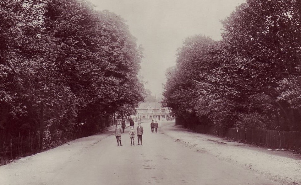
This is not to say the other parts of the catchment escaped – there was flooding higher up the Ravensbourne with Shortlands impassable; the local landowners at Southend, the Forster’s, home was flooded and the nearby bridge on Beckenham Lane (now Hill Road) was washed away – the bridge that replaced is pictured in the background of the postcard below. The cricket pitches by Catford stations were flooded up to sills of pavilion windows. Similarly, Bell Green was impassable on the River Pool (5).

The local press though focussed on the Quaggy and lower Ravensbourne – we’ll follow the trail of destruction and damage downstream from Lee Green. 

At Lee Green the basement of the shops at what was then called Eastbourne Terrace on Eltham Road (to the left of the photo, a couple of decades later) were completely flooded out with seemingly some flooding at ground level too. 

Further downstream where the Quaggy is bridged by Manor Lane, the road was impassable.  The area was in a period of transition from its rural past to suburbia, having been opened up by the railways through (but not stopping at) Hither Green, Lee and Blackheath.  There were still some larger houses from the exclusive village past – all situated in the higher ground around Old Road and on the hill between Lee High Road and Belmont Hill.   The lower lying fields were under water as was any housing built on the flood plain.  The same continued downstream through what is now Manor Park – the course of the Quaggy was a little different at that stage though. 

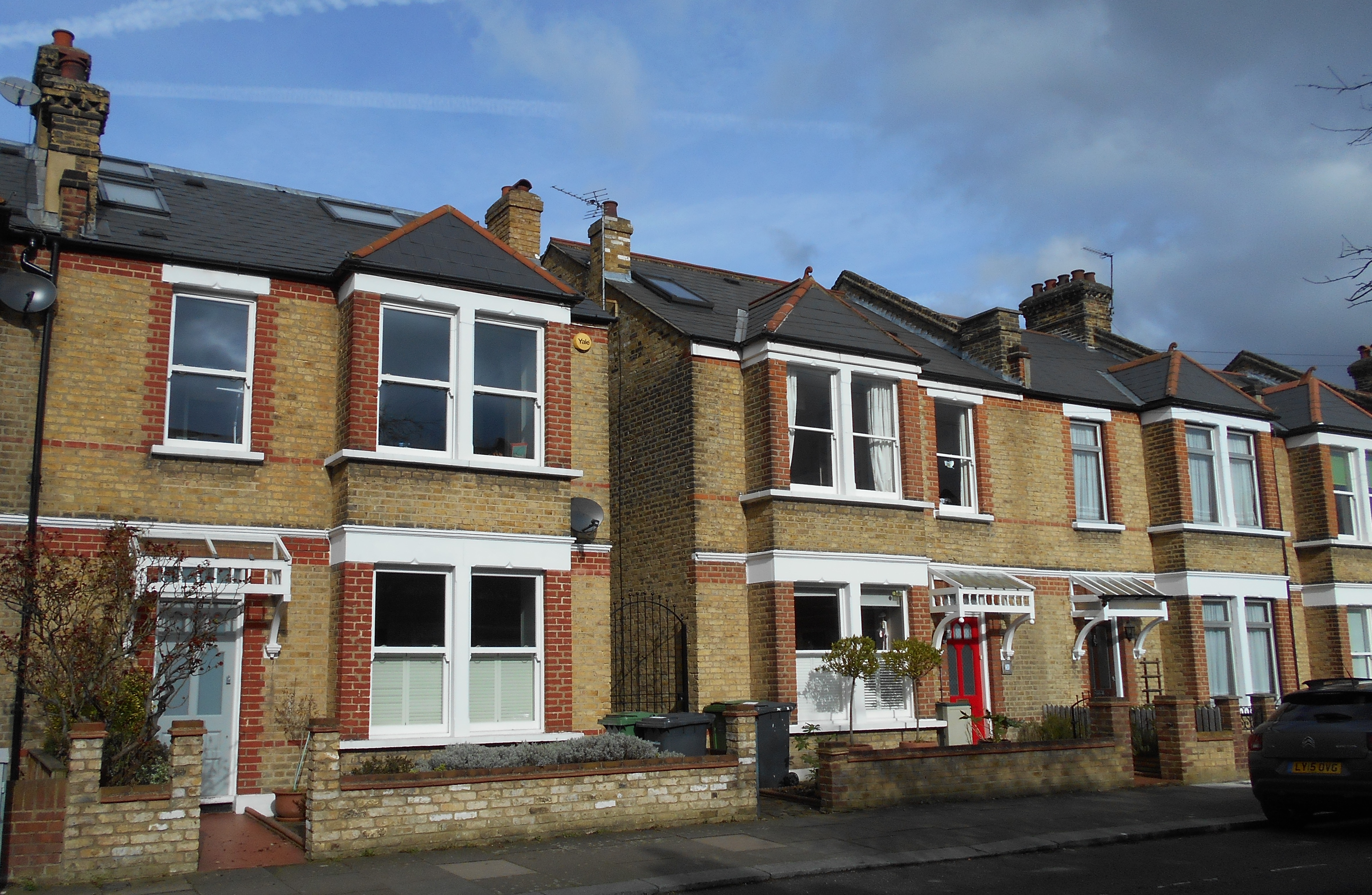
The houses that had been completed on what is now Leahurst Road (then a dog leg of Ennersdale Road) which backed onto the Quaggy were badly flooded.  As a result of the 1876 floods, the local Board of Works had built a large concrete wall, an early use of the material, to try to reduce the impact of future floods.  It was described as ‘perfectly useless’ as water bypassed it and inundated the houses in Eastdown Park.  The wall is still there – extended upwards a little after the 1878 floods.

There was a small dairy on Weardale Road, probably next door to the Rose of Lee.  Unsurprisingly it became flooded and the cowherd turned out the 30 cows who were found wandering in the water on Manor Park. The were taken to the higher ground of Lee Manor Farm.  Elsewhere in Lee, pigs were drowned.   

Beyond the Rose of Lee the relatively newly built Eastdown Park bridge ‘blown up by the force of the water.’ The bridge between Weardale Road and Eastdown Park also seems to have been destroyed.

The food waters became deeper as they went down Lee High Road, up to 1.2 metres (4’) deep in the houses of Elm Place, just before Clarendon Rise (then Road).  The Sultan on the other side Clarendon Rise was badly flooded too – the third time that this had happened in a decade as the publican, Robert Janes, explained in the press. The pub is pictured below from the next century.

Beyond the Sultan, flood waters flowed both over and under the road – at one point it was expected that the culvert  from the bottom of Belmont Hill to St Stephens church might be destroyed but in the end it was just the road surface that was wrecked – this is the high pavement that now stands in front of the police station. 

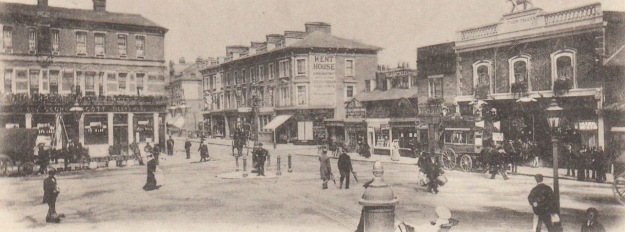
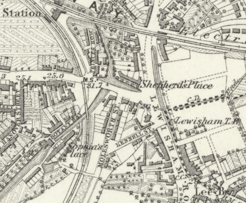
The roadway in front of St Stephens several feet underwater – with the Roebuck, Plough and other pubs such as the Albion all flooded.  Boats used to ferry people through Lewisham.  There was a real bottle neck around Plough Bridge, the ‘utter insufficiency’ of the narrow Plough Bridge to carry off ordinary storm water was regarded as one of the causes too. The whole area around Lewisham Bridge (pictured below from a few decades later) badly flooded, particularly Molesworth and Rennell Streets and unsurprisingly Esplanade Cottages in the middle of the Ravensbourne, along with the pub the Maid in Mill and rest of Mill Lane.

An iron girder bridge at Stonebridge Villas was washed down along with a wall by the railway, built to try to reduce flooding a year before was washed away – hundreds of houses on the lower lying parts of what became the Orchard estate to the east of the Ravensbourne were inundated. It was the same with the market gardens on the western side, along with large swathes of Deptford. Virtually all the area around the Ravensbourne on the map below from 15 years later was left underwater.

In addition to the high rainfall there was a clear underlying cause which was summed up well by a local man, Frederick Barff, who had grown up in Lee when it was still rural but was living in Eastdown Park in 1871 and if still there in 1878 would have been flooded out. He observed that prior to the development of Lee from the mid-1850s while there had been flooding, it initially stood in large areas of fields which absorbed the runoff without major consequences. The growth of Victorian suburbia had led to increased run off and more water ending up in rivers and stream and at a quicker pace (6).

In the immediate aftermath a temporary wooden bridge over the Quaggy between Weardale Road and Eastdown Park was approved the following day by the Metropolitan Board of Works (7).

There was a public meeting at the Plough on the Friday (next day) to ‘consider the best means of alleviating the distress amongst the poor of Lewisham, Lee, Blackheath and Catford. Crowded by the clergymen, parish officials and leading tradesmen of the district.’ In days before the state intervened in disasters like this it was left to charity to provide ‘coal and relief to those poor people in the district’ whose homes had been flooded. Over £200 was collected or promised for the Lewisham and Lee Inundation Relief Fund – with £120 going to the parishes of St Mark and St Stephen in central Lewisham that had been worst affected; £50 for Ladywell; with £50 for Lee and Blackheath.

So, what happened afterwards?  The approach that was used was one that continued towards the end of the 20th century and the 1968 floods – straightening and deepening rivers to try to move water on more rapidly.  This happened on the Quaggy behind what is now Brightfield Road – as the maps from 1863 and 1893 show. The Quaggy was also moved and straightened between Manor Park and Longhurst Roads – this happened a little later once the land was developed for housing.

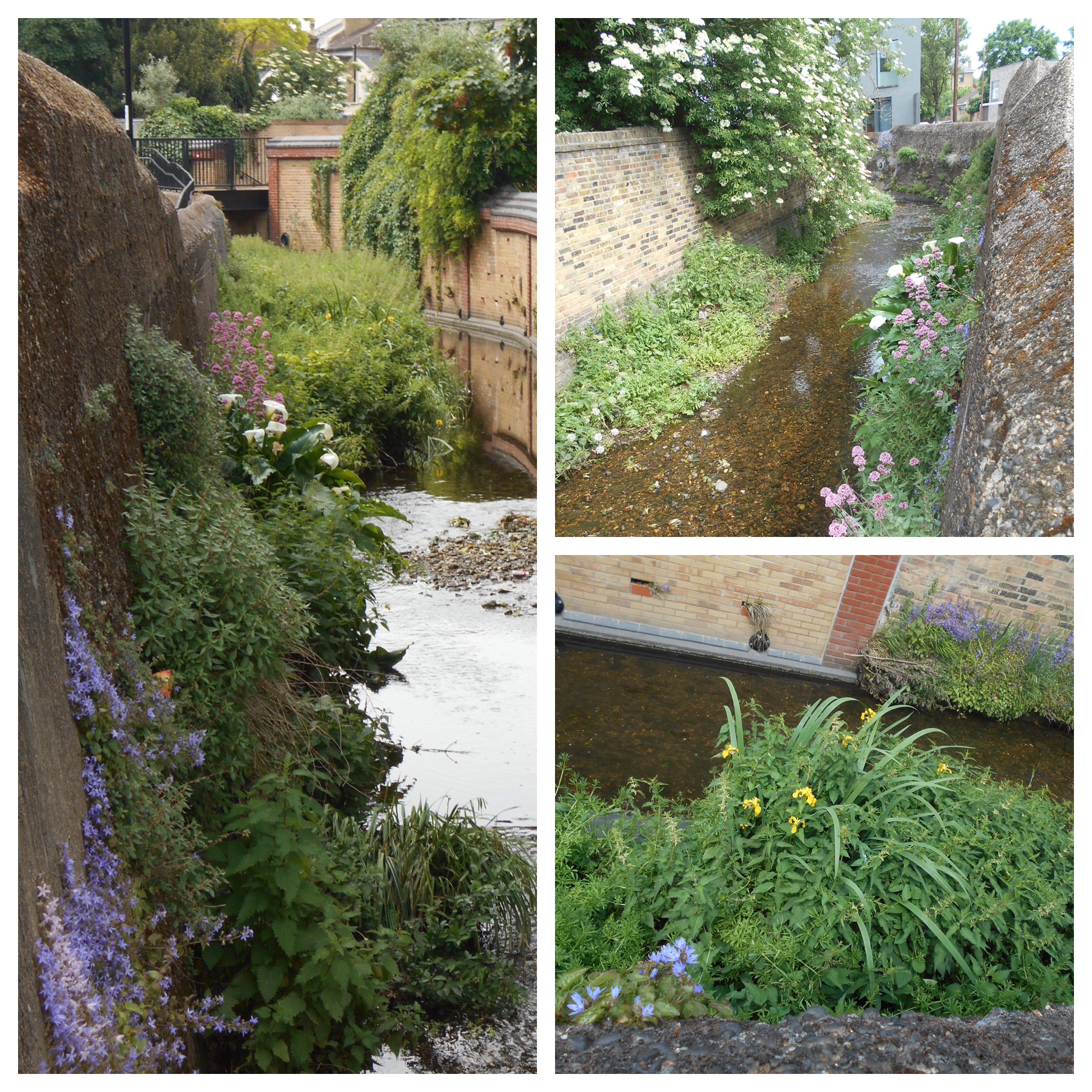
Several bridges were replaced – the partially destroyed Eastdown Park bridge was rebuilt and replaced with a girder one (see below from the river), the river level is lower there now too, although whether this happened post 1878 or 1968 isn’t immediately clear (8). 

Plough Bridge was replaced in 1881 by the Metropolitan Board of Works (9) having been preceded by ‘general dredging and clearing the channels of the river’ (10).  Later a new sewer between Lee Bridge and Deptford Creek was constructed to try to take some pressure off the rivers from run off (11).

Another bridge replaced by the Board of Works was the one on Lee Road.  Previously this had been a ford and footbridge, but a large single span bridge replaced it following the floods, presumably with a lowering of the river bed (12). 

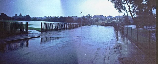
The underlying problems remained though, making flows quicker may alleviate problems in one location but without storage and a whole catchment solution, including the ability to control flows on the Thames it wasn’t much better than a sticker plaster. The fields that had acted as sponges continued to be developed and increased run off. In reality, not much had changed by the 1968 floods and it took the development of flood storage in Sutcliffe Park (pictured below) in the early 2000s to really make much difference. Without it Lewisham would regularly flood – it is pictured from late 2020.

Notes

Most of the information for this post comes from the Kentish Mercury of 27 April 1878 which covered the flooding and its aftermath in depth.  Readers can assume that contemporary information comes from there unless otherwise referenced.

  1. Dundee Courier 12 April 1878
  2. Kentish Mercury 20 April 1878
  3. ibid
  4. ibid
  5. ibid
  6. ibid
  7. Kentish Independent – 13 April 1878
  8. Woolwich Gazette 31 July 1880
  9. Woolwich Gazette 1 October 1881
  10. Kentish Mercury 16 October 1880
  11. Woolwich Gazette 17 June 1882
  12. Woolwich Gazette 31 July 1880

Credits

  • Census and related data comes via Find My Past, subscription required
  • The Ordnance Survey maps are on a non-commercial licence via the National Library of Scotland
  • Postcards of Lewisham Bridge and what was then Beckenham Lane are via eBay from 2016
  • The photograph of the Sultan is used with the permission of Robert Crawford, the great grandson of the Craddocks, licensees there in the 1920s, it remains his family’s copyright
  • The photograph of the destroyed bridge in Eastdown Park is from the collection of Lewisham Archives and remains their copyright, but is used with their permission

Brightfield Road – the Street with Two Names (Part 1)

Streets having their names changed is nothing unusual – we’ve covered it a couple of times before with Dermody Road (formerly Hocum Pocum Lane), Waite Davies Road (formerly (Butterfield Street). Similarly, on the other side of Lee High Road the bottom of Dacre Park was previously known as Turner Road. Like the second two examples, there is fading evidence of a painted street sign bearing the earlier name. However, it isn’t as easy to decipher the former name, Robertson Street, due to multiple layers of faint paint, re-pointing and a burglar alarm. In a pair of blog posts we’ll tell the history of the street – from its building to the present day.

The builder of the original part was someone we’ve covered several times before, John Pound, mainly in relation to his house building but also shops on Burnt Ash Road, pubs and Lee Public Halls. The street was built by Pound around 1862 (1), with applications made to the Board of Works that March for drainage connections. The land was owned by Lord Northbrook, although it doesn’t seem to have been farmed as part of Lee Manor Farm – it isn’t in the farm map of 1846 – and the estate seems to have retained the freehold post development (2) as permission was sought from Lord Northbrook’s agent for some work.

The homes were unlike most of those in the rest of the area at the time. The arrival of the railway in Blackheath had seen substantial homes with space for servants built to the north of Lee High Road. The function of these smaller houses was similar to those in Lee New Town – providing homes for the servants who didn’t ‘live-in’ and working classes of mid-Victorian Lee. There was another function too, large-scale housing development in what was then suburbia needed somewhere for the building labourers and trades to live in an era without cheap public transport. Pound seems to have done the same around Waite Davies Road and Summerfield Street for his brickworks in South Lee. It was a pattern followed by Cameron Corbett with houses in Sandhurst Road a few decades later.

Pound also seems to have built the neighbouring Hedgely Street – he made an application for sewer connections in 1868 (3).  The street was adopted and paved in 1871 at a cost of 4/6d on the rates for occupiers – not the landlord (4).

So, who were the early occupants?  We’ll look at the first 20 houses in the 1871 census, the first census they appeared in; while the numbers appeared as consecutive in the census reports it isn’t clear whether this was the case on the ground.  The numbering is now odds and evens. The shops have been ignored for now, but may be returned to in a later post.

The majority (52%) of heads of household were working in the building trade, mainly skilled trades with the remainder split between various forms of domestic service and other trades.  Relatively few of the women worked, but those who did, tended to be listed in the census as charwoman or laundress.  While not in in the houses reviewed in detail, elsewhere in the street there were farm labourers housed – presumably still working at either Burnt Ash, Lee Manor or Horn Park which were all still working at that stage.

Almost half of the houses were either home to two households or took in a lodger, there were some very overcrowded homes as a result – 13 lived at no 17 for example. Almost all the households had children.

A decade later the average number in each house was 6.7 (it had been 5.5 in 1871), mainly due to an increase in lodgers and shared houses.  More women were working, although the trades were mainly around washing, ironing and cleaning.  Male employment had changed little too, the majority working in the building trades.

Unsurprisingly, there was some crime relating to the street, a fair amount of it alcohol related. John Mahoney had to be removed by heavies from the Tiger’s Head for being drunk and aggressive. He then went over the road to what is now referred to as the New Tiger’s Head, but press reports called the Little Tiger, where he was arrested after falling asleep drunk. He then violently assaulted the arresting officer for which he spent 6 weeks in prison (5).

Robert Stow was found guilty of assaulting a police officer after being arrested for being drunk and disorderly outside the nearby Duke of Edinburgh – his defence was that he didn’t know it was a policeman and that he’d had too much rum to drink cut no ice with the magistrates.  He was fined 20/- or 2 weeks in prison (6).

Theft wasn’t completely absent though – Thomas Upton (23) a labourer from 19 Robertson Street charged with stealing 25 hens from Blackheath Park and then selling them in Greenwich.  He was sent to prison for 14 days (7).

The western side of the terrace backed not onto the Quaggy, as it does now, but onto a path from that broadly followed what is now Aislibie Road.  After the floods in 1878 and probably also to allow better development of the land that was to form Lampmead Road, the Quaggy was deepened, straightened and took the route of the path. The differences are clear between the 1863 (top map below) and 1893 visits of the Ordnance Survey Cartographers.

The extension of the street to the northern side of the Quaggy seems to have happened around 1885 following the piecemeal sale of the Lee House estate. The builder may well have been George Mitchell; he made the application for connecting the new homes Brightfield Road to the existing sewers in what was still referred to as Robertson Street. John Pound asked for money for the connection (8). It is assumed that these would be the homes that are now numbered 109 to 127 Brightfield Road (some of which are pictured below), but could have been those to the south over the Quaggy.

Three years later a decision was made by the Metropolitan Board of Works in March 1888 to change street names in the area.  It seems that Lampmead Road was created, it had originally been a dog-leg of Lenham Road going towards Lee High Road.  The biggest change was in relation to Brightfield Road – from 1883 it had run from Old Road and then dog-legged around to the new homes built by George Mitchell.  The section from Old Road now became Aislibie Road and Brightfield Road, while shortened to the north took expanded over the river and Robertson Street was no more (9). In addition to the remains of the painted sign, a stone one remains and is now part of a garden wall.

The new Brightfield Road had changed a lot by 1891 compared with the last census for Robertson Street. John Pound’s building work had finished in the area and only 8% of the heads of household at the eastern end of the street were working in the building industry, just over a third were servants – mainly jobs relating to horses with the remainder a wide variety of manual jobs. As was the case a decade earlier a lot of the women worked – mainly as dressmakers and laundresses. Most households had children and most of the houses were either shared or homes to lodgers too – overcrowding remained, although it was less bad than in 1881 – the average was 5.8 rather than 6.7 a decade earlier.

There were a few sales of the houses which seemed to be all tenanted over the next few years. In 1892, 111 -125 (odds) were up for sale at auction. These are the larger houses backing on to Manor House Gardens, then let as a military crammer school before the House and Gardens were sold to the London County Council in 1898. The particulars of the sale of the houses in Brightfield Road noted the proximity to Lee and Blackheath stations. Each house was ‘conveniently arranged for two families. Let to very respectable tenants at 12/- a week.’ There were unexpired leases of 92 years (10).

Three years later some more of the later houses, 75-79 which were adjacent to the original houses were sold – they were advertised as being on long leases, having a weekly rent of 12/- and an annual ground rent of £5 (11).

The change in name didn’t stop crime relating to the street in 1897, Emma Agate was arrested for theft of a large number of garments from Lee Public Halls Steam Laundry (in early 2021 home to Travis Perkins off Holme Lacey Road) where she worked as an ironer, she was found with a number of pawn tickets. She denied the charges but was remanded in custody (12).

There were a couple of bigamy cases – William James was charged with bigamously marrying Mary Bator of number 61 in 1889 (13). Four years later, Walter Garland admitted to a bigamous marriage to Alexandra Taylor of 60 Brightfield Road (14).

We’ll leave Brightfield Road at the end of the 19th century, returning in the second part to cover the 20th century and beyond.

Notes

  1. Kentish Mercury 22 March1862
  2. Kentish Independent 01 June 1872
  3. Kentish Independent 10 October 1868
  4. Kentish Independent 16 December 1871
  5. Kentish Mercury 18 June 1870
  6. Kentish Mercury 30 October 1875
  7. Kentish Independent 10 April 1886
  8. Kentish Independent 02 May 1885
  9. Kentish Mercury 9 March 1888
  10. Kentish Mercury 25 July 1892
  11. Kentish Mercury 29 September 1895
  12. Woolwich Gazette 27 August 1897
  13. Kentish Mercury 13 June 1890
  14. Woolwich Gazette 27 April 1894

Credits

  • The maps are on a Non-Commercial Licence via the National Library of Scotland
  • All the census and related data came via Find My Past (subscription required)
  • The photo of the stone sign is courtesy of Frederic Heffer

Beating the Bounds of Lee, Part 7- Lewisham to Blackheath

During the first 2020 Coronavirus lockdown Running Past followed the long thin boundary of Victorian Lee before it was subsumed into Lewisham, aided only by a Second Edition Ordnance Survey map. This was in stages, from Lee Green to Winn Road, appropriately passing Corona Road en route; the next through Grove Park; then on through Marvels and Elmstead Woods and a Borough of Deptford Cemetery; the circuit skirted Chinbrook Meadows and followed the appropriately named stream Border Ditch; then another Ditch, Hither Green Ditch, more or less parallel to Verdant Lane and Manor Lane before following the Quaggy from Longhurst Road into Lewisham.

We’d left the 1893 boundary by St Stephens Church in Lewisham where the Quaggy is, or more likely was joined by Upper Kid Brook. When the stream was followed a few years back from its source around Hervey Road, on the lower slopes of Shooters Hill, there seemed no obvious evidence of flows coming into the Quaggy. The position was different in 1893 though, as we shall see.

The view looking towards St Stephens from what was captured in a postcard from slightly, although not much later; at the stage there were two confluences of the Quaggy and the Ravensbourne, the pictured Lewisham Bridge (an area a little later known as the Obelisk) and Plough Bridge by the former eponymous pub.

Even though Upper Kid Brook has disappeared from view, the course of the boundary and river is obvious from the valley. The valley though is not the shape that it had been until the 1840s as the North Kent Line, which opened in 1849 effectively stole the valley, deepening it in places.

There used to be a boundary marker on the curb on the northern side of St Stephen’s Grove, but it seems to have been lost at some stage. There is a slight dip in Lockmead Road, the remains of the fluvial erosion from the Brook, before the boundary hugs the rear fences of Cressingham Road, a boundary in terms of land ownership too. The Lee-Lewisham border comes out into 2020 public space in a relatively new development at the top of Cressingham Road. Looking towards the Brook and boundary from the railway underpass is a variation on a recurring theme from the circuit of Lee – a Lewisham Natureman stag.

In 1893, on the site of the new housing, was a small lake, the Brook was dammed to create it. The lake was at the end of the grounds of one of the large houses of Lee, Belmont, which gave its name to the Hill. it is mapped below. The house was built for the architect George Ledwell Taylor around 1830, when there would have been clear views to the dockyards of Deptford, where he worked for the Navy.

With the city encroaching and the railway passing, the large house ceased to be as desirable and was sold for the development of what turned out to be some of the most elegant Edwardian housing in Lewisham.

The Brook, and the Lewisham – Lee boundary drifted slightly to the north after he grounds of Belmont. By 1893 this was on the northern side of the railway around the end of what is now Belmont Grove. The railway is in a cutting within the valley, the pre-1849 level Brook and boundary would have been roughly at current road levels.

The railway had split the grounds of another of the large mansions of Lee, the Cedars – home in 1893 at to Ellen Penn, the widow of John Penn the eminent marine engineer. The northern portion of grounds had been laid out in the late 18th century for the then owner, Samuel Brandram, by the architect George Gwilt (1), who dammed Upper Kid Brook to form a pair of ornamental lakes, big enough for boating. Brandram was a paint and chemicals manufacturer and merchant whose large business was based in Rotherhithe.

The lakes were filled in by the next owners, Penfold’s whose carting business was to fill them with rubbish before selling the site on for housing development in the 1980s, now known as St Joseph’s Vale.

The boundary and Brook crossed Love Lane, now Heath Lane – part of an ancient path from Lee High Road to the Heath. In 1893, this area was still fields, with several boundary markers indicating on the ground the now hidden Brook. It wasn’t fields for long – within around 200 metres the fields turned to railway sidings, which extended another 600 metres up to the station, including the current car park.

The hidden street and boundary largely skirted the sidings – cutting across the late 1970s council housing of Nesbit Close and around the top of the current Perks Close. The Nesbit is E Nesbit who lived in various Lewisham locations, including a Blackheath home around half a mile away. Perks, of course, is a reference to Stationmaster of the Railway Children, played by Bernard Cribbins.

The boundary followed the edge of what is now Baizdon Road and then what is and was Collins Street. The former was named after a Blackheath miller, the latter after two mid 19th century Lee residents – Ann and Julia Collins (2). At the far end of Collins Street a boundary marker remains on a wall – the fence next to it seems to be the actual location of the Lee – Lewisham boundary.

The boundary continues following the building line to Blackheath Village; there was a three way boundary here Lee – Lewisham – Charlton. We’ll stop the circuit for now at a boundary marker, a replacement for one from 1903, when it would have been a Greenwich – Lewisham one.

Notes

  1. Neil Rhind (forthcoming) Blackheath and Its Environs Volume 3
  2. Joan Read (1990) Lewisham Street Names and Their Origins In the corner of the latter into the centre of Blackheath. – the area

The 1893 map which is used twice is via the National Library of Scotland on a non-commercial licence.

The Postcards are via eBay from 2016

This, and the rest of the series of posts on the Lee boundary, would probably not have happened without Mike Horne, he was the go-to person on London’s boundary markers; he had catalogued almost all of them in a series of documents. He was always helpful, enthusiastic and patient. He died of a heart attack in March but would have loved my ‘find’ of a London County Council marker in some undergrowth on Blackheath during 2020’s lockdown, and would have patiently explained the details of several others he knew to me. A sad loss, there is a lovely series of tributes to him via this link.

Beating the Bounds of Lee, Part 6 – Following the Quaggy

During the 2020 Coronavirus lockdown Running Past followed the long, thin boundary of Victorian Lee before it was subsumed into Lewisham in 1900, aided only by a 1893 Second Edition Ordnance Survey map. This has been in stages, from Lee Green to Winn Road, appropriately passing Corona Road en route; the second part took us through Grove Park, crossing the never built Ringway; we then passed through Marvels and Elmstead Woods and a Borough of Deptford Cemetery; the fourth part took us through Chinbrook Meadows appropriately following Border Ditch; and the last part followed the hidden stream Hither Green Ditch more or less parallel to Verdant Lane and Manor Lane.

We left the boundary at the confluence of Hither Green Ditch with the Quaggy to which we will return, following the red dots on the map.

The confluence has actually moved – in 1893 it was more or less where 49 Longhurst Road is now located; it is now around 40 metres away on a sharp corner between between Manor Park and Leahurst Road (pictured below).

In 1893 this was still, just, the land of Lee Manor Farm, although this would change dramatically over the next decade. As was the case when we followed the boundary along Hither Green Ditch, the Quaggy not only was the Lee – Lewisham boundary it was one between two farms. On the west was North Park Farm (the top of the map below) and on the east Lee Manor Farm – the sale of the former to Cameron Corbett who created what is known as the Corbett Estate and the latter by the Northbrooks in a more piecemeal fashion was to shape the urban landscape.

The boundary was within the flood plain, with the Quaggy meandering along the boundary of the farm, the Lee – Lewisham boundary of 1893. While this was acceptable in farmland it wasn’t in relation to the smaller suburban housing about to be developed the east of the railway. Memories of the devastating floods of 1878 will still have been prominent – the theory about dealing with such floods, which prevailed until the end of the following century, was to deepen and straighten the river, moving the water on as quickly as possible – this is clear from the photograph below. This approach also made development easier as had been seen with the development of Lampmead Road following the sale of Lee House in the 1880s.

Like the previous sections, the boundary is being followed on foot, the footwear of choice has changed though because while the rest of the route has been run, this section, apart from a 300 metre covered section in central Lewisham, is by walking along the river bed so waders became the footwear of choice.

The river and boundary continue to diverge for a little, the 1893 flow of the Quaggy and consequently the boundary meandered along what is now broadly Longhurst Road. It was never any more than 50 metres away from the river’s current, very straight, deep, engineered course. The convergence of the 19th boundary and the Quaggy more or less where the 21st century bridge from the the entrance from Longhurst Road into Manor Park is now situated – just above the start line for the annual (in non-COVID-19 years) Quaggy Duck Race.

While the Quaggy and Lee – Lewisham boundary are now coterminous and the meanders are broadly similar in 2020 to 1893, much changed in the intervening period. The Quaggy was straightened and channelised through what until the 1960s was the last bit of farming in Lee – a piggery. The open space, Manor Park, was created in the mid-1960s with meanders restored to something very close to those that existed in 1893 in 2007.

At the exit of the Park, there is a bridge, it is a long-standing crossing of the Quaggy, part of an ancient path known as Hocum Pocum Lane which ran from St Mary’s Church in Lewisham to Lee High Road. Despite the work done further upstream to deepen and straighten the course it flooded badly here in 1968.

Beyond Manor Park, the river and 1893 boundary squeezes between the Victorian housing of Weardale Road and Eastdown Park. The land for the latter land had already been developed by 1893, Eastdown Park on land that had been cultivated by the market gardens of Lewisham Nursery, run by Messrs Willmott and Chaundy, until 1860.

Beyond the river’s first meander is the garden of 45 Eastdown Park, possibly very briefly home to the Ginger Baker, his father was there just before the Cream drummer was born in 1939.  A hundred metres or so further on another there is another building with a musical history – the Rose of Lee, now Dirty South, which saw the first public performance by Kate Bush.

We have already mentioned serious flooding that occurred in the spring of 1878 in relation to straightening the Quaggy upstream.  However, while the meanders and boundary of Lewisham and Lee hadn’t changed since then, the depth of the watercourse had.  It is at least half a metre lower than in the prictue showing the partial destruction of the bridge in Eastdown Park.  So whilst it is a pleasant wander down the river there is little to see beyond boundary walls and banks for much of this stretch.

In 1893 on the opposite side of the Eastdown Park bridge was a Baptist Chapel, this was largely destroyed during World War 2 and the site is a vacant garage, last home to Penfold’s.

Both sides of the river and boundary into Lewisham were lined with housing in 1893; on the Lee (High Road) side a few remain, 152 was once home to William Sidery (pictured top) part of a multi generational Lee building firm.  Grove Cottage next to the Ambulance Station dates back to 1835 and 96 is the last remaining section of Lee Place (not to be confused with the eponymous mansion off Old Road) which was built in 1813 (lower picture) (1).

The remaining houses were largely lost to Fry’s garage and showrooms, which themsleves were replaced by a large Lidl and topped by an even larger block of flats this century.

On the opposite side of the river in Lewisham in 1893 was the well established College Park estate, briefly home to the poet James Elroy Flecker.

Behind the housing the river retains a pleasant almost rural feeling idlyll – it has probably changed very little in the 127 years since the Ordnance survey map being followed was surveyed.  

Beyond Clarendon Rise bridge, on the Lee side, was the Sultan in 1893 (pictured from early in the 20th century below), replaced in the last decade by Nandos; on the Lewisham side of the bridge is now the beautiful Hindu temple although that was a yard in 1893. Penfold’s moved into the site adjacent to both, known as Clarendon Yard around 1904.

The river disappears under what was referred to as Lee Bridge in 1893 for around 300 metres.  Alas, dear reader, this part was done at street level. 

The raised area above the river was an established shopping parade in 1896 with a tea dealer (83), a pair of boot makers (75 & 81), a wool shop (79), a confectioners with an architect and auctioneers above (77), Singer’s sewing machines (73), a stationers (71), a series of household goods shopsunder George Stroud’s ownership (65-69), a chemist (63), a florist (61) and the mainstay of that part of Lewisham high Street for generations – Chiesman’s Department Store (pictured a few years into the 20th century). 

Much has changed now, rather than Chiesmans dominating the street scene it is a massive and not particularly attractive police station. 

On the side of the police station is memorial that celebrates the contribution of Asquith Gibbes to Lewisham and, in the context of of the Black Lives Matter protests of earlier in lockdown, seems an important place to pause. Such memorials to members of London’s Black community remain a rarity, although just inside the Lee border is the Desmond Tutu Peace Garden, Tutu was a curate in Grove Park.

Asquith Gibbes was born in Grenada, and arrived in Britain in the late 1950s, working in Lewisham for 40 years fighting racial inequalities in education, policing and housing. There is a fuller biography of him as part of the brief for the memorial – two examples of his work have national significance. He chaired Millwall Anti-Racist Trust and instigated the ‘Kick it Out’ programme at Millwall Football Club in 1993, a campaign that was adopted nationally. Asquith was also part of very significant work with the Association of Chief Police Officers and the Home Office on reforming ‘stop and search’ rules.

Returning to the Lee – Lewisham boundary of 1893, the Quaggy re-emerges just beyond the shops of 1893 and the police station. The boundary though takes a sharp turn to the east (right) by St Stephen’s church, at what is/was the confluence of the Quaggy and Upper Kid Brook, following the latter towards Blackheath. We’ll cover that part of the boundary at our next visit.

Picture Credits

  • The picture of Chiesmans shop in Lewisham is via e Bay in June 2016
  • The photographs of 1968 floods, the destroyed bridge in Eastdown Park and the map of Lee Manor Farm are from the collection of Lewisham Archives and remain their copyright, but are used with their permission
  • The Ordnance Survey map of 1893 is via the National Library of Scotland on a non-commercial licence
  • The photograph of the Sultan is used with the permission of Robert Crawford, the great grandson of the Craddocks, licensees there in the 1920s, it remains his family’s copyright.

Note

1 Lewisham Leisure (1990) ‘From the Tiger to the Clocktower’

This, and the rest of the series of posts on the Lee boundary, would probably not have happened without Mike Horne, he was the go-to person on London’s boundary markers; he had catalogued almost all of them in a series of documents. He was always helpful, enthusiastic and patient. He died of a heart attack in March but would have loved my ‘find’ of a London County Council marker in some undergrowth on Blackheath during 2020’s lockdown, and would have patiently explained the details of several others he knew to me. A sad loss, there is a lovely series of tributes to him via this link.

Beating the Bounds of Lee, Part 4 – Chinbrook and Downham

During the 2020 Coronavirus lockdown Running Past has been following the boundary of Victorian Lee before it was subsumed into Lewisham, aided only by a Second Edition Ordnance Survey map surveyed in 1893 and a fair amount of local knowledge. Posts have taken us in stages from Lee Green to Winn Road, appropriately passing Corona Road en route; the second took us through Grove Park, crossing the never built Ringway and the previous one through Marvels and Elmstead Woods leaving the boundary on the edge of Chinbrook Meadows allotments – and it is on to the Meadows that we now proceed.

This section is marked by the red dots on the adjacent map.

At around the point of a kissing gate, at the top of a steep hill down into Chinbrook Meadows the 1893 and 2020 variants of the boundary of Lee diverge.

The current variant of the boundary heads down into the lovely Chinbrook Meadows; it wasn’t always like this when the farmland became a park, the Quaggy was hidden. A blog post from a few years ago, covers its rejuvenation in 2002. The now Bromley and Lewisham border largely hugs the bottom of the railway embankment coming in from Elmstead Woods.

The 1863 version of the boundary crosses the railway in what is a deep cutting at this point, and emerged in what was then a small field and is now part of the smaller southwestern field of Chinbrook Meadows following the fences to the rear of the gardens of Portland Road until the Quaggy is again reached (further upstream than when covered in earlier in the circuit of Lee).

The 1893 boundary followed the Quaggy for around 100 metres until a confluence with the Border Ditch underneath the railway embankment. The ‘border’ in Border Ditch appropriately refers to the boundary we are currently following. When we followed Border Ditch as part of the tracking of the Quaggy and its constituent tributaries, the Ditch in Chinbrook Meadows was in a poor state but there were plans for a sustainable urban drainage system to be incorporated into its flow. Alas, this seems not to have materialised and the watercourse looked decidedly uninviting during lockdown – the photographs of its latter stages are from the initial visit in 2016.

Border Ditch has an even shorter flow than the Quaggy within Chinbrook Meadows – it emerges from culverting in a way that is more reminiscent of a drain than a stream.  As had been the case in the summer of 2016, there was little sign of movement in the ominous looking muddy water. 

The Ditch continues upstream and seems to have marked the border until the 1991 proposals came into force, although as was noted in the post on Border Ditch there were several minor re-alignments of the Ditch and the boundary over the years

Over the other side of the physical boundaries of the railway, which required a significant detour, Border Ditch only appeared as a field boundary on the 1893 Ordnance Survey map. It is now not only the border between Bromley and Lewisham but between the private sector semis of the former and the social housing of the latter. Traces of water were difficult to find in lockdown in the normally still flowing division between the two.

Streams, even quite small ones create valleys and out on the main Burnt Ash Lane the dip is noticeable and there lies both the current and 1893 variants of the boundary. The photograph above probably dates from just after the map was drawn, is of what was then a bridge and is looking towards Bromley.

Burnt Ash Lane was a name that once continued from here to the junction with St Mildred’s Road, but the it was renamed in ‘honour’ of the Lords of the Manor – the Baring Family. At the time they bought the Manor of Lee at least part of the Barings money was coming from an enslaved estate in Montego Bay in Jamaica. John Pound built much of Victorian Grove Park, on Northbrook/Baring land, naming the pub after them – the lovely Baring Hall.

We’ve strayed 400 metres away from the boundary putting the street name into some context, so back to the border, Border Ditch. The 1893 Lee (now Lewisham) – Bromley border continued westwards across fields to a three-way split in 1893 with Lewisham providing the third part of the trio. During the 19th century there had stood, according to F H Hart, ‘a tall round-top oak tree, a land mark from Lee Church’ at the junction of Lee Terrace and Brandram Road. It seems that this may have been lost by 1893, as this point was marked with a boundary post. In 2020, it is part of one of the dozens of largely access roads to garages in the area made largely redundant by the increase in car size, this one behind Welbeck Avenue.

The redundant access road is the course of Border Ditch which continues another 50 metres or so to a source in what is now some school playing fields. A small pond was marked in 1893. Oddly for such an elevated situation, close to the watershed between the Quaggy and Ravensbourne catchments, this was a small World War 1 airfield, Grove Park Landing Ground.

On the other side of the redundant track to redundant garages is the edge of one of the larger London County Council (LCC) estates, Downham, which was built in the late 1920s and early 1930s. The name doesn’t have any local links, rather it was that of a Chairman of the LCC just after World War 1.

The Lee – Lewisham boundary of 1893 was through fields, the boundary following what were then the hedges of field edges not marked in any way by posts, markers or marks on trees. Despite the transformation of the area between the World Wars, the street pattern still at least partially follows the field patterns. The former Lee – Lewisham boundary was follows the middle of what is now Geraint Road; like many boundaries that follow roads, it’s marked by white paint. The 1893 boundary then bisects Ivorydown, the name of a former field in this area, to reach Downham Way.

We will leave the boundary there for now because on the other side the nature of what is followed changes from field edge to hidden stream.

Credits and Thanks

  • The Ordnance Survey Map is via the National Library of Scotland on a non-commercial licence.
  • The black and white photograph of Burnt Ash Lane was originally used in the post on Border Ditch on the basis of a creative commons from this site, although the photograph library with it seems to have been deleted.

The series of posts on the Lee boundary that this post is part of, would probably not have happened without Mike Horne, he was the go-to person on London’s boundary markers; he had catalogued almost all of them in a series of documents. He was always helpful, enthusiastic and patient. He died of a heart attack in March but would have loved my ‘find’ of a London County Council marker in some undergrowth on Blackheath during 2020’s lockdown, and would have patiently explained the details of several others he knew to me. A sad loss, there is a lovely series of tributes to him via this link.

Beating The Bounds of Lee Part 2 – Winn Road to Grove Park

In the last post, we returned to the old tradition of ‘beating the bounds’ of the civil parish of Lee, ‘armed’ mainly with a Second Edition Ordnance Survey map of the area and a decent amount of local knowledge of the history. The survey for the map had been carried out in 1893, but it seems to have updated to reflect boundary changes relating to Mottingham in 1894.

We had left the Lee boundary on Winn Road, part of a small estate developed by William Winn, which, appropriately for the time this post was written, includes Corona Road.

The route followed is the red line on adjacent Ordnance Survey map. It was broadly the same circuit that had been followed in 1822 by the great and the good of the parish. Included in their number, although not in the ‘good’ part, was the final tenant of Lee Place, the odious Benjamin Aislabie – a slave owner after slavery was abolished in the Empire. At least the parish spelled his name incorrectly as ‘Aislibie’ when naming a street after him.

This image has an empty alt attribute; its file name is af0690cd-be10-40de-8e36-558916f75f88.jpeg

We had left the boundary at the final of a trio of 1903 Lewisham boundary markers at the south easterly junction of Winn and Guibal Roads. Lee was merged with Lewisham into the Borough of Lewisham in 1900. The 1893 boundary was about 15 metres to the west and cut across to what is now Burnt Ash Pond, mid way down Melrose Close. The current Lewisham boundary with Greenwich veers off to the east down Winn Road to the Quaggy.

Burnt Ash Pond is usually a delightful little oasis of calm, but seemed to be suffering from lock down, seemingly covered with either duckweed or green algae when passed by on this occasion. The 1893 variant of the boundary passed through the Pond and continued southwards down Melrose Close, attractive late 1970s council housing, diminished by an entrance through largely abandoned garages. In 1893 the boundary passed through back gardens parallel to Burnt Ash Hill, almost opposite College Farm. There is an 1865 Lee Parish marker hidden in the undergrowth next to the pond, although it is not visible from the outside.

The name ‘Melrose’ came from another farm which seems to have evolved out of Horn Park Farm, whose farm yard we crossed in the first post, and was essentially a market garden operation and was also referred to as Woodman’s Farm, after its tenants. The Close was probably part of its land. Its farmhouse in Ashdale Road remains and was used as a site office for the developers of much of the area we are about to pass through, Wates. The farm’s main claim to fame was the unintentional landing of Willows II (pictured below) which was aiming for Crystal Palace and in the process created a record for the longest airship flight.

This image has an empty alt attribute; its file name is image.jpeg


The boundary continues parallel to Burnt Ash Hill until a point almost opposite Ashwater Road when it follows what are now the rear fences of houses on the northern side of Senlac Road, presumably named after the likely location of the Battle of Hastings. In the back garden of a group of Wates built interwar semis between Exford and Ashdale Roads, there was once the junction of the parishes of Lee, Eltham and Mottingham. The house with three boundaries, then had two and now has none – the Bromley boundary is now at the bottom of the hill following the Quaggy. The change is a relatively recent one, dating from 1991 proposals, the current resident remembers paying council tax to both Lewisham and Bromley. In 1893 we would have been in fields.

The 1893 boundary broadly followed what is now an access road to the rear of houses in Jevington Road. The end of Jevington Road has a chain link fronted jungle facing it, the boundary pierces through the chain link, on the Mottingham side of the 19th century border is now a Den of a former Dragon, a Bannatyne Health Club. The Lee side is, arguably even healthier – some allotments, along with a community volunteer run library.

This image has an empty alt attribute; its file name is c184c1fd-fb72-4fc1-aba9-0217594ac8ee.jpeg

This section would have been very different if the Conservative run Greater London Council (GLC) plans for Ringway 2 had come to fruition in the late 1960s. In South London, it was essentially a motorway replacement for the South Circular.

There was much secrecy about the detail of the route, although the most likely version suggested by Chris Marshall would have seen a five lane motorway driven through the allotments, with a minor interchange for Burnt Ash Hill and a major one on Baring Road. There was much opposition across south London to the scheme, and the absence of a motorway here points to its success. The only tangible remains of Ringway in the area is an eponymous community centre on Baring Road.

Returning to 1893, when the Ordnance Survey cartographers visited, the Grove Park Hospital had yet to be built – that wouldn’t be for another 15 years. We’ve covered the hospital when we followed the Quaggy through these parts.

On the northern wall is a boundary marker – the ‘MP’ is clear in that it relates to Mottingham Parish which from 1894 to 1934 was a ‘detached’ part of the Bromley Rural District. The ‘LP’ is less clear, Lee had disappeared into Lewisham by the time the hospital was built, but it was the Borough of Lewisham rather than the parish.

In 1893 the parish of Lee meandered across the soon to be hospital site, changing direction at a tree that doubled up as a boundary marker. The tree is long gone, presumably felled when the hospital was constructed and the boundary moved to the edge of the hospital site. Oddly, in the housing that replaced most of the hospital buildings, there is a tree at the same point as the former boundary marker.

On the eastern side of the hospital site, Lee’s boundary takes on a new format, the Quaggy. Rivers and streams often form the boundaries between parishes and local authorities, as we have found with several streams and rivers – including the River Wilmore in Penge and Border Ditch that we will encounter later in our perambulation around Lee.

Alas, the conterminous boundary with the Quaggy (shown top left below) only lasts for around 50 metres, about 2 and a half chains of Victorian measurement. However, we swap one watercourse for another as the boundary veers off the the east, following Grove Park Ditch, which depending on rainfall levels either cascades or splutters into the Quaggy (top right, below).

The confluence is a pipe opposite the Sydenham Cottages Nature Reserve, named after the farm workers cottages above. The nomenclature ‘Ditch’ is used quite a lot within the Quaggy catchment, it shouldn’t be seen as belittling or derogatory it is just the way smaller streams are described – there also are Milk StreetBorder and Petts Wood further upstream.

About 50 metres inside the Lee side of the boundary, Lewisham Natureman has been recently active – a new stag has been painted, drinking from the Quaggy (or would be in more typical flows) in the shade of an elder bush. We will return to his work at a few other points on our travels around the Lee boundary.

The course of Grove Park Ditch isn’t certain, it is culverted for almost half a mile, but would have crossed the fields below more or less parallel to a very rural looking Marvels Lane from 1914, presumably coterminous with the boundary.

There is a boundary marker outside 94 Grove Park Road. It is weathered and unreadable, but marks the Lee boundary with Mottingham – given the style is similar to those around Winn Road at the beginning of this section it probably dates from 1903, however, the location of the boundary was the same in 1893.

In the next instalment, we will follow the boundary through the rural Grove Park of 1893.

Picture Credits

  • The Ordnance Survey Map is via the National Library of Scotland, it is used here on a non-commercial licence
  • The picture of Willows II is from an original postcard in the authors ‘collection’
  • The Ringway map comes from Chris Marshall’s fascinating website
  • The postcard of Grove Park is from e Bay in November 2016

The series of posts on the Lee boundary that this post is part of, would probably not have happened without Mike Horne, he was the go-to person on London’s boundary markers; he had catalogued almost all of them in a series of documents. He was always helpful, enthusiastic and patient. He died of a heart attack in March but would have loved my ‘find’ of a London County Council marker in some undergrowth on Blackheath during 2020’s lockdown, and would have patiently explained the details of several others he knew to me. A sad loss, there is a lovely series of tributes to him via this link.

Beating The Bounds of Lee, Part 1- Lee Green to Winn Road

As regular readers of Running Past will be aware, the blog has followed the course of a number of natural features and human constructs – rivers and streams, notably the Quaggy and its tributaries, the Greenwich Park branch railway and the Prime Meridian from the edge of Croydon, back through Lewisham and to the Greenwich Observatory. Such wanders make for interesting cross sections of the city. We turn our attention to another of these constructs – the boundary of the former civil parish of Lee which existed until 1900.

Beating the bounds is an ancient tradition, reminding parishioners of the importance of boundaries which was carried out during Rogationtide—the fifth week after Easter. There would be a walking of the parish boundaries, with children would carrying willow which would be used to beat the boundary markers. The boundary markers might be stones, streams or marks on trees, or roads. Oddly, other than around Lee Green, roads seem to have been neglected in deciding the parish boundaries of Lee.

No willow will be harmed in the perambulation of Lee, the on-ground research for which appropriately started on Rogation Sunday. The variant of Lee that we will be metaphorically beating is the civil parish mapped with the second edition of the Ordnance Survey 6” to the mile series. It was was surveyed in 1893 and published a few years later, just before Lee was merged with Lewisham to form the new Borough of Lewisham in 1900.

Lee in 1893 was a long narrow parish, a width of just over a mile and a quarter at its broadest point between Lee Bridge at the western end of Lee High Road to just beyond Cambridge Drive’s junction with Eltham Road. It’s length was around 5 miles at its longest – Blackheath, just to the north of the railway, in the north, to Marvels Wood on the borders of Mottingham to the south. The boundary was around 14 miles long, although with the diversions made to avoid trespass and Hot Fuzz style demolition of garden fences the actual 21st century trip around the borders of late 19th century Lee is somewhat longer….

We start at Lee Green, one of the three original centres of Lee, along with Old Road and the top of Belmont Hill; it had the green that it’s name implies, along with a windmill and a farm. The boundary with Liberty of Kidbrooke was to the north east, beyond the Quaggy and with the Parish of Eltham in the north eastern quadrant of Lee Green and to the north of Eltham Road. In 1893, that quadrant included a previous incarnation of the New Tigers Head, then called the Tiger Tavern, the photograph below was taken around 1897.

The Old Tigers Head shown above was the 1896 variant; three years before, when the Ordnance Survey visited, it was the earlier building pictured below. It was about to be demolished with the pub briefly migrating a couple of doors down during the rebuilding.

On the Lee side, the farm, called Lee Green Farm, had been there in 1863 when the Ordnance Survey cartographers first mapped the area, but had been demolished soon after. The farm building had been relocated to the current site of Leybridge Court on the already built Leyland Road by 1893.

Opposite, the impressive Fire Station would still be 13 years away, and its predecessor on Lee High Road a couple of years off, it would be the temporary Old Tigers Head first.

The boundary followed the centre of Eltham Road; in 1893 there was a boundary post more or less next to the easternmost leg of Ravens Way, presumably named after the Ravensbourne Athletic, whose buildings were incorporated into the post war development, but had not been developed in 1893. In the first incarnation of the Ordnance Survey map, the Lee Green Toll Gate (pictured below) would have been a few metres behind, a bus stop is located in its place now. Tolls were meant to cover the costs of maintaining the roads, but with the coming of the railways (1849 in Lewisham and Blackheath) income dropped and in 1888 the remaining Turnpike Trusts were wound up with responsibilities going to the local authorities.

The current, and indeed 1893 surveyed boundary, goes to the rear of the houses in Cambridge Drive, following the edge of the Old Colfeans playing fields. Cambridge Drive, originally Road, and the land bordering Eltham Road had been one of the first parcels of land sold from Horn Park Farm for housing by the Crown Estate. The 1890s and current variants of the boundary slightly diverge around Dorville Road, briefly, home to Edith Nesbit. The former border slightly cut across the playing fields, but was presumably revised to ensure that the cricketing boundaries weren’t crossed by administrative ones.

The boundary, now with Greenwich (in 1863 with Eltham), re-emerges on Upwood Road. Former municipal generations needed to make boundary stones or even marks on trees to indicate the edge of their territory. Their modern counterparts have more subtle methods – different shades of tarmac, wheelie bins of changed hues and my favourite here, the humble street light. Lewisham has energy efficient, 21st century LED lights whereas the Royal Borough has a cornucopia of types including some rather attractive Borough of Woolwich concrete ones which probably dates from the 1950s.

The 1893 and current variants again diverge at this point, the former boundary heading south east, the current one turning back westwards behind elegant interwar detached houses of Upwood Road. The divergence seems to have been after the move of Colfe’s, then a Grammar School, in 1963. The original had been in a site between Lewisham Hill and Granville Park in Lewisham.

It had been largely demolished by a V-1 flying bomb in 1944 – the site is pictured above, and until the 1960s used what are now Brindishe Green and Trinity Primary schools in Beacon and Leahurst Roads respectively. The new school would have stood astride the then Woolwich and Lewisham boundary, so the current variant hugs the railway line heading towards Mottingham from Lee.

The boundary crosses the South Circular close to Alnwick Road where a pleasant Green is situated. The 1893 flâneur would have found the last large farm of Lee at the southern edge of the green on what is now Horncastle Road. Running Past has already told the story of Horn Park Farm; but there was a cautionary tale that is worth repeating in relation to boundaries.

Magistrates at the Green Man in Blackheath had to decide on the case of whether Lee or Eltham parishes should pay for the care of a farm worker at the farm. The boundary passed through the centre of the house on the farm he lived in. In fact, his bed was actually on the boundary – the magistrates found in favour of Lee as the farm labourer would have put his feet on the Eltham side first.

The development of Horncastle Road seemed to follow field boundaries, which also marked the administrative border. There were a couple of stones in 1893 that have been replaced by rear garden fences. As we saw in a post on Corona Road, the Crown Estate, had sold off land alongside Burnt Ash Hill, initially used as a brick works used by John Pound and then developed by William Winn. Almost all of Winn’s development has been lost to the Blitz and post war redevelopment.

The 1893 boundary bisected a tennis club within the development, but seems to have been adjusted soon after as there are a trio of very weathered 1903 boundary markers marking the current border between Lewisham and Greenwich on Corona Road at its junction with Guibal Road, on Guibal Road itself and at the junction of Guibal and Winn Roads.

While the derivation of Winn and Corona Road is clear, developer and relating to the Crown, Guibal isn’t immediately obvious. It isn’t a family name of either William Winn or his wife and the only obvious mentions in the press at the time relate to the development of a centrifugal mining fan by a French engineer, Théophile Guibal in 1872. It is not an obvious connection to an area with no mining heritage.

In the next post on ‘beating the bounds’ we will look at the boundary from Winn Road southwards towards Grove Park.

Picture Credits

  • The Ordnance Survey map is on a non-commercial licence from the National Library of Scotland, other maps from the same source have been referred to for the post;
  • The photographs of Lee Green and the Lee Green Toll Gate are from the collection of Lewisham Archives, remain their copyright and are used with their permission;
  • The photograph of the earlier version of the Old Tigers Head is from an information board at Lee Green; and
  • The photograph of Lewisham Hill and Granville Park bomb damage is via the Imperial War Museum on a Creative Commons).

This, and the series of posts on the Lee boundary that will follow, would probably not have happened without Mike Horne, he was the go-to person on London’s boundary markers; he had catalogued almost all of them in a series of documents. He was always helpful, enthusiastic and patient. He died of a heart attack in March but would have loved my ‘find’ of a London County Council marker in some undergrowth on Blackheath during 2020’s lockdown, and would have patiently explained the details of several others he knew to me. A sad loss, there is a lovely series of tributes to him via this link.

Old Road & Beyond – A Walk Through Some of Lee’s Past

The area bordering Manor House Gardens has a rich and interesting history which Running Past has written numerous posts about.  This post was written to ‘accompany’ a walk organised as part of the 2019 Manor House Gardens Festival, it can be used to independently to walk the route (it’s a circuit of around a mile, which can be found here) or as virtual tour of the area.  The ‘walk’ is divided into sections which relate to the planned stopping points – each of which is full of links to other posts in the blog which will have more detailed information.

Some Background

Before it was enveloped by the city Lee was a village, a village with three centres – Lee Green, the area around St Margaret’s Church and Old Road, as John Rocque’s map from 1746 shows.

Lee remained largely rural until mid-19th century until the coming of the railways – Blackheath & Lewisham stations opened in 1849, Lee in 1866 and Hither Green not until mid-1890s (it was just a junction before that).

The mid-1860s Ordnance Survey map above shows how little development there was beyond Lee Green and to the south of Old Road; farms remained until the 1920s and 1930s, such as Burnt Ash and Horn Park.

The Manor House

Old Road was once home to a series of large houses, starting from the eastern end these were Lee House, The Cedars, Lee Place, the Manor House, Pentland House and The Firs – geography played an important part, it is on a small hill which would have offered impressive views to the east and south but were high enough to protect from flooding from the Quaggy and the now diverted Mid Kid Brook, which used to flow down Lee High Road.

Lee Place

The first of the country houses was Lee Place; Its building was the result of the death of Lord of the Manor, Brian Annesley who had a moated farm probably where St Margaret’s Lee School is now situated.  His later years are believed to at least partially inspired Shakespeare to write King Lear – there was happier ending than in the play though.  The estate split up on his death.

Lee Place (above) probably built by/for George Thompson – had links to the slave trade but is better known as a soldier and MP during the Commonwealth brother of Maurice who lived at Lee Farm. It was the home to the Boone family (it was their family chapel) for several generations but was let out from the mid-18th century.  Its last tenant was Benjamin Aislabie.

The estate was sold in 1824 as still has an impact on the current landscape as it was broken up into relatively small lots which were developed at different times.  It allowed too the straightening of Lee High Road – the straightened bit was known as New Road for several decades

The Manor House

Lee Farm was previously on the site, which moved to what is now the junction of Baring and St Mildred’s Roads in 1727 and became Burnt Ash Farm. The former farm was bought initially by the slave trading brother of George Thomson, Maurice and then by William Coleman who sought to re-create the lands of the old Manor for his nephew,Thomas Lucas, both were ‘merchants’ with strong links to the slave trade.

The Grade II listed Manor House was built on the site of the farm in 1770 by Richard Jupp for Lucas.  It was bought by Sir Francis Baring in early 19th century, whose family wealth also had its origins in the slave trade – used it as their near London base – the merchant on the maroon plaque is depressingly vague. The Northbrooks let in out during much of the 19th century

They sold the house as a library and grounds to the London County Council in 1898 opening to the public in 1902.  The Northbrooks owned much of Lee and their gradual selling off of their ‘estate’ in the latter part of the 19th century which shaped the current urban landscape.

Pentland House

Pentland House was built in early 1790s and is probably the oldest residential building in Lewisham – it is a close run thing with St Mary’s Vicarage though!  It has been added to considerably and rendered in the early 19th century when extended.

It was home to the rich, but not that significant Smith family, who sold to some more Smiths, who sold to some more Smiths (albeit with a prefix) – it became a Goldsmiths’ College hall in 1913 which stayed until the early 2000s.  It is currently a largely backpackers hostel.

Flats & Houses Opposite

The houses and flats opposite are a bit less grand – Bankwell Road & adjoining bits of Old Road – completed in 1908, possibly by James Watt – it was the central of three plots of land bounded by Lee High Road and Old Road – as the 1890s Ordnance Survey maps below shows.

The eastern of the plots are Arts & Crafts style flats which are a bit out of kilter with rest of area.  The land they were built on had been part of Lee Place – the house itself was on this part.  The land was bought as an orchard and kitchen garden for Pentland House with the flats & Market Terrace on Lee High Road built in the mid-1930s.

Before moving on worth reflecting on the library, the park and indirectly the rest of the current urban landscape was paid for by the slave labour in the plantations of the Caribbean owned or traded by those that lived here and over the road.

On the way to Lochaber Hall at the first house on Manor Lane Terrace look at the wall – the remains of a sign pointing towards air raid shelters in Manor House Gardens (more on that later).

Lochaber Hall, the Firs, Holy Trinity

Lochaber Hall

If think Lochaber Hall looks like a church hall you’d be right, it was originally church hall for Holy Trinity in Glenton Road (pictured below).  The church was destroyed in the Blitz and is now Callaghan Close (almost opposite the Telephone Exchange) and named after the 1970s Prime Minister who lived in Blackheath.

The Hall was designed by Ernest Newton, a locally renowned architect and President of RIBA, he also designed St Swithuns, the original Church of Good Shepherd and Baring Hall at Grove Park. Slightly surprisingly it is Grade II listed. Immediately after World War Two it was used as a hall for the Church of the Good Shepherd as that church was largely destroyed in a fire & the congregation was using the adjacent hall as the church.

The Firs Estate

The Firs was another of the large country houses of Lee, it was a large red-brick house which was a built around 1700 as the ‘town’ residence for the Papillion’s, a prominent Huguenot banking family – it stayed in the family’s ownership for a century.  The last owner from the mid-1860s was John Wingfield Larkin, a member of a wealthy Kent family who had been a merchant in Egypt and British consul in Alexandria between 1838 and 1841.  The family sold up on his death as the city encroached in 1893.

It was developed as Murillo, Old, Rembrandt & Lochaber Roads by the end of 19th century.  It is not certain who the builder/developer was – although is a stained glass for Siderys on Murillo Road – who were prominent builders in the area.

The houses on the corner of Manor Lane Terrace and Abernethy were largely destroyed on the 1st night of the blitz.  27 Murillo Road was home to one of the more prominent Lewisham suffragettes – Caroline Townsend.

Lee Manor Farm

This was originally at the Manor House, moved to what is now the junction of St Mildred’s Road and was renamed Burnt Ash Farm in 1727; that farm was split in the early 19th century and new farm buildings constructed opposite The Firs (close to the current junction of Manor Lane Terrace and Manor Lane).  It didn’t stay the farm house that long and we’ll return to it at our next stop.

Junction of Manor Lane Terrace & Kellerton Road

Manor Park Estate

We are in the land of W J Scudamore here and along with John Pound are probably the two firms of builders that most influenced the area – buying land from the Northbrooks. W J Scudamore were based on Manor Lane (corner of Handen Road) then Lee High Road (part of Sainsbury’s site) and latterly on Holme Lacey Road in Lee and active in Lee, Hither Green and later elsewhere from the 1890s until the 1930s.

The Manor Park Estate (as the roads around here were originally referred to as) was built for a mixture of rent and sale – sale prices were £265 or£275 for the bigger ones – it was 1906…!

They definitely also built

  • Shops on Manor Lane (eastern side)
  • Newstead Road
  • Some of St Mildred’s Road
  • Holme Lacey & Dalinger Roads
  • Several small sections of Leahurst, Longhurst and Fernbrook Roads
  • Probably lots of others too

Wolfram Close

On the site of the last location of the Lee Manor Farm (pictured below) – the land farmed was to the south of here.  The farmhouse seems to have been sold with the land for the Manor Park Estate and became a home for the Scudamore family who remained there until 1961.

The site was redeveloped in the 1960s or early 1970s, it isn’t clear whether this was by Scudamores, as they went into liquidation in 1966. It is presumably named after the last occupant of the Manor House – Henry Wolffram from Stuttgart who ran a ‘crammer’ school for would-be army officers – the spelling of his name is incorrect though – the cul de sac as one ‘F’ the name two ‘Fs’.

The council estate behind Cordwell Road – is named after one of the last farmers of the farm.


Manor House Gardens

The park was created in the early 1770s as gardens for the Manor House until 1898 when the Northbrooks sold up to the London County Council (LCC), which as with Mountsfield Park on the Hither Green and Catford borders wanted to ensure that the newly developing suburbia had parks and libraries provided. The Gardens had been left in a poor state by last occupant (Henry Wolffram) and didn’t open to the public until 1902.

Source –  eBay Feb 2016

It contains a rather impressive Ice House which was used as an air raid shelter in World War Two; there were a couple of other ones too, the outline of one of them was visible in the parched grass in the hot weather of 2018.

The Gardens have been ‘listed’ since 1987 and underwent a major refurbishment in 2000.  The small lake has been part of grounds for most of its post agricultural life.  The River Quaggy flows through the Gardens, it used to be at a higher level but the bed was  excavated partially to reduce flooding – probably in the 1880s.

Behind the library, there are two little bits of Catford – foundation stones for the now demolished St Laurence Church and the original Town Hall.

Lenham Road/Lammead Road Corner

If we were standing here in the 1870s we would be in or next to the River Quaggy as there was a meander that originally came up to this point. It was straightened in 1880s both to allow development but possibly too as flood prevention measure – there were really bad floods in 1878.

Most of housing on Lenham, Lampmead (and Aislibie that will walk up) Roads dates from late 1880s when Lee House (more on that later) was demolished and the land sold for development. It was slightly different on the other side of the river – Robertson Street, now Brightfield Road probably dates from the late 1850s or early 1860s.

The houses at the corner are very different – early 1960s council housing as opposed to late Victorian.  This was because early in the morning of 22 June 1944 a V-1 flying bomb hit the corner, killing 6.  There was a lot of Blitz damage on Lenham Road as well as on Aislibie Road where there are several bits of infill council housing from the late 1950s or early 1960s.

49 Lampmead (above) was home to Phyllis Noble who was to become Phyllis Willmott and wrote a 3 part autobiography about growing up in Lee in the 1920s and 30s – this has been covered a few times – including in relation to the Sunday Constitutional and children’s play.

Almsot opposite, at the junction with Aislibie Road in 2016 a house had Blitz type damage as a result of badly executed building work.

Lee Centre

Lee House & Centre

This was originally the site of Lee House, a medieval mansion that was rebuilt in the 1820s probably partially as a result of the re-alignment of Old Road, it is pictured below. However, by the 1880s it no longer met the needs of the wealthy Victorian gent as city encroached with the railways.

Lee Centre was built on the site in the 1880s – initially it was home to a few clubs, including a chess club. But it was never developed uses that befitted its impressive architecture by World War 2 it had effectively become used for storage and nurse appointments; it was used for education from 1970s and more recently by various charities.

Next door was built as St Margaret’s Parish Rooms, long before Kingswood Halls were built; it was also home to school for many years before becoming offices and warehouses for stationery supplier and then a toy merchant.  It has been a nursery for the last decade or so.

Chiesmans’ Warehouse

In a former incarnation this was home to the teetotal Lee Working Men’s Institution, it was taken over as a depot for the Lewisham Department Store, Chiesmans who rebuilt it around 1914 – it was almost completely destroyed in during the Blitz before being rebuilt on same footprint for Chiesmans in mid 1950s.  After some slightly less than legitimate activities it is slowly being converted into flats.

The Cedars

Was situated on what is now the opposite corner of Aislbie Road, it was another large house – the estate was broken up and mostly sold at the same time as Lee House.  The house itself remained until the 1890s before being sold for development – hence the housing at the north-western corner of Aislibie Road is different to the rest of the street.  The street itself was named after, although spelled incorrectly, the slave owner and terrible cricketer Benjamin Aislabie – the last tenant of Lee Place.


Manor House Gardens (Old Road entrance)

This is next door to 36 Old Road, this was part of the estate of The Cedars.  Post development the site was used for many years as stables for Thomas Tilling’s horse drawn buses and then as a workshop by the firm afterwards.  It went through several uses afterwards – the sweet makers Whitehouse and Co from 1929; John Edgington and Co Marquee Manufacturers who latterly made floats for the Lord Mayors Show were there from 1949 (including some of those below) and then Penfolds used it as a crash repair workshop from the late 1980s until around 2010.  Development into flats started a few years later but has been paused for a couple of years.


Picture Credits

  • John Rocque’s 18th century map is from the information board at Lee Green
  • The Ordnance Survey map from the 1860s is on a Creative Commons via the National Library of Scotland
  • The picture of Lee Place comes from the information board opposite St Margaret’s Church
  • The picture of Holy Trinity Glenton Road is via Wikipedia Commons – originally from Illustrated London News
  • The photograph of The Firs is from the information board on Brandram Road, opposite St Margaret’s church.
  • The drawing of Lee Manor Farm is part of the collection of Lewisham Archives, it remains their copyright and is used with their permission
  • The 1890s Ordnance Survey map is courtesy of the National Library of Scotland on a Creative Commons.
  • The pair of Ordnance Survey maps from  1863 (top) and 1893 are on a Creative Commons via National Library of Scotland
  • The sale plan of Lee House is part of the collection of Lewisham Archives, it remains their copyright and is used with their permission
  • The picture of Benjamin Aislabie is on a Creative Commons via one of Lewisham Archives sites 

The 1968 Lewisham Floods

Mid-September sees the 50th anniversary of the 1968 floods in Lewisham caused by the Rivers Ravensbourne, Quaggy and Pool all overflowing their banks as a result of two days very heavy rain on 15 and 16 September 1968.  The summer of 1968  had been one of the wettest on record, so the ground was already pretty much saturated causing large amounts of water to immediately run-off with large amounts draining into the local rivers.

So what caused the floods? A warm and very moist air front which had its origins in the western Mediterranean converged with a cool, moist one from the Baltic over south eastern England.  The fronts then moved very little for two days.   A broad area from the Thames Estuary to Hampshire received six weeks of rain, 75 mm (3” for you non-metric folk), during those two days.  A large area including south east London received double this – 150 mm (6”) – 3 months of rain in 48 hours.  On  Sunday 15 September alone, the Met Office noted that Bromley saw the heaviest rain with 129.5 mm (5.2”); rain in Bromley  ends up in flowing down the Ravensbourne and Quaggy to Lewisham. With this volume of rainfall it is not surprising that drainage systems failed to cope.

To understand the sheer scale of the flooding it is worth noting that the Quaggy, which typically had a depth of 15 cm (3”) at one point was over 5 metres deep in Lewisham (1). Traffic was unable to run at all along the main road between Catford and Loampit Hill as the entire area, built in the Ravensbourne flood plain was flooded (2).

The Ravensbourne

The Ravensbourne runs in a fairly flat valley all the way through Catford and Lewisham and there was flooding all the way along course – The Times photographed flooding on Southend Lane, close to Bromley Road where the usually hidden Ravensbourne crosses (3).  There was flooding too further upstream at Bromley South where the Ravensbourne burst its banks.

There were lots of memories on Facebook threads on this of using boats from Peter Pan’s Pond – originally a mill pond on the Ravensbourne (now the pond outside Homebase) to row around the area, including getting into the bar at the Tiger’s Head and generally playing in the flooded waters.

In nearby Watermead Road, flood waters reached 1.5 metres deep in places (as they did on Southend Lane) – houses there took a year to dry out and there was some looting after the flood waters receded.   A little further downstream is one of iconic pictures of the Lewisham floods – the Robertson’s Jam Factory which had the Ravensbourne immediately behind (on a Creative Commons via David Wright on Geograph).    

Unsurprisingly, a hundred metres further down Bromley Road, there was also flooding at the junction with Aitken Road (on a Creative Commons via David Wright on Geograph). Those with basement flats were particularly badly affected – in one on Barmeston Road the water went up to the ceiling.  

The volume of water coming down the Ravensbourne was augmented by the also flooded River Pool (see below) – the confluence is just south of Catford Bridge.  This meant that Catford Town Centre was under water.  There were memories on Facebook of free buses being laid on to transport people wanting to get from Stanstead Road to Brownhill Road, elsewhere refuse lorries did the same thing.

There was a ‘not entirely successful’ attempt to sail from Catford to Lewisham on a wooden garage door brought downstream on the Ravensbourne.  More appropriate forms of water transport were used in Ladywell Fields where an unknown kayaker paddled close to the railway bridge.

The extent of the flooding becomes apparent in the foreshortened by telephoto lens shot looking towards Ladywell Bridge from the around the ‘playtower’

While not shown in the picture there was a boat that ferried people across the worst of the flooding at Ladywell.  Marsala Road, parallel to the Ravensbourne, itself became ‘a fast flowing river’ with water levels inside houses rising to over a metre above ground level at one point.  There were Facebook memories of playing on a tractor inner tube in the flood water on the street. The ground floors in neighbouring Elmira Street were flooded too.

In Lewisham it seems that the flooding caused a crane to topple over – presumably on the Sundermead Estate that was being built at the time (4).

The Quaggy

From its entry into Lewisham at Chinbrook Meadows (and no doubt further upstream too) there was flooding along the Quaggy, Just outside the park in Marvels Lane, next to Sydenham Cottages as the Quaggy burst its banks.

Lee Green flooded, although probably not as badly as it had done in the past from snow melt in the early 19th century.  Manor Lane, where the Quaggy is bridged and Leahurst Road flooded too. There was flooding on Lee High Road and the parallel streets – with memories of submerged basements and flooded gardens around Eastdown Park – the photogrpah belwo shows the bottom of Dermody Road and the bridge over the Quaggy into Weardale Road.

On Lee High road itself the shops on Manor Park Parade (opposite the Rose of Lee, now Dirty South) had almost 2 metres of water in their basements).

At Lee Bridge water reached the top of the steps of the White Horse and there are rumours of paper money floating in the basement of the then Midland (now HSBC) Bank opposite, which were covered in a blog post on the last stretch of the Quaggy.

The bottom of the High Street flooded as the whole area around the Quaggy and Ravensbourne confluence was inundated – perhaps the most icon photograph of the floods are of the ‘Lewisham Lake’, it made the front page of the Daily Mirror but local people put on their wellies just got on with life as the photograph below outside the Odeon (formerly Gaumont) shows.

One of the largely culverted tributary streams of the Quaggy, Hither Green Ditch, seems to have flooded on Verdant Lane.

The Pool

The Pool effectively forms in Cator Park in Beckenham from the confluence of The Beck, Chaffinch Brook (which certainly flooded) and the River Willmore (often known as Boundary Stream).   Unsurprisingly, the River Pool flooded too at, and below, Bell Green.  The photograph below is from Winsford Road, with the backdrop of Grangemill Road in Bellingham (on a Creative Commons via David Wright on Geograph) – the area flooded to the left is still open ground and known locally as Dog Field (after a very short-lived greyhound track that was once there).  The high waters washed away large amounts of coke from the gas works, off screen right, which was deposited on the allotments behind Dog Field.

A little further upstream the Pool overflowed near Bell Green making the bridge from Southend Lane impassable other than by boat

Pool River in Flood - 1968

Elsewhere in the South East

Given the extent of the weather front it wasn’t surprising that the flooding wasn’t an isolated issue for Lewisham, although it was one of the areas that was hit worst; large swathes of south east England were flooded with rail contact between London and Kent was being completely cut.   Edenbridge in Kent was completely cut off after the River Eden, a tributary of the Medway, burst its banks. 150 passengers on a diverted train from Charing Cross to Hastings stuck on the train for almost 12 hours at the station there (6).

The AA described the picture from above with only a little exaggeration –  ‘The whole of the area form Essex to the Sussex-Hampshire border was like a giant lake, with dozens of main roads and hundreds of secondary roads flooded.’ (7)

In days when mobile communication is the norm – landlines were the only means of telecommunications – over 78,000 (9), including many in Lewisham were down as the GPO were overwhelmed (8).  Still 28,000 of those out of action by 19th September (10)

In the days that followed the flooding spread as the storm water made its way down the Thames – East Molesey being particularly badly affected. (11)

The Immediate Aftermath

In the days after the flood before the water subsided the army were brought into deliver food to those cut off on upper floors (14). Shops had sales of tinned food without labels which became something of a lucky dip and town centre shops, such as Chiesmans, had flood damage sales.

Basements were pumped out – including the Rose of Lee (now Dirty South) and no doubt the shops opposite.

The Mayor of Lewisham had used his dinghy to ferry a few people around and investigate what was happening on the ground (lake?) himself whilst the area was flooded (11).  However, the then Tory run council was accused of “falling down” on its duties.  Some victims were paid up to £1600 from surpluses on funds set up following the Lewisham Rail Crash in 1957 and the Hither Green one of 1967 (12).  Some were rehoused by the council, but beyond that, other than giving people a bottle of bleach, there seems to have been little practical support for those families make homeless or having had possessions ruined – particularly those who weren’t insured.  After the floods subsided, carpets were hung over fences and other possessions left outside in the hope that they would dry out and recover …..and then there would have been the smell as they probably didn’t properly dry out.

Lewisham’s population has changed a lot since 1968, many of the areas alongside the rivers have seen gentrification and those with better paying occupations move in.  It is easy to forget the changes in the last 50 years – ‘Employers, Managers and Professional Workers’ made up 34.5% of the adult population in last census in 2011 – in the census immediately after the floods in 1971 only 10.5% fell into this category.  Census employment categories have changed a lot over time but it is worth remembering that manual work still dominated in the area at the time of the floods.  Household contents insurance was rarer, and then, as now, poorer households didn’t have it.   While overall household insurance costs from the floods across south east England were estimated at £15 million (13), this would obviously not have taken into account those without.

There was little in the way of a Parliamentary debate about the floods – Parliament was in recess when the floods happened and seems to have moved-on by the time that the floods were debated in mid-October – in the Commons the focus was on farming and in the Lords, oddly on a telephone exchange in Cobham that was flooded for a couple of days.

Longer Term Changes

There was little change in approach to moving peak flows downstream, a continuation of plans that had been started on the River Willmore (Boundary Stream) in Penge and other local rivers of creating concrete banks and beds to move water on faster – sometimes referred to as ‘channelisation’.


This continued along parts of the Quaggy – notably between Grove Park and Eltham Bridge (see above); the River Pool between Bell Green and Catford had its meanders removed (left) and the concrete casing and straightening continued from its confluence with the Ravensbourne all the way through Catford, Ladywell and Lewisham (see below).

There were still occasional more localised flooding’s but the real downside of the concrete straight-jackets was that the lack of natural banks and beds meant that the rivers lost much of the plant and wildlife.

New approaches started to be developed from the late 1990s, with large scale flood water storage areas in Sutcliffe Park (above) and Weigall Road which hold peaks flows – much of this happening through work by QWAG, the Environment Agency and other local groups. Similar work is planned in Beckenham Place Park.   More natural, wider banks and meanders have been added and restored in several areas – notably in John Roan Playing Fields, Chinbrook Meadows, Manor Park and Ladywell Fields (below from late 2013) – these allow the rivers to hold more water in peaks, slow down flows and allow the return of plant and wildlife on banks.

Notes

  1. The Times (London, England), Tuesday, Sep 17, 1968;
  2. Ibid
  3. The Times (London, England), Monday, Sep 16, 1968; pg. 5; Issue 57357.
  4. The Times (London, England), Monday, Sep 16, 1968; pg. 5; Issue 57357.
  5. ibid
  6. The Times (London, England), Tuesday, Sep 17, 1968; pg. 1; Issue 57358. (796 words)
  7. The Times (London, England), Monday, Sep 16, 1968; pg. 1
  8. The Times (London, England), Tuesday, Sep 17, 1968; pg. 10; Issue 57358. (1129 words)
  9. The Times (London, England), Friday, Sep 20, 1968; pg. 2; Issue 57361. (376 words)
  10. The Times (London, England), Wednesday, Sep 18, 1968; pg. 1; Issue 57359.  (792 words)
  11. South East London and Kentish Mercury 19 September 1968
  12. The Times (London, England), Monday, Sep 16, 1968; pg. 1
  13. The Times (London, England), Monday, Sep 23, 1968; pg. 4; Issue 57363.
  14. The Times (London, England), Friday, Sep 20, 1968; pg. 21; Issue 57361.

Picture Credits

  • Most of credited within the text
  • The Ordnance Survey map of the Pool’s meanders is via the National Library of Scotland on a Creative Commons
  • The photograph of Marvels Lane is from Borough Photographs, used with permission of Lewisham Archives
  • The photograph outside the Odeon has appeared numerous times on social media, never credited – if you are the copyright owner do let me know so that I can credit you (or remove if you would prefer.
  • The remaining 1968 photos were copied by Emily Hay from Lewisham Archives and are used with the kind permission of both
  • The modern photographs are mine, feel free to use them, credited, for non-commercial purposes.

A massive thank you to Emily Hay both for the photos and talking with me about her childhood memories of the floods – it was really helpful and much appreciated.

Following the Quaggy – Manor Park to the Ravensbourne

We left the Quaggy just outside Manor Park having seen the park’s rejuvenation  from one of Lewisham’s worst bits of open space to one of its best, before that Running Past had followed the Quaggy from its sources around Locksbottom; then on through Petts Wood, the Hawkwood Estate, Chislehurst and Bickley, through the golf courses of Sundridge Park and on to Chinbrook Meadows; through the concrete and countryside of Mottingham; and then on through the playing fields and parkland of Sutcliffe Park and the Lee/Blackheath borders.
We left the river at an old crossing, although relatively new bridge that formed part of Hocum Pocum Lane; we continue along the Lane although it is now referred to as Weardale Road.  Unusually, it is visible for a short stretch as the western side of Weardale Road remains undeveloped, in spring it is a riot of colour from the plants that have colonised the banks.  The bridge is a great place for seeing the iridescent blue blur of the kingfisher – often sighted almost skimming the surface of the water, with occasional sightings of egrets and herons fishing in the shallows.
After 100 metres or so It bends sharply to the left, on the bend, in a tight triangular site, is almost certainly the finest modern building on the Quaggy – 22 Weardale Road – designed by and Anglo-Dutch architectural practice 31/44.
A little further on is the Rose of Lee pub, latterly called the Dirty South although it has gone through several names in the last 25 years.  It opened around 1900 and, perhaps, it’s greatest claim to fame was that it was the first venue that Kate Bush played.  It suffered damage and looting during the 2011 riots that spread across numerous locations in London in early August, it looked as though it was to become another lost Lewisham pub.  There were occasional signs of life and a few drinkers during 2016, but it took until 2017 to have a major revamp and re-open as the Dirty South in late October 2017.
Around here the Quaggy was once joined by Mid Kid Brook which used to flow  more or less alongside Lee High Road from close to Lee Green, its former valley is clear in places.  However, it was diverted to follow Lee Road to Lee Green, probably around the early 18th century.
The river is bridged by Eastdown Park, a bridge that was partially destroyed in a flooding in 1878 in an era when flooding seemed more common.
On the west side of f the Eastdown Park bridge (to the left of the photograph) is currently Penfolds garage – the remaining part of a company that used to have three bases locally, including taking over Lee Picture Palace as a car showroom in the 1970s. The usage of the site, which used to be home to a Baptist Chapel (below – source eBay April 2016), is about to change again – this time to flats.
The river follows a tight channel, built on both sides, occasionally over it – such as by KwikFit. The banks had been almost rural on the south-eastern side of until the College Park Estate in the late 1860s as the map below shows (on a Creative Commons from the National Library of Scotland).
By the next bridge, over Clarendon Rise, is without a doubt the most attractive riverside building on The Quaggy, a Hindu Temple, the London Sivan Kovil.  In September each year it is the venue for probably the most stunningly beautiful site in Lewisham – the Chariot Festival.
Attempts continue to be made either side of the Clarendon Road bridge to slow down flows through artificial meanders, while this allows some of the normal fluvial erosion and depositions on rivers in their natural state and thus will help a little with plant growth, it will be of little use in high flows though.
Soon after Clarendon Rise, just behind Lewis Grove, the Quaggy is covered at what used to be known as Lee Bridge.  Like much of the area upstream this too was liable to flooding – on an earlier Facebook thread on the river further upstream there were stories of what was then the Midland Bank (postcard from eBay September 2016) flooding in and notes floating around the flooded basement of the bank.
Historically, flooding was very common around Lee Bridge, this 1968 photograph, outside the Odeon (formerly Gaumont) Cinema commonly shown in relation to Lewisham flooding will probably relate to both the Quaggy and  Ravensbourne though – see comments below.
The extent of the covering of the Quaggy has varied over time, the recent development of the police station offered an opportunity to extend its visibility but it wasn’t taken and there is less of the Quaggy open now than there was a century ago as the postcard below shows (source – eBay February 2016).
The river currently re-emerges in front of St Stephen’s church, having first been joined by Upper Kid Brook. There used to be two arms to the Quaggy at this point – one by the former Roebuck pub, the second by the former Plough as the map below shows ( (Image on a Creative Commons from the National Library of Scotland). Both pubs disappeared in the early 2000s, as part of the redevelopment of Lewisham town centre.
The river broadly follows the course by the former Plough Bridge (left photo above) but at the time of writing, the confluence with the Ravensbourne is hidden in the middle of the Lewisham Gateway development which has rendered the area around the station almost unrecognisable.  Eventually, the confluence with the Ravensbourne will be in a small park, Confluence Place, but it may be a wait until the reality is anywhere near the architect’s impression.