During the 2020 Coronavirus lockdown Running Past has been following the boundary of Victorian Lee before it was subsumed into Lewisham, aided only by a Second Edition Ordnance Survey map surveyed in 1893 and a fair amount of local knowledge. Posts have taken us in stages from Lee Green to Winn Road, appropriately passing Corona Road en route; the second took us through Grove Park, crossing the never built Ringway and the previous one through Marvels and Elmstead Woods leaving the boundary on the edge of Chinbrook Meadows allotments – and it is on to the Meadows that we now proceed.

This section is marked by the red dots on the adjacent map.
At around the point of a kissing gate, at the top of a steep hill down into Chinbrook Meadows the 1893 and 2020 variants of the boundary of Lee diverge.

The current variant of the boundary heads down into the lovely Chinbrook Meadows; it wasn’t always like this when the farmland became a park, the Quaggy was hidden. A blog post from a few years ago, covers its rejuvenation in 2002. The now Bromley and Lewisham border largely hugs the bottom of the railway embankment coming in from Elmstead Woods.

The 1863 version of the boundary crosses the railway in what is a deep cutting at this point, and emerged in what was then a small field and is now part of the smaller southwestern field of Chinbrook Meadows following the fences to the rear of the gardens of Portland Road until the Quaggy is again reached (further upstream than when covered in earlier in the circuit of Lee).

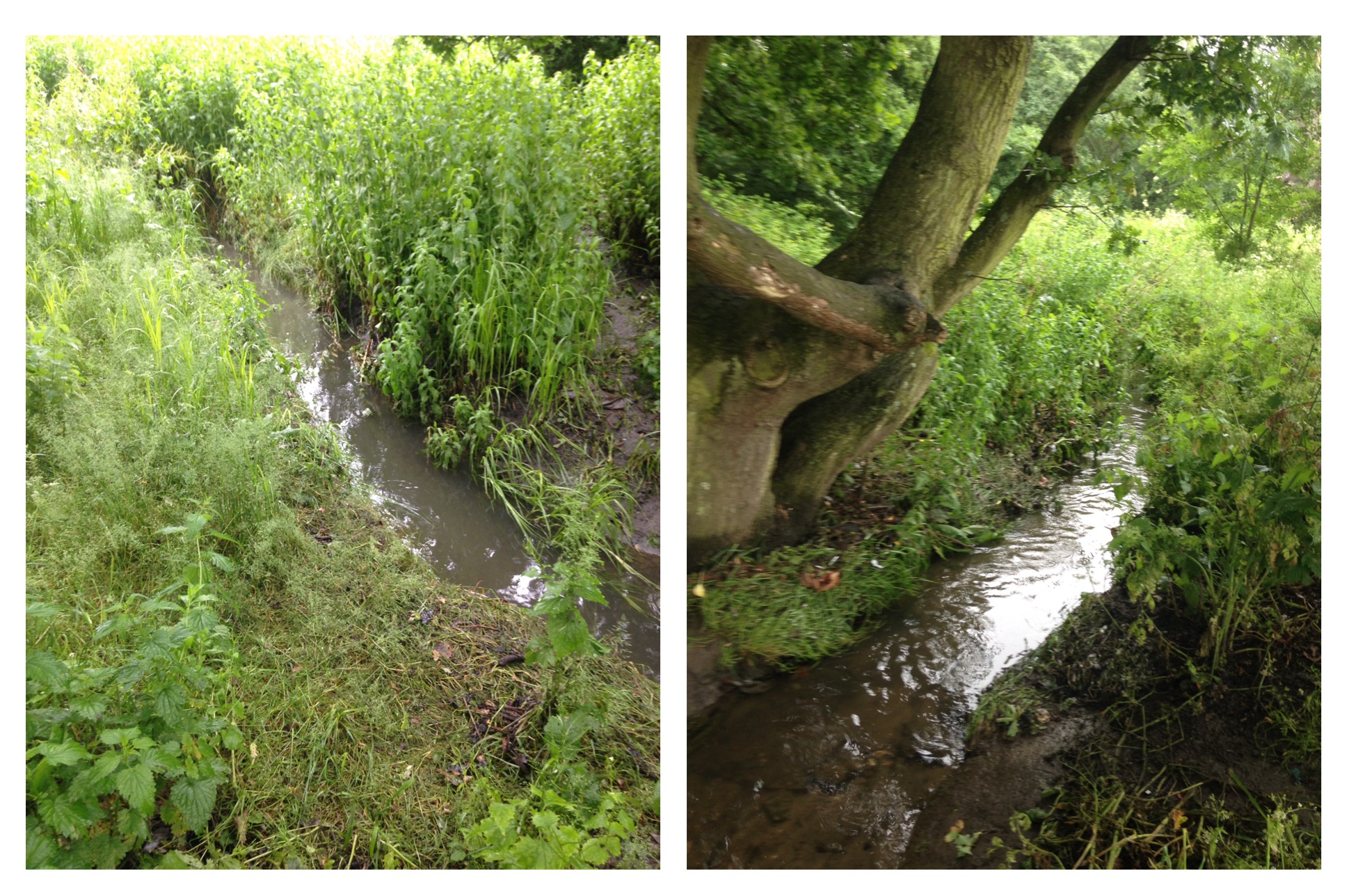
The 1893 boundary followed the Quaggy for around 100 metres until a confluence with the Border Ditch underneath the railway embankment. The ‘border’ in Border Ditch appropriately refers to the boundary we are currently following. When we followed Border Ditch as part of the tracking of the Quaggy and its constituent tributaries, the Ditch in Chinbrook Meadows was in a poor state but there were plans for a sustainable urban drainage system to be incorporated into its flow. Alas, this seems not to have materialised and the watercourse looked decidedly uninviting during lockdown – the photographs of its latter stages are from the initial visit in 2016.

Border Ditch has an even shorter flow than the Quaggy within Chinbrook Meadows – it emerges from culverting in a way that is more reminiscent of a drain than a stream. As had been the case in the summer of 2016, there was little sign of movement in the ominous looking muddy water.
The Ditch continues upstream and seems to have marked the border until the 1991 proposals came into force, although as was noted in the post on Border Ditch there were several minor re-alignments of the Ditch and the boundary over the years
Over the other side of the physical boundaries of the railway, which required a significant detour, Border Ditch only appeared as a field boundary on the 1893 Ordnance Survey map. It is now not only the border between Bromley and Lewisham but between the private sector semis of the former and the social housing of the latter. Traces of water were difficult to find in lockdown in the normally still flowing division between the two.

Streams, even quite small ones create valleys and out on the main Burnt Ash Lane the dip is noticeable and there lies both the current and 1893 variants of the boundary. The photograph above probably dates from just after the map was drawn, is of what was then a bridge and is looking towards Bromley.
Burnt Ash Lane was a name that once continued from here to the junction with St Mildred’s Road, but the it was renamed in ‘honour’ of the Lords of the Manor – the Baring Family. At the time they bought the Manor of Lee at least part of the Barings money was coming from an enslaved estate in Montego Bay in Jamaica. John Pound built much of Victorian Grove Park, on Northbrook/Baring land, naming the pub after them – the lovely Baring Hall.

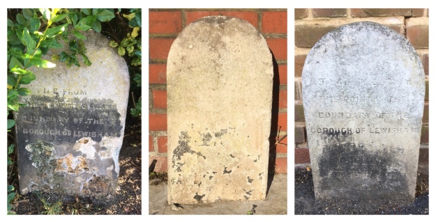
We’ve strayed 400 metres away from the boundary putting the street name into some context, so back to the border, Border Ditch. The 1893 Lee (now Lewisham) – Bromley border continued westwards across fields to a three-way split in 1893 with Lewisham providing the third part of the trio. During the 19th century there had stood, according to F H Hart, ‘a tall round-top oak tree, a land mark from Lee Church’ at the junction of Lee Terrace and Brandram Road. It seems that this may have been lost by 1893, as this point was marked with a boundary post. In 2020, it is part of one of the dozens of largely access roads to garages in the area made largely redundant by the increase in car size, this one behind Welbeck Avenue.
The redundant access road is the course of Border Ditch which continues another 50 metres or so to a source in what is now some school playing fields. A small pond was marked in 1893. Oddly for such an elevated situation, close to the watershed between the Quaggy and Ravensbourne catchments, this was a small World War 1 airfield, Grove Park Landing Ground.
On the other side of the redundant track to redundant garages is the edge of one of the larger London County Council (LCC) estates, Downham, which was built in the late 1920s and early 1930s. The name doesn’t have any local links, rather it was that of a Chairman of the LCC just after World War 1.

The Lee – Lewisham boundary of 1893 was through fields, the boundary following what were then the hedges of field edges not marked in any way by posts, markers or marks on trees. Despite the transformation of the area between the World Wars, the street pattern still at least partially follows the field patterns. The former Lee – Lewisham boundary was follows the middle of what is now Geraint Road; like many boundaries that follow roads, it’s marked by white paint. The 1893 boundary then bisects Ivorydown, the name of a former field in this area, to reach Downham Way.
We will leave the boundary there for now because on the other side the nature of what is followed changes from field edge to hidden stream.
Credits and Thanks
- The Ordnance Survey Map is via the National Library of Scotland on a non-commercial licence.
- The black and white photograph of Burnt Ash Lane was originally used in the post on Border Ditch on the basis of a creative commons from this site, although the photograph library with it seems to have been deleted.
The series of posts on the Lee boundary that this post is part of, would probably not have happened without Mike Horne, he was the go-to person on London’s boundary markers; he had catalogued almost all of them in a series of documents. He was always helpful, enthusiastic and patient. He died of a heart attack in March but would have loved my ‘find’ of a London County Council marker in some undergrowth on Blackheath during 2020’s lockdown, and would have patiently explained the details of several others he knew to me. A sad loss, there is a lovely series of tributes to him via this link.